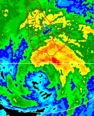
ATL: GRACE - Remnants - Discussion

Moderator: S2k Moderators

Message
Author
Shell Mound
Category 5
Category 5
Posts: 2434
Age: 31
Joined: Thu Sep 07, 2017 3:39 pm
Location: St. Petersburg, FL → Scandinavia

Re: ATL: INVEST 95L - Discussion

#101 Postby Shell Mound » Thu Aug 12, 2021 3:15 am

Hammy wrote:Easterly shear seems like a major inhibitor so far this year--this is the second or third strong disturbance/low to be decapitated from the east.

As we saw last year, the strong African monsoon and high amplitude of the waves is only contributing to easterly shear and AWB-induced intrusions of dry air.
0 likes   
CVW / MiamiensisWx / Shell Mound
The posts in this forum are NOT official forecasts and should not be used as such. They are just the opinion of the poster and may or may not be backed by sound meteorological data. They are NOT endorsed by any professional institution or STORM2K. For official information, please refer to products from the NHC and NWS.

User avatar
aspen
Category 5
Category 5
Posts: 8061
Joined: Sat Oct 12, 2019 7:10 pm
Location: Connecticut, USA

Re: ATL: INVEST 95L - Discussion

#102 Postby aspen » Thu Aug 12, 2021 6:03 am

Looks like 95L has two competing “centers”, one near 15N and another near 10N. Whichever one becomes dominant will determine the fixture track of the system, either into the Caribbean or into the Bahamas and near the East Coast.
2 likes   
Irene '11 Sandy '12 Hermine '16 5/15/2018 Derecho Fay '20 Isaias '20 Elsa '21 Henri '21 Ida '21

I am only a meteorology enthusiast who knows a decent amount about tropical cyclones. Look to the professional mets, the NHC, or your local weather office for the best information.

User avatar
HurricaneEnzo
Category 2
Category 2
Posts: 724
Joined: Wed Mar 14, 2018 12:18 pm
Location: Newport, NC (Hurricane Alley)

Re: ATL: INVEST 95L - Discussion

#103 Postby HurricaneEnzo » Thu Aug 12, 2021 6:21 am

This has the pre-Isaias double blobber look this morning. 2 blobs enter, only 1 blob will take home victory.
1 likes   
Bertha 96' - Fran 96' - Bonnie 98' - Dennis 99' - Floyd 99' - Isabel 03' - Alex 04' - Ophelia 05' - Irene 11' - Arthur 14' - Matthew 16' - Florence 18' - Dorian 19' - Isaias 20' (countless other tropical storms and Hurricane swipes)

I am not a Professional Met just an enthusiast. Get your weather forecasts from the Pros!

User avatar
cycloneye
Admin
Admin
Posts: 139600
Age: 67
Joined: Thu Oct 10, 2002 10:54 am
Location: San Juan, Puerto Rico

Re: ATL: INVEST 95L - Discussion

#104 Postby cycloneye » Thu Aug 12, 2021 6:51 am

Showers and thunderstorms remain disorganized in association with a
tropical wave located about 1400 miles east of the Lesser
Antilles. Environmental conditions are expected to gradually
become more conducive for development, and a tropical depression
could form by early next week while the system moves generally
westward at about 20 mph across the tropical Atlantic. This system
is expected to reach portions of the Leeward Islands late Saturday
or early Sunday.
* Formation chance through 48 hours...low...30 percent.
* Formation chance through 5 days...medium...60 percent.
0 likes   
Visit the Caribbean-Central America Weather Thread where you can find at first post web cams,radars
and observations from Caribbean basin members Click Here

User avatar
Kohlecane
Category 2
Category 2
Posts: 567
Age: 32
Joined: Sun Jul 31, 2011 11:03 pm
Location: Beaufort, SC

Re: ATL: INVEST 95L - Discussion

#105 Postby Kohlecane » Thu Aug 12, 2021 7:03 am

Best looking Wave I've seen, this will be interesting to track, TWC is already throwing out there that if it follows the ensembles to the N then it can spell trouble for a stronger storm coming close to the CONUS :wink:
0 likes   
Once I see the REDS and GREENS Converge on a Base Velocity. ... I'm There!!

This is NOT an Official Forecast....Just my Opinion. For official information, please refer to the NHC and NWS products.
HIGHLIGHTS : '13 El Reno Tornado : 2013 Storm Chaser Tour, Joaquin; SC flood event, Matthew '16, Lowcountry Snow storm Jan '18

User avatar
Stormybajan
Category 1
Category 1
Posts: 428
Joined: Thu May 20, 2021 3:21 pm
Location: Windward Islands

Re: ATL: INVEST 95L - Discussion

#106 Postby Stormybajan » Thu Aug 12, 2021 7:05 am

This wave looked so strange, I was sure the southern portion would take over but the northern portion always stayed around and to my eyes looks to be taking over. Maybe this is why models are not so hot with 95L to date
0 likes   
Sad West Indies and Manchester United fan ⚽️

User avatar
Kohlecane
Category 2
Category 2
Posts: 567
Age: 32
Joined: Sun Jul 31, 2011 11:03 pm
Location: Beaufort, SC

Re: ATL: INVEST 95L - Discussion

#107 Postby Kohlecane » Thu Aug 12, 2021 7:13 am

Stormybajan wrote:This wave looked so strange, I was sure the southern portion would take over but the northern portion always stayed around and to my eyes looks to be taking over. Maybe this is why models are not so hot with 95L to date

:uarrow: :idea:
0 likes   
Once I see the REDS and GREENS Converge on a Base Velocity. ... I'm There!!

This is NOT an Official Forecast....Just my Opinion. For official information, please refer to the NHC and NWS products.
HIGHLIGHTS : '13 El Reno Tornado : 2013 Storm Chaser Tour, Joaquin; SC flood event, Matthew '16, Lowcountry Snow storm Jan '18

User avatar
cycloneye
Admin
Admin
Posts: 139600
Age: 67
Joined: Thu Oct 10, 2002 10:54 am
Location: San Juan, Puerto Rico

Re: ATL: INVEST 95L - Discussion

#108 Postby cycloneye » Thu Aug 12, 2021 7:53 am

A. TROPICAL DISTURBANCE (95L)

B. 12/1130Z

C. 14.3N

D. 41.0W

E. FIVE/GOES-E

F. T1.5/2.0

G. IR/EIR/VIS

H. REMARKS...CORRECTED FOR CLASSIFICATION IMAGE TIME. SYSTEM HAS LOOSELY
DEFINED CLOUND LINES AROUND AN LLCC THAT IS NEAR THE ACTIVE SMALL COLD
OVERCAST RESULTING IN A SHEAR PATTERN DT OF 1.5. THE 24 HR DEVELOPING
TREND RESULTS IN DEVELOPING SLOWLY. MET AND PT ARE 1.5.FT IS BASED ON
MET DUE TO UNCERTAINTY IN THE EXACT LLCC LOCATION EMBEDDED IN A BROAD
CIRCULATION AND CLOUD FEATURES NOT BEING CLEAR CUT.

I. ADDL POSITIONS

NIL


...PATEL
2 likes   
Visit the Caribbean-Central America Weather Thread where you can find at first post web cams,radars
and observations from Caribbean basin members Click Here

User avatar
cycloneye
Admin
Admin
Posts: 139600
Age: 67
Joined: Thu Oct 10, 2002 10:54 am
Location: San Juan, Puerto Rico

Re: ATL: INVEST 95L - Discussion

#109 Postby cycloneye » Thu Aug 12, 2021 8:01 am

3 likes   
Visit the Caribbean-Central America Weather Thread where you can find at first post web cams,radars
and observations from Caribbean basin members Click Here

User avatar
abajan
S2K Supporter
S2K Supporter
Posts: 4175
Joined: Sun Sep 07, 2003 5:10 am
Location: Barbados

Re: ATL: INVEST 95L - Discussion

#110 Postby abajan » Thu Aug 12, 2021 8:14 am

cycloneye wrote:
A. TROPICAL DISTURBANCE (95L)

B. 12/1130Z

C. 14.3N

D. 41.0W

E. FIVE/GOES-E

F. T1.5/2.0

G. IR/EIR/VIS

H. REMARKS...CORRECTED FOR CLASSIFICATION IMAGE TIME. SYSTEM HAS LOOSELY
DEFINED CLOUND LINES AROUND AN LLCC THAT IS NEAR THE ACTIVE SMALL COLD
OVERCAST RESULTING IN A SHEAR PATTERN DT OF 1.5. THE 24 HR DEVELOPING
TREND RESULTS IN DEVELOPING SLOWLY. MET AND PT ARE 1.5.FT IS BASED ON
MET DUE TO UNCERTAINTY IN THE EXACT LLCC LOCATION EMBEDDED IN A BROAD
CIRCULATION AND CLOUD FEATURES NOT BEING CLEAR CUT.

I. ADDL POSITIONS

NIL


...PATEL

Visual of 1130z position (14.3N 41.0W) according to Google Maps:

Image
0 likes   

User avatar
Yellow Evan
Professional-Met
Professional-Met
Posts: 15960
Age: 25
Joined: Fri Jul 15, 2011 12:48 pm
Location: Henderson, Nevada/Honolulu, HI
Contact:

Re: ATL: INVEST 95L - Discussion

#111 Postby Yellow Evan » Thu Aug 12, 2021 8:27 am

Image

Almost there. Just needs westerlies.
5 likes   

User avatar
Teban54
Category 5
Category 5
Posts: 1984
Joined: Sat May 19, 2018 1:19 pm

Re: ATL: INVEST 95L - Discussion

#112 Postby Teban54 » Thu Aug 12, 2021 8:49 am

I was expecting posts similar to the "Team East Blob vs Team West Blob" contests in last year's Isaias thread. Guess people have been too focused on Fred...
2 likes   

User avatar
aspen
Category 5
Category 5
Posts: 8061
Joined: Sat Oct 12, 2019 7:10 pm
Location: Connecticut, USA

Re: ATL: INVEST 95L - Discussion

#113 Postby aspen » Thu Aug 12, 2021 8:50 am


I guess Team North Blob is gonna win.
6 likes   
Irene '11 Sandy '12 Hermine '16 5/15/2018 Derecho Fay '20 Isaias '20 Elsa '21 Henri '21 Ida '21

I am only a meteorology enthusiast who knows a decent amount about tropical cyclones. Look to the professional mets, the NHC, or your local weather office for the best information.

User avatar
Category5Kaiju
Category 5
Category 5
Posts: 3438
Age: 22
Joined: Thu Dec 24, 2020 12:45 pm
Location: Seattle

Re: ATL: INVEST 95L - Discussion: Update: ASCAT has center almost closed

#114 Postby Category5Kaiju » Thu Aug 12, 2021 9:06 am

0 likes   
Unless explicitly stated, all information covered in my posts is based on my opinions and observations. Please refer to a professional meteorologist or an accredited weather research agency otherwise, especially if serious decisions must be made in the event of a potentially life-threatening tropical storm or hurricane.

User avatar
Iceresistance
Category 5
Category 5
Posts: 8931
Age: 20
Joined: Sat Oct 10, 2020 9:45 am
Location: Tecumseh, OK/Norman, OK

Re: ATL: INVEST 95L - Discussion: Update: ASCAT has center almost closed

#115 Postby Iceresistance » Thu Aug 12, 2021 9:08 am

Next Name is Grace, It's already close to TS-Force winds!

Image

Image
7 likes   
Bill 2015 & Beta 2020

Winter 2020-2021 :cold:

All observations are in Tecumseh, OK unless otherwise noted.

Winter posts are focused mainly for Oklahoma & Texas.

Take any of my forecasts with a grain of salt, refer to the NWS, SPC, and NHC for official information

Never say Never with weather! Because ANYTHING is possible!

AlphaToOmega
Category 5
Category 5
Posts: 1448
Joined: Sat Jun 26, 2021 10:51 am
Location: Somewhere in Massachusetts

Re: ATL: INVEST 95L - Discussion: Update: ASCAT has center almost closed

#116 Postby AlphaToOmega » Thu Aug 12, 2021 9:18 am

Because it is a closed low, I see the NHC significantly increasing formation chances in the next TWO.
0 likes   

User avatar
Stormybajan
Category 1
Category 1
Posts: 428
Joined: Thu May 20, 2021 3:21 pm
Location: Windward Islands

Re: ATL: INVEST 95L - Discussion: Update: ASCAT has center almost closed

#117 Postby Stormybajan » Thu Aug 12, 2021 9:21 am

AlphaToOmega wrote:Because it is a closed low, I see the NHC significantly increasing formation chances in the next TWO.

Agreed I think they will go with 60/80
0 likes   
Sad West Indies and Manchester United fan ⚽️

User avatar
Category5Kaiju
Category 5
Category 5
Posts: 3438
Age: 22
Joined: Thu Dec 24, 2020 12:45 pm
Location: Seattle

Re: ATL: INVEST 95L - Discussion: Update: ASCAT has center almost closed

#118 Postby Category5Kaiju » Thu Aug 12, 2021 9:24 am

I would not be surprised to see cherry by the 2 EST advisory
0 likes   
Unless explicitly stated, all information covered in my posts is based on my opinions and observations. Please refer to a professional meteorologist or an accredited weather research agency otherwise, especially if serious decisions must be made in the event of a potentially life-threatening tropical storm or hurricane.

User avatar
aspen
Category 5
Category 5
Posts: 8061
Joined: Sat Oct 12, 2019 7:10 pm
Location: Connecticut, USA

Re: ATL: INVEST 95L - Discussion: Update: ASCAT has center almost closed

#119 Postby aspen » Thu Aug 12, 2021 9:32 am

With 95L concentrating around 14N instead of 11-12N, that puts the islands of Barbuda, Antigua, Guadeloupe, Saint Kitts, and Saint Martin at the most risk by Saturday night/Sunday morning. It also means a Caribbean Cruiser track is significantly less likely, because all models except for the HMON/HWRF show it gaining latitude over the next 3-4 days. Either it’ll run over the Greater Antilles like Laura, or stay to the north like Irma. We won’t know for sure until an actual defined center forms, but I think we can confidently say that the NE Leeward Islands are at the most risk.
3 likes   
Irene '11 Sandy '12 Hermine '16 5/15/2018 Derecho Fay '20 Isaias '20 Elsa '21 Henri '21 Ida '21

I am only a meteorology enthusiast who knows a decent amount about tropical cyclones. Look to the professional mets, the NHC, or your local weather office for the best information.

afswo
Professional-Met
Professional-Met
Posts: 23
Age: 54
Joined: Tue Jul 22, 2008 4:06 am
Location: Maryland

Re: ATL: INVEST 95L - Discussion

#120 Postby afswo » Thu Aug 12, 2021 9:49 am

InfernoFlameCat wrote:Shame I am going to miss the peak of this storm if it develops. Got boot camp for ROTC in college next week.


Good Luck! Make the most of it, take away the best of it, and don't take anything too personal. Speaking from 29 years experience in the USAF (Retired CMSgt (E-9)).
7 likes   


Return to “2021”

Who is online

Users browsing this forum: No registered users and 4 guests