


Moderator: S2k Moderators


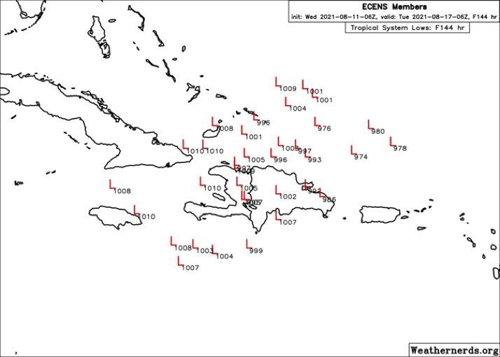
Spacecoast wrote:0z ECMF Wind tracks - many more members this morning
[url]https://i.ibb.co/gMdsS03/ecmdi.jpg [/url]


Spacecoast wrote:0z ECMF Wind tracks - many more members this morning
[url]https://i.ibb.co/gMdsS03/ecmdi.jpg [/url]
Spacecoast wrote:0z ECMF Wind tracks - many more members this morning
[url]https://i.ibb.co/gMdsS03/ecmdi.jpg [/url]
aspen wrote:12z ICON makes landfall in Puerto Rico, but then the storm starts curving north, missing DR and entering the Bahamas.
Spacecoast wrote:0z ECMF Wind tracks - many more members this morning
[url]https://i.ibb.co/gMdsS03/ecmdi.jpg [/url]

cycloneye wrote:https://twitter.com/AndyHazelton/status/1425494071737569287
Spacecoast wrote:cycloneye wrote:https://twitter.com/AndyHazelton/status/1425494071737569287
It seems like a role reversal.
Last season, you couldn't get the Euro to genesis until last minute, while the GFS / FV3 were both spitting out model storms like crazy.
This season, the GFS / GEFS seem slow to genesis, while the Euro ensembles are sniffing out storms many days ahead out GFS.
Were there any changes to either globals, or is it just this years environment?

tolakram wrote:12Z Euro
https://i.imgur.com/6I9xAym.gif

Users browsing this forum: No registered users and 12 guests


