InfernoFlameCat wrote:Kingarabian wrote:InfernoFlameCat wrote:Elsa has a pinwheel eye in the latest frame.
https://www.tropicaltidbits.com/sat/sat ... roduct=vis
Pinhole eyes are much smaller than that.
Pinwheel eye not pinhole
Ah my bad lol.
Moderator: S2k Moderators


InfernoFlameCat wrote:Kingarabian wrote:InfernoFlameCat wrote:Elsa has a pinwheel eye in the latest frame.
https://www.tropicaltidbits.com/sat/sat ... roduct=vis
Pinhole eyes are much smaller than that.
Pinwheel eye not pinhole
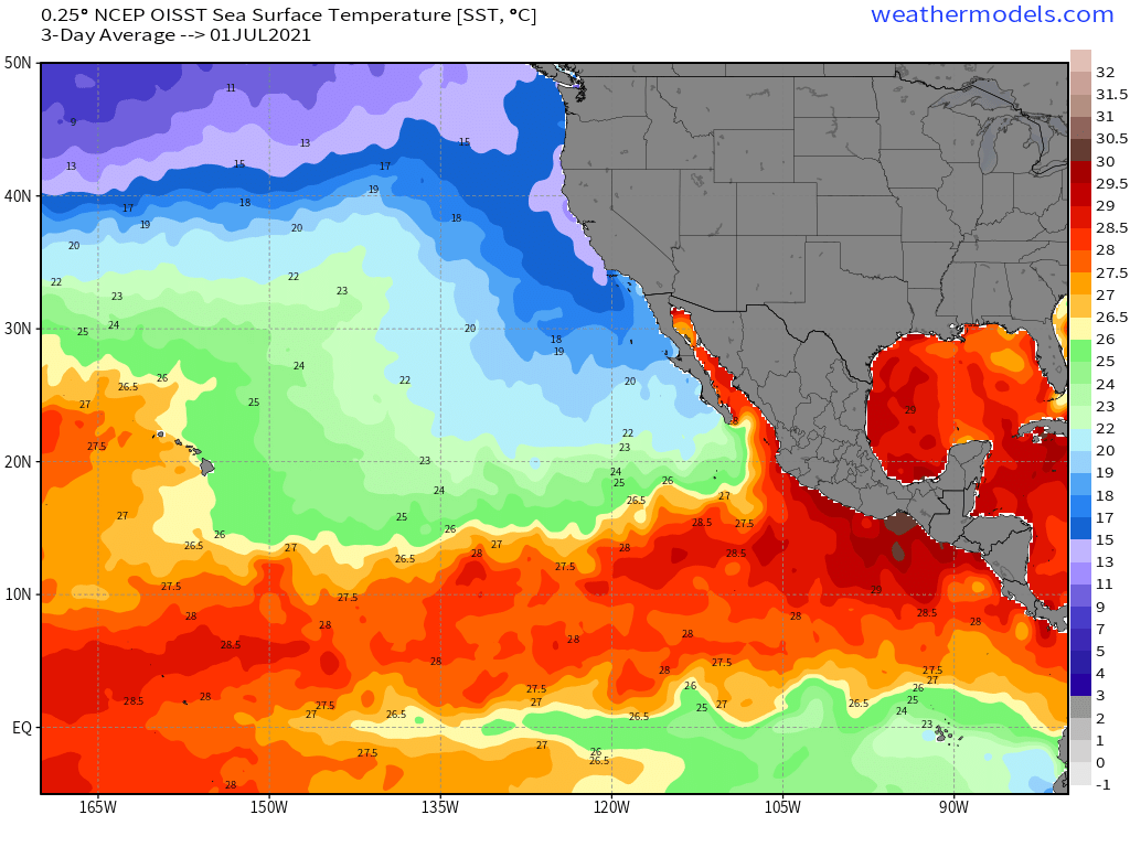
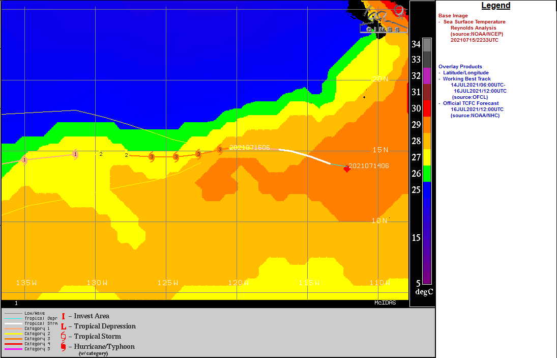
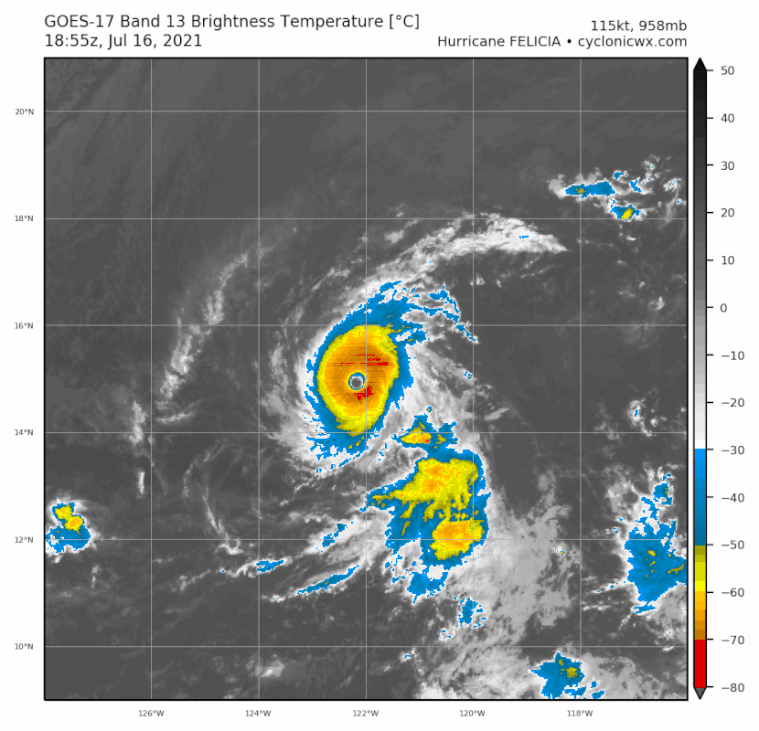
cycloneye wrote:Even thou Best Track has 115kts, I dont fell confortable until the advisory is out because something may happen on the downside in the hour before it comes out.


AutoPenalti wrote:Very impressive.
https://i.ibb.co/DWPsWKb/goes17-vis-06-E-202107161815.gif
I've been having trouble uploading through Imgur lately, it seems to be only when I download straight from TT.
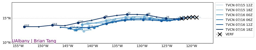
aspen wrote:HWRF is finally running for 96E. Watch it blow this up into a Cat 3 lol. The first HWRF runs always overdo the intensity.
AlphaToOmega wrote:aspen wrote:HWRF is finally running for 96E. Watch it blow this up into a Cat 3 lol. The first HWRF runs always overdo the intensity.
So what was that about overdoing intensity?
aspen wrote:AlphaToOmega wrote:aspen wrote:HWRF is finally running for 96E. Watch it blow this up into a Cat 3 lol. The first HWRF runs always overdo the intensity.
So what was that about overdoing intensity?
Well, at least it did better than basically every other model.
The award for the Worst Storm Initialization Ever goes to today’s 12z CMC and ICON runs, which initialized Felicia as a >1000 mbar tropical storm when it was officially a Cat 3 in the mid 960s.


aspen wrote:The core is so tiny that I can’t tell if there’s any trace of partial eyewalls forming.
https://rammb-data.cira.colostate.edu/tc_realtime/products/storms/2021ep06/amsusr89/2021ep06_amsusr89_202107161627.gif


Users browsing this forum: No registered users and 30 guests


