ATL: FRED - Post-Tropical - Discussion

Moderator: S2k Moderators

Message
Author
User avatar
captainbarbossa19
Professional-Met
Professional-Met
Posts: 1092
Age: 27
Joined: Wed Aug 21, 2019 11:09 pm
Location: Beaumont, TX

Re: ATL: SIX - Potential Tropical Cyclone - Discussion

#321 Postby captainbarbossa19 » Mon Aug 09, 2021 4:48 pm

StPeteMike wrote:Think there’s a good chance the forecast strength will be upgraded, so I hope no one is taking this lightly. Once the storm can get consolidated, models will be able to forecast it better. On top of that, storm is pretty small, so it won’t take much effort to rapidly strengthen if it makes it north of the islands.


One thing to also keep in mind is that this storm is small enough that Hispaniola may not do as much damage as one might anticipate. I think it's around the same size as Laura, so if the storm is still somewhat weak crossing over the mountains, it may not dissipate.
1 likes   

User avatar
Blown Away
S2K Supporter
S2K Supporter
Posts: 10145
Joined: Wed May 26, 2004 6:17 am

Re: ATL: SIX - Potential Tropical Cyclone - Discussion

#322 Postby Blown Away » Mon Aug 09, 2021 4:53 pm

cycloneye wrote:
aspen wrote:I’m thinking we could see a center shift to the N or NE towards the deepest convection if hot towers don’t start firing over what I think is the MLC. What time is recon scheduled to head out tomorrow?


At 4:30 AM and will be plane from NOAA.


NHC has PTC6 crossing 15.4N at 2am, IMO it's going to cross that latitude much earlier.
0 likes   
Hurricane Eye Experience: David 79, Irene 99, Frances 04, Jeanne 04, Wilma 05... EYE COMING MY WAY IN 2024…
Hurricane Brush Experience: Andrew 92, Erin 95, Floyd 99, Matthew 16, Irma 17, Ian 22, Nicole 22…

User avatar
Category5Kaiju
Category 5
Category 5
Posts: 4095
Joined: Thu Dec 24, 2020 12:45 pm
Location: Seattle

Re: ATL: SIX - Potential Tropical Cyclone - Discussion

#323 Postby Category5Kaiju » Mon Aug 09, 2021 4:57 pm

captainbarbossa19 wrote:
StPeteMike wrote:Think there’s a good chance the forecast strength will be upgraded, so I hope no one is taking this lightly. Once the storm can get consolidated, models will be able to forecast it better. On top of that, storm is pretty small, so it won’t take much effort to rapidly strengthen if it makes it north of the islands.


One thing to also keep in mind is that this storm is small enough that Hispaniola may not do as much damage as one might anticipate. I think it's around the same size as Laura, so if the storm is still somewhat weak crossing over the mountains, it may not dissipate.


If anything like we saw with some recent storms (Laura and Elsa included), hitting the tall mountains there could actually force the system to become better structured due to the friction. Now of course there’s a reason why people call Hispaniola the “shredder” and I know different storms are different, but I have seen and heard of enough cases of land interaction not really doing much to completely wither away a storm, notorious examples being David, Georges, the 1900 Galveston storm, Matthew, and of course Laura and Elsa.
1 likes   
Unless explicitly stated, all info in my posts is based on my own opinions and observations. Tropical storms and hurricanes can be extremely dangerous. Do not think you can beat Mother Nature. Refer to an accredited weather research agency or meteorologist if you need to make serious decisions regarding an approaching storm.

User avatar
toad strangler
S2K Supporter
S2K Supporter
Posts: 4543
Joined: Sun Jul 28, 2013 3:09 pm
Location: Earth
Contact:

Re: ATL: SIX - Potential Tropical Cyclone - Discussion

#324 Postby toad strangler » Mon Aug 09, 2021 4:59 pm

Category5Kaiju wrote:
captainbarbossa19 wrote:
StPeteMike wrote:Think there’s a good chance the forecast strength will be upgraded, so I hope no one is taking this lightly. Once the storm can get consolidated, models will be able to forecast it better. On top of that, storm is pretty small, so it won’t take much effort to rapidly strengthen if it makes it north of the islands.


One thing to also keep in mind is that this storm is small enough that Hispaniola may not do as much damage as one might anticipate. I think it's around the same size as Laura, so if the storm is still somewhat weak crossing over the mountains, it may not dissipate.


If anything like we saw with some recent storms (Laura and Elsa included), hitting the tall mountains there could actually force the system to become better structured due to the friction. Now of course there’s a reason why people call Hispaniola the “shredder” and I know different storms are different, but I have seen and heard of enough cases of land interaction not really doing much to completely wither away a storm, notorious examples being David, Georges, the 1900 Galveston storm, Matthew, and of course Laura and Elsa.


It's not just Hispaniola that carries the "Shredder" name. It's all three of the big islands. That's the full shredder chain!
0 likes   

User avatar
galaxy401
Category 5
Category 5
Posts: 2419
Age: 30
Joined: Sat Aug 25, 2012 9:04 pm
Location: Casa Grande, Arizona

Re: ATL: SIX - Potential Tropical Cyclone - Discussion

#325 Postby galaxy401 » Mon Aug 09, 2021 5:01 pm

Yeah that track does look slightly concerning but it is still early August so I'm not expecting a storm that strong overall. There's also the possibility it just goes through Hispaniola and all of Cuba too.

Category5Kaiju wrote:If anything like we saw with some recent storms (Laura and Elsa included), hitting the tall mountains there could actually force the system to become better structured due to the friction. Now of course there’s a reason why people call Hispaniola the “shredder” and I know different storms are different, but I have seen and heard of enough cases of land interaction not really doing much to completely wither away a storm, notorious examples being David, Georges, the 1900 Galveston storm, Matthew, and of course Laura and Elsa.


It's really a "shredder" when it comes to strong hurricanes since many of them never recover from crossing those mountains. Weaker storms like Laura and Elsa fare better.
0 likes   
Got my eyes on moving right into Hurricane Alley: Florida.

User avatar
StPeteMike
Category 2
Category 2
Posts: 631
Joined: Thu Jun 07, 2018 11:26 pm

Re: ATL: SIX - Potential Tropical Cyclone - Discussion

#326 Postby StPeteMike » Mon Aug 09, 2021 5:02 pm

captainbarbossa19 wrote:
StPeteMike wrote:Think there’s a good chance the forecast strength will be upgraded, so I hope no one is taking this lightly. Once the storm can get consolidated, models will be able to forecast it better. On top of that, storm is pretty small, so it won’t take much effort to rapidly strengthen if it makes it north of the islands.


One thing to also keep in mind is that this storm is small enough that Hispaniola may not do as much damage as one might anticipate. I think it's around the same size as Laura, so if the storm is still somewhat weak crossing over the mountains, it may not dissipate.

Thing with Laura, and even Elsa, was that both storms didn’t have a center that was well together. Elsa was a little better in this description, but you can’t disrupt what’s not there. Elsa had multiple smaller vortices fighting to be the dominant one and land interaction wasn’t going to have an impact on a storm that could easily just replace one smaller vort with another. Laura also had this, but not at the same magnitude.

If future Fred gets itself together before Hispaniola and then crashes into the island, the island will do much more damage because there’s an established circulation to disrupt with no other vort to come in from behind and replace it.
7 likes   
The above post is not official and should not be used as such. It is the opinion of the poster and may or may not be backed by sound meteorological data. It is not endorsed by any professional institution or storm2k.org. For official information, please refer to the NHC and NWS products.

User avatar
toad strangler
S2K Supporter
S2K Supporter
Posts: 4543
Joined: Sun Jul 28, 2013 3:09 pm
Location: Earth
Contact:

Re: ATL: SIX - Potential Tropical Cyclone - Discussion

#327 Postby toad strangler » Mon Aug 09, 2021 5:03 pm

galaxy401 wrote:Yeah that track does look slightly concerning but it is still early August so I'm not expecting a storm that strong overall. There's also the possibility it just goes through Hispaniola and all of Cuba too.

Category5Kaiju wrote:If anything like we saw with some recent storms (Laura and Elsa included), hitting the tall mountains there could actually force the system to become better structured due to the friction. Now of course there’s a reason why people call Hispaniola the “shredder” and I know different storms are different, but I have seen and heard of enough cases of land interaction not really doing much to completely wither away a storm, notorious examples being David, Georges, the 1900 Galveston storm, Matthew, and of course Laura and Elsa.


It's really a "shredder" when it comes to strong hurricanes since many of them never recover from crossing those mountains. Weaker storms like Laura and Elsa fare better.


Agree, also huge factors are speed and angle of approach. This particular track may carry SIX over just one island and at a decent clip although the new 18z GFS is attracted to Cuba as well.
0 likes   

AlphaToOmega
Category 5
Category 5
Posts: 1448
Joined: Sat Jun 26, 2021 10:51 am
Location: Somewhere in Massachusetts

Re: ATL: SIX - Potential Tropical Cyclone - Discussion

#328 Postby AlphaToOmega » Mon Aug 09, 2021 5:17 pm

06L, a post-tropical cyclone :lol:
779
WTNT61 KNHC 092213
TCUAT1

Post-Tropical Cyclone Six Tropical Cyclone Update
NWS National Hurricane Center Miami FL AL062021
615 PM AST Mon Aug 09 2021

The government of the Netherlands has issued a Tropical Storm Watch
for Saba and St. Eustatius

$$
Forecaster Cangialosi
8 likes   

User avatar
toad strangler
S2K Supporter
S2K Supporter
Posts: 4543
Joined: Sun Jul 28, 2013 3:09 pm
Location: Earth
Contact:

Re: ATL: SIX - Potential Tropical Cyclone - Discussion

#329 Postby toad strangler » Mon Aug 09, 2021 5:25 pm

This taken from Weather Tigers update just released and posted by @SFLcane in the Indicators thread. Look at the daily ACE spike on about the date this system may be nearby FL
That's a little eerie. There are only 6 signals higher since 1900.

Image
1 likes   

Keldeo1997
Category 2
Category 2
Posts: 637
Joined: Fri Oct 11, 2019 11:35 pm

Re: ATL: SIX - Potential Tropical Cyclone - Discussion

#330 Postby Keldeo1997 » Mon Aug 09, 2021 6:01 pm

Image

Image

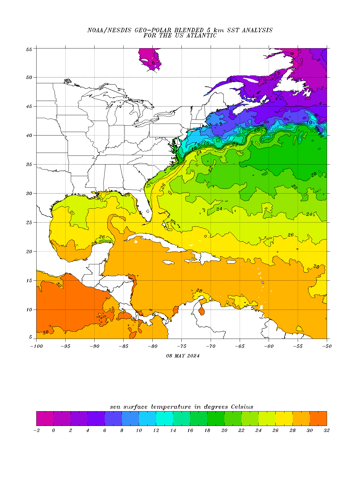
Its to far out but I will say that if this thing gets into the Gulf intact and the upper levels are good then you better watch out. It will likely track over a nasty loop current which could be a explosive intensification nightmare.
Last edited by Keldeo1997 on Mon Aug 09, 2021 6:11 pm, edited 1 time in total.
7 likes   

User avatar
Blown Away
S2K Supporter
S2K Supporter
Posts: 10145
Joined: Wed May 26, 2004 6:17 am

Re: ATL: SIX - Potential Tropical Cyclone - Discussion

#331 Postby Blown Away » Mon Aug 09, 2021 6:07 pm

Keldeo1997 wrote:http://isotherm.rsmas.miami.edu/heat/images/ohc_aQG3_latest_natl.gif

Its to far out but I will say that if this thing gets into the Gulf intact and the environment is decent then you better watch out. It will likely track over a nasty loop current which could be a explosive intensification nightmare.


SST’s are a big factor in Hurricane development, but upper level conditions are just as important, so you can’t assume if a system just passes over the loop current it automatically means explosive development.
8 likes   
Hurricane Eye Experience: David 79, Irene 99, Frances 04, Jeanne 04, Wilma 05... EYE COMING MY WAY IN 2024…
Hurricane Brush Experience: Andrew 92, Erin 95, Floyd 99, Matthew 16, Irma 17, Ian 22, Nicole 22…

User avatar
toad strangler
S2K Supporter
S2K Supporter
Posts: 4543
Joined: Sun Jul 28, 2013 3:09 pm
Location: Earth
Contact:

Re: ATL: SIX - Potential Tropical Cyclone - Discussion

#332 Postby toad strangler » Mon Aug 09, 2021 6:09 pm

Blown Away wrote:
Keldeo1997 wrote:http://isotherm.rsmas.miami.edu/heat/images/ohc_aQG3_latest_natl.gif

Its to far out but I will say that if this thing gets into the Gulf intact and the environment is decent then you better watch out. It will likely track over a nasty loop current which could be a explosive intensification nightmare.


SST’s are a big factor in Hurricane development, but upper level conditions are just as important, so you can’t assume if a system just passes over the loop current it automatically means explosive development.


YUP, there ain't no "I" in team!
0 likes   

User avatar
GCANE
S2K Supporter
S2K Supporter
Posts: 11496
Joined: Mon Oct 22, 2007 8:03 am

Re: ATL: SIX - Potential Tropical Cyclone - Discussion

#333 Postby GCANE » Mon Aug 09, 2021 6:13 pm

Entraining high TPW air quickly
3 likes   

User avatar
AtlanticWind
S2K Supporter
S2K Supporter
Posts: 1888
Age: 66
Joined: Sun Aug 08, 2004 9:57 pm
Location: Plantation,Fla

Re: ATL: SIX - Potential Tropical Cyclone - Discussion

#334 Postby AtlanticWind » Mon Aug 09, 2021 6:20 pm

Convection again on northeast, could see a reformation or the system pulled some toward that flare up
0 likes   

AlphaToOmega
Category 5
Category 5
Posts: 1448
Joined: Sat Jun 26, 2021 10:51 am
Location: Somewhere in Massachusetts

Re: ATL: SIX - Potential Tropical Cyclone - Discussion

#335 Postby AlphaToOmega » Mon Aug 09, 2021 6:34 pm

ZCZC MIATWOAT ALL
TTAA00 KNHC DDHHMM

Tropical Weather Outlook
NWS National Hurricane Center Miami FL
800 PM EDT Mon Aug 9 2021

For the North Atlantic...Caribbean Sea and the Gulf of Mexico:

The National Hurricane Center is issuing advisories on Potential
Tropical Cyclone Six, located just east of the Leeward Islands.
* Formation chance through 48 hours...high...90 percent.
* Formation chance through 5 days...high...90 percent.

&&
Public Advisories on Potential Tropical Cyclone Six are issued
under WMO header WTNT31 KNHC and under AWIPS header MIATCPAT1.
Forecast/Advisories on Potential Tropical Cyclone Six are issued
under WMO header WTNT21 KNHC and under AWIPS header MIATCMAT1.

$$
Forecaster Cangialosi
NNNN
0 likes   

User avatar
abajan
S2K Supporter
S2K Supporter
Posts: 4230
Joined: Sun Sep 07, 2003 5:10 am
Location: Barbados

Re: ATL: INVEST 94L - Discussion

#336 Postby abajan » Mon Aug 09, 2021 6:50 pm

GeneratorPower wrote:
sma10 wrote:In regards to future-Fred, perhaps the most ominous sign for S FL is its historical connection to Wilma.


I don't know what this means.


[youtube]https://youtu.be/uq7noaMwLfg[/youtube]
1 likes   

User avatar
Category5Kaiju
Category 5
Category 5
Posts: 4095
Joined: Thu Dec 24, 2020 12:45 pm
Location: Seattle

Re: ATL: INVEST 94L - Discussion

#337 Postby Category5Kaiju » Mon Aug 09, 2021 6:56 pm

abajan wrote:
GeneratorPower wrote:
sma10 wrote:In regards to future-Fred, perhaps the most ominous sign for S FL is its historical connection to Wilma.


I don't know what this means.


https://youtu.be/uq7noaMwLfg


Yes indeed :D I was too young to see the height of that show, but I wish I could have
1 likes   
Unless explicitly stated, all info in my posts is based on my own opinions and observations. Tropical storms and hurricanes can be extremely dangerous. Do not think you can beat Mother Nature. Refer to an accredited weather research agency or meteorologist if you need to make serious decisions regarding an approaching storm.

User avatar
toad strangler
S2K Supporter
S2K Supporter
Posts: 4543
Joined: Sun Jul 28, 2013 3:09 pm
Location: Earth
Contact:

Re: ATL: SIX - Potential Tropical Cyclone - Discussion

#338 Postby toad strangler » Mon Aug 09, 2021 7:07 pm

3 likes   

User avatar
weeniepatrol
Category 5
Category 5
Posts: 1273
Joined: Sat Aug 22, 2020 5:30 pm
Location: WA State

Re: ATL: SIX - Potential Tropical Cyclone - Discussion

#339 Postby weeniepatrol » Mon Aug 09, 2021 7:21 pm

toad strangler wrote:Morales throws big shade

http://twitter.com/JohnMoralesNBC6/status/1424883735196049409?s=20


Lol.
4 likes   

User avatar
AubreyStorm
Category 1
Category 1
Posts: 337
Age: 44
Joined: Fri Jun 16, 2017 6:21 pm
Location: Texas, USA

Re: ATL: SIX - Potential Tropical Cyclone - Discussion

#340 Postby AubreyStorm » Mon Aug 09, 2021 7:21 pm

toad strangler wrote:Morales throws big shade

http://twitter.com/JohnMoralesNBC6/status/1424883735196049409?s=20


Morales always have problems with NHC, always!
1 likes   
The posts are NOT an official forecast. Please REFER to the NHC and NWS for official forecasts and products.


Return to “2021”

Who is online

Users browsing this forum: No registered users and 5 guests