Special Tropical Weather Outlook
NWS National Hurricane Center Miami FL
505 AM EDT Thu Aug 26 2021
For the North Atlantic...Caribbean Sea and the Gulf of Mexico:
Special tropical weather outlook issued to update the discussion of
the system south of Jamaica.
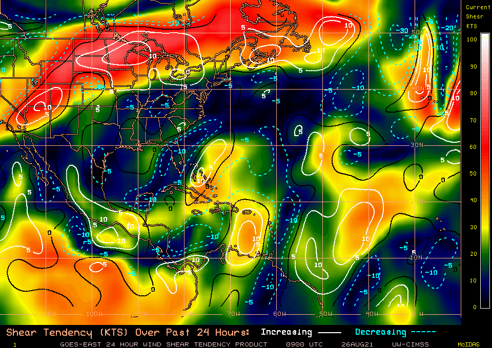
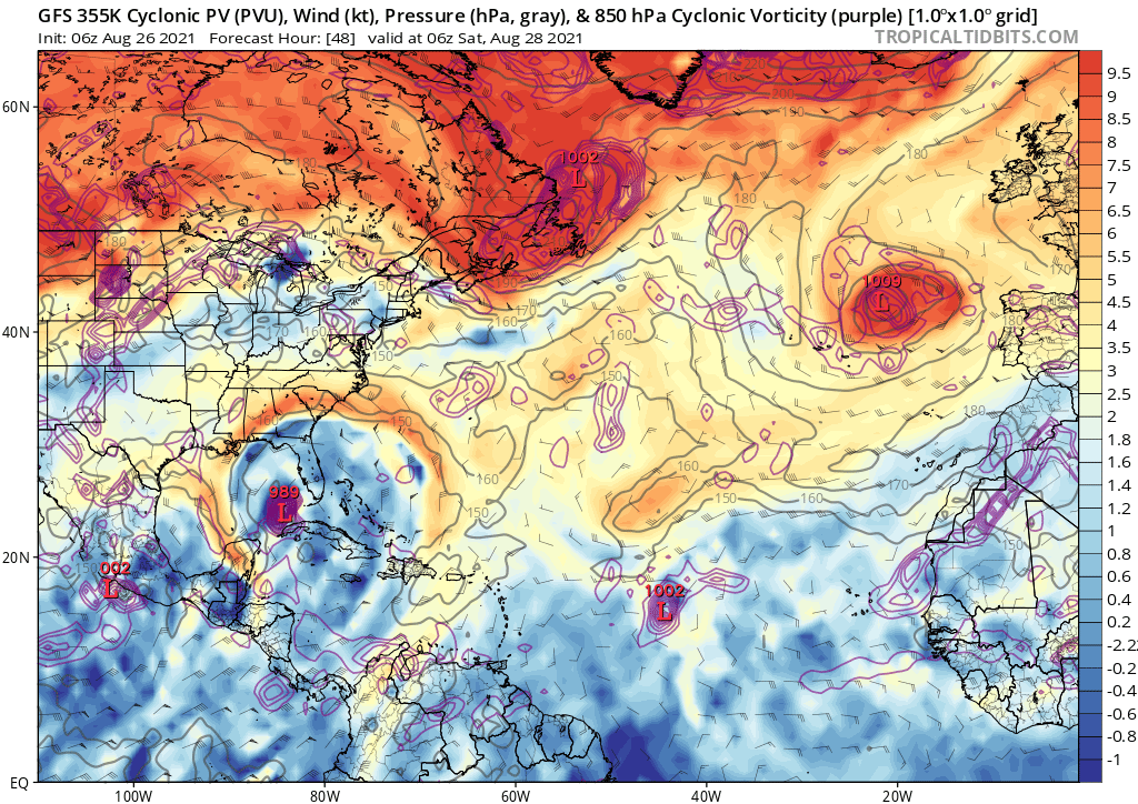
Updated: Shower and thunderstorm activity continues to become better
organized in association with a trough of low pressure located less
than 200 miles south of Jamaica. Environmental conditions remain
conducive for development, and a tropical depression or storm is
expected to form later today or tomorrow. This system is forecast to
move northwestward over the northwestern Caribbean Sea near the
Cayman Islands tonight, near Cuba and the Yucatan Peninsula of
Mexico on Friday, and into the Gulf of Mexico this weekend. Given
the recent developmental trends, Tropical Storm Warnings for the
Cayman Islands and Tropical Storm Watches for western Cuba could be
required later today.
Regardless of development, locally heavy rainfall and flooding will
be possible over portions of Jamaica and the Cayman Islands today
and tonight, and will likely spread across Cuba and the Yucatan
Peninsula on Friday. In addition, this system could bring dangerous
impacts from storm surge, wind, and heavy rainfall to portions of
the coasts of Louisiana, Texas, and the Mexican state of Tamaulipas
late this weekend and early next week. However, uncertainty remains
large since the system has yet to form. Interests in these areas
should closely monitor the progress of this system and ensure they
have their hurricane plan in place. An Air Force Reserve
reconnaissance aircraft is scheduled to investigate the system later
today, if necessary. Additional information on this system,
including gale warnings, can be found in High Seas Forecasts issued
by the National Weather Service.
* Formation chance through 48 hours...high...90 percent.
* Formation chance through 5 days...high...90 percent.
NWS National Hurricane Center Miami FL
505 AM EDT Thu Aug 26 2021
For the North Atlantic...Caribbean Sea and the Gulf of Mexico:
Special tropical weather outlook issued to update the discussion of
the system south of Jamaica.
Updated: Shower and thunderstorm activity continues to become better
organized in association with a trough of low pressure located less
than 200 miles south of Jamaica. Environmental conditions remain
conducive for development, and a tropical depression or storm is
expected to form later today or tomorrow. This system is forecast to
move northwestward over the northwestern Caribbean Sea near the
Cayman Islands tonight, near Cuba and the Yucatan Peninsula of
Mexico on Friday, and into the Gulf of Mexico this weekend. Given
the recent developmental trends, Tropical Storm Warnings for the
Cayman Islands and Tropical Storm Watches for western Cuba could be
required later today.
Regardless of development, locally heavy rainfall and flooding will
be possible over portions of Jamaica and the Cayman Islands today
and tonight, and will likely spread across Cuba and the Yucatan
Peninsula on Friday. In addition, this system could bring dangerous
impacts from storm surge, wind, and heavy rainfall to portions of
the coasts of Louisiana, Texas, and the Mexican state of Tamaulipas
late this weekend and early next week. However, uncertainty remains
large since the system has yet to form. Interests in these areas
should closely monitor the progress of this system and ensure they
have their hurricane plan in place. An Air Force Reserve
reconnaissance aircraft is scheduled to investigate the system later
today, if necessary. Additional information on this system,
including gale warnings, can be found in High Seas Forecasts issued
by the National Weather Service.
* Formation chance through 48 hours...high...90 percent.
* Formation chance through 5 days...high...90 percent.