ATL: CLAUDETTE - Remnants - Discussion
Moderator: S2k Moderators
-
MarioProtVI
- Category 5

- Posts: 1034
- Age: 24
- Joined: Sun Sep 29, 2019 7:33 pm
- Location: New Jersey
Re: ATL: Potential Tropical Cyclone Three - Discussion
Down to 80/80, although it should be far lower then that now. Next!
0 likes
-
TallyTracker
- Category 2

- Posts: 787
- Joined: Thu Oct 11, 2018 2:46 pm
Re: ATL: Potential Tropical Cyclone Three - Discussion
The NHC doesn’t seem to be putting an upgrade over land out of the question. Very unusual! 
0 likes
Fran '96, Georges '98, Gordon '00, Gabrielle '01, Charley '04, Frances '04, Jeanne '04, Barry '07, Fay '08, Debby '12, Matthew '16, Emily '17, Irma '17, Michael ‘18, Elsa ‘21, Fred ‘21, Mindy ‘21, Nicole ‘22, Idalia ‘23, Debby ‘24, Helene ‘24

Re: ATL: Potential Tropical Cyclone Three - Discussion
Could develop over land.
However, it should be noted that in this case landfall
will not instantly put an end to the chances of tropical or
subtropical cyclone development, as much of the associated strong
winds and convection will remain over water for at least 12 h.
2 likes
Kendall -> SLO -> PBC
Memorable Storms: Katrina (for its Florida landfall...) Wilma Matthew Irma
Memorable Storms: Katrina (for its Florida landfall...) Wilma Matthew Irma
-
ElectricStorm

- Category 5
- Posts: 5147
- Age: 25
- Joined: Tue Aug 13, 2019 11:23 pm
- Location: Norman, OK
Re: ATL: Potential Tropical Cyclone Three - Discussion
TallyTracker wrote:The NHC doesn’t seem to be putting an upgrade over land out of the question. Very unusual!
Yeah I noticed that. Very interesting... Could be a Julia 2016 type situation.
0 likes
B.S Meteorology, University of Oklahoma '25
Please refer to the NHC, NWS, or SPC for official information.
Please refer to the NHC, NWS, or SPC for official information.
-
AnnularCane

- S2K Supporter

- Posts: 2962
- Joined: Thu Jun 08, 2006 9:18 am
- Location: Wytheville, VA
Re: ATL: Potential Tropical Cyclone Three - Discussion
You mean this might continue surviving over land? What might cause that?
0 likes
"But it never rained rain. It never snowed snow. And it never blew just wind. It rained things like soup and juice. It snowed mashed potatoes and green peas. And sometimes the wind blew in storms of hamburgers." -- Judi Barrett, Cloudy with a Chance of Meatballs
-
ncforecaster89
- Category 1

- Posts: 269
- Age: 55
- Joined: Sat Oct 20, 2018 12:32 pm
- Contact:
Re: ATL: Potential Tropical Cyclone Three - Discussion
Ubuntwo wrote:Could develop over land.However, it should be noted that in this case landfall
will not instantly put an end to the chances of tropical or
subtropical cyclone development, as much of the associated strong
winds and convection will remain over water for at least 12 h.
In situations like these, frictional convergence can help to tighten the COC, and with such a relatively disorganized system...that may very well help PTC3 achieve tropical cyclone classification.
1 likes

Re: ATL: Potential Tropical Cyclone Three - Discussion
Ocean Springs:
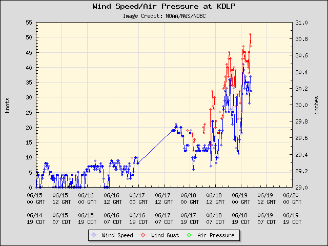
Heavy stuff has been coming down for the last 60 minutes. Big gusts, skies opened up, and gaps are filled with water. Supposed to get slightly worse over the next 3 hours. I hear we're seeing some minor flooding in the lower areas slightly south of my location. No power outages HERE, thus far. No wild reports of extremely nasty gusts as well. We've got the freezer loaded, charcoal stocked, and whiskey flowing regardless.
Heavy stuff has been coming down for the last 60 minutes. Big gusts, skies opened up, and gaps are filled with water. Supposed to get slightly worse over the next 3 hours. I hear we're seeing some minor flooding in the lower areas slightly south of my location. No power outages HERE, thus far. No wild reports of extremely nasty gusts as well. We've got the freezer loaded, charcoal stocked, and whiskey flowing regardless.
4 likes
-
StPeteMike

- Category 2
- Posts: 656
- Joined: Thu Jun 07, 2018 11:26 pm
Re: ATL: Potential Tropical Cyclone Three - Discussion
This might get a post season classification, but I don’t think they’ll give this a name or even TD3 later today. It might not even get a post season classification, they might consider the inability to keep a LLC intact and hold its place as the LLC of this system for over 6 hours as a reason to think this was just a broad low with multiple weak LLCs imbedded within it.
0 likes
The above post is not official and should not be used as such. It is the opinion of the poster and may or may not be backed by sound meteorological data. It is not endorsed by any professional institution or storm2k.org. For official information, please refer to the NHC and NWS products.
-
Sciencerocks
- Category 5
- Posts: 10186
- Age: 40
- Joined: Thu Jul 06, 2017 1:51 am

Re: ATL: CLAUDETTE - Tropical Storm - Discussion
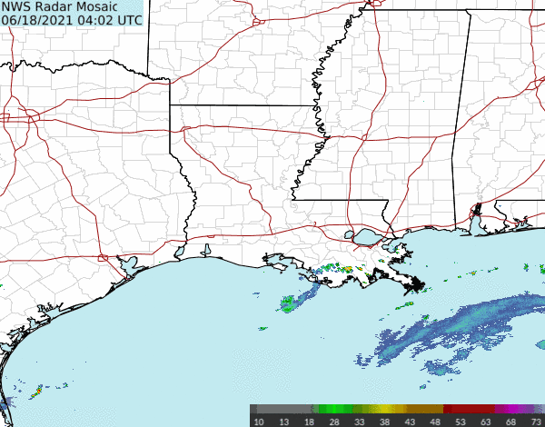
03L CLAUDETTE 210619 0600 29.2N 91.0W ATL 40 1006
The system that we have been tracking for a few days finally has
enough of a well-defined center and organized convection to be
considered a tropical storm. While the organization is not
classical by any means, and there are some hybrid characteristics,
the cyclone most resembles a sheared tropical storm, so the system
is now Tropical Storm Claudette. The initial wind speed remains 40
kt, in line with surface observations and radar. These winds are
primarily occurring in a strong band on the eastern side of the
cyclone well away from the center.
2 likes

Re: ATL: CLAUDETTE - Tropical Storm - Discussion
NHC Discussion:
The biggest change to the forecast is that almost all of the
reliable global models, save the GFS, are showing the system
regenerating near or offshore of the North Carolina coast in 60 to
72 hours. Thus the forecast has been extended from the last one
and now shows the system as a tropical cyclone over the western
Atlantic Ocean. The new intensity forecast is more conservative
than most of the guidance, but is higher than the previous advisory.
Extratropical transition is expected by 96 hours near Nova Scotia.
0 likes
-
EquusStorm
- Category 5
- Posts: 1649
- Age: 35
- Joined: Thu Nov 07, 2013 1:04 pm
- Location: Jasper, AL
- Contact:
Re: ATL: CLAUDETTE - Tropical Storm - Discussion
Lmaooo of all the things I expected to happen in this early pre-dawn hour, that was not very high on the list
Blake giving 'em another TCR to write after just finishing 52 of them
Blake giving 'em another TCR to write after just finishing 52 of them
4 likes
Colors of lost purpose on the canvas of irrelevance
Not a meteorologist, in fact more of an idiot than anything. You should probably check with the NHC or a local NWS office for official information.
Not a meteorologist, in fact more of an idiot than anything. You should probably check with the NHC or a local NWS office for official information.
-
MarioProtVI
- Category 5
- Posts: 1034
- Age: 24
- Joined: Sun Sep 29, 2019 7:33 pm
- Location: New Jersey
Re: ATL: CLAUDETTE - Tropical Storm - Discussion
Center is still poorly defined and not any better then last night. Disagree with the naming and should’ve just remained a low.
3 likes
-
EquusStorm
- Category 5
- Posts: 1649
- Age: 35
- Joined: Thu Nov 07, 2013 1:04 pm
- Location: Jasper, AL
- Contact:
Re: ATL: CLAUDETTE - Tropical Storm - Discussion
I don't know if other forecasters would've pulled the trigger, while the multiple swirls from earlier seem to have consolidated into a more defined low level swirl on the coast (perhaps now visible on radar as a surface swirl with very light precip racing past New Orleans) it was 100 miles from deep convection and that's really far on the subjective end of tropical cyclone. Convection to the east also looks more like a QLCS associated with mid-level circulation than tropical banding. Clearly a very subjective call and am honestly surprised said call was made, but eh, I've seen things not too much worse classified. Will be less of an issue if it regenerates into a more bona fide namable TC off the East Coast.
3 likes
Colors of lost purpose on the canvas of irrelevance
Not a meteorologist, in fact more of an idiot than anything. You should probably check with the NHC or a local NWS office for official information.
Not a meteorologist, in fact more of an idiot than anything. You should probably check with the NHC or a local NWS office for official information.
-
WacoWx
- Category 2
- Posts: 692
- Joined: Mon Dec 28, 2009 4:14 pm
- Location: NOT Waco, TX ----> Dallas, TX
Re: ATL: CLAUDETTE - Tropical Storm - Discussion
Can someone post a link to the visible satellite imagery? I’m leaving Jackson MS for Mobile in a few hours and I’d like to know What to expect cloud - cover’wise
0 likes
-
Dean4Storms
- S2K Supporter
- Posts: 6358
- Age: 63
- Joined: Sun Aug 31, 2003 1:01 pm
- Location: Miramar Bch. FL
Re: ATL: CLAUDETTE - Tropical Storm - Discussion
WacoWx wrote:Can someone post a link to the visible satellite imagery? I’m leaving Jackson MS for Mobile in a few hours and I’d like to know What to expect cloud - cover’wise
https://www.tropicaltidbits.com/sat/satlooper.php?region=03L&product=vis-swir
0 likes
-
Hypercane_Kyle

- Category 5
- Posts: 3465
- Joined: Sat Mar 07, 2015 7:58 pm
- Location: Cape Canaveral, FL
Re: ATL: Potential Tropical Cyclone Three - Discussion
Hypercane_Kyle wrote:My guess is this one will get a name right as its crossing the coastline.
6 likes
My posts are my own personal opinion, defer to the National Hurricane Center (NHC) and other NOAA products for decision making during hurricane season.
Who is online
Users browsing this forum: No registered users and 40 guests