2021APR17 101000 7.9 893.7 167.0 7.9 8.0 8.0 NO LIMIT OFF OFF OFF OFF 16.97 -84.71 EYE 20 IR 79.9 11.87 -129.51 ARCHER HIM-8 19.0
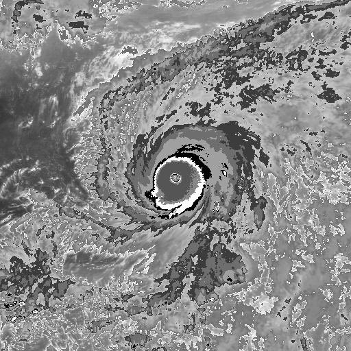
Goni reached a peak CI of 7.8
2020OCT31 184000 7.8 899.3 164.0 7.8 7.9 7.9 NO LIMIT OFF OFF OFF OFF 15.72 -82.75 EYE 17 IR 54.0 13.71 -124.80 ARCHER HIM-8 24.4
2020OCT31 190000 7.8 897.3 164.0 7.8 7.9 7.9 NO LIMIT OFF OFF OFF OFF 16.88 -82.73 EYE 17 IR 54.0 13.70 -124.72 ARCHER HIM-8 24.5
2020OCT31 193000 7.8 897.3 164.0 7.8 7.8 7.8 NO LIMIT OFF OFF OFF OFF 10.15 -82.69 EYE 17 IR 54.0 13.71 -124.61 ARCHER HIM-8 24.6
2020OCT31 200000 7.8 897.3 164.0 7.8 7.9 7.9 NO LIMIT OFF OFF OFF OFF 17.48 -82.68 EYE 16 IR 54.0 13.68 -124.46 ARCHER HIM-8 24.7