18z HMON slower, stronger, NE or previous runs. Shows strong TS/Cat 1 into PR in @30 hours...
Moderator: S2k Moderators


Blown Away wrote:https://i.imgur.com/9nzL8s1.gif
18z HMON slower, stronger, NE or previous runs. Shows strong TS/Cat 1 into PR in @30 hours...


Blown Away wrote:https://i.imgur.com/9nzL8s1.gif
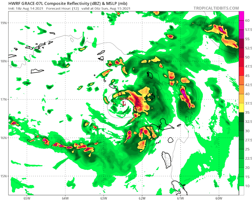
18z HMON slower, stronger, NE or previous runs. Shows strong TS/Cat 1 into PR in @30 hours...
Blown Away wrote:5pm 15.9N/60.7W - Due W at 26 mph.
HMON is at 16.5N/61.1W at 9 hours... Grace at 26 mph would have blown by that position way W, so throw out 18z models if you believe in the 5pm stats... IMO


AxaltaRacing24 wrote:FWIW, the NHC said that this HWRF had some new recon data in it.

IcyTundra wrote:0Z runs should hopefully intialize better with recon data.

Category5Kaiju wrote:So the HWRF depicting a northwestward turn and going over the DR and PR is predicted based on the recon data? That would be interesting.
HurricaneFrances04 wrote:Must be a complex setup. One gust of wind blows the wrong way and we get a completely different outcome. Kind of crazy the models can't figure it out only 48 hours out though.
SouthFLTropics wrote:HurricaneFrances04 wrote:Must be a complex setup. One gust of wind blows the wrong way and we get a completely different outcome. Kind of crazy the models can't figure it out only 48 hours out though.
Are we seeing a real time butterfly affect with the models? The notion that a butterfly can flap its wings and affect the weather. Not sure if there is truth the the theory in space/time but it’s about the best explanation that I can come up with. Chaos theory at its finest.
Sent from my iPhone using Tapatalk
Users browsing this forum: No registered users and 42 guests