ATL: FRED - Post-Tropical - Discussion
Moderator: S2k Moderators
-
Evil Jeremy

- S2K Supporter

- Posts: 5463
- Age: 32
- Joined: Mon Apr 10, 2006 2:10 pm
- Location: Los Angeles, CA
Re: ATL: INVEST 94L - Discussion
Never underestimate a wave with a broad and consistently popping (even if unorganized) convective component as it approaches the Lesser Antilles. Seen that story before.
9 likes
Frances 04 / Jeanne 04 / Katrina 05 / Wilma 05 / Fay 08 / Debby 12 / Andrea 13 / Colin 16 / Hermine 16 / Matthew 16 / Irma 17
-
captainbarbossa19

- Professional-Met

- Posts: 1094
- Age: 27
- Joined: Wed Aug 21, 2019 11:09 pm
- Location: Beaumont, TX
Re: ATL: INVEST 94L - Discussion
Shell Mound wrote:Aric Dunn wrote:
save south florida ? many system have crossed those regions and come out the other side to deepen again..
Those systems were larger than 94L. A small system such as 94L would likely struggle to contend with the mountainous terrain and lose its stacked circulation.
Laura:

Last edited by captainbarbossa19 on Sun Aug 08, 2021 1:17 pm, edited 1 time in total.
2 likes
-
toad strangler

- S2K Supporter
- Posts: 4546
- Joined: Sun Jul 28, 2013 3:09 pm
- Location: Earth
- Contact:
Re: ATL: INVEST 94L - Discussion
Shell Mound wrote:Aric Dunn wrote:Shell Mound wrote:A more southerly track would still take 94L toward the Tiburón Peninsula and some of the highest peaks on the island of Hispaniola, which would save South Florida.
save south florida ? many system have crossed those regions and come out the other side to deepen again..
Those systems were larger than 94L. A small system such as 94L would likely struggle to contend with the mountainous terrain and lose its stacked circulation.
Nah vehemently disagree. smaller circulations can get cranking much faster than large areas of disrupted circulation. If 94L is weak to begin while crossing GA mountains there would n't be much to disrupt anyway. We shall see!
4 likes
My Weather Station
https://www.wunderground.com/dashboard/pws/KFLPORTS603
https://www.wunderground.com/dashboard/pws/KFLPORTS603
-
toad strangler
- S2K Supporter
- Posts: 4546
- Joined: Sun Jul 28, 2013 3:09 pm
- Location: Earth
- Contact:
Re: ATL: INVEST 94L - Discussion
Evil Jeremy wrote:Never underestimate a wave with a broad and consistently popping (even if unorganized) convective component as it approaches the Lesser Antilles. Seen that story before.
Especially this time of year .... that calendar demands that a wave in an area like 94L be given much respect in August.
2 likes
My Weather Station
https://www.wunderground.com/dashboard/pws/KFLPORTS603
https://www.wunderground.com/dashboard/pws/KFLPORTS603
-
Aric Dunn
- Category 5

- Posts: 21238
- Age: 43
- Joined: Sun Sep 19, 2004 9:58 pm
- Location: Ready for the Chase.
- Contact:
Re: ATL: INVEST 94L - Discussion
HWRF reorganizing it south OF CUBA after landfall with Hispaniola.
1 likes
Note: If I make a post that is brief. Please refer back to previous posts for the analysis or reasoning. I do not re-write/qoute what my initial post said each time.
If there is nothing before... then just ask
Space & Atmospheric Physicist, Embry-Riddle Aeronautical University,
I believe the sky is falling...
If there is nothing before... then just ask
Space & Atmospheric Physicist, Embry-Riddle Aeronautical University,
I believe the sky is falling...
-
captainbarbossa19
- Professional-Met
- Posts: 1094
- Age: 27
- Joined: Wed Aug 21, 2019 11:09 pm
- Location: Beaumont, TX
Re: ATL: INVEST 94L - Discussion
Aric Dunn wrote:HWRF reorganizing it south OF CUBA after landfall with Hispaniola.
Reminding me of a certain storm from last year when it comes to track.
3 likes
-
Blown Away

- S2K Supporter
- Posts: 10253
- Joined: Wed May 26, 2004 6:17 am
Re: ATL: INVEST 94L - Discussion


Latest... Does appear to be somewhat consolidating farther N than earlier today...
Last edited by Blown Away on Sun Aug 08, 2021 2:01 pm, edited 2 times in total.
3 likes
Hurricane Eye Experience: David 79, Irene 99, Frances 04, Jeanne 04, Wilma 05… Hurricane Brush Experience: Andrew 92, Erin 95, Floyd 99, Matthew 16, Irma 17, Ian 22, Nicole 22…

Re: ATL: INVEST 94L - Discussion
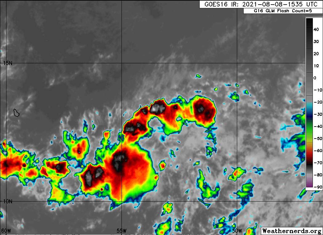
18z Best track. I am not sure if I agree with it being so far east. I place it closer to 54W.
But they could be still tracking the over all broad vorticity.
At 1800 UTC, 08 August 2021, DISTURBANCE INVEST 94 (AL94) was located in the North Atlantic basin at 13.1°N and 53.3°W.
But they could be still tracking the over all broad vorticity.
At 1800 UTC, 08 August 2021, DISTURBANCE INVEST 94 (AL94) was located in the North Atlantic basin at 13.1°N and 53.3°W.
0 likes
-
Aric Dunn
- Category 5
- Posts: 21238
- Age: 43
- Joined: Sun Sep 19, 2004 9:58 pm
- Location: Ready for the Chase.
- Contact:
Re: ATL: INVEST 94L - Discussion
NDG wrote:18z Best track. I am not sure if I agree with it being so far east. I place it closer to 54W.
But they could be still tracking the over all broad vorticity.
At 1800 UTC, 08 August 2021, DISTURBANCE INVEST 94 (AL94) was located in the North Atlantic basin at 13.1°N and 53.3°W.
I have it at 55.3
0 likes
Note: If I make a post that is brief. Please refer back to previous posts for the analysis or reasoning. I do not re-write/qoute what my initial post said each time.
If there is nothing before... then just ask
Space & Atmospheric Physicist, Embry-Riddle Aeronautical University,
I believe the sky is falling...
If there is nothing before... then just ask
Space & Atmospheric Physicist, Embry-Riddle Aeronautical University,
I believe the sky is falling...
Re: ATL: INVEST 94L - Discussion
The convection out front eroding the dry air a bit. If it manages to stay south of Barbados it may do ok.
0 likes
-
MGC

- S2K Supporter
- Posts: 5940
- Joined: Sun Mar 23, 2003 9:05 pm
- Location: Pass Christian MS, or what is left.
Re: ATL: INVEST 94L - Discussion
Starting to get that tumbleweed look. Better watch this one....MGC
4 likes
-
SFLcane

- S2K Supporter
- Posts: 10281
- Age: 48
- Joined: Sat Jun 05, 2010 1:44 pm
- Location: Lake Worth Florida
Re: ATL: INVEST 94L - Discussion
Meh… Not overly impressed as of right. Plenty of obstacles ahead one of them being land interaction. My bet is the nhc starts back tracking on those favorable conditions ahead.
We will see
We will see
0 likes
-
Blown Away
- S2K Supporter
- Posts: 10253
- Joined: Wed May 26, 2004 6:17 am
Re: ATL: INVEST 94L - Discussion

I couldn't make the "L" pop out at last second, lol... But IMO the "L" is where the Low is when the clip finishes and let's see if that new convection ball builds...
0 likes
Hurricane Eye Experience: David 79, Irene 99, Frances 04, Jeanne 04, Wilma 05… Hurricane Brush Experience: Andrew 92, Erin 95, Floyd 99, Matthew 16, Irma 17, Ian 22, Nicole 22…
-
cycloneye

- Admin

- Posts: 149550
- Age: 69
- Joined: Thu Oct 10, 2002 10:54 am
- Location: San Juan, Puerto Rico
Re: ATL: INVEST 94L - Discussion
1 likes
Visit the Caribbean-Central America Weather Thread where you can find at first post web cams,radars
and observations from Caribbean basin members Click Here
and observations from Caribbean basin members Click Here
-
Stormybajan

- Category 1

- Posts: 453
- Joined: Thu May 20, 2021 3:21 pm
- Location: Windward Islands
Re: ATL: INVEST 94L - Discussion
Blown Away wrote:https://i.imgur.com/gIYDvK7.gif
I couldn't make the "L" pop out at last second, lol... But IMO the "L" is where the Low is when the clip finishes and let's see if that new convection ball builds...
Not looking as good it did earlier or even last night, the issue clearly isnt shear but I think its found itself too close to the very dry air to its west, needs to form a moisture pouch for itself. We'll see if tonight it can refire some convection
0 likes
Sad West Indies and Manchester United fan ⚽️
-
Aric Dunn
- Category 5
- Posts: 21238
- Age: 43
- Joined: Sun Sep 19, 2004 9:58 pm
- Location: Ready for the Chase.
- Contact:
Re: ATL: INVEST 94L - Discussion
You can see the well defiend llc just peaking out from the convection. now we wait to see for convection fire back over it.


7 likes
Note: If I make a post that is brief. Please refer back to previous posts for the analysis or reasoning. I do not re-write/qoute what my initial post said each time.
If there is nothing before... then just ask
Space & Atmospheric Physicist, Embry-Riddle Aeronautical University,
I believe the sky is falling...
If there is nothing before... then just ask
Space & Atmospheric Physicist, Embry-Riddle Aeronautical University,
I believe the sky is falling...

Re: ATL: INVEST 94L - Discussion
MGC wrote:Starting to get that tumbleweed look. Better watch this one....MGC
I'll take a tumbleweed any day, Elsa developed an eye feature just before raking the southern part of Barbados which caused a lot of damage. Not seeing the concentrated showers yet so hopefully Barbados gets off with just squalls this time but with three invests out there I don't envy the NHC. Models are probably set for track accuracy, best scenario might be 93l and 94l take their time working out which one will become dominant and they steal enough resources from each other that neither become majors.
0 likes
-
Aric Dunn
- Category 5
- Posts: 21238
- Age: 43
- Joined: Sun Sep 19, 2004 9:58 pm
- Location: Ready for the Chase.
- Contact:
Re: ATL: INVEST 94L - Discussion
a little closer and slower for anyone not seeing it.


2 likes
Note: If I make a post that is brief. Please refer back to previous posts for the analysis or reasoning. I do not re-write/qoute what my initial post said each time.
If there is nothing before... then just ask
Space & Atmospheric Physicist, Embry-Riddle Aeronautical University,
I believe the sky is falling...
If there is nothing before... then just ask
Space & Atmospheric Physicist, Embry-Riddle Aeronautical University,
I believe the sky is falling...
-
AtlanticWind

- S2K Supporter
- Posts: 1898
- Age: 67
- Joined: Sun Aug 08, 2004 9:57 pm
- Location: Plantation,Fla
Re: ATL: INVEST 94L - Discussion
Being in South Florida I am not overly concerned yet, but this is one of the systems I watch closely for impacts since the models
are pretty tightly clustered on a path toward this area. Again models not showing much in intensity but
it is 6 days out from here. August /Sept. is the time to be prepared for sudden changes to forecasts for this type of situation.
Still my best guess is that this becomes weak/moderate T.S. and interacts with the islands enough to keep it weak. Hoping.
Always worry about rainfall in Haiti , hopefully moving fast enough that it wont be to bad
2 likes
-
AtlanticWind
- S2K Supporter
- Posts: 1898
- Age: 67
- Joined: Sun Aug 08, 2004 9:57 pm
- Location: Plantation,Fla
Re: ATL: INVEST 94L - Discussion
Aric Dunn wrote:a little closer and slower for anyone not seeing it.
https://i.ibb.co/G9FHjhB/LABELS-19700101-000000-131.gif
https://i.ibb.co/KLtyDYv/Capture.png
looks like it could be, but not sure its not a swirl in a little bit broader circulation.
0 likes
Who is online
Users browsing this forum: No registered users and 12 guests