ATL: SAM - Remnants - Discussion
Moderator: S2k Moderators
-
ElectricStorm

- Category 5

- Posts: 5147
- Age: 25
- Joined: Tue Aug 13, 2019 11:23 pm
- Location: Norman, OK
Re: ATL: INVEST 98L - Discussion
IMO I think there's a non-zero chance this ends up in the Caribbean. GFS tends to underestimate ridges and now with the collapse in convection and the SAL lurking, it's probably not going to develop nearly as soon as it looked like it could yesterday. These weaker storms can be sneaky and get further west than modeled, so I think all the islands are in play here and so is the eastern CONUS. Until we see an actual turn and recurve, this one is going to have to be watched.
4 likes
B.S Meteorology, University of Oklahoma '25
Please refer to the NHC, NWS, or SPC for official information.
Please refer to the NHC, NWS, or SPC for official information.
-
Category5Kaiju

- Category 5
- Posts: 4334
- Joined: Thu Dec 24, 2020 12:45 pm
- Location: Seattle and Phoenix
Re: ATL: INVEST 98L - Discussion
aspen wrote:Imagine this suddenly doesn’t develop and becomes another Peter after all of this model support that exceeds what Peter ever had lol
If 98L doesn’t start regaining convection by tonight, the HWRF is probably going to bust (again).
Eh, I doubt that will be the case; because of the simple fact that 98L's long term future does not as of currently involve any TUTTs and phenomenal shear like Peter did.
1 likes
Unless explicitly stated, all info in my posts is based on my own opinions and observations. Tropical storms and hurricanes can be extremely dangerous. Refer to an accredited weather research agency or meteorologist if you need to make serious decisions regarding an approaching storm.

Re: ATL: INVEST 98L - Discussion
Weather Dude wrote:and now with the collapse in convection and the SAL lurking, it's probably not going to develop nearly as soon as it looked like it could yesterday.
Pretty much all models don’t have a developed TC until Friday or early Saturday. That still seems reasonable now, unless 98L is still anemic by this time tomorrow.
0 likes
Irene '11 Sandy '12 Hermine '16 5/15/2018 Derecho Fay '20 Isaias '20 Elsa '21 Henri '21 Ida '21
I am only a meteorology enthusiast who knows a decent amount about tropical cyclones. Look to the professional mets, the NHC, or your local weather office for the best information.
I am only a meteorology enthusiast who knows a decent amount about tropical cyclones. Look to the professional mets, the NHC, or your local weather office for the best information.
-
ElectricStorm
- Category 5
- Posts: 5147
- Age: 25
- Joined: Tue Aug 13, 2019 11:23 pm
- Location: Norman, OK
Re: ATL: INVEST 98L - Discussion
aspen wrote:Weather Dude wrote:and now with the collapse in convection and the SAL lurking, it's probably not going to develop nearly as soon as it looked like it could yesterday.
Pretty much all models don’t have a developed TC until Friday or early Saturday. That still seems reasonable now, unless 98L is still anemic by this time tomorrow.
A couple runs yesterday looked like they developed it pretty quickly which seemed possible at the time since it was looking pretty good.
0 likes
B.S Meteorology, University of Oklahoma '25
Please refer to the NHC, NWS, or SPC for official information.
Please refer to the NHC, NWS, or SPC for official information.
-
SFLcane

- S2K Supporter

- Posts: 10281
- Age: 48
- Joined: Sat Jun 05, 2010 1:44 pm
- Location: Lake Worth Florida
Re: ATL: INVEST 98L - Discussion
Unfortunately there’s no Tutt in this invests path so conditions could be rather favorable nearing the islands.
0 likes
-
Sciencerocks
- Category 5
- Posts: 10186
- Age: 40
- Joined: Thu Jul 06, 2017 1:51 am
Re: ATL: INVEST 98L - Discussion
Weather Dude wrote:aspen wrote:Weather Dude wrote:and now with the collapse in convection and the SAL lurking, it's probably not going to develop nearly as soon as it looked like it could yesterday.
Pretty much all models don’t have a developed TC until Friday or early Saturday. That still seems reasonable now, unless 98L is still anemic by this time tomorrow.
A couple runs yesterday looked like they developed it pretty quickly which seemed possible at the time since it was looking pretty good.
I forget if any global run yesterday broke the consensus and developed 98L quickly, but I definitely remember that the HMON was WAY too fast with development. If it verified, we would have a moderate TS by now, Hurricane Sam by late tomorrow, and a major on Friday. The more recent runs have come into agreement with the HWRF and the globals, showing slow development that picks up late Thursday into early Friday and has a moderate TS by early-mid Saturday.
I was expecting a spin-down phase for 98L after all the other good-looking waves we’ve seen this year. They look great initially due to strong MLCs, then have an anemic or less active phase, then they begin redeveloping convection that gets the MLC to form and LLC.
4 likes
Irene '11 Sandy '12 Hermine '16 5/15/2018 Derecho Fay '20 Isaias '20 Elsa '21 Henri '21 Ida '21
I am only a meteorology enthusiast who knows a decent amount about tropical cyclones. Look to the professional mets, the NHC, or your local weather office for the best information.
I am only a meteorology enthusiast who knows a decent amount about tropical cyclones. Look to the professional mets, the NHC, or your local weather office for the best information.
-
jaxfladude
- Category 5
- Posts: 1249
- Joined: Wed Aug 24, 2005 9:36 pm
- Location: Jacksonville, Fla
Re: ATL: INVEST 98L - Discussion
Is this invest something to watch for Caribbean and/or others including ConUS? Or is the current background state staying negative long enough for this invrst lifespan?
0 likes
Stay safe y'all
-
wxman57

- Moderator-Pro Met

- Posts: 23175
- Age: 68
- Joined: Sat Jun 21, 2003 8:06 pm
- Location: Houston, TX (southwest)
Re: ATL: INVEST 98L - Discussion
jaxfladude wrote:Is this invest something to watch for Caribbean and/or others including ConUS? Or is the current background state staying negative long enough for this invrst lifespan?
If it stays weak, it could enter the Caribbean. As for a U.S. threat, probably not. First strong cold front of the season will be moving out into the Gulf tonight. Jet stream digs south into the Gulf and off the East Coast next week. That would shut down the season for most of the U.S. The lone exception would be the FL Peninsula, where the prime season is Oct/Nov for systems coming out of the NW Caribbean.
5 likes
-
gatorcane

- S2K Supporter
- Posts: 23708
- Age: 48
- Joined: Sun Mar 13, 2005 3:54 pm
- Location: Boca Raton, FL
Re: ATL: INVEST 98L - Discussion
wxman57 wrote:jaxfladude wrote:Is this invest something to watch for Caribbean and/or others including ConUS? Or is the current background state staying negative long enough for this invrst lifespan?
If it stays weak, it could enter the Caribbean. As for a U.S. threat, probably not. First strong cold front of the season will be moving out into the Gulf tonight. Jet stream digs south into the Gulf and off the East Coast next week. That would shut down the season for most of the U.S. The lone exception would be the FL Peninsula, where the prime season is Oct/Nov for systems coming out of the NW Caribbean.
I agree, fronts are starting to move through. I don’t see 98l being a U.S threat. As for Florida always need to watch the Caribbean in October and maybe some of November with La Niña.
2 likes

Re: ATL: INVEST 98L - Discussion
I am in the cone again.
This one seems to be more of a possible threat to me than Peter was.
#watching
3 likes
Too many hurricanes to remember
-
cycloneye

- Admin

- Posts: 149505
- Age: 69
- Joined: Thu Oct 10, 2002 10:54 am
- Location: San Juan, Puerto Rico
Re: ATL: INVEST 98L - Discussion
A small but concentrated area of showers and thunderstorms is
redeveloping along a tropical wave located a few hundred miles
southwest of the Cabo Verde Islands. Environmental conditions are
expected to become more conducive for development, and a tropical
depression is likely to form by Thursday or Friday while the system
moves westward at 10 to 15 mph across the eastern and central
tropical Atlantic Ocean.
* Formation chance through 48 hours...medium...60 percent.
* Formation chance through 5 days...high...90 percent.
1 likes
Visit the Caribbean-Central America Weather Thread where you can find at first post web cams,radars
and observations from Caribbean basin members Click Here
and observations from Caribbean basin members Click Here
-
cycloneye
- Admin
- Posts: 149505
- Age: 69
- Joined: Thu Oct 10, 2002 10:54 am
- Location: San Juan, Puerto Rico
Re: ATL: INVEST 98L - Discussion
msbee wrote:
I am in the cone again.
This one seems to be more of a possible threat to me than Peter was.

#watching
Yes, we have to watch closely this one. Let's see how it all evolve in the next few days.
1 likes
Visit the Caribbean-Central America Weather Thread where you can find at first post web cams,radars
and observations from Caribbean basin members Click Here
and observations from Caribbean basin members Click Here
-
ElectricStorm
- Category 5
- Posts: 5147
- Age: 25
- Joined: Tue Aug 13, 2019 11:23 pm
- Location: Norman, OK
Re: ATL: INVEST 98L - Discussion
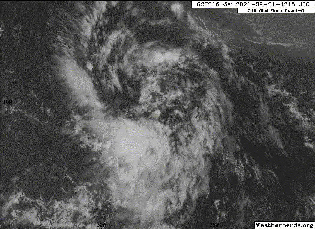
Convection starting to blow up on the north side. Still has a ways to go, but it's making some progress since having hardly any convection at all this morning. I think we'll be looking at TD18/TS Sam by Friday or Saturday.
0 likes
B.S Meteorology, University of Oklahoma '25
Please refer to the NHC, NWS, or SPC for official information.
Please refer to the NHC, NWS, or SPC for official information.
-
wxman57
- Moderator-Pro Met
- Posts: 23175
- Age: 68
- Joined: Sat Jun 21, 2003 8:06 pm
- Location: Houston, TX (southwest)
Re: ATL: INVEST 98L - Discussion
The Euro, which takes it to the northern DR as a hurricane at day 10, has 50+ kt W-WNW wind across the Florida straits at 200mb at day 10 and very dry air northward across the southeast U.S. and the Gulf. Not a favorable environment in its path. Will have to wait and see if/how/when it develops over the coming week to have a better idea of its future.
5 likes
-
ColdMiser123

- Professional-Met

- Posts: 905
- Age: 29
- Joined: Mon Sep 26, 2016 3:26 pm
- Location: Northeast US
Re: ATL: INVEST 98L - Discussion
wxman57 wrote:The Euro, which takes it to the northern DR as a hurricane at day 10, has 50+ kt W-WNW wind across the Florida straits at 200mb at day 10 and very dry air northward across the southeast U.S. and the Gulf. Not a favorable environment in its path. Will have to wait and see if/how/when it develops over the coming week to have a better idea of its future.
There's a lot of volatility with the upper level wind forecast over Florida with the 0z to the 12z Euro, such uncertainty highlights why this should be watched closely over the next several days.
0z Euro:

12z Euro:

7 likes
B.S., M.S., Meteorology & Atmospheric Science
-
Sciencerocks
- Category 5
- Posts: 10186
- Age: 40
- Joined: Thu Jul 06, 2017 1:51 am


Re: ATL: INVEST 98L - Discussion
Honestly still waiting for the models to just poof this storm on the next couple runs. More likely than not IMO given how things have been this year with the models. Trends are certainly concerning on the Euro but until we have an actual storm, I'll take each run with about 5 grains of salt 
2 likes
Who is online
Users browsing this forum: No registered users and 47 guests