#634 Postby aspen » Sun Aug 15, 2021 1:15 pm
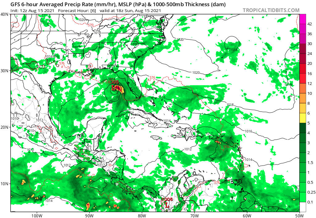
HWRF peaks as a 951 mbar major hurricane in 120hr. Obviously we’re seeing HWRF intensity bias, but if Grace takes a track like this and if it’s in a better shape entering then Gulf than Fred, then such a scenario isn’t impossible. I think another reason why the HWRF gets so aggressive is because Grace runs right over the broiling hot Loop Current.
Edit: it has an ERI phase and ends up as a 940 mbar Category 4 Hurricane by 126hr, the strongest Atlantic HWRF intensity output this year so far. HWRF bias plus the Loop Current is quite the combination.
Last edited by
aspen on Sun Aug 15, 2021 1:22 pm, edited 1 time in total.
1 likes
Irene '11 Sandy '12 Hermine '16 5/15/2018 Derecho Fay '20 Isaias '20 Elsa '21 Henri '21 Ida '21
I am only a meteorology enthusiast who knows a decent amount about tropical cyclones. Look to the professional mets, the NHC, or your local weather office for the best information.


