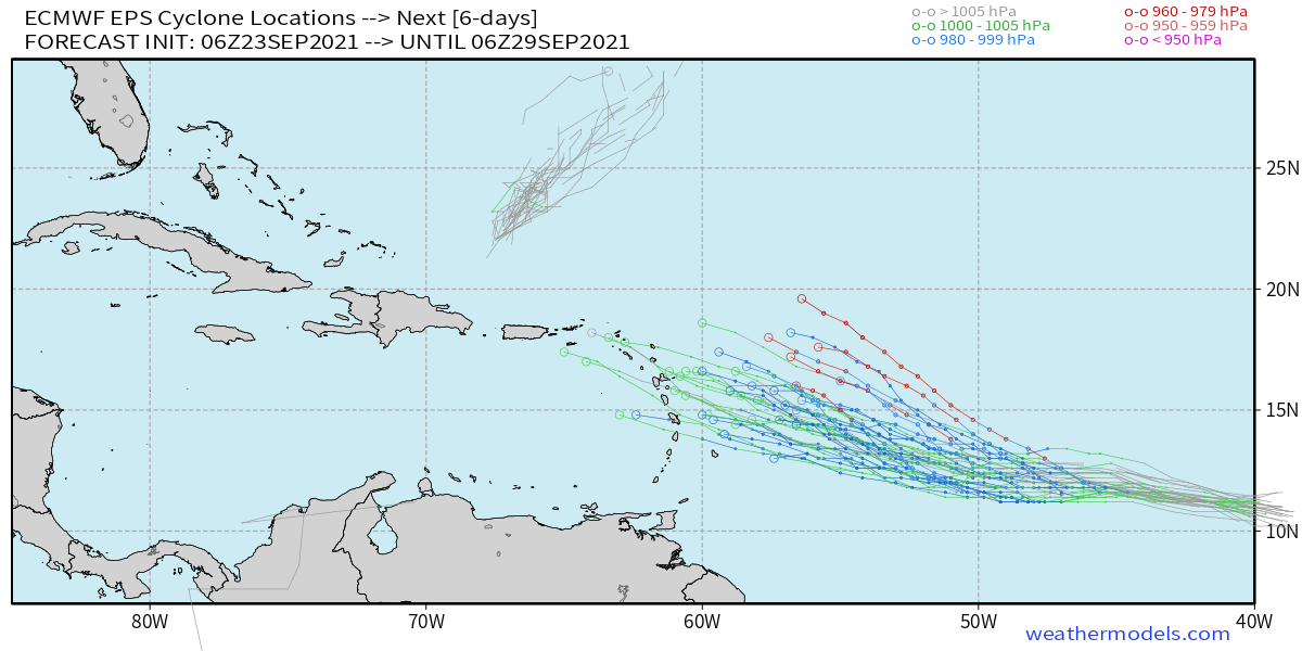
cycloneye wrote:SFLcane wrote:The mean on the 06z Eps looks like it would move into the Caribbean.
Hi Adrian. Do you have a graphic?
Here is a better representation:

Moderator: S2k Moderators

cycloneye wrote:SFLcane wrote:The mean on the 06z Eps looks like it would move into the Caribbean.
Hi Adrian. Do you have a graphic?
aspen wrote:00z and 06z runs on the latest CDAS SST map.
00z Euro: black, 24-240 hrs
06z GFS: sky blue, 24-240 hrs
00z CMC: green, 24-240 hrs
00z ICON: navy blue, 24-180 hrs
HMON: white, 24-120 hrs
HWRF: yellow, 24-120 hrs
https://i.imgur.com/TNsyamL.png


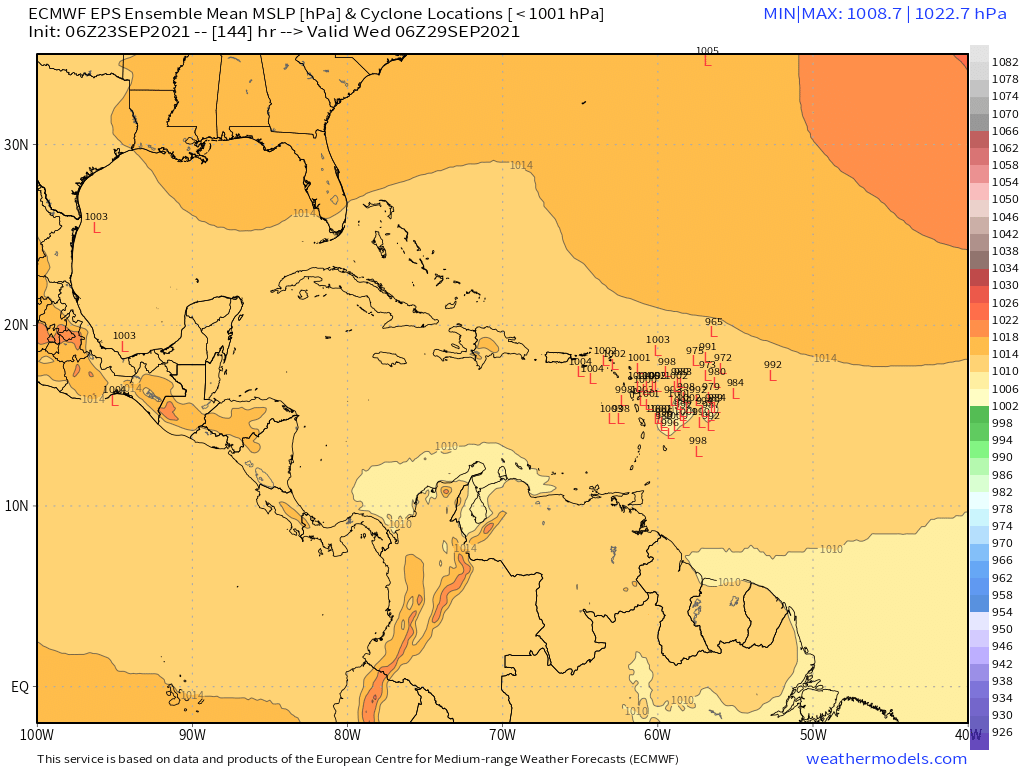
USTropics wrote:cycloneye wrote:SFLcane wrote:The mean on the 06z Eps looks like it would move into the Caribbean.
Hi Adrian. Do you have a graphic?
Here is a better representation:
https://i.imgur.com/4la40ei.png

USTropics wrote:cycloneye wrote:SFLcane wrote:The mean on the 06z Eps looks like it would move into the Caribbean.
Hi Adrian. Do you have a graphic?
Here is a better representation:
https://i.imgur.com/4la40ei.png
kevin wrote:Looks like the Euro is really sticking to its southern track. Whatever happens now, it'll be a massive bust for either the Euro or all the other models depending on which track actually verifies. Or maybe we'll get some sort of compromise between the two possibilities.

Shell Mound wrote:
Yesterday roughly three-fifths (~60%) of the fifty-one EPS ensembles showed “Sam” becoming a hurricane on or before D7 (168h) and remaining to the north of the Leeward Islands. Now more than four-fifths (> 80%) of the EPS members show “Sam” strengthening no further than ~60 kt at most during the upcoming week and tracking toward the northeastern Caribbean rather than strengthening into a hurricane and curving earlier. On the one hand, this implies an increased threat to the islands, but on the other, it also indicates a far more hostile environment—possibly due to SAL-induced, fast background flow hindering organisation, as was seen with some other systems to date—that would inhibit significant deepening. Given that “Sam” is likely to be a small, fast-moving system, even if it were to impact the islands, most locations would see relatively little impact from either rain or wind, as “Sam” would likely be no stronger than a high-end TS at that point.

CyclonicFury wrote:Shell Mound wrote:
Yesterday roughly three-fifths (~60%) of the fifty-one EPS ensembles showed “Sam” becoming a hurricane on or before D7 (168h) and remaining to the north of the Leeward Islands. Now more than four-fifths (> 80%) of the EPS members show “Sam” strengthening no further than ~60 kt at most during the upcoming week and tracking toward the northeastern Caribbean rather than strengthening into a hurricane and curving earlier. On the one hand, this implies an increased threat to the islands, but on the other, it also indicates a far more hostile environment—possibly due to SAL-induced, fast background flow hindering organisation, as was seen with some other systems to date—that would inhibit significant deepening. Given that “Sam” is likely to be a small, fast-moving system, even if it were to impact the islands, most locations would see relatively little impact from either rain or wind, as “Sam” would likely be no stronger than a high-end TS at that point.
Sam seems to be organizing much quicker than most models expected. Also, Sam is NOT likely going to be a fast moving storm at all. It's going to take about 5-6 more days before it exits the MDR.


SFLcane wrote:12z Gfs weaker perhaps trending towards euro.

Users browsing this forum: No registered users and 47 guests


