ATL: KATE - Remnants - Discussion
Moderator: S2k Moderators
Re: ATL: INVEST 98L - Discussion
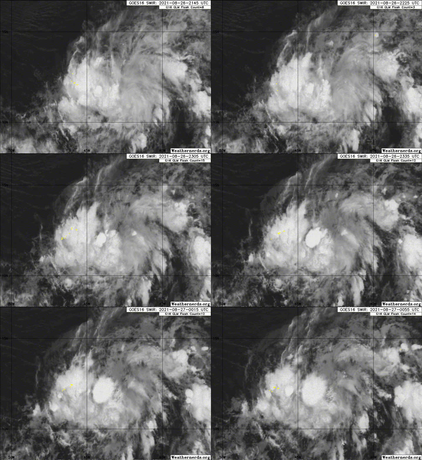
The new burst of convection could help the strong MLC bore its way down to the surface and form an LLC. With 97L not developing and not being strong enough to significantly break the ridge, 98L will probably continue going west for some time. Models have had to correct west pretty much ever since this was first designated.
6 likes
Irene '11 Sandy '12 Hermine '16 5/15/2018 Derecho Fay '20 Isaias '20 Elsa '21 Henri '21 Ida '21
I am only a meteorology enthusiast who knows a decent amount about tropical cyclones. Look to the professional mets, the NHC, or your local weather office for the best information.
I am only a meteorology enthusiast who knows a decent amount about tropical cyclones. Look to the professional mets, the NHC, or your local weather office for the best information.
-
Sciencerocks
- Category 5

- Posts: 10186
- Age: 40
- Joined: Thu Jul 06, 2017 1:51 am
- galaxy401
- Category 5

- Posts: 2446
- Age: 30
- Joined: Sat Aug 25, 2012 9:04 pm
- Location: Casa Grande, Arizona
Re: ATL: INVEST 98L - Discussion
Looking more likely this will be Julian. Code Red now.
Tropical Weather Outlook
NWS National Hurricane Center Miami FL
200 AM EDT Fri Aug 27 2021
For the North Atlantic...Caribbean Sea and the Gulf of Mexico:
A tropical wave located about midway between the Cabo Verde Islands
and the Lesser Antilles continues to produce a large area of
disorganized showers and thunderstorms. Gradual development of this
system is expected, and a tropical depression is likely to form
during the next couple of days before it moves into an environment
of stronger upper-level winds and slightly cooler waters. The
disturbance is forecast to move west-northwestward for another day
or so and then turn northward over the weekend.
* Formation chance through 48 hours...high...70 percent.
* Formation chance through 5 days...high...80 percent.
0 likes
Got my eyes on moving right into Hurricane Alley: Florida.
Re: ATL: INVEST 98L - Discussion
ScottNAtlanta wrote:Ok...this was 20/40, then 20/30, and now it's 60/70.

Looking at the WV loop if anything it looks like it is being pushed just south of west. According to most of the models this needs to take a pretty drastic turn north in the next 24hrs and I just don't see it. I think the models were taking a 97L into account being much stronger than it got.
Ahh I was gonna mention this, lots of focus on IDA right now that for sure, but don't let 98 fool you, regardless of LI if any at all this invest has been hanging in there and has been impressive looking since almost 20W with it's pulsing, just makes me wonder how that next wave coming off of Africa is going to pan out. Again if it pulls N great but it has been slated to go NW for the last 50+ hours
0 likes
Once I see the REDS and GREENS Converge on a Base Velocity. ... I'm There!!
This is NOT an Official Forecast....Just my Opinion. For official information, please refer to the NHC and NWS products.
HIGHLIGHTS : '13 El Reno Tornado : 2013 Storm Chaser Tour, Joaquin; SC flood event, Matthew '16, Lowcountry Snow storm Jan '18
This is NOT an Official Forecast....Just my Opinion. For official information, please refer to the NHC and NWS products.
HIGHLIGHTS : '13 El Reno Tornado : 2013 Storm Chaser Tour, Joaquin; SC flood event, Matthew '16, Lowcountry Snow storm Jan '18
Re: ATL: INVEST 98L - Discussion
Convection has really wanted overnight. Any progress it made yesterday seems to have been tossed out the window.
0 likes
Irene '11 Sandy '12 Hermine '16 5/15/2018 Derecho Fay '20 Isaias '20 Elsa '21 Henri '21 Ida '21
I am only a meteorology enthusiast who knows a decent amount about tropical cyclones. Look to the professional mets, the NHC, or your local weather office for the best information.
I am only a meteorology enthusiast who knows a decent amount about tropical cyclones. Look to the professional mets, the NHC, or your local weather office for the best information.
- ScottNAtlanta
- Category 5

- Posts: 2535
- Joined: Sat May 25, 2013 3:11 pm
- Location: Atlanta, GA
Re: ATL: INVEST 98L - Discussion
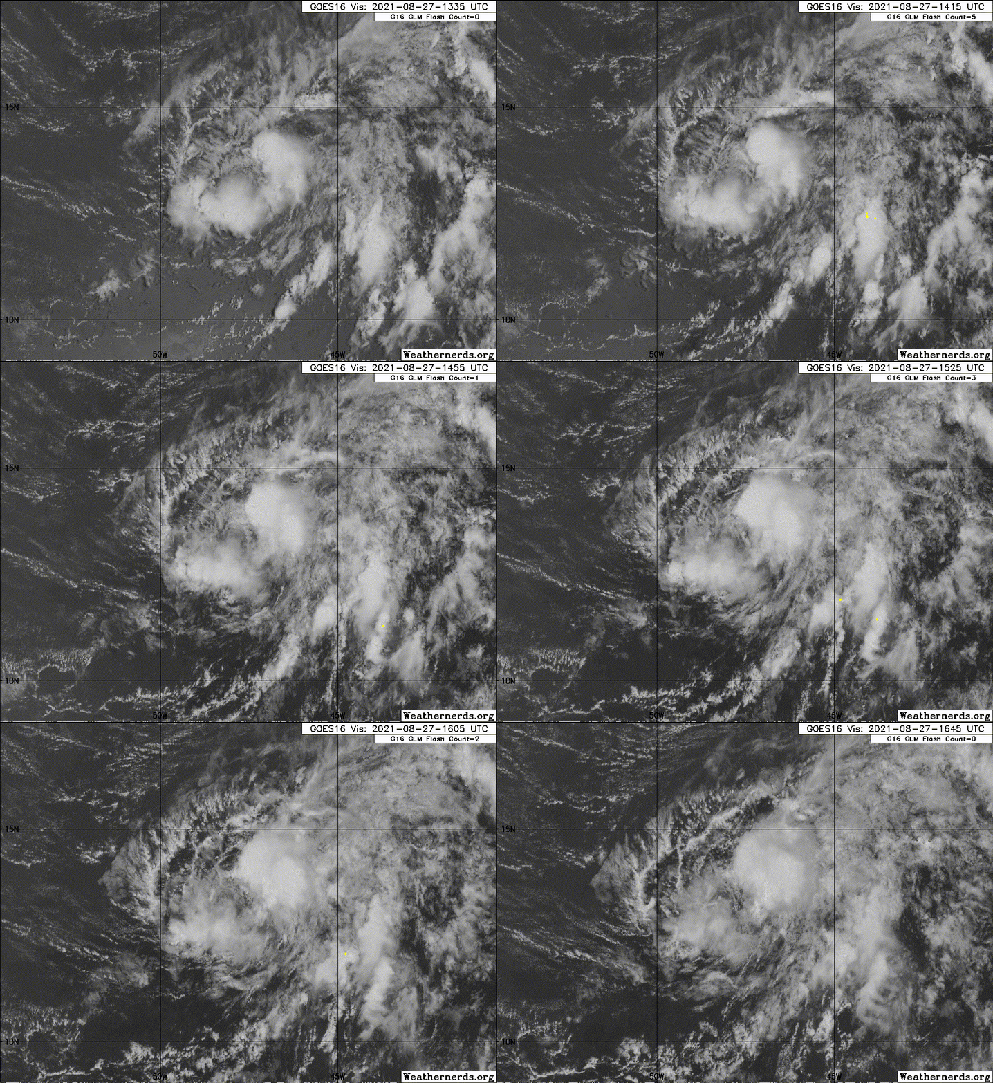
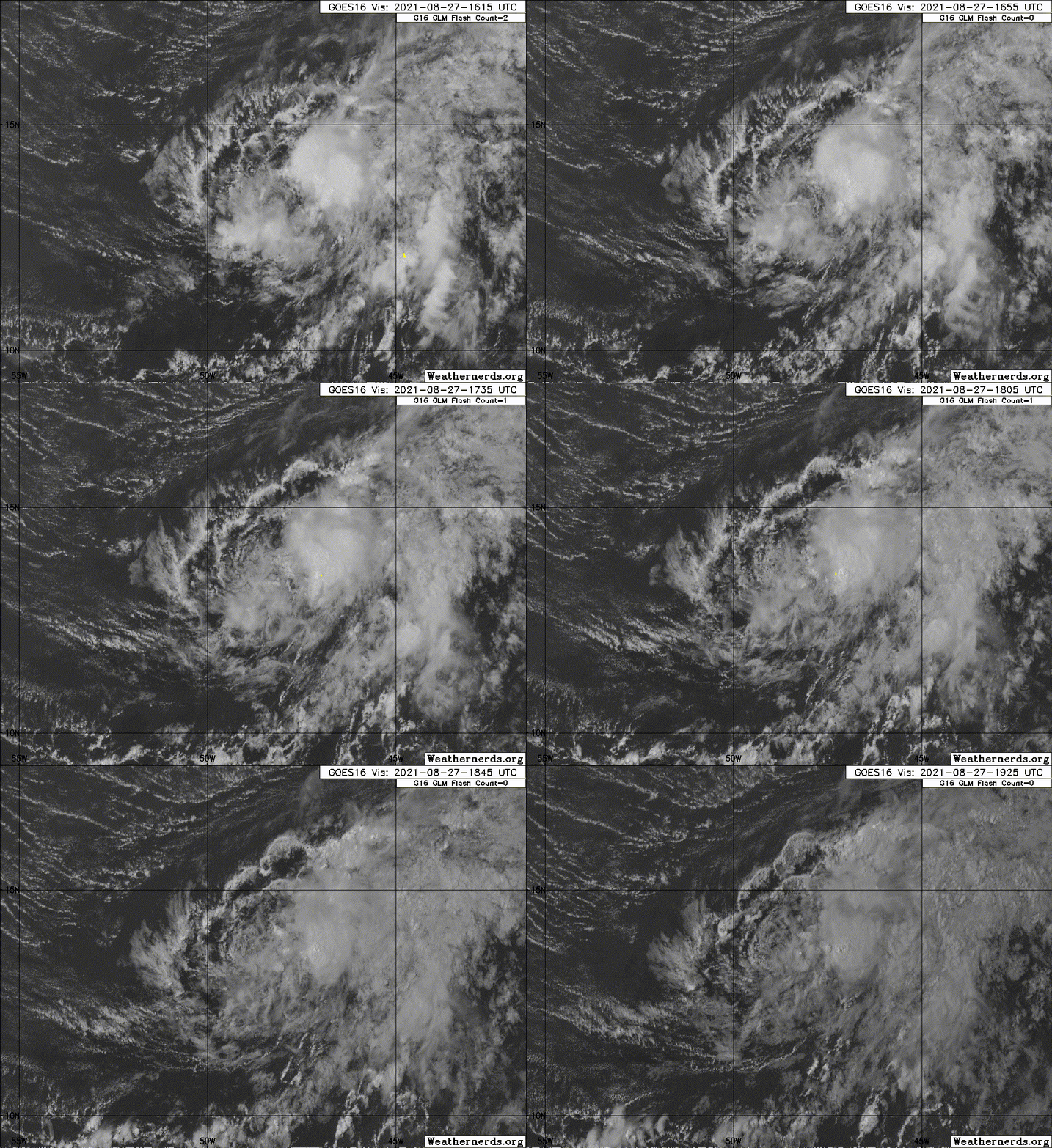
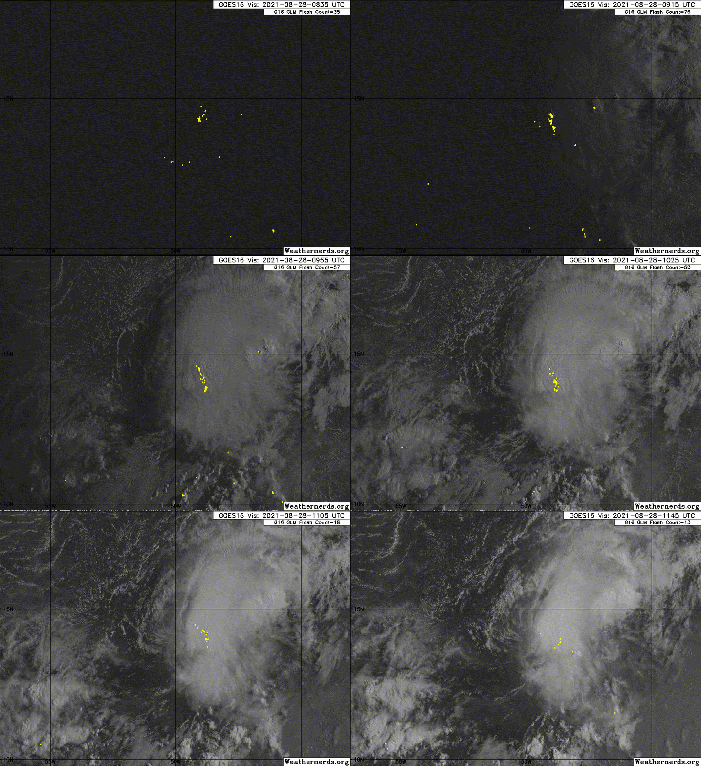
Looking at visible this morning, you can see this has a rather robust LLC. It just needs one good blowup over the center and this is a depression
0 likes
The posts in this forum are NOT official forecast and should not be used as such. They are just the opinion of the poster and may or may not be backed by sound meteorological data. They are NOT endorsed by any professional institution or storm2k.org. For official information, please refer to the NHC and NWS products.
-
Sciencerocks
- Category 5

- Posts: 10186
- Age: 40
- Joined: Thu Jul 06, 2017 1:51 am
Re: ATL: INVEST 98L - Discussion
The NHC has bumped it up to 80/80 and said a TD is likely to form either tonight or tomorrow. I guess we’re going to see Julian this weekend.
0 likes
Irene '11 Sandy '12 Hermine '16 5/15/2018 Derecho Fay '20 Isaias '20 Elsa '21 Henri '21 Ida '21
I am only a meteorology enthusiast who knows a decent amount about tropical cyclones. Look to the professional mets, the NHC, or your local weather office for the best information.
I am only a meteorology enthusiast who knows a decent amount about tropical cyclones. Look to the professional mets, the NHC, or your local weather office for the best information.
- cycloneye
- Admin

- Posts: 149550
- Age: 69
- Joined: Thu Oct 10, 2002 10:54 am
- Location: San Juan, Puerto Rico
Re: ATL: INVEST 98L - Discussion
Showers and thunderstorms associated with a tropical wave located
about midway between the Cabo Verde Islands and the Lesser Antilles
have become a little better organized today. Additional
development of this system is expected, and a tropical depression
is likely to form later tonight or Saturday before it moves into an
environment of stronger upper-level winds and slightly cooler
waters. The disturbance is forecast to move west-northwestward
through tonight, then turn northward Saturday.
* Formation chance through 48 hours...high...80 percent.
* Formation chance through 5 days...high...80 percent.
0 likes
Visit the Caribbean-Central America Weather Thread where you can find at first post web cams,radars
and observations from Caribbean basin members Click Here
and observations from Caribbean basin members Click Here
-
Sciencerocks
- Category 5

- Posts: 10186
- Age: 40
- Joined: Thu Jul 06, 2017 1:51 am
-
Sciencerocks
- Category 5

- Posts: 10186
- Age: 40
- Joined: Thu Jul 06, 2017 1:51 am
- cycloneye
- Admin

- Posts: 149550
- Age: 69
- Joined: Thu Oct 10, 2002 10:54 am
- Location: San Juan, Puerto Rico
Re: ATL: INVEST 98L - Discussion
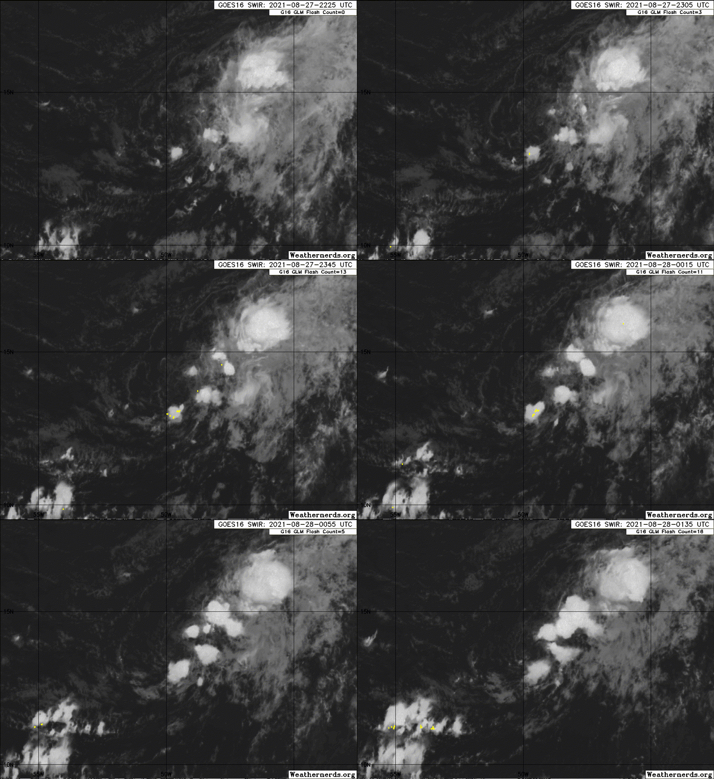
2 days ago, it looked almost like a TD but now not so much.
0 likes
Visit the Caribbean-Central America Weather Thread where you can find at first post web cams,radars
and observations from Caribbean basin members Click Here
and observations from Caribbean basin members Click Here
- InfernoFlameCat
- Category 5

- Posts: 2127
- Age: 22
- Joined: Mon Dec 14, 2020 10:52 am
- Location: Buford, GA
Re: ATL: INVEST 98L - Discussion
98L is looking very close to becoming a Tc.
0 likes
I am by no means a professional. DO NOT look at my forecasts for official information or make decisions based on what I post.
Goal: to become a registered expert over tropical and subtropical cyclones.
Goal: to become a registered expert over tropical and subtropical cyclones.
Re: ATL: TEN - Tropical Depression - Discussion
AL, 10, 2021082806, , BEST, 0, 137N, 498W, 30, 1007, TD, 34, NEQ, 0, 0, 0, 0, 1011, 150, 50, 0, 0, L, 0, , 0, 0, TEN, M, 0, , 0, 0, 0, 0, genesis-num, 024, TRANSITIONED, alB82021 to al102021,
5 likes
Re: ATL: TEN - Tropical Depression - Discussion
Invest 98L is now TD-10
https://www.nhc.noaa.gov/text/refresh/M ... 0854.shtml?
https://www.nhc.noaa.gov/text/refresh/M ... 0854.shtml?
000
WTNT35 KNHC 280854
TCPAT5
BULLETIN
Tropical Depression Ten Advisory Number 1
NWS National Hurricane Center Miami FL AL102021
500 AM AST Sat Aug 28 2021
...NEW DEPRESSION FORMS OVER THE CENTRAL TROPICAL ATLANTIC...
...EXPECTED TO BECOME A TROPICAL STORM LATER TODAY...
SUMMARY OF 500 AM AST...0900 UTC...INFORMATION
----------------------------------------------
LOCATION...14.0N 49.9W
ABOUT 820 MI...1320 KM ESE OF THE LEEWARD ISLANDS
MAXIMUM SUSTAINED WINDS...35 MPH...55 KM/H
PRESENT MOVEMENT...NNW OR 340 DEGREES AT 7 MPH...11 KM/H
MINIMUM CENTRAL PRESSURE...1007 MB...29.74 INCHES
WATCHES AND WARNINGS
--------------------
There are no coastal watches or warnings in effect.
DISCUSSION AND OUTLOOK
----------------------
At 500 AM AST (0900 UTC), the center of Tropical Depression Ten was
located near latitude 14.0 North, longitude 49.9 West. The
depression is moving toward the north-northwest near 7 mph (11 km/h)
and this motion is forecast to continue this morning. By this
afternoon, the depression is forecast to move northward, and then
maintain that general motion into early next week. On the forecast
track, the system is expected to remain over the open Atlantic well
to the east of the Lesser Antilles.
Maximum sustained winds are near 35 mph (55 km/h) with higher gusts.
Some slight strengthening is forecast during the next 48 hours, and
the depression is expected to become a tropical storm later today.
The estimated minimum central pressure is 1007 mb (29.74 inches).
HAZARDS AFFECTING LAND
----------------------
None.
NEXT ADVISORY
-------------
Next complete advisory at 1100 AM AST.
$$
Forecaster Stewart
Last edited by ChrisH-UK on Sat Aug 28, 2021 6:43 am, edited 1 time in total.
0 likes
- Stormybajan
- Category 1

- Posts: 453
- Joined: Thu May 20, 2021 3:21 pm
- Location: Windward Islands
Re: ATL: TEN - Tropical Depression - Discussion
ChrisH-UK wrote:Invest 97L is now TD-10
https://www.nhc.noaa.gov/text/refresh/M ... 0854.shtml?000
WTNT35 KNHC 280854
TCPAT5
BULLETIN
Tropical Depression Ten Advisory Number 1
NWS National Hurricane Center Miami FL AL102021
500 AM AST Sat Aug 28 2021
...NEW DEPRESSION FORMS OVER THE CENTRAL TROPICAL ATLANTIC...
...EXPECTED TO BECOME A TROPICAL STORM LATER TODAY...
SUMMARY OF 500 AM AST...0900 UTC...INFORMATION
----------------------------------------------
LOCATION...14.0N 49.9W
ABOUT 820 MI...1320 KM ESE OF THE LEEWARD ISLANDS
MAXIMUM SUSTAINED WINDS...35 MPH...55 KM/H
PRESENT MOVEMENT...NNW OR 340 DEGREES AT 7 MPH...11 KM/H
MINIMUM CENTRAL PRESSURE...1007 MB...29.74 INCHES
WATCHES AND WARNINGS
--------------------
There are no coastal watches or warnings in effect.
DISCUSSION AND OUTLOOK
----------------------
At 500 AM AST (0900 UTC), the center of Tropical Depression Ten was
located near latitude 14.0 North, longitude 49.9 West. The
depression is moving toward the north-northwest near 7 mph (11 km/h)
and this motion is forecast to continue this morning. By this
afternoon, the depression is forecast to move northward, and then
maintain that general motion into early next week. On the forecast
track, the system is expected to remain over the open Atlantic well
to the east of the Lesser Antilles.
Maximum sustained winds are near 35 mph (55 km/h) with higher gusts.
Some slight strengthening is forecast during the next 48 hours, and
the depression is expected to become a tropical storm later today.
The estimated minimum central pressure is 1007 mb (29.74 inches).
HAZARDS AFFECTING LAND
----------------------
None.
NEXT ADVISORY
-------------
Next complete advisory at 1100 AM AST.
$$
Forecaster Stewart
you mean 98L?
0 likes
Sad West Indies and Manchester United fan ⚽️
Re: ATL: TEN - Tropical Depression - Discussion
Stormybajan wrote:ChrisH-UK wrote:Invest 97L is now TD-10
https://www.nhc.noaa.gov/text/refresh/M ... 0854.shtml?000
WTNT35 KNHC 280854
TCPAT5
BULLETIN
Tropical Depression Ten Advisory Number 1
NWS National Hurricane Center Miami FL AL102021
500 AM AST Sat Aug 28 2021
........................................
NEXT ADVISORY
-------------
Next complete advisory at 1100 AM AST.
$$
Forecaster Stewart
you mean 98L?
Oops,thanks i've fixed it.
1 likes
-
Sciencerocks
- Category 5

- Posts: 10186
- Age: 40
- Joined: Thu Jul 06, 2017 1:51 am
- ElectricStorm
- Category 5

- Posts: 5148
- Age: 25
- Joined: Tue Aug 13, 2019 11:23 pm
- Location: Norman, OK
Re: ATL: TEN - Tropical Depression - Discussion
Almost a swirl alert. I don't really see this one getting very strong at all, maybe a weak TS, similar to the NHC forecast.
0 likes
B.S Meteorology, University of Oklahoma '25
Please refer to the NHC, NWS, or SPC for official information.
Please refer to the NHC, NWS, or SPC for official information.
Re: ATL: TEN - Tropical Depression - Discussion
Weather Dude wrote:Almost a swirl alert. I don't really see this one getting very strong at all, maybe a weak TS, similar to the NHC forecast.
Supposed to maintain a depression status. Strange poleward movement for such a weak system.
0 likes
Who is online
Users browsing this forum: No registered users and 12 guests

