AL, 92, 2021061218, , BEST, 0, 200N, 945W, 20, 1008, DB, 34, NEQ, 0, 0, 0, 0, 1010, 100, 90, 0, 0, L, 0, , 0, 0, INVEST, S, 0, , 0, 0, 0, 0, genesis-num, 004, SPAWNINVEST, al742021 to al922021,
ATL: CLAUDETTE - Remnants - Discussion
Moderator: S2k Moderators
-
cycloneye

- Admin

- Posts: 149509
- Age: 69
- Joined: Thu Oct 10, 2002 10:54 am
- Location: San Juan, Puerto Rico
ATL: CLAUDETTE - Remnants - Discussion
Here we go.
2 likes
Visit the Caribbean-Central America Weather Thread where you can find at first post web cams,radars
and observations from Caribbean basin members Click Here
and observations from Caribbean basin members Click Here
-
Sciencerocks
- Category 5

- Posts: 10186
- Age: 40
- Joined: Thu Jul 06, 2017 1:51 am
Re: ATL: INVEST 92L - Discussion
Tropical Weather Outlook
NWS National Hurricane Center Miami FL
200 PM EDT Sat Jun 12 2021
For the North Atlantic...Caribbean Sea and the Gulf of Mexico:
An area of cloudiness and showers over the Bay of Campeche and the
adjacent land areas is associated with a trough of low pressure.
Slow development of this system is possible over the next several
days as it moves slowly and erratically, and a tropical depression
could form in this area by the middle of next week. Regardless of
development, due to the slow motion heavy rainfall is possible over
portions of Central America and southern Mexico. Please consult
products from your local meteorological service for more
information.
* Formation chance through 48 hours...low...10 percent.
* Formation chance through 5 days...medium...40 percent.
$$
Forecaster Beven/Latto
2 likes
-
Sciencerocks
- Category 5
- Posts: 10186
- Age: 40
- Joined: Thu Jul 06, 2017 1:51 am

Re: ATL: INVEST 92L - Discussion
Levi got his 1st video out on 92L.
1 likes
Robbielyn McCrary
I know just about enough to sound like I know what I'm talking about sometimes. But for your safety please follow the nhc for truly professional forecasting.
I know just about enough to sound like I know what I'm talking about sometimes. But for your safety please follow the nhc for truly professional forecasting.
-
cycloneye
- Admin
- Posts: 149509
- Age: 69
- Joined: Thu Oct 10, 2002 10:54 am
- Location: San Juan, Puerto Rico
Re: ATL: INVEST 92L - Discussion
5 likes
Visit the Caribbean-Central America Weather Thread where you can find at first post web cams,radars
and observations from Caribbean basin members Click Here
and observations from Caribbean basin members Click Here

Re: ATL: INVEST 92L - Discussion
BOC looks juiced but if tries to get north of 25N anytime soon it will be shredded. Hopefully we won’t get to much rain out of this, the gulf coast from Mobile to Corpus Cristi has been pretty wet YTD.
0 likes
The following post is NOT an official forecast and should not be used as such. It is just the opinion of the poster and may or may not be backed by sound meteorological data. It is NOT endorsed by any professional institution including storm2k.org For Official Information please refer to the NHC and NWS products.

Re: ATL: INVEST 92L - Discussion
The important points from Levi’s video:
1.) there is a weak, elongated circulation currently present
2.) 92L will be under low-moderate shear within a “safe pocket” until Monday or Tuesday
3.) A gigantic ridge will push 92L south and impart a ton of shear mid-week
4.) As the ridge weakened by the end of the week, 92L will have another pocket of reduced shear, and it looks like it’ll probably move north
2 likes
Irene '11 Sandy '12 Hermine '16 5/15/2018 Derecho Fay '20 Isaias '20 Elsa '21 Henri '21 Ida '21
I am only a meteorology enthusiast who knows a decent amount about tropical cyclones. Look to the professional mets, the NHC, or your local weather office for the best information.
I am only a meteorology enthusiast who knows a decent amount about tropical cyclones. Look to the professional mets, the NHC, or your local weather office for the best information.
-
Hypercane_Kyle

- Category 5
- Posts: 3465
- Joined: Sat Mar 07, 2015 7:58 pm
- Location: Cape Canaveral, FL
Re: ATL: INVEST 92L - Discussion
Messy

0 likes
My posts are my own personal opinion, defer to the National Hurricane Center (NHC) and other NOAA products for decision making during hurricane season.
-
captainbarbossa19

- Professional-Met

- Posts: 1094
- Age: 27
- Joined: Wed Aug 21, 2019 11:09 pm
- Location: Beaumont, TX
Re: ATL: INVEST 92L - Discussion
Yep. Looks like a soon-to-be June TC (possibly). Definitely not August or September quality. It is rather rare to get a June hurricane.
0 likes
-
cycloneye
- Admin
- Posts: 149509
- Age: 69
- Joined: Thu Oct 10, 2002 10:54 am
- Location: San Juan, Puerto Rico
Re: ATL: INVEST 92L - Discussion
Tropical Weather Outlook
NWS National Hurricane Center Miami FL
800 PM EDT Sat Jun 12 2021
For the North Atlantic...Caribbean Sea and the Gulf of Mexico:
An area of cloudiness and showers over the Bay of Campeche and the
adjacent land areas is associated with a trough of low pressure.
Slow development is possible over the next several days while this
system moves slowly and erratically, and a tropical depression could
form in this area by the middle of next week. Regardless of
development, heavy rainfall is possible over portions of Central
America and southern Mexico during the next several days. Please
consult products from your local meteorological service for more
information.
* Formation chance through 48 hours...low...10 percent.
* Formation chance through 5 days...medium...40 percent.
$$
Forecaster Papin/Pasch
0 likes
Visit the Caribbean-Central America Weather Thread where you can find at first post web cams,radars
and observations from Caribbean basin members Click Here
and observations from Caribbean basin members Click Here
-
cycloneye
- Admin
- Posts: 149509
- Age: 69
- Joined: Thu Oct 10, 2002 10:54 am
- Location: San Juan, Puerto Rico
Re: ATL: INVEST 92L - Discussion
00z Best Track is stationary as this was the same position at 18z.
AL, 92, 2021061300, , BEST, 0, 200N, 945W, 20, 1008, DB
0 likes
Visit the Caribbean-Central America Weather Thread where you can find at first post web cams,radars
and observations from Caribbean basin members Click Here
and observations from Caribbean basin members Click Here
-
DorkyMcDorkface

- Category 5
- Posts: 1019
- Age: 28
- Joined: Mon Sep 30, 2019 1:32 pm
- Location: Mid-Atlantic
Re: ATL: INVEST 92L - Discussion
A likely scenario I am seeing from looking at the models is that a compact circulation forms in the BoC, moves inland for a time, and then lifts north with the rest of the gyre into the Gulf Coast as a sloppier and broader system. Not unlike Cristobal from last year minus the basin crossover.
0 likes
Please note the thoughts expressed by this account are solely those of the user and are from a hobbyist perspective. For more comprehensive analysis, consult an actual professional meteorologist or meteorological agency.
Floyd 1999 | Isabel 2003 | Hanna 2008 | Irene 2011 | Sandy 2012 | Isaias 2020
-
Sciencerocks
- Category 5
- Posts: 10186
- Age: 40
- Joined: Thu Jul 06, 2017 1:51 am


Re: ATL: INVEST 92L - Discussion
Sciencerocks wrote:https://imagizer.imageshack.com/img923/4445/CZ1pXB.gif
Based on curvature it looks like a center might be trying to form around 21/97.
0 likes
The above post is not official and should not be used as such. It is the opinion of the poster and may or may not be backed by sound meteorological data. It is not endorsed by any professional institution or storm2k.org. For official information, please refer to the NHC and NWS products.
-
cycloneye
- Admin
- Posts: 149509
- Age: 69
- Joined: Thu Oct 10, 2002 10:54 am
- Location: San Juan, Puerto Rico
Re: ATL: INVEST 92L - Discussion
Tropical Weather Outlook
NWS National Hurricane Center Miami FL
800 AM EDT Sun Jun 13 2021
For the North Atlantic...Caribbean Sea and the Gulf of Mexico:
A trough of low pressure continues to produce a large area of
disorganized cloudiness and showers over the Bay of Campeche.
Slow development is possible over the next several days while the
broad disturbance moves little, and a tropical depression could form
in this area late in the week. Regardless of development, heavy
rainfall will be possible over portions of Central America and
southern Mexico during the next several days. Please consult
products from your local meteorological service for more
information.
* Formation chance through 48 hours...low...10 percent.
* Formation chance through 5 days...medium...50 percent.
$$
Forecaster Blake
0 likes
Visit the Caribbean-Central America Weather Thread where you can find at first post web cams,radars
and observations from Caribbean basin members Click Here
and observations from Caribbean basin members Click Here
-
Dean4Storms
- S2K Supporter

- Posts: 6358
- Age: 63
- Joined: Sun Aug 31, 2003 1:01 pm
- Location: Miramar Bch. FL
Re: ATL: INVEST 92L - Discussion
Agree with the NHC, better conditions for development appears more likely late week as anything in the near term will be heavily sheared and battling dry air entrainment. Off we go into the deep tropics season for 2021.
0 likes
-
cycloneye
- Admin
- Posts: 149509
- Age: 69
- Joined: Thu Oct 10, 2002 10:54 am
- Location: San Juan, Puerto Rico
Re: ATL: INVEST 92L - Discussion
Continues in the same spot of 20N-94.5W since yesterday at 18z when it was up as Invest but before when they were tracking it, was also in that position. The home of 92L is there.
AL, 92, 2021061312, , BEST, 0, 200N, 945W, 20, 1010, DB
AL, 92, 2021061118, , BEST, 0, 200N, 945W, 20, 1010, DB, 0, , 0, 0, 0, 0, 1010, 100, 90, 0, 0, L, 0, , 0, 0, GENESIS004, , 0, , 0, 0, 0, 0, genesis-num, 004,
AL, 92, 2021061200, , BEST, 0, 200N, 945W, 20, 1010, DB, 0, , 0, 0, 0, 0, 1012, 100, 90, 0, 0, L, 0, , 0, 0, GENESIS004, , 0, , 0, 0, 0, 0, genesis-num, 004,
AL, 92, 2021061206, , BEST, 0, 200N, 945W, 20, 1010, DB, 0, , 0, 0, 0, 0, 1012, 100, 90, 0, 0, L, 0, , 0, 0, GENESIS004, , 0, , 0, 0, 0, 0, genesis-num, 004,
AL, 92, 2021061212, , BEST, 0, 200N, 945W, 20, 1010, DB, 0, , 0, 0, 0, 0, 1012, 150, 90, 0, 0, L, 0, , 0, 0, GENESIS004, , 0, , 0, 0, 0, 0, genesis-num, 004,
AL, 92, 2021061218, , BEST, 0, 200N, 945W, 20, 1010, DB, 0, , 0, 0, 0, 0, 1012, 150, 90, 0, 0, L, 0, , 0, 0, INVEST, S, 0, , 0, 0, 0, 0, genesis-num, 004, SPAWNINVEST, al742021 to al922021,
AL, 92, 2021061300, , BEST, 0, 200N, 945W, 20, 1010, DB, 0, , 0, 0, 0, 0, 1012, 150, 90, 0, 0, L, 0, , 0, 0, INVEST, S, 0, , 0, 0, 0, 0, genesis-num, 004,
AL, 92, 2021061306, , BEST, 0, 200N, 945W, 20, 1010, DB, 0, , 0, 0, 0, 0, 1012, 150, 90, 0, 0, L, 0, , 0, 0, INVEST, S, 0, , 0, 0, 0, 0, genesis-num, 004,
AL, 92, 2021061312, , BEST, 0, 200N, 945W, 20, 1010, DB, 34, NEQ, 0, 0, 0, 0, 1012, 150, 90, 0, 0, L, 0, , 0, 0, INVEST, S, 0, , 0, 0, 0, 0, genesis-num, 004,
0 likes
Visit the Caribbean-Central America Weather Thread where you can find at first post web cams,radars
and observations from Caribbean basin members Click Here
and observations from Caribbean basin members Click Here
Re: ATL: INVEST 92L - Discussion
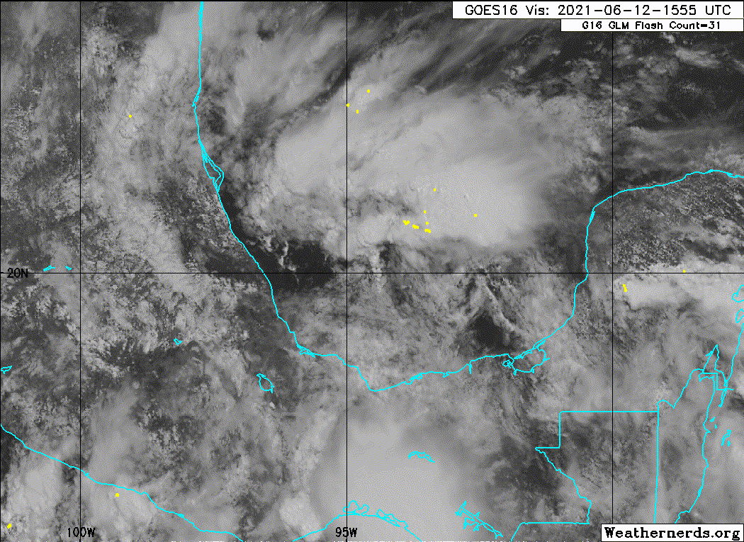
Looking at the early morning visible satellite we have what looks like a tiny circulation on coast of Mexico near Tuxpan which will likely push farther inland and something might redevelop later to the southeast.
Euro has backed off a lot and of course GFS has ramped up. Let the model wars begin.
Euro has backed off a lot and of course GFS has ramped up. Let the model wars begin.
Last edited by tailgater on Sun Jun 13, 2021 9:10 am, edited 1 time in total.
0 likes
The following post is NOT an official forecast and should not be used as such. It is just the opinion of the poster and may or may not be backed by sound meteorological data. It is NOT endorsed by any professional institution including storm2k.org For Official Information please refer to the NHC and NWS products.
-
ScottNAtlanta

- Category 5
- Posts: 2535
- Joined: Sat May 25, 2013 3:11 pm
- Location: Atlanta, GA
Re: ATL: INVEST 92L - Discussion
From what I gather, this isn't supposed to do much until 5-7 days from now. If it did develop early, it will just get blown apart.
0 likes
The posts in this forum are NOT official forecast and should not be used as such. They are just the opinion of the poster and may or may not be backed by sound meteorological data. They are NOT endorsed by any professional institution or storm2k.org. For official information, please refer to the NHC and NWS products.
-
Aric Dunn
- Category 5
- Posts: 21238
- Age: 43
- Joined: Sun Sep 19, 2004 9:58 pm
- Location: Ready for the Chase.
- Contact:
Re: ATL: INVEST 92L - Discussion
Our happy little LLC is migrating east, being pulled to the convection. Only a short matter of time now.

6 likes
Note: If I make a post that is brief. Please refer back to previous posts for the analysis or reasoning. I do not re-write/qoute what my initial post said each time.
If there is nothing before... then just ask
Space & Atmospheric Physicist, Embry-Riddle Aeronautical University,
I believe the sky is falling...
If there is nothing before... then just ask
Space & Atmospheric Physicist, Embry-Riddle Aeronautical University,
I believe the sky is falling...
Who is online
Users browsing this forum: No registered users and 37 guests