* GFS version *
* EAST PACIFIC 2021 SHIPS INTENSITY FORECAST *
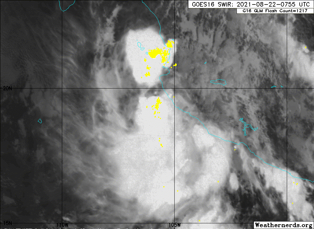
* IR SAT DATA AVAILABLE, OHC AVAILABLE *
* INVEST EP942021 08/22/21 06 UTC *
TIME (HR) 0 6 12 18 24 36 48 60 72 84 96 108 120 132 144 156 168
V (KT) NO LAND 30 33 37 41 44 51 56 56 54 48 44 41 40 38 37 34 33
V (KT) LAND 30 33 37 41 44 51 56 56 54 48 44 41 40 38 37 34 33
V (KT) LGEM 30 32 35 37 39 42 42 38 33 28 24 21 19 17 N/A N/A N/A
Storm Type TROP TROP TROP TROP TROP TROP TROP TROP TROP TROP TROP TROP TROP TROP TROP TROP TROP
SHEAR (KT) 13 13 11 9 7 10 12 11 10 9 11 7 10 15 17 15 17
SHEAR ADJ (KT) 0 0 1 2 3 1 1 3 0 3 0 0 -1 -1 -4 -2 -4
SHEAR DIR 72 80 74 81 53 56 97 92 110 101 134 168 199 186 186 188 192
SST (C) 29.7 29.5 29.1 28.8 28.6 27.4 26.4 26.0 25.6 25.2 24.4 24.4 24.5 23.3 23.1 23.7 24.3
POT. INT. (KT) 163 161 156 154 152 140 129 125 121 116 108 109 109 97 94 100 105
200 MB T (C) -51.3 -51.4 -51.3 -51.0 -51.2 -51.1 -51.2 -51.4 -51.3 -51.8 -51.6 -51.7 -51.7 -52.1 -52.2 -52.6 -52.6
200 MB VXT (C) 0.7 0.8 0.7 1.0 1.1 0.9 0.7 0.7 0.5 0.6 0.6 0.3 0.1 0.0 0.0 0.0 0.0
TH_E DEV (C) 7 5 6 6 3 2 1 0 0 0 0 0 0 0 0 1 2
700-500 MB RH 75 75 76 76 76 72 68 62 59 58 54 50 49 42 37 34 29
MODEL VTX (KT) 5 8 10 11 10 14 14 12 11 8 7 6 6 LOST LOST LOST LOST
850 MB ENV VOR 82 78 74 81 78 84 52 35 38 44 47 44 19 0 6 15 11
200 MB DIV 52 59 40 40 25 20 21 -2 10 17 -15 -55 -22 11 -13 -4 -17
700-850 TADV 3 4 1 -3 -10 -3 6 8 3 7 5 3 9 14 20 16 20
LAND (KM) 10 94 191 299 414 458 646 815 1029 1190 1402 1689 1975 1955 1685 1439 1224
LAT (DEG N) 18.9 18.9 19.0 19.1 19.2 19.5 19.8 19.9 20.2 20.7 20.9 20.8 20.9 xx.x xx.x xx.x xx.x
LONG(DEG W) 104.3 105.7 106.9 108.2 109.5 112.5 115.5 118.2 121.0 123.8 126.6 129.8 133.1 xxx.x xxx.x xxx.x xxx.x
STM SPEED (KT) 14 12 12 12 13 15 13 13 13 13 14 15 14 14 11 11 9
HEAT CONTENT 22 19 18 17 14 6 1 0 0 0 0 0 0 0 0 0 0
FORECAST TRACK FROM TABM INITIAL HEADING/SPEED (DEG/KT):265/ 14 CX,CY: -13/ 0
T-12 MAX WIND: 25 PRESSURE OF STEERING LEVEL (MB): 457 (MEAN=587)
GOES IR BRIGHTNESS TEMP. STD DEV. 50-200 KM RAD: 19.2 (MEAN=14.5)
% GOES IR PIXELS WITH T < -20 C 50-200 KM RAD: 79.0 (MEAN=65.0)
PRELIM RI PROB (DV .GE. 35 KT IN 36 HR): 22.6
INDIVIDUAL CONTRIBUTIONS TO INTENSITY CHANGE
6 12 18 24 36 48 60 72 84 96 108 120 132 144 156 168
------------------------------------------------------------------------------
SAMPLE MEAN CHANGE 0. 0. 1. 1. 1. 2. 1. 1. 0. -0. -1. -2. -2. -3. -4. -4.
SST POTENTIAL -0. -0. 0. 1. 6. 11. 16. 20. 23. 24. 24. 23. 21. 19. 17. 16.
VERTICAL SHEAR MAG 1. 2. 2. 3. 4. 4. 3. 2. 1. -0. 0. 1. -0. -1. -3. -5.
VERTICAL SHEAR ADJ -0. -0. -0. -0. -0. -1. -1. -1. -0. -0. -0. -0. -0. -0. -0. 0.
VERTICAL SHEAR DIR 0. 0. 0. 0. -0. -0. -1. -1. -2. -2. -2. -2. -2. -2. -2. -2.
PERSISTENCE 1. 1. 1. 1. 1. 1. 1. 1. 1. 1. 1. 1. 1. 1. 1. 1.
200/250 MB TEMP. -0. -0. -1. -1. -2. -1. -1. -0. 1. 1. 2. 2. 2. 2. 2. 2.
THETA_E EXCESS 0. -0. -0. -1. -2. -4. -5. -7. -9. -10. -11. -12. -13. -13. -15. -17.
700-500 MB RH 0. 0. 0. 1. 1. 1. 1. 1. 1. 1. 1. 0. 0. 0. -0. -1.
MODEL VTX TENDENCY 1. 2. 4. 4. 6. 9. 8. 8. 4. 3. 0. 0. -0. -0. -0. -0.
850 MB ENV VORTICITY 0. 0. 0. 0. 0. -0. -0. -1. -1. -1. -1. -1. -1. -1. -0. -0.
200 MB DIVERGENCE 0. 0. 0. 0. -0. -0. -1. -1. -1. -2. -3. -2. -2. -1. 0. 1.
850-700 T ADVEC -0. -0. -0. 0. 0. 0. 0. 0. 0. 0. 0. 0. 1. 1. 2. 3.
ZONAL STORM MOTION 0. 0. 1. 1. 2. 3. 3. 2. 2. 2. 2. 2. 1. 1. 1. -0.
STEERING LEVEL PRES -0. -0. -1. -1. -1. -2. -2. -2. -2. -3. -3. -3. -2. -2. -2. -1.
DAYS FROM CLIM. PEAK 0. 0. 0. 0. 0. 1. 1. 1. 2. 2. 3. 3. 3. 4. 5. 6.
GOES PREDICTORS 1. 1. 1. 1. 1. 1. 0. 0. -0. -0. -0. -0. -0. -0. -0. -1.
OCEAN HEAT CONTENT 0. 0. 0. -0. -0. -0. -1. -1. -0. -0. 0. 1. 1. 2. 3. 5.
RI POTENTIAL 0. 1. 2. 3. 4. 3. 2. 0. -0. -1. -1. -1. -1. -1. -1. -1.
------------------------------------------------------------------------------
TOTAL CHANGE 3. 7. 11. 14. 21. 26. 26. 24. 18. 15. 11. 10. 8. 7. 4. 3.
CURRENT MAX WIND (KT): 30. LAT, LON: 18.9 104.3
** 2021 E. Pacific RI INDEX EP942021 INVEST 08/22/21 06 UTC **
(SHIPS-RII PREDICTOR TABLE for 30 KT OR MORE MAXIMUM WIND INCREASE IN NEXT 24-h)
Predictor Value RI Predictor Range Scaled Value(0-1) % Contribution
POT = MPI-VMAX (KT) : 127.2 40.5 to 149.3 0.80 5.9
12 HR PERSISTENCE (KT) : 5.0 -22.0 to 44.0 0.41 3.5
D200 (10**7s-1) : 43.2 -33.0 to 159.5 0.40 2.7
850-200 MB SHEAR (KT) : 10.6 19.6 to 1.3 0.49 3.3
MAXIMUM WIND (KT) : 30.0 22.5 to 132.0 0.21 1.1
STD DEV OF IR BR TEMP : 19.2 37.8 to 2.1 0.52 2.4
BL DRY-AIR FLUX (W/M2) : 52.4 800.8 to -82.5 0.85 -4.4
HEAT CONTENT (KJ/CM2) : 18.0 2.7 to 106.7 0.15 0.6
%area of TPW <45 mm upshear : 0.0 56.6 to 0.0 1.00 1.5
2nd PC OF IR BR TEMP : -2.2 2.2 to -2.3 0.98 0.8
SHIPS Prob RI for 20kt/ 12hr RI threshold= 8% is 1.3 times climatological mean ( 6.3%)
SHIPS Prob RI for 25kt/ 24hr RI threshold= 20% is 1.6 times climatological mean (12.5%)
SHIPS Prob RI for 30kt/ 24hr RI threshold= 17% is 2.0 times climatological mean ( 8.6%)
SHIPS Prob RI for 35kt/ 24hr RI threshold= 16% is 2.6 times climatological mean ( 6.2%)
SHIPS Prob RI for 40kt/ 24hr RI threshold= 0% is 0.0 times climatological mean ( 4.2%)
SHIPS Prob RI for 45kt/ 36hr RI threshold= 16% is 2.4 times climatological mean ( 6.7%)
SHIPS Prob RI for 55kt/ 48hr RI threshold= 14% is 2.4 times climatological mean ( 5.9%)
SHIPS Prob RI for 65kt/ 72hr RI threshold= 12% is 2.5 times climatological mean ( 4.7%)
Matrix of RI probabilities
------------------------------------------------------------------------------
RI (kt / h) | 20/12 | 25/24 | 30/24 | 35/24 | 40/24 | 45/36 | 55/48 |65/72
------------------------------------------------------------------------------
SHIPS-RII: 8.1% 20.4% 17.3% 16.3% 0.0% 16.1% 14.5% 11.7%
Logistic: 3.7% 22.2% 10.2% 4.4% 1.3% 5.1% 2.1% 2.5%
Bayesian: 0.2% 1.2% 0.2% 0.0% 0.0% 0.2% 0.1% 0.0%
Consensus: 4.0% 14.6% 9.2% 6.9% 0.4% 7.1% 5.6% 4.7%
DTOPS: 999.0% 999.0% 999.0% 999.0% 999.0% 999.0% 999.0% 999.0%
## ANNULAR HURRICANE INDEX (AHI) EP942021 INVEST 08/22/21 06 UTC ##
## STORM NOT ANNULAR, SCREENING STEP FAILED, NPASS=3 NFAIL=4 ##
## AHI= 0 (AHI OF 100 IS BEST FIT TO ANN. STRUC., 1 IS MARGINAL, 0 IS NOT ANNULAR) ##