ATL: IAN - Models
Moderator: S2k Moderators
Re: ATL: NINE - Models
6z gfs spends a whole day over Florida, gets out into the Atlantic then Loops back and hits Florida again (much weaker) and THEN gets into the Gulf again. Inverse happy hour.
3 likes

Re: ATL: NINE - Models
Anybody has the 06z HWRF, don't see it on tropical tidbits and weathernerds is exceeding load capacity and not showing it at this time.
0 likes
-
Iceresistance

- Category 5

- Posts: 9592
- Age: 22
- Joined: Sat Oct 10, 2020 9:45 am
- Location: Tecumseh, OK/Norman, OK
Re: ATL: NINE - Models
NDG wrote:Anybody has the 06z HWRF, don't see it on tropical tidbits and weathernerds is exceeding load capacity and not showing it at this time.
I got it on TT, brushes the western tip of Cuba at +90-93 hours, weakens a little bit, but only to reintensify even stronger.
Last edited by Iceresistance on Fri Sep 23, 2022 6:53 am, edited 1 time in total.
1 likes
Bill 2015 & Beta 2020
Winter 2020-2021
All observations are in Tecumseh, OK unless otherwise noted.
Winter posts are focused mainly for Oklahoma & Texas.
Take any of my forecasts with a grain of salt, refer to the NWS, SPC, and NHC for official information
Never say Never with weather! Because ANYTHING is possible!
Winter 2020-2021
All observations are in Tecumseh, OK unless otherwise noted.
Winter posts are focused mainly for Oklahoma & Texas.
Take any of my forecasts with a grain of salt, refer to the NWS, SPC, and NHC for official information
Never say Never with weather! Because ANYTHING is possible!

Re: ATL: NINE - Models
NDG wrote:Anybody has the 06z HWRF, don't see it on tropical tidbits and weathernerds is exceeding load capacity and not showing it at this time.
Low-end cat 3 before landfall on the westernmost point of Cuba (958 mb, 97 kt). Landfall causes slight weakening to 89 kt.

And it's currently at +102 hrs, 947 mb & 105 kt.

1 likes

Re: ATL: NINE - Models
Seems the approach and distance from Jamaica may give some early hints where the storm may ultimately go.
0 likes
-
tolakram
- Admin

- Posts: 20186
- Age: 62
- Joined: Sun Aug 27, 2006 8:23 pm
- Location: Florence, KY (name is Mark)
Re: ATL: NINE - Models
Iceresistance wrote:NDG wrote:Anybody has the 06z HWRF, don't see it on tropical tidbits and weathernerds is exceeding load capacity and not showing it at this time.
I got it on TT, brushes the western tip of Cuba at +90-93 hours, weakens a little bit, but only to reintensify even stronger.
It's here, just slow to load. Not finished yet, moving west of Cuba.
https://www.tropicaltidbits.com/analysis/models/?model=hwrf®ion=09L&pkg=mslp_wind&runtime=2022092306&fh=102
2 likes
M a r k
- - - - -
Join us in chat: Storm2K Chatroom Invite. Android and IOS apps also available.
The posts in this forum are NOT official forecasts and should not be used as such. Posts are NOT endorsed by any professional institution or STORM2K.org. For official information and forecasts, please refer to NHC and NWS products.
-
skyline385

- Category 5
- Posts: 2728
- Age: 35
- Joined: Wed Aug 26, 2020 11:15 pm
- Location: Houston TX

-
gatorcane

- S2K Supporter

- Posts: 23708
- Age: 48
- Joined: Sun Mar 13, 2005 3:54 pm
- Location: Boca Raton, FL
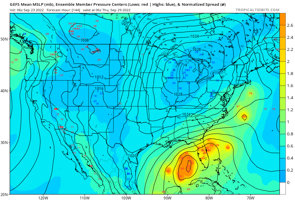
Re: ATL: NINE - Models
Looks like the GFS ensembles have a big cluster west of the west coast of Florida that hang back:
1 likes
Re: ATL: NINE - Models
I am still not used to seeing the GFS and hurricane models based off of it being to the left of the Euro. Is usually the other way around.
Hope the 06z GFS doesn't come to fruition, it will be catastrophic for central & SW FL.
Hope the 06z GFS doesn't come to fruition, it will be catastrophic for central & SW FL.
1 likes
-
tolakram
- Admin
- Posts: 20186
- Age: 62
- Joined: Sun Aug 27, 2006 8:23 pm
- Location: Florence, KY (name is Mark)
Re: ATL: NINE - Models
Really going to depend on where the center ends up consolidating IMO. If it ends up further south you can thank Fiona for maybe taking a storm that would have stayed east of Florida and changing the outcome.
last frame of HWRF

last frame of HWRF
2 likes
M a r k
- - - - -
Join us in chat: Storm2K Chatroom Invite. Android and IOS apps also available.
The posts in this forum are NOT official forecasts and should not be used as such. Posts are NOT endorsed by any professional institution or STORM2K.org. For official information and forecasts, please refer to NHC and NWS products.
- - - - -
Join us in chat: Storm2K Chatroom Invite. Android and IOS apps also available.
The posts in this forum are NOT official forecasts and should not be used as such. Posts are NOT endorsed by any professional institution or STORM2K.org. For official information and forecasts, please refer to NHC and NWS products.
-
skyline385
- Category 5
- Posts: 2728
- Age: 35
- Joined: Wed Aug 26, 2020 11:15 pm
- Location: Houston TX
-
tolakram
- Admin
- Posts: 20186
- Age: 62
- Joined: Sun Aug 27, 2006 8:23 pm
- Location: Florence, KY (name is Mark)
Re: ATL: NINE - Models
NDG wrote:I am still not used to seeing the GFS and hurricane models based off of it being to the left of the Euro. Is usually the other way around.
Hope the 06z GFS doesn't come to fruition, it will be catastrophic for central & SW FL.
I trust the GFS more when a storm is forming under shear. Not really confident but the GFS tends to sniff out center relocations a lot better than the Euro, which generally keeps a broad low like it's doing now. Really don't know, but I think that's why the GFS is further west.
3 likes
M a r k
- - - - -
Join us in chat: Storm2K Chatroom Invite. Android and IOS apps also available.
The posts in this forum are NOT official forecasts and should not be used as such. Posts are NOT endorsed by any professional institution or STORM2K.org. For official information and forecasts, please refer to NHC and NWS products.
- - - - -
Join us in chat: Storm2K Chatroom Invite. Android and IOS apps also available.
The posts in this forum are NOT official forecasts and should not be used as such. Posts are NOT endorsed by any professional institution or STORM2K.org. For official information and forecasts, please refer to NHC and NWS products.
-
Jelmergraaff
- Tropical Storm

- Posts: 138
- Age: 23
- Joined: Fri Aug 27, 2021 1:00 pm
- Location: The Netherlands
Re: ATL: NINE - Models
Both HMON (126kt/934mb) and HWRF (118kt/943mb) show TD Nine getting to category 4 strength at +126 hours. Even if it crosses over Western-Cuba, not much of a significant disruption it seems like.


0 likes
21-year old meteorologist and student MSc Climate Studies from The Netherlands. Interested in all fields of meteorology and climatology, including tropical systems like hurricanes.
Re: ATL: NINE - Models
tolakram wrote:NDG wrote:I am still not used to seeing the GFS and hurricane models based off of it being to the left of the Euro. Is usually the other way around.
Hope the 06z GFS doesn't come to fruition, it will be catastrophic for central & SW FL.
I trust the GFS more when a storm is forming under shear. Not really confident but the GFS tends to sniff out center relocations a lot better than the Euro, which generally keeps a broad low like it's doing know. Really don't know, but I think that's why the GFS is further west.
It could also be that the GFS shows ridging across central FL into the central GOM slightly stronger longer thus a more westward track than the Euro which shows the trough a little further south. Such a disagreement in such short range.


0 likes
-
tolakram
- Admin
- Posts: 20186
- Age: 62
- Joined: Sun Aug 27, 2006 8:23 pm
- Location: Florence, KY (name is Mark)
Re: ATL: NINE - Models
EC-FAST 72 hours

0 likes
M a r k
- - - - -
Join us in chat: Storm2K Chatroom Invite. Android and IOS apps also available.
The posts in this forum are NOT official forecasts and should not be used as such. Posts are NOT endorsed by any professional institution or STORM2K.org. For official information and forecasts, please refer to NHC and NWS products.
- - - - -
Join us in chat: Storm2K Chatroom Invite. Android and IOS apps also available.
The posts in this forum are NOT official forecasts and should not be used as such. Posts are NOT endorsed by any professional institution or STORM2K.org. For official information and forecasts, please refer to NHC and NWS products.


Re: ATL: NINE - Models
tolakram wrote:EC-FAST 72 hours
https://i.imgur.com/eEdM53N.png
Is that west of 00z?
0 likes
-
AJC3

- Admin
- Posts: 4156
- Age: 62
- Joined: Tue Aug 31, 2004 7:04 pm
- Location: Ballston Spa, New York
- Contact:
Re: ATL: NINE - Models
0 likes
Re: ATL: NINE - Models
06z Euro a slight shift to the west through 90 hrs and slightly weaker than its previous 0z run.

1 likes
-
SFLcane

- S2K Supporter
- Posts: 10281
- Age: 48
- Joined: Sat Jun 05, 2010 1:44 pm
- Location: Lake Worth Florida
Re: ATL: NINE - Models
NDG wrote:06z Euro a slight shift to the west through 90 hrs and slightly weaker than its previous 0z run.
https://i.imgur.com/U3Yko6f.gif
Hmm don’t think it will be that weak and that run would probably still hit SFL.
0 likes
Who is online
Users browsing this forum: No registered users and 38 guests