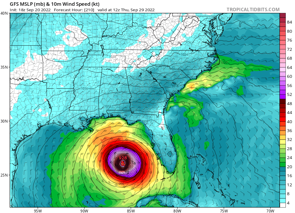
Jelmergraaff wrote:GFS (18z) gets it all the way to the western edge of Cuba, but the intensification is a lot less in the Carribian compared to the 12z (run).
https://imgur.com/IDCPRR8
But the rate of intensification is much higher in the Caribbean compared to 12z.