

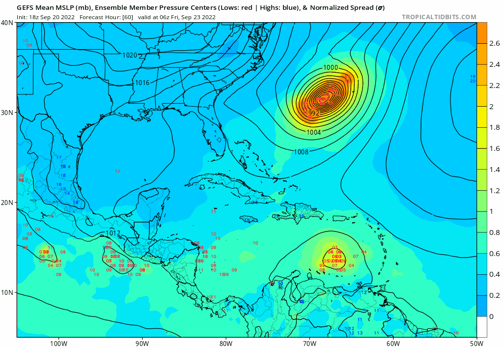
wxman57 wrote:Note that the Cat 5 - happy GFS is also indicating a lot of westerly shear across the Gulf late next week. That could be a factor in keeping it in check, somewhat. That said, I'll be initiating 7-day track forecasts tomorrow morning. Day 7 point north of the western tip of Cuba, heading for somewhere in Florida. I have it 90 kts at day 7, reserving the right to modify depending on additional data in a few days. I don't think it will likely impact from Mobile westward due to the west winds aloft across the Gulf.
Yesterday you were saying not to put much trust into the GFS beyond 4-5 days out. (Which I agree with). What makes you think the upper air pattern is a lock over a week in advance this time?


