Yeah although it took a minor hit intensity wise crossing Cuba, the structure looks well intact and would assume it regains its initial intensity and then some over the next few hours. I am not one for wobble watching in the very short term (i.e. over the course of a couple hours) as they tend to cancel out over the scheme of things... but I do think some clear right (east) of track motion has been apparent for several hours now which could have a legit impact on the future track and primary impacts on the Florida Peninsula. Hopefully the folks in Fort Myers haven't been overly complacent... heck even Naples could have some issues if the trend continues further.
Edit: I saw after posting this initially they expanded the hurricane watches southward in SW Florida, and filled in the tropical storm watches for metro SE Florida... seems reasonable to me based on trends.
ATL: IAN - Post-Tropical - Discussion
Moderator: S2k Moderators
-
Meteorcane

- Category 2

- Posts: 559
- Joined: Thu Jul 21, 2011 6:49 am
- Location: North Platte Nebraska
Re: ATL: IAN - Hurricane - Discussion
Last edited by Meteorcane on Tue Sep 27, 2022 10:04 am, edited 1 time in total.
3 likes

Re: ATL: IAN - Hurricane - Discussion
23.0N 83.5W is Ian's position as of the 11 am advisory
For reference, per last night's 11 pm advisory, Ian was forecasted to be at 22.8N 83.7W. He's definitely further north and east.
For reference, per last night's 11 pm advisory, Ian was forecasted to be at 22.8N 83.7W. He's definitely further north and east.
2 likes
Re: ATL: IAN - Hurricane - Discussion
11 am forecast track is essentially not too much different from the previous one?...and the 11am discussion mentions that the southwesterly shear is forecast to increase by tomorrow, but not enough to significantly weaken Ian prior to landfall. The point to remember is that Ian will be landfalling as an "extremely dangerous hurricane"(NHC) in Southwestern Florida, prepare accordingly my friends...
Last edited by underthwx on Tue Sep 27, 2022 10:10 am, edited 1 time in total.
2 likes
-
ScottNAtlanta

- Category 5

- Posts: 2535
- Joined: Sat May 25, 2013 3:11 pm
- Location: Atlanta, GA
Re: ATL: IAN - Hurricane - Discussion
Hurricane watch is in effect south from Bonita Beach to Chokoloskee. That is Lee and Collier Counties.
Last edited by ScottNAtlanta on Tue Sep 27, 2022 10:07 am, edited 2 times in total.
1 likes
The posts in this forum are NOT official forecast and should not be used as such. They are just the opinion of the poster and may or may not be backed by sound meteorological data. They are NOT endorsed by any professional institution or storm2k.org. For official information, please refer to the NHC and NWS products.

Re: ATL: IAN - Hurricane - Discussion
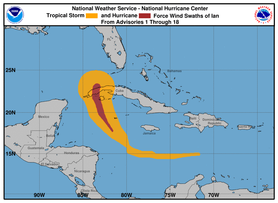
The wind field has increased significantly since before it crossed Cuba.
1 likes
Igor 2010, Sandy 2012, Fay 2014, Gonzalo 2014, Joaquin 2015, Nicole 2016, Humberto 2019, Imelda 2025
I am only a tropical weather enthusiast. My predictions are not official and may or may not be backed by sound meteorological data. For official information, please refer to the NHC and NWS products.
I am only a tropical weather enthusiast. My predictions are not official and may or may not be backed by sound meteorological data. For official information, please refer to the NHC and NWS products.
-
eastcoastFL

- Category 5
- Posts: 3996
- Age: 44
- Joined: Thu Apr 12, 2007 12:29 pm
- Location: Palm City, FL
Re: ATL: IAN - Hurricane - Discussion
Iceresistance wrote:ADT is at 6.3UW - CIMSS
ADVANCED DVORAK TECHNIQUE
ADT-Version 9.0
Tropical Cyclone Intensity Algorithm
----- Current Analysis -----
Date : 27 SEP 2022 Time : 142020 UTC
Lat : 23:01:12 N Lon : 83:27:35 W
CI# /Pressure/ Vmax
6.3 / 937mb / 122kts
Final T# Adj T# Raw T#
6.3 6.3 6.3
Estimated radius of max. wind based on IR : 20 km
Center Temp : +11.6C Cloud Region Temp : -67.5C
Scene Type : EYE
Subtropical Adjustment : OFF
Extratropical Adjustment : OFF
It's too high, but the structure of this system is impressive.
Yup, Ian is going to continue to intensify on approach. At least for the next 12-24 hours.
1 likes
Personal Forecast Disclaimer:
The posts in this forum are NOT official forecast and should not be used as such. They are just the opinion of the poster and may or may not be backed by sound meteorological data. They are NOT endorsed by any professional institution or storm2k.org. For official information, please refer to the NHC and NWS products.
The posts in this forum are NOT official forecast and should not be used as such. They are just the opinion of the poster and may or may not be backed by sound meteorological data. They are NOT endorsed by any professional institution or storm2k.org. For official information, please refer to the NHC and NWS products.
-
jlauderdal
- S2K Supporter

- Posts: 7240
- Joined: Wed May 19, 2004 5:46 am
- Location: NE Fort Lauderdale
- Contact:
Re: RE: Re: ATL: IAN - Hurricane - Discussion
Remember Irene?Blown Away wrote:
Amazing this NE movement, little burst of acceleration in last few frames.

1 likes
Re: ATL: IAN - Hurricane - Discussion
We're going to end up emptying out tampa bay rather overflowing it.
11 likes
-
ScottNAtlanta
- Category 5
- Posts: 2535
- Joined: Sat May 25, 2013 3:11 pm
- Location: Atlanta, GA
Re: ATL: IAN - Hurricane - Discussion
Also on this path Ian will be crossing the highest temperature water in the GOM off the FL west coast. I said a little prayer of thanks this morning that my parents will not be going to Bonita Beach for the winter for another 2 weeks. Hopefully they will have somewhere to go to.
Last edited by ScottNAtlanta on Tue Sep 27, 2022 10:11 am, edited 1 time in total.
1 likes
The posts in this forum are NOT official forecast and should not be used as such. They are just the opinion of the poster and may or may not be backed by sound meteorological data. They are NOT endorsed by any professional institution or storm2k.org. For official information, please refer to the NHC and NWS products.
-
eastcoastFL
- Category 5
- Posts: 3996
- Age: 44
- Joined: Thu Apr 12, 2007 12:29 pm
- Location: Palm City, FL
Re: ATL: IAN - Hurricane - Discussion
New watches and warnings
WATCHES AND WARNINGS
--------------------
CHANGES WITH THIS ADVISORY:
A Storm Surge Warning has been issued for the U.S. east coast from
Marineland Florida to the mouth of St. Mary's River including the
St. Johns River, and the Dry Tortugas. Along the Florida west
coast, a Storm Surge Warning has been issued from Suwanee River to
Anclote River.
A Hurricane Watch is in effect for the west coast of Florida from
south of Bonita Beach to Chokoloskee.
A Storm Surge Watch has been issued from the mouth of the St.
Mary's River to South Santee River South Carolina.
The Tropical Storm Warning along the U.S. east coast has been
extended north to Altamaha Sound Georgia and south to Boca Raton
Florida.
A Tropical Storm Watch is in effect from south of Boca Raton to east
of Flamingo Florida, for the upper Florida Keys and Florida Bay.
A Tropical Storm Watch is in effect from north of Altamaha Sound to
South Santee River South Carolina.
2 likes
Personal Forecast Disclaimer:
The posts in this forum are NOT official forecast and should not be used as such. They are just the opinion of the poster and may or may not be backed by sound meteorological data. They are NOT endorsed by any professional institution or storm2k.org. For official information, please refer to the NHC and NWS products.
The posts in this forum are NOT official forecast and should not be used as such. They are just the opinion of the poster and may or may not be backed by sound meteorological data. They are NOT endorsed by any professional institution or storm2k.org. For official information, please refer to the NHC and NWS products.
-
eastcoastFL
- Category 5
- Posts: 3996
- Age: 44
- Joined: Thu Apr 12, 2007 12:29 pm
- Location: Palm City, FL
Re: ATL: IAN - Hurricane - Discussion

2 likes
Personal Forecast Disclaimer:
The posts in this forum are NOT official forecast and should not be used as such. They are just the opinion of the poster and may or may not be backed by sound meteorological data. They are NOT endorsed by any professional institution or storm2k.org. For official information, please refer to the NHC and NWS products.
The posts in this forum are NOT official forecast and should not be used as such. They are just the opinion of the poster and may or may not be backed by sound meteorological data. They are NOT endorsed by any professional institution or storm2k.org. For official information, please refer to the NHC and NWS products.
-
cycloneye

- Admin

- Posts: 149110
- Age: 69
- Joined: Thu Oct 10, 2002 10:54 am
- Location: San Juan, Puerto Rico
Re: ATL: IAN - Hurricane - Discussion
Anyone has the closeup view of trayectory with the line?
2 likes
Visit the Caribbean-Central America Weather Thread where you can find at first post web cams,radars
and observations from Caribbean basin members Click Here
and observations from Caribbean basin members Click Here


Re: ATL: IAN - Hurricane - Discussion
cycloneye wrote:Anyone has the closeup view of trayectory with the line?
I just zoom in on the NHC interactive cone and make sure to have "track" checked. Now showing landfall just north of Venice.
https://www.nhc.noaa.gov/refresh/graphi ... k#contents
2 likes
-
Category5Kaiju

- Category 5
- Posts: 4322
- Joined: Thu Dec 24, 2020 12:45 pm
- Location: Seattle and Phoenix
Re: ATL: IAN - Hurricane - Discussion
With a core that big, which will likely expand upon landfall, there’s little doubt that even if landfall is south of Tampa, that the city could unfortunately experience high winds and rain. This is not Charley 2.0. It’s much bigger.
2 likes
Unless explicitly stated, all info in my posts is based on my own opinions and observations. Tropical storms and hurricanes can be extremely dangerous. Refer to an accredited weather research agency or meteorologist if you need to make serious decisions regarding an approaching storm.
-
CourierPR

- Category 5
- Posts: 1336
- Age: 72
- Joined: Tue Aug 31, 2004 7:53 pm
- Location: Pompano Beach, Florida
Re: RE: Re: ATL: IAN - Hurricane - Discussion
jlauderdal wrote:Remember Irene?Blown Away wrote:https://i.imgur.com/Mcooqnp.gif
Amazing this NE movement, little burst of acceleration in last few frames.
I remember how we were told Irene would pass well to our west in the GOM, then suddenly it was headed toward the southern FL peninsula.
1 likes

Re: ATL: IAN - Hurricane - Discussion
cycloneye wrote:Anyone has the closeup view of trayectory with the line?

2 likes


Re: ATL: IAN - Hurricane - Discussion
NWS JAX updates
From Briefing PDF on 09/27/2022 06:00
https://www.weather.gov/media/jax/briefings/nws-jax-briefing.pdf

000
FXUS62 KJAX 271257
AFDJAX
Area Forecast Discussion
National Weather Service Jacksonville FL
857 AM EDT Tue Sep 27 2022
.UPDATE...
.SHORT TERM...
(Wednesday through Friday Night)
Issued at 403 AM EDT Tue Sep 27 2022
Wednesday into Thursday night, waves of showers with scattered
embedded storms will be on the increase from south to north
first over NE FL, then progress into SE GA by the late afternoon
to early evening hours as Hurricane Ian moves northward. As of
early this morning, the National Hurricane center is forecasting
the system to be a Major Hurricane over the eastern Gulf of Mexico
on Wednesday with a slowing trend as it approaches the west coast
of FL late Wednesday into Wednesday night. A plume of tropical
moisture will move ahead of the system and drive very heavy
rainfall rates both Wednesday over the southern half of the area
and into the day Thursday as the system is forecast to creep over
west central FL and the Weather Prediction center has a moderate
risk for excessive rainfall both days, first over NE FL areas from
I-10 southward and then over most of the area on Thursday as the
system weakens and slowly enters southern portions of the area by
Thursday night with about 3 to 5 inches of rain expected over the
highlighted moderate risk areas during the day. Winds on Wednesday
will become very breezy along the coast as high pressure builds
in from the northwest and then over southern portions of NE FL
areas as Hurricane Ian approaches from the southwest where
tropical Storm conditions will begin to develop. Tropical Storm
conditions will slowly translate northward towards the
Jacksonville area and along the FL/GA state line by late Wednesday
night into Thursday, then into SE GA areas by daytime Thursday as
high pressure builds north of the region. A threat for isolated
tornadoes will also be expected Wednesday and Thursday.
Friday, models have been shifting the track of Ian more east into
the central and northern FL peninsula while slowing it`s forward
speed and this will continue the heavy rainfall and flooding
threat into at least Friday as Ian weakens and lifts north through
our area. Despite Ian likely weakening a lot over land Friday,
tropical storm conditions will still be possible over most of
the area with only gradually improving conditions from south to
north by late Friday into Friday night as what`s left of the
circulation swirls northward.
Flash and Urban/low lying flooding impacts will be likely Wednesday
through Friday due to the succession of tropical rainbands crossing
over much of the area along with potential for river flooding as
well. The greatest wind impacts will come down to where Ian
ultimately tracks, though an isolated tornado threat is also
expected as our area will be on the right side of the storm track
though at least Friday.
From Briefing PDF on 09/27/2022 06:00
https://www.weather.gov/media/jax/briefings/nws-jax-briefing.pdf
000
FXUS62 KJAX 271257
AFDJAX
Area Forecast Discussion
National Weather Service Jacksonville FL
857 AM EDT Tue Sep 27 2022
.UPDATE...
.SHORT TERM...
(Wednesday through Friday Night)
Issued at 403 AM EDT Tue Sep 27 2022
Wednesday into Thursday night, waves of showers with scattered
embedded storms will be on the increase from south to north
first over NE FL, then progress into SE GA by the late afternoon
to early evening hours as Hurricane Ian moves northward. As of
early this morning, the National Hurricane center is forecasting
the system to be a Major Hurricane over the eastern Gulf of Mexico
on Wednesday with a slowing trend as it approaches the west coast
of FL late Wednesday into Wednesday night. A plume of tropical
moisture will move ahead of the system and drive very heavy
rainfall rates both Wednesday over the southern half of the area
and into the day Thursday as the system is forecast to creep over
west central FL and the Weather Prediction center has a moderate
risk for excessive rainfall both days, first over NE FL areas from
I-10 southward and then over most of the area on Thursday as the
system weakens and slowly enters southern portions of the area by
Thursday night with about 3 to 5 inches of rain expected over the
highlighted moderate risk areas during the day. Winds on Wednesday
will become very breezy along the coast as high pressure builds
in from the northwest and then over southern portions of NE FL
areas as Hurricane Ian approaches from the southwest where
tropical Storm conditions will begin to develop. Tropical Storm
conditions will slowly translate northward towards the
Jacksonville area and along the FL/GA state line by late Wednesday
night into Thursday, then into SE GA areas by daytime Thursday as
high pressure builds north of the region. A threat for isolated
tornadoes will also be expected Wednesday and Thursday.
Friday, models have been shifting the track of Ian more east into
the central and northern FL peninsula while slowing it`s forward
speed and this will continue the heavy rainfall and flooding
threat into at least Friday as Ian weakens and lifts north through
our area. Despite Ian likely weakening a lot over land Friday,
tropical storm conditions will still be possible over most of
the area with only gradually improving conditions from south to
north by late Friday into Friday night as what`s left of the
circulation swirls northward.
Flash and Urban/low lying flooding impacts will be likely Wednesday
through Friday due to the succession of tropical rainbands crossing
over much of the area along with potential for river flooding as
well. The greatest wind impacts will come down to where Ian
ultimately tracks, though an isolated tornado threat is also
expected as our area will be on the right side of the storm track
though at least Friday.
Last edited by jdray on Tue Sep 27, 2022 10:23 am, edited 1 time in total.
1 likes
-
AutoPenalti
- Category 5
- Posts: 4091
- Age: 29
- Joined: Mon Aug 17, 2015 4:16 pm
- Location: Ft. Lauderdale, Florida
Re: ATL: IAN - Hurricane - Discussion
1 likes
The posts in this forum are NOT official forecasts and should not be used as such. They are just the opinion of the poster and may or may not be backed by sound meteorological data. They are NOT endorsed by any professional institution or STORM2K. For official information, please refer to products from the NHC and NWS.
Model Runs Cheat Sheet:
GFS (5:30 AM/PM, 11:30 AM/PM)
HWRF, GFDL, UKMET, NAVGEM (6:30-8:00 AM/PM, 12:30-2:00 AM/PM)
ECMWF (1:45 AM/PM)
TCVN is a weighted averaged
-
Iceresistance

- Category 5
- Posts: 9564
- Age: 22
- Joined: Sat Oct 10, 2020 9:45 am
- Location: Tecumseh, OK/Norman, OK
Re: ATL: IAN - Hurricane - Discussion
VDM at 963 mb
Eye is smaller at 18 Nautical Miles Circular.
VORTEX DATA MESSAGE AL092022
A. 27/14:27:20Z
B. 22.93 deg N 083.50 deg W
C. 700 mb 2775 m
D. 963 mb
E. 150 deg 5 kt
F. CLOSED
G. C18
H. 75 kt
I. 050 deg 9 nm 14:24:30Z
J. 135 deg 89 kt
K. 047 deg 14 nm 14:23:00Z
L. 78 kt
M. 349 deg 8 nm 14:34:00Z
N. 093 deg 87 kt
O. 352 deg 12 nm 14:35:00Z
P. 8 C / 3061 m
Q. 14 C / 3055 m
R. 14 C / NA
S. 12345 / 07
T. 0.02 / 1.75 nm
U. AF302 2109A IAN OB 09 CCA
MAX FL WIND 94 KT 057 / 7 NM 13:03:30Z
Eye is smaller at 18 Nautical Miles Circular.
5 likes
Bill 2015 & Beta 2020
Winter 2020-2021
All observations are in Tecumseh, OK unless otherwise noted.
Winter posts are focused mainly for Oklahoma & Texas.
Take any of my forecasts with a grain of salt, refer to the NWS, SPC, and NHC for official information
Never say Never with weather! Because ANYTHING is possible!
Winter 2020-2021
All observations are in Tecumseh, OK unless otherwise noted.
Winter posts are focused mainly for Oklahoma & Texas.
Take any of my forecasts with a grain of salt, refer to the NWS, SPC, and NHC for official information
Never say Never with weather! Because ANYTHING is possible!
Who is online
Users browsing this forum: No registered users and 30 guests