ATL: EARL - Post-Tropical - Discussion

Moderator: S2k Moderators

Message
Author
User avatar
cycloneye
Admin
Admin
Posts: 139331
Age: 67
Joined: Thu Oct 10, 2002 10:54 am
Location: San Juan, Puerto Rico

Re: ATL: INVEST 91L - Discussion

#41 Postby cycloneye » Sun Aug 28, 2022 7:05 am

Central Tropical Atlantic:
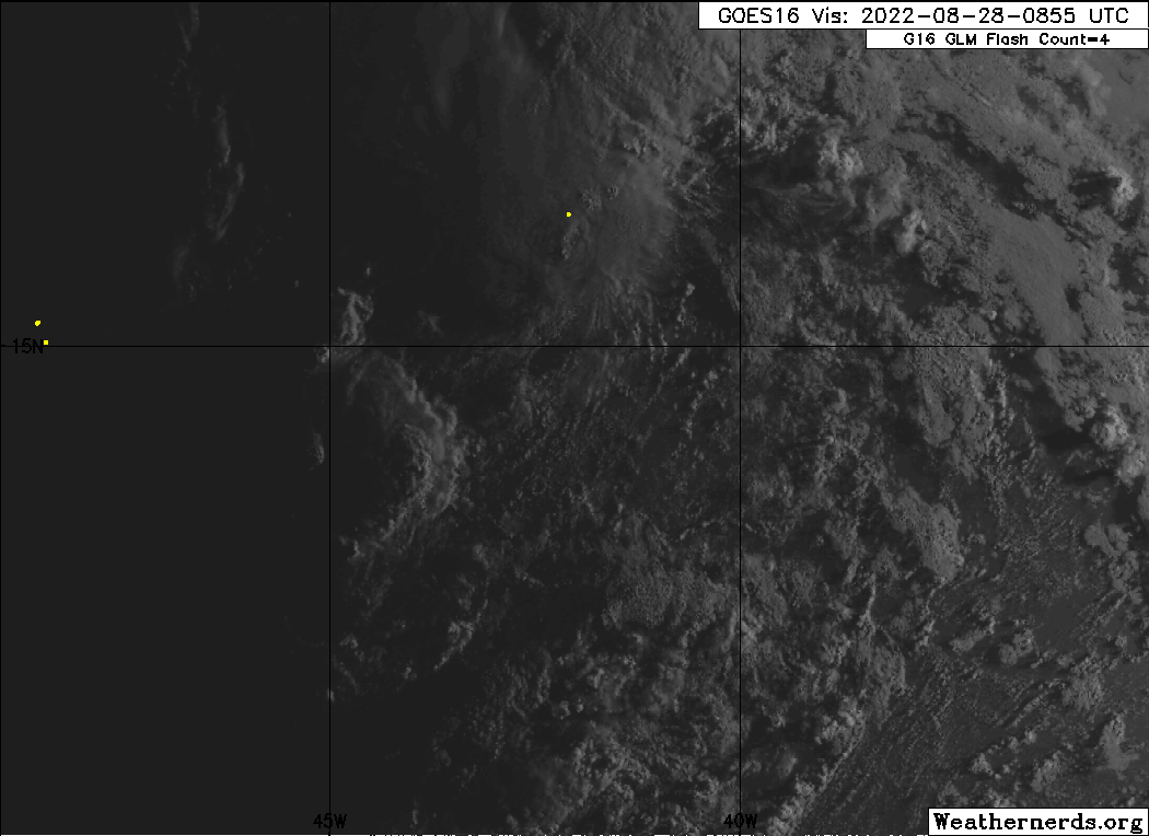
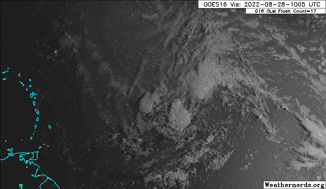
A broad and elongated area of low pressure is located over the
central tropical Atlantic Ocean. Although the associated shower
and thunderstorm activity has increased somewhat since yesterday,
it currently lacks organization. Environmental conditions are
expected to be generally conducive for gradual development, and a
tropical depression is likely to form later this week while moving
toward the west and then west-northwest at around 10 mph, toward the
waters east of the Leeward Islands.
* Formation chance through 48 hours...low...30 percent.
* Formation chance through 5 days...high...70 percent.
0 likes   
Visit the Caribbean-Central America Weather Thread where you can find at first post web cams,radars
and observations from Caribbean basin members Click Here

User avatar
Hurricaneman
Category 5
Category 5
Posts: 7284
Age: 43
Joined: Tue Aug 31, 2004 3:24 pm
Location: central florida

Re: ATL: INVEST 91L - Discussion

#42 Postby Hurricaneman » Sun Aug 28, 2022 7:08 am

The LLC I’m seeing is moving under the southern blob of convection, could be the start of cyclogenesis
2 likes   

Keldeo1997
Category 2
Category 2
Posts: 514
Joined: Fri Oct 11, 2019 11:35 pm

Re: ATL: INVEST 91L - Discussion

#43 Postby Keldeo1997 » Sun Aug 28, 2022 7:11 am

0 likes   

User avatar
NDG
S2K Supporter
S2K Supporter
Posts: 14934
Joined: Sun Jul 09, 2006 10:14 pm
Location: Orlando, FL

ATL: INVEST 91L - Models

#44 Postby NDG » Sun Aug 28, 2022 7:19 am

I think the future of 91L in the 5-10 day range will be how the dry air ahead of it behaves. The 0z Euro run keeps it weak after passing to the north of Leeward Islands because it shows it being displaced from the UL high and getting westerly dry shear.
Keep in mind that the Euro has been doing well against the GFS when it comes to recognizing the dry air in the basin.
Time will tell.

Image
Image
0 likes   

User avatar
Blown Away
S2K Supporter
S2K Supporter
Posts: 9867
Joined: Wed May 26, 2004 6:17 am

Re: ATL: INVEST 91L - Discussion

#45 Postby Blown Away » Sun Aug 28, 2022 7:24 am

Image

Looks like 91L is consolidating to the SW. IMO, this could put the NE Caribbean in play.
7 likes   
Hurricane Eye Experience: David 79, Irene 99, Frances 04, Jeanne 04, Wilma 05... EYE COMING MY WAY IN 2024…
Hurricane Brush Experience: Andrew 92, Erin 95, Floyd 99, Matthew 16, Irma 17, Ian 22, Nicole 22…

User avatar
cycloneye
Admin
Admin
Posts: 139331
Age: 67
Joined: Thu Oct 10, 2002 10:54 am
Location: San Juan, Puerto Rico

Re: ATL: INVEST 91L - Discussion

#46 Postby cycloneye » Sun Aug 28, 2022 7:38 am

12z Best Track:

AL, 91, 2022082812, , BEST, 0, 145N, 438W, 25, 1009, DB
2 likes   
Visit the Caribbean-Central America Weather Thread where you can find at first post web cams,radars
and observations from Caribbean basin members Click Here

User avatar
wxman57
Moderator-Pro Met
Moderator-Pro Met
Posts: 22484
Age: 66
Joined: Sat Jun 21, 2003 8:06 pm
Location: Houston, TX (southwest)

Re: ATL: INVEST 91L - Discussion

#47 Postby wxman57 » Sun Aug 28, 2022 7:38 am

Blown Away wrote:[url]https://i.postimg.cc/XJksKXtC/58666903.gif [/url]

Looks like 91L is consolidating to the SW. IMO, this could put the NE Caribbean in play.


It's precisely where the models that take it north of the islands expected it to be. The ridge to the north should weaken significantly on Wednesday, which would allow for a northward jog. That should be enough to keep it north of the Caribbean.
5 likes   

User avatar
SFLcane
S2K Supporter
S2K Supporter
Posts: 9617
Age: 46
Joined: Sat Jun 05, 2010 1:44 pm
Location: Lake Worth Florida

Re: ATL: INVEST 91L - Discussion

#48 Postby SFLcane » Sun Aug 28, 2022 7:40 am

wxman57 wrote:
Blown Away wrote:[url]https://i.postimg.cc/XJksKXtC/58666903.gif [/url]

Looks like 91L is consolidating to the SW. IMO, this could put the NE Caribbean in play.


It's precisely where the models that take it north of the islands expected it to be. The ridge to the north should weaken significantly on Wednesday, which would allow for a northward jog. That should be enough to keep it north of the Caribbean.


And… potentially out to sea from there.
1 likes   

USTropics
Category 5
Category 5
Posts: 2420
Joined: Sun Aug 12, 2007 3:45 am
Location: Florida State University

Re: ATL: INVEST 91L - Discussion

#49 Postby USTropics » Sun Aug 28, 2022 8:05 am

Blown Away wrote:[url]https://i.postimg.cc/XJksKXtC/58666903.gif [/url]

Looks like 91L is consolidating to the SW. IMO, this could put the NE Caribbean in play.


This is a good observation, and the 700mb and 850mb vort signature support this. Below are 48 hours loops of both since the wave axis began to interact with the monsoonal mesocomplex (SW blob):

mid-level
Image

low-level
Image

Can notice in the last few frames mid-level vort signature has decreased in the northern axis while low-level vort signature has migrated a bit further south. Current modeling suggests development wouldn't occur until after this system interacted with the ULL, which stretched out the wave axis/convection and favored development eventually on the northern flank. If something at the surface becomes established towards the SW and earlier in the forecast period could throw a bit of a wrench in the model solutions currently. Model runs yesterday did show a favorable environment and brief development today before interaction with the ULL disrupted the process. As I stated a few days ago, dynamic models would be a bit all over the place while they figured out the physics of consolidation, and while typically the northern flank would be favored as the wave axis enters the Caribbean (due to physics of wave tilt, see Dorian redevelopment after interacting with the islands), that's not always the case east of the Caribbean.
3 likes   

User avatar
wxman57
Moderator-Pro Met
Moderator-Pro Met
Posts: 22484
Age: 66
Joined: Sat Jun 21, 2003 8:06 pm
Location: Houston, TX (southwest)

Re: ATL: INVEST 91L - Discussion

#50 Postby wxman57 » Sun Aug 28, 2022 8:28 am

SFLcane wrote:
wxman57 wrote:
Blown Away wrote:[url]https://i.postimg.cc/XJksKXtC/58666903.gif [/url]

Looks like 91L is consolidating to the SW. IMO, this could put the NE Caribbean in play.


It's precisely where the models that take it north of the islands expected it to be. The ridge to the north should weaken significantly on Wednesday, which would allow for a northward jog. That should be enough to keep it north of the Caribbean.


And… potentially out to sea from there.


Perhaps, but I have been saying that the SE U.S. Coast is under-the-gun this season. Too early to tell for this system.
6 likes   

User avatar
SFLcane
S2K Supporter
S2K Supporter
Posts: 9617
Age: 46
Joined: Sat Jun 05, 2010 1:44 pm
Location: Lake Worth Florida

Re: ATL: INVEST 91L - Discussion

#51 Postby SFLcane » Sun Aug 28, 2022 8:31 am

wxman57 wrote:
SFLcane wrote:
wxman57 wrote:
It's precisely where the models that take it north of the islands expected it to be. The ridge to the north should weaken significantly on Wednesday, which would allow for a northward jog. That should be enough to keep it north of the Caribbean.


And… potentially out to sea from there.


Perhaps, but I have been saying that the SE U.S. Coast is under-the-gun this season. Too early to tell for this system.


I here ya! Keeping an eye on this one incase.
1 likes   

User avatar
MHC Tracking
Tropical Storm
Tropical Storm
Posts: 170
Joined: Mon Mar 15, 2021 10:05 am

Re: ATL: INVEST 91L - Discussion

#52 Postby MHC Tracking » Sun Aug 28, 2022 8:33 am

Blown Away wrote:[url]https://i.postimg.cc/XJksKXtC/58666903.gif [/url]

Looks like 91L is consolidating to the SW. IMO, this could put the NE Caribbean in play.

The more south it consolidates, the fewer dry air problems it has.
0 likes   

User avatar
InfernoFlameCat
Category 5
Category 5
Posts: 1966
Age: 21
Joined: Mon Dec 14, 2020 10:52 am
Location: Buford, GA

Re: ATL: INVEST 91L - Discussion

#53 Postby InfernoFlameCat » Sun Aug 28, 2022 8:34 am

When Wxman57 isn’t bearish on a storm(aka accurate 95% of the time) watch out. It’s a go.
5 likes   
I am by no means a professional. DO NOT look at my forecasts for official information or make decisions based on what I post.

Goal: to become a registered expert over tropical and subtropical cyclones.

User avatar
Blown Away
S2K Supporter
S2K Supporter
Posts: 9867
Joined: Wed May 26, 2004 6:17 am

Re: ATL: INVEST 91L - Discussion

#54 Postby Blown Away » Sun Aug 28, 2022 8:38 am

Image

Appears NE convection lobe should die off and SW lobe is increasing convection and low level convergence. Clearly see the dry air surge from the N and IMO 91L will lean on the L side of the guidance for a few days.
0 likes   
Hurricane Eye Experience: David 79, Irene 99, Frances 04, Jeanne 04, Wilma 05... EYE COMING MY WAY IN 2024…
Hurricane Brush Experience: Andrew 92, Erin 95, Floyd 99, Matthew 16, Irma 17, Ian 22, Nicole 22…

User avatar
SoupBone
Category 5
Category 5
Posts: 3073
Joined: Tue Sep 20, 2005 5:24 pm

Re: ATL: INVEST 91L - Discussion

#55 Postby SoupBone » Sun Aug 28, 2022 8:41 am

wxman57 wrote:
SFLcane wrote:
wxman57 wrote:
It's precisely where the models that take it north of the islands expected it to be. The ridge to the north should weaken significantly on Wednesday, which would allow for a northward jog. That should be enough to keep it north of the Caribbean.


And… potentially out to sea from there.


Perhaps, but I have been saying that the SE U.S. Coast is under-the-gun this season. Too early to tell for this system.


I have parroted your forecast all season long, and you sure are looking correct so far. You'll have to provide a detailed explanation post-season if you end up nailing it.
0 likes   
Personal Forecast Disclaimer:
The posts in this forum are NOT official forecast and should not be used as such. They are just the opinion of the poster and may or may not be backed by sound meteorological data. They are NOT endorsed by any professional institution or storm2k.org. For official information, please refer to the NHC and NWS products.

User avatar
SFLcane
S2K Supporter
S2K Supporter
Posts: 9617
Age: 46
Joined: Sat Jun 05, 2010 1:44 pm
Location: Lake Worth Florida

Re: ATL: INVEST 91L - Discussion

#56 Postby SFLcane » Sun Aug 28, 2022 8:42 am

0 likes   

User avatar
SFLcane
S2K Supporter
S2K Supporter
Posts: 9617
Age: 46
Joined: Sat Jun 05, 2010 1:44 pm
Location: Lake Worth Florida

Re: ATL: INVEST 91L - Discussion

#57 Postby SFLcane » Sun Aug 28, 2022 8:44 am

Those tracks could come further south.
0 likes   

User avatar
MHC Tracking
Tropical Storm
Tropical Storm
Posts: 170
Joined: Mon Mar 15, 2021 10:05 am

Re: ATL: INVEST 91L - Discussion

#58 Postby MHC Tracking » Sun Aug 28, 2022 8:47 am

Broad, but almost closed circulation. If dry air doesn't get in its way I could see this spinning up short term.
Image
5 likes   

User avatar
drezee
S2K Supporter
S2K Supporter
Posts: 3644
Joined: Mon Jun 09, 2003 12:49 pm
Location: FL

Re: ATL: INVEST 91L - Discussion

#59 Postby drezee » Sun Aug 28, 2022 8:49 am

1 likes   

User avatar
tropicwatch
Category 5
Category 5
Posts: 3205
Age: 60
Joined: Sat Jun 02, 2007 10:01 am
Location: Panama City Florida
Contact:

Re: ATL: INVEST 91L - Discussion

#60 Postby tropicwatch » Sun Aug 28, 2022 9:06 am

MHC Tracking wrote:Broad, but almost closed circulation. If dry air doesn't get in its way I could see this spinning up short term.
https://cdn.discordapp.com/attachments/733552978572869632/1013441264483577897/20220828.1220.mtb.ASCAT.wind.91L.INVEST.25kts-1009mb.145N.438W.25km.noqc.jpg


Could make an argument for a TD.
2 likes   
Tropicwatch


Agnes 72', Eloise 75, Elena 85', Kate 85', Charley 86', Florence 88', Beryl 94', Dean 95', Erin 95', Opal 95', Earl 98', Georges 98', Ivan 2004', Arlene 2005', Dennis 2005', Ida 2009' Debby 2012' Irma 2017' Michael 2018'


Return to “2022”

Who is online

Users browsing this forum: No registered users and 4 guests