ATL: TAMMY - Post-Tropical - Discussion
Moderator: S2k Moderators


-
cycloneye

- Admin

- Posts: 149711
- Age: 69
- Joined: Thu Oct 10, 2002 10:54 am
- Location: San Juan, Puerto Rico
Re: ATL: INVEST 94L - Discussion
Tropical Weather Outlook
NWS National Hurricane Center Miami FL
800 PM EDT Mon Oct 16 2023
For the North Atlantic...Caribbean Sea and the Gulf of Mexico:
1. Central Tropical Atlantic (AL94):
A broad area of low pressure located over the central tropical
Atlantic, about midway between the Windward Islands and the
west coast of Africa, is producing a large area of disorganized
showers and thunderstorms. Environmental conditions are expected
to remain conducive for further development, and a tropical
depression will likely form during the next few days. This system
is forecast to move westward to west-northwestward across the
central and western tropical Atlantic during the next several days.
* Formation chance through 48 hours...medium...40 percent.
* Formation chance through 7 days...high...80 percent.
Forecaster Roberts
1 likes
Visit the Caribbean-Central America Weather Thread where you can find at first post web cams,radars
and observations from Caribbean basin members Click Here
and observations from Caribbean basin members Click Here
Re: ATL: INVEST 94L - Discussion
Tropical Weather Outlook
NWS National Hurricane Center Miami FL
200 AM EDT Tue Oct 17 2023
For the North Atlantic...Caribbean Sea and the Gulf of Mexico:
1. Central Tropical Atlantic (AL94):
A broad area of low pressure located over the central tropical
Atlantic, about midway between the Windward Islands and the Cabo
Verde Islands, is producing a large area of disorganized showers
and thunderstorms. Environmental conditions are expected to
remain conducive for gradual development, and a tropical depression
will likely form during the next few days while the system moves
westward to west-northwestward across the central and western
tropical Atlantic. Interests in the Lesser Antilles should monitor
the progress of this system.
* Formation chance through 48 hours...medium...50 percent.
* Formation chance through 7 days...high...80 percent.
Forecaster Cangialosi

0 likes

-
floridasun
- Tropical Storm

- Posts: 245
- Joined: Tue Sep 14, 2021 3:59 pm
Re: ATL: INVEST 94L - Discussion
abajan wrote:https://images2.imgbox.com/e7/e7/5mUPXg11_o.gif
It getting bigger now look like pretty strong wave now
1 likes

Re: ATL: INVEST 94L - Discussion
floridasun wrote:abajan wrote:https://images2.imgbox.com/e7/e7/5mUPXg11_o.gif
It getting bigger now look like pretty strong wave now
If this closes off into a tropical storm just before the islands Puerto Rico might be in the cone.
0 likes
Re: ATL: INVEST 94L - Discussion
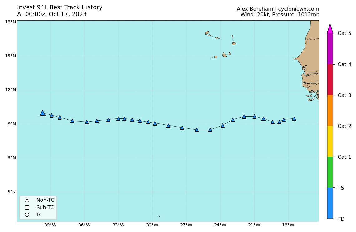
8AM
Central Tropical Atlantic (AL94):
A broad area of low pressure located over the central tropical
Atlantic about 1100 miles east of the Windward Islands continues to
produce a large area of disorganized showers and thunderstorms.
Environmental conditions are expected to remain conducive for
gradual development, and a tropical depression will likely form
during the next 2-3 days while the system moves westward to
west-northwestward across the central and western tropical Atlantic.
Interests in the Lesser Antilles should monitor the progress of
this system. Additional information on this system, including gale
warnings, can be found in High Seas Forecasts issued by the
National Weather Service.
* Formation chance through 48 hours...medium...60 percent.
* Formation chance through 7 days...high...80 percent.
0 likes
-
wxman57

- Moderator-Pro Met

- Posts: 23175
- Age: 68
- Joined: Sat Jun 21, 2003 8:06 pm
- Location: Houston, TX (southwest)
Re: ATL: INVEST 94L - Discussion
Nimbus wrote:floridasun wrote:abajan wrote:https://images2.imgbox.com/e7/e7/5mUPXg11_o.gif
It getting bigger now look like pretty strong wave now
If this closes off into a tropical storm just before the islands Puerto Rico might be in the cone.
The cone is completely irrelevant. It only represents an area where the center of storms tracked 66.7% of the time over the past 5 seasons. It's always the same for every storm and every advisory in a season. Pay no attention to the cone, as it does not represent current forecast uncertainty.
2 likes
Re: ATL: INVEST 94L - Discussion
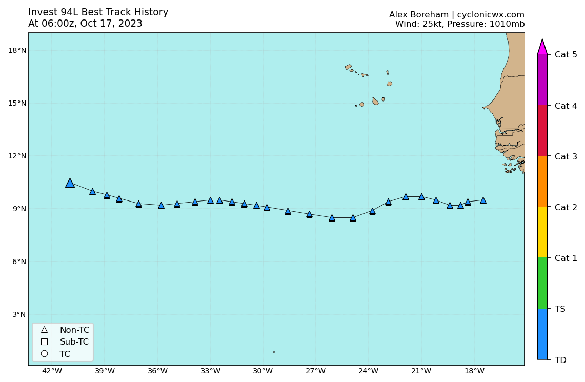
AL, 94, 2023101712, , BEST, 0, 109N, 423W, 25, 1010, LO
Last edited by abajan on Tue Oct 17, 2023 8:04 am, edited 1 time in total.
0 likes
-
wxman57
- Moderator-Pro Met
- Posts: 23175
- Age: 68
- Joined: Sat Jun 21, 2003 8:06 pm
- Location: Houston, TX (southwest)
Re: ATL: INVEST 94L - Discussion
I think that the NHC is being influenced too much by the GFS and HWRF as far as development potential. The wave is moving into some fairly strong westerly shear. Doesn't look very impressive at all. More rain for the NE Caribbean islands Fri-Sun.
3 likes
-
cycloneye
- Admin
- Posts: 149711
- Age: 69
- Joined: Thu Oct 10, 2002 10:54 am
- Location: San Juan, Puerto Rico
Re: ATL: INVEST 94L - Discussion
wxman57 wrote:I think that the NHC is being influenced too much by the GFS and HWRF as far as development potential. The wave is moving into some fairly strong westerly shear. Doesn't look very impressive at all. More rain for the NE Caribbean islands Fri-Sun.
Here in PR, some areas are in drought and some of the other islands too. We welcome the beneficial rains it could bring to the NE Caribbean islands. No more than that of course.
5 likes
Visit the Caribbean-Central America Weather Thread where you can find at first post web cams,radars
and observations from Caribbean basin members Click Here
and observations from Caribbean basin members Click Here
-
MarioProtVI
- Category 5

- Posts: 1039
- Age: 24
- Joined: Sun Sep 29, 2019 7:33 pm
- Location: New Jersey
Re: ATL: INVEST 94L - Discussion
wxman57 wrote:I think that the NHC is being influenced too much by the GFS and HWRF as far as development potential. The wave is moving into some fairly strong westerly shear. Doesn't look very impressive at all. More rain for the NE Caribbean islands Fri-Sun.
It doesn’t look bad rn and certainly better then the last few days. Also, EURO tends to struggle with MDR waves IIRC and also tends to keep storms broadened out despite every other model saying otherwise. The EURO ensembles still have a strong TS/C1. So to say they’re being influenced too much by one or two models is absurd considering literally every other model except for like two develops this into at least a strong TS.
2 likes
-
Sciencerocks
- Category 5
- Posts: 10193
- Age: 40
- Joined: Thu Jul 06, 2017 1:51 am

-
cycloneye
- Admin
- Posts: 149711
- Age: 69
- Joined: Thu Oct 10, 2002 10:54 am
- Location: San Juan, Puerto Rico
Re: ATL: INVEST 94L - Discussion
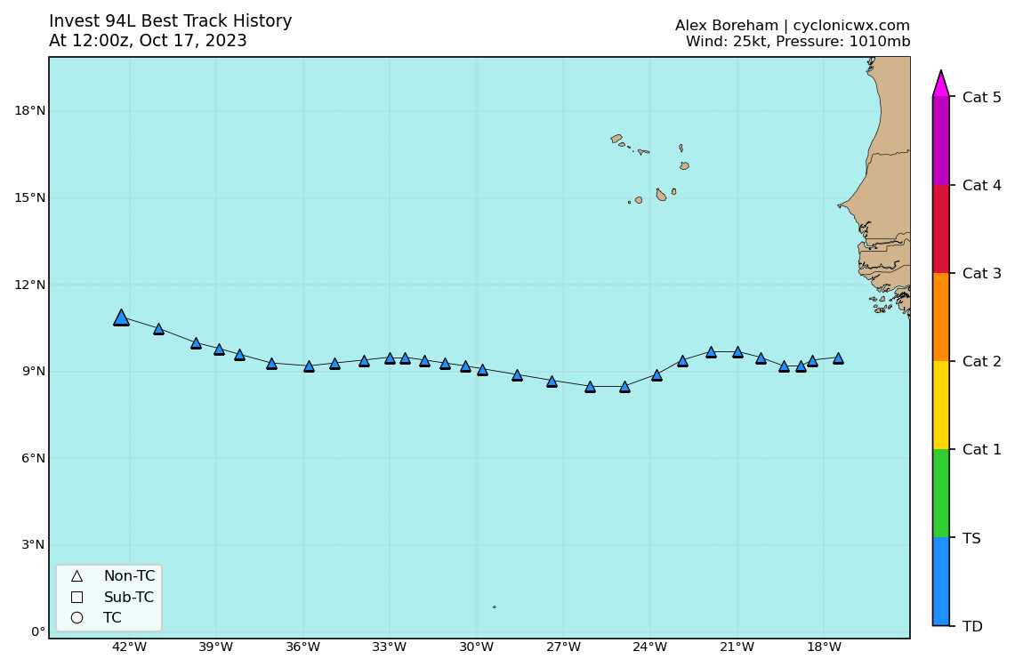
Tropical Weather Outlook
NWS National Hurricane Center Miami FL
200 PM EDT Tue Oct 17 2023
For the North Atlantic...Caribbean Sea and the Gulf of Mexico:
1. Central Tropical Atlantic (AL94):
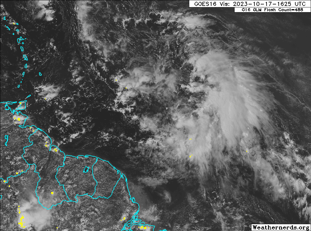
Satellite images indicate that a broad area of low pressure located
about 1100 miles east of the Windward Islands has become better
defined since this morning, and the associated showers and
thunderstorms are also showing signs of organization. Environmental
conditions are expected to remain conducive for gradual
development, and a tropical depression will likely form during the
next day or two while the system moves westward to
west-northwestward across the central and western tropical
Atlantic. Interests in the Lesser Antilles should monitor the
progress of this system. Additional information, including gale
warnings, can be found in High Seas Forecasts issued by the National
Weather Service. Regardless of development, this system has the
potential to bring gusty winds, heavy rainfall and flooding to
portions of the Lesser Antilles beginning Friday.
* Formation chance through 48 hours...high...70 percent.
* Formation chance through 7 days...high...80 percent.
High Seas Forecasts issued by the National Weather Service
can be found under AWIPS header NFDHSFAT1, WMO header FZNT01
KWBC, and online at ocean.weather.gov/shtml/NFDHSFAT1.php
Forecaster Blake
NWS National Hurricane Center Miami FL
200 PM EDT Tue Oct 17 2023
For the North Atlantic...Caribbean Sea and the Gulf of Mexico:
1. Central Tropical Atlantic (AL94):
Satellite images indicate that a broad area of low pressure located
about 1100 miles east of the Windward Islands has become better
defined since this morning, and the associated showers and
thunderstorms are also showing signs of organization. Environmental
conditions are expected to remain conducive for gradual
development, and a tropical depression will likely form during the
next day or two while the system moves westward to
west-northwestward across the central and western tropical
Atlantic. Interests in the Lesser Antilles should monitor the
progress of this system. Additional information, including gale
warnings, can be found in High Seas Forecasts issued by the National
Weather Service. Regardless of development, this system has the
potential to bring gusty winds, heavy rainfall and flooding to
portions of the Lesser Antilles beginning Friday.
* Formation chance through 48 hours...high...70 percent.
* Formation chance through 7 days...high...80 percent.
High Seas Forecasts issued by the National Weather Service
can be found under AWIPS header NFDHSFAT1, WMO header FZNT01
KWBC, and online at ocean.weather.gov/shtml/NFDHSFAT1.php
Forecaster Blake
1 likes
Visit the Caribbean-Central America Weather Thread where you can find at first post web cams,radars
and observations from Caribbean basin members Click Here
and observations from Caribbean basin members Click Here
-
DorkyMcDorkface

- Category 5
- Posts: 1043
- Age: 28
- Joined: Mon Sep 30, 2019 1:32 pm
- Location: Mid-Atlantic
Re: ATL: INVEST 94L - Discussion


1 likes
Please note the thoughts expressed by this account are solely those of the user and are from a hobbyist perspective. For more comprehensive analysis, consult an actual professional meteorologist or meteorological agency.
Floyd 1999 | Isabel 2003 | Hanna 2008 | Irene 2011 | Sandy 2012 | Isaias 2020
-
cycloneye
- Admin
- Posts: 149711
- Age: 69
- Joined: Thu Oct 10, 2002 10:54 am
- Location: San Juan, Puerto Rico
Re: ATL: INVEST 94L - Discussion
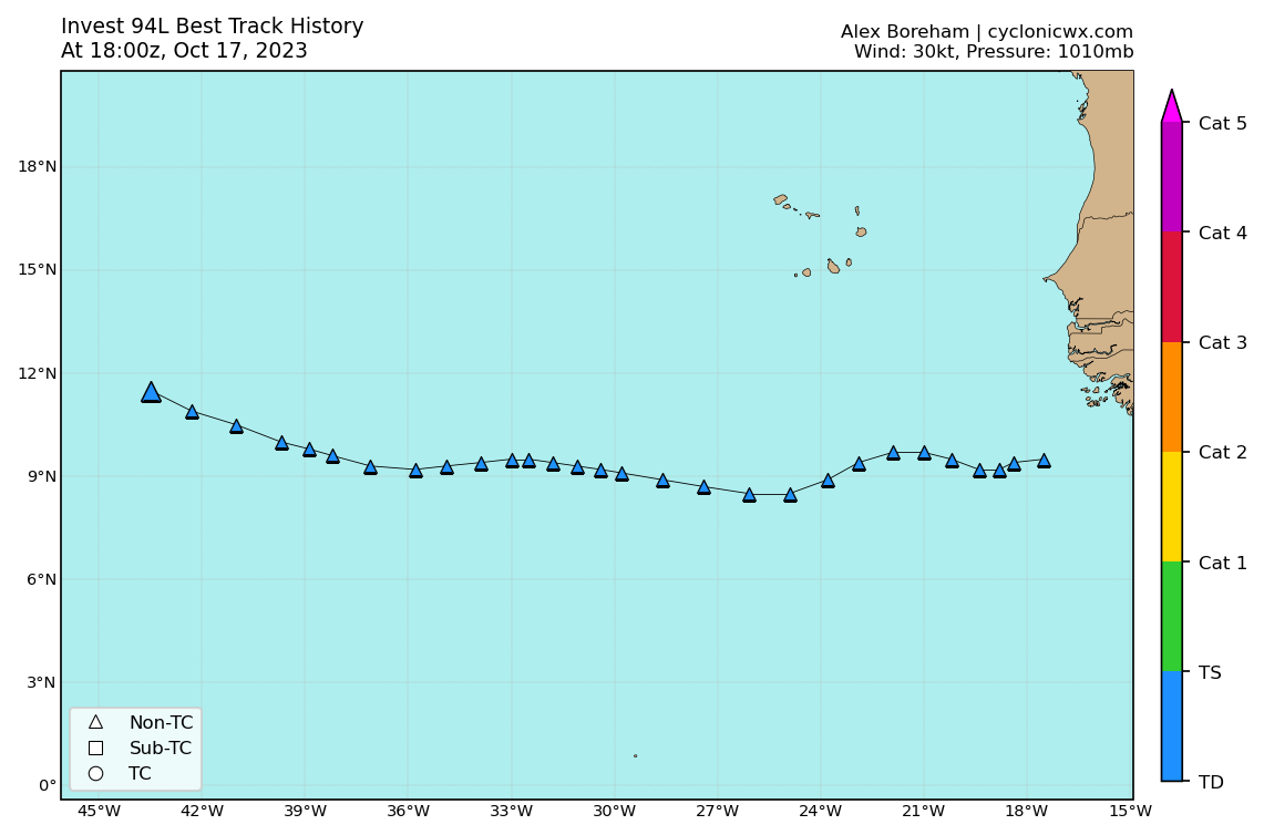
Tropical Weather Outlook
NWS National Hurricane Center Miami FL
800 PM EDT Tue Oct 17 2023
For the North Atlantic...Caribbean Sea and the Gulf of Mexico:
1. Central Tropical Atlantic (AL94):
Showers and thunderstorms associated with a broad area of low
pressure located a little over 1000 miles east of the Windward
Islands continue to show signs of organization. Environmental
conditions are expected to remain conducive for gradual
development, and a tropical depression is likely to form during the
next day or two while the system moves westward to
west-northwestward across the central and western tropical
Atlantic. Interests in the Lesser Antilles should monitor the
progress of this system. Additional information, including gale
warnings, can be found in High Seas Forecasts issued by the
National Weather Service. Regardless of development, this system
has the potential to bring gusty winds, heavy rainfall, and flooding
to portions of the Lesser Antilles beginning Friday.
* Formation chance through 48 hours...high...70 percent.
* Formation chance through 7 days...high...80 percent.
High Seas Forecasts issued by the National Weather Service
can be found under AWIPS header NFDHSFAT1, WMO header FZNT01
KWBC, and online at ocean.weather.gov/shtml/NFDHSFAT1.php
Forecaster Roberts
1 likes
Visit the Caribbean-Central America Weather Thread where you can find at first post web cams,radars
and observations from Caribbean basin members Click Here
and observations from Caribbean basin members Click Here
Who is online
Users browsing this forum: No registered users and 52 guests