ATL: INVEST 95L - Discussion

Moderator: S2k Moderators

Message
Author
User avatar
abajan
S2K Supporter
S2K Supporter
Posts: 4175
Joined: Sun Sep 07, 2003 5:10 am
Location: Barbados

Re: ATL: INVEST 95L - Discussion- Code Red 70%

#121 Postby abajan » Sat Jul 22, 2023 12:46 pm

cycloneye wrote:
Blown Away wrote:If model support continues to drop, thinking NHC going to lower odds soon.
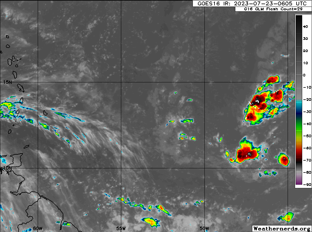
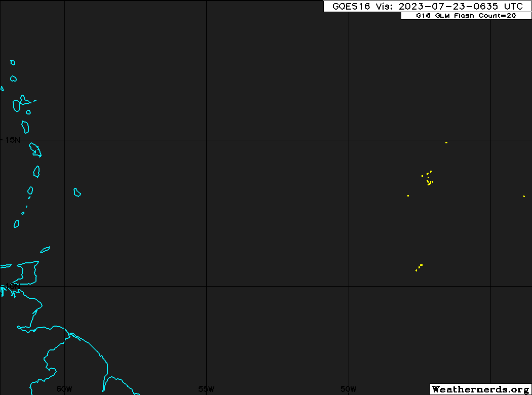
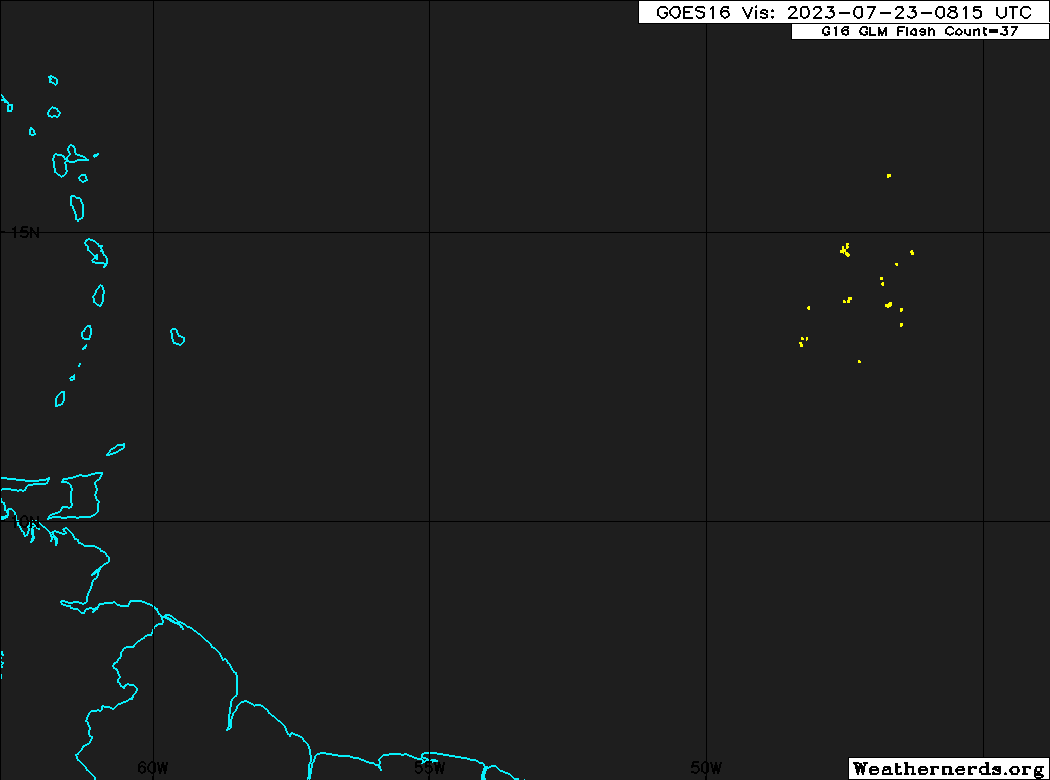

Bingo.

Central Tropical Atlantic (AL95):
Shower activity associated with a small area of low pressure located
roughly midway between the Cabo Verde Islands and the Lesser
Antilles has become a little less organized since yesterday.
Environmental conditions are forecast to remain marginally conducive
for some gradual development, and this system could become a
tropical depression early next week while it moves westward across
the tropical Atlantic. Interests in the Lesser Antilles should
monitor the progress of this system.
* Formation chance through 48 hours...medium...40 percent.
* Formation chance through 7 days...medium...60 percent.


Looks a lot less organized to my amateur eye.
3 likes   

User avatar
chaser1
S2K Supporter
S2K Supporter
Posts: 4731
Age: 63
Joined: Sat Oct 15, 2005 5:59 pm
Location: Longwood, Fl

Re: ATL: INVEST 95L - Discussion- TWO 2 PM Down to 40%/60%

#122 Postby chaser1 » Sat Jul 22, 2023 1:53 pm

Bridge to Scotty, update?
I've giv'n her all she's got captain, an' I canna give her no more.
2 likes   
Personal Forecast Disclaimer:
The posts in this forum are NOT official forecast and should not be used as such. They are just the opinion of the poster and may or may not be backed by sound meteorological data. They are NOT endorsed by any professional institution or storm2k.org. For official information, please refer to the NHC and NWS products.


User avatar
Iceresistance
Category 5
Category 5
Posts: 8929
Age: 20
Joined: Sat Oct 10, 2020 9:45 am
Location: Tecumseh, OK/Norman, OK

Re: ATL: INVEST 95L - Discussion

#123 Postby Iceresistance » Sat Jul 22, 2023 2:29 pm

cycloneye wrote:
Iceresistance wrote:Per WeatherNerds, ASCAT is coming to 95L


But when? We need one to see how is the structure of 95L tonight.

Sorry, I went to bed directly after this post. :oops:
2 likes   
Bill 2015 & Beta 2020

Winter 2020-2021 :cold:

All observations are in Tecumseh, OK unless otherwise noted.

Winter posts are focused mainly for Oklahoma & Texas.

Take any of my forecasts with a grain of salt, refer to the NWS, SPC, and NHC for official information

Never say Never with weather! Because ANYTHING is possible!

User avatar
Hammy
Category 5
Category 5
Posts: 5594
Age: 40
Joined: Fri May 25, 2012 5:25 pm
Contact:

Re: ATL: INVEST 95L - Discussion- TWO 2 PM Down to 40%/60%

#124 Postby Hammy » Sat Jul 22, 2023 2:31 pm

This was already a tropical depression yesterday by all definitions, and is well past it's peak at this point
4 likes   
The above post is not official and should not be used as such. It is the opinion of the poster and may or may not be backed by sound meteorological data. It is not endorsed by any professional institution or storm2k.org. For official information, please refer to the NHC and NWS products.

User avatar
wxman57
Moderator-Pro Met
Moderator-Pro Met
Posts: 22495
Age: 66
Joined: Sat Jun 21, 2003 8:06 pm
Location: Houston, TX (southwest)

Re: ATL: INVEST 95L - Discussion- TWO 2 PM Down to 40%/60%

#125 Postby wxman57 » Sat Jul 22, 2023 3:17 pm

40%/60% makes no sense. Best chance of it becoming a depression is within the next 48 hrs. It gets ripped apart after then. Next!
9 likes   

Steve H.
Category 5
Category 5
Posts: 2134
Joined: Sat Oct 19, 2002 9:06 am
Location: Palm Bay, Florida

Re: ATL: INVEST 95L - Discussion- TWO 2 PM Down to 40%/60%

#126 Postby Steve H. » Sat Jul 22, 2023 3:23 pm

Yes, 95L is history. Don is gone 8-)
0 likes   

User avatar
cycloneye
Admin
Admin
Posts: 139500
Age: 67
Joined: Thu Oct 10, 2002 10:54 am
Location: San Juan, Puerto Rico

Re: ATL: INVEST 95L - Discussion- 40%/50%

#127 Postby cycloneye » Sat Jul 22, 2023 6:24 pm

8 PM down to 50% in 7 days.

Central Tropical Atlantic (AL95):
Shower activity associated with a small area of low pressure
located about midway between the Cabo Verde Islands and the
Lesser Antilles has diminished considerably since this time
yesterday. Although environmental conditions are only forecast to
be marginally conducive for some gradual development, the system
could still become a tropical depression early next week while it
moves westward across the tropical Atlantic. Interests in the
Lesser Antilles should monitor the progress of this system.
* Formation chance through 48 hours...medium...40 percent.
* Formation chance through 7 days...medium...50 percent.
1 likes   
Visit the Caribbean-Central America Weather Thread where you can find at first post web cams,radars
and observations from Caribbean basin members Click Here

User avatar
wxman57
Moderator-Pro Met
Moderator-Pro Met
Posts: 22495
Age: 66
Joined: Sat Jun 21, 2003 8:06 pm
Location: Houston, TX (southwest)

Re: ATL: INVEST 95L - Discussion- 40% / 50%

#128 Postby wxman57 » Sat Jul 22, 2023 7:41 pm

Bones says 95L has flat-lined. Its best chance of development was yesterday. The farther west it tracks, the higher the shear. He doesn't understand NHC's higher development chances past 48 hrs.

Image
7 likes   

User avatar
cycloneye
Admin
Admin
Posts: 139500
Age: 67
Joined: Thu Oct 10, 2002 10:54 am
Location: San Juan, Puerto Rico

Re: ATL: INVEST 95L - Discussion- 40% / 50%

#129 Postby cycloneye » Sat Jul 22, 2023 7:51 pm

AL, 95, 2023072300, , BEST, 0, 114N, 442W, 25, 1012, LO
0 likes   
Visit the Caribbean-Central America Weather Thread where you can find at first post web cams,radars
and observations from Caribbean basin members Click Here

User avatar
abajan
S2K Supporter
S2K Supporter
Posts: 4175
Joined: Sun Sep 07, 2003 5:10 am
Location: Barbados

Re: ATL: INVEST 95L - Discussion- 40% / 50%

#130 Postby abajan » Sat Jul 22, 2023 10:09 pm

wxman57 wrote:Bones says 95L has flat-lined. Its best chance of development was yesterday. The farther west it tracks, the higher the shear. He doesn't understand NHC's higher development chances past 48 hrs.

http://wxman57.com/images/itsdeadjim.jpg


It now looks awful! And I don't mean that in an archaic sense. :lol:
1 likes   

User avatar
Jr0d
S2K Supporter
S2K Supporter
Posts: 1177
Joined: Tue Aug 27, 2019 10:52 am
Location: Cayo Hueso

Re: ATL: INVEST 95L - Discussion- 40% / 50%

#131 Postby Jr0d » Sat Jul 22, 2023 10:16 pm

I figured this was coming when I checked up on ithe invest tonight.

Image
1 likes   

User avatar
ElectricStorm
Category 5
Category 5
Posts: 4620
Age: 23
Joined: Tue Aug 13, 2019 11:23 pm
Location: Skiatook, OK / Norman, OK

Re: ATL: INVEST 95L - Discussion

#132 Postby ElectricStorm » Sat Jul 22, 2023 11:16 pm

Looked pretty close to a TD yesterday but doesn't have much of a chance now. Might be down to a lemon in the next TWO. Maybe the next wave can do better
1 likes   
I am in no way a professional. Take what I say with a grain of salt as I could be totally wrong. Please refer to the NHC, NWS, or SPC for official information.

Boomer Sooner!

User avatar
GCANE
S2K Supporter
S2K Supporter
Posts: 10787
Joined: Mon Oct 22, 2007 8:03 am

Re: ATL: INVEST 95L - Discussion

#133 Postby GCANE » Sun Jul 23, 2023 2:35 am

Getting close to 50W and firing back up.
WV satellite imagery showing shear to the west starting around 53W.
However, GFS is forecasting higher humidity and water temps at about the same point.

https://rammb-data.cira.colostate.edu/t ... 230600.png
2 likes   

User avatar
chaser1
S2K Supporter
S2K Supporter
Posts: 4731
Age: 63
Joined: Sat Oct 15, 2005 5:59 pm
Location: Longwood, Fl

Re: ATL: INVEST 95L - Discussion

#134 Postby chaser1 » Sun Jul 23, 2023 2:50 am

GCANE wrote:Getting close to 50W and firing back up.
WV satellite imagery showing shear to the west starting around 53W.
However, GFS is forecasting higher humidity and water temps at about the same point.

https://rammb-data.cira.colostate.edu/t ... 230600.png


LOL, It's gonna fight till the bitter end
2 likes   
Personal Forecast Disclaimer:
The posts in this forum are NOT official forecast and should not be used as such. They are just the opinion of the poster and may or may not be backed by sound meteorological data. They are NOT endorsed by any professional institution or storm2k.org. For official information, please refer to the NHC and NWS products.


User avatar
abajan
S2K Supporter
S2K Supporter
Posts: 4175
Joined: Sun Sep 07, 2003 5:10 am
Location: Barbados

Re: ATL: INVEST 95L - Discussion

#135 Postby abajan » Sun Jul 23, 2023 4:35 am

chaser1 wrote:
GCANE wrote:Getting close to 50W and firing back up.
WV satellite imagery showing shear to the west starting around 53W.
However, GFS is forecasting higher humidity and water temps at about the same point.

https://rammb-data.cira.colostate.edu/t ... 230600.png


LOL, It's gonna fight till the bitter end

Indeed. Let's all raise our glasses for a toast to 95L's heroic swansong, shall we? :lol:

Image

Image

Tropical Weather Outlook
NWS National Hurricane Center Miami FL
200 AM EDT Sun Jul 23 2023

For the North Atlantic...Caribbean Sea and the Gulf of Mexico:

Active Systems:
The National Hurricane Center is issuing advisories on Hurricane
Don, located over the central Atlantic.

1. Central Tropical Atlantic (AL95):
Shower activity remains limited in association with a small area of
low pressure located about 1000 miles east of the Windward Islands.
Although environmental conditions are only forecast to be marginally
conducive for some gradual development, this system could still
become a tropical depression during the next few days while it
moves westward across the tropical Atlantic and eastern Caribbean
Sea. Unfavorable upper-level winds are forecast when the system
moves into the central Caribbean around midweek, decreasing the
chances of formation. Interests in the Lesser Antilles should
monitor the progress of this system.
* Formation chance through 48 hours...low...30 percent.
* Formation chance through 7 days...medium...40 percent.

Forecaster Blake
0 likes   

User avatar
cycloneye
Admin
Admin
Posts: 139500
Age: 67
Joined: Thu Oct 10, 2002 10:54 am
Location: San Juan, Puerto Rico

Re: ATL: INVEST 95L - Discussion

#136 Postby cycloneye » Sun Jul 23, 2023 6:50 am

Tropical Weather Outlook
NWS National Hurricane Center Miami FL
800 AM EDT Sun Jul 23 2023

For the North Atlantic...Caribbean Sea and the Gulf of Mexico:

Active Systems:
The National Hurricane Center is issuing advisories on Hurricane
Don, located over the central Atlantic.

Central Tropical Atlantic (AL95):
Shower activity continues to be limited in association with a small
area of low pressure located about 900 miles east of the Windward
Islands. Although environmental conditions are only forecast to be
marginally conducive for some gradual development, this system
could still become a tropical depression during the next few days
while it moves westward across the tropical Atlantic and eastern
Caribbean Sea. Unfavorable upper-level winds are forecast when the
system moves into the central Caribbean around midweek, decreasing
the chances of formation. Interests in the Lesser Antilles should
monitor the progress of this system.
* Formation chance through 48 hours...low...30 percent.
* Formation chance through 7 days...medium...40 percent.

$$
Forecaster Pasch
1 likes   
Visit the Caribbean-Central America Weather Thread where you can find at first post web cams,radars
and observations from Caribbean basin members Click Here

User avatar
abajan
S2K Supporter
S2K Supporter
Posts: 4175
Joined: Sun Sep 07, 2003 5:10 am
Location: Barbados

Re: ATL: INVEST 95L - Discussion

#137 Postby abajan » Sun Jul 23, 2023 7:02 am

Circulation seems to be centered near 10.5N 47.0W but there's shear dead ahead!

Image
1 likes   

User avatar
abajan
S2K Supporter
S2K Supporter
Posts: 4175
Joined: Sun Sep 07, 2003 5:10 am
Location: Barbados

Re: ATL: INVEST 95L - Discussion

#138 Postby abajan » Sun Jul 23, 2023 7:55 am

Comprehensive video from Meteorologist Brian Shields (aka Mr. Weatherman).


Link: https://youtu.be/duUVFVd9RAY
0 likes   

User avatar
cycloneye
Admin
Admin
Posts: 139500
Age: 67
Joined: Thu Oct 10, 2002 10:54 am
Location: San Juan, Puerto Rico

Re: ATL: INVEST 95L - Discussion

#139 Postby cycloneye » Sun Jul 23, 2023 8:01 am

Is still losing some latitude.

AL, 95, 2023072312, , BEST, 0, 106N, 461W, 25, 1012, LO
1 likes   
Visit the Caribbean-Central America Weather Thread where you can find at first post web cams,radars
and observations from Caribbean basin members Click Here

User avatar
GCANE
S2K Supporter
S2K Supporter
Posts: 10787
Joined: Mon Oct 22, 2007 8:03 am

Re: ATL: INVEST 95L - Discussion

#140 Postby GCANE » Sun Jul 23, 2023 8:14 am

Looks like the shear ahead of the wave is confined to the 300 to 400mb level and is associated with quite a bit of moisture.
So, its a mixed bag, meaning it will wash out the SAL ahead of the wave and add moisture in the mid to upper level of the troposphere.
3 likes   


Return to “2023”

Who is online

Users browsing this forum: No registered users and 11 guests