
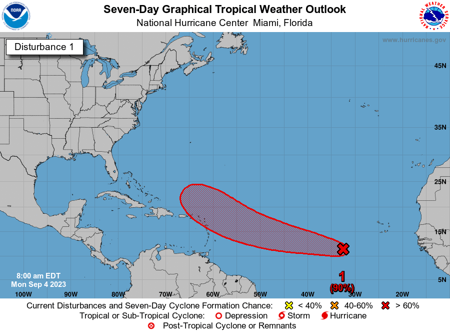
Still needs to work on the structure, convection is needed.
By the way, 95L is lucky to get 4 good ASCAT passes in a row
Moderator: S2k Moderators
dukeblue219 wrote:869MB wrote:Unfortunately, in my opinion, a 1989 Hurricane Hugo 500mb upper-level pattern can't be ruled out at this juncture.
I was 3 when Hugo hit SC, and to some degree the damage I saw (and admittedly the excitement as a 3 year old) spurned a lot of my interest in tropical weather to this day. I, too, will be watching the upper levels closely for that rare setup that drives a storm directly into the east coast. Fortunately we are far out and that kind of setup takes everything lined up just right...
Hugo is also infamous as the storm that tried to take down a P-3 with Jeff Masters: https://www.wunderground.com/hurricane/ ... ugo-part-1
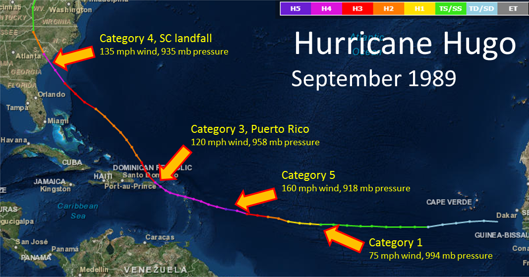
cycloneye wrote:869MB wrote:Unfortunately, in my opinion, a 1989 Hurricane Hugo 500mb upper-level pattern can't be ruled out at this juncture. Just 24 to 36 hours ago, I really didn't think such a pattern would ever materialize. But now, I'm not quite so sure. The latest Operational GFS and Euro runs are kind of trending in that direction but in different manners. Nonetheless, most of us have been doing this long enough to know to never take mid to long-range upper patterns verbatim, and calling Fish Storm or CONUS strike based upon these models is premature. With that being said, I have the Hugo upper-level pattern memorized and will be very closely observing how the models resolve the pattern over the forthcoming days.
The U.S. 500mb Geopotential Height Composite Mean between 8/15/1989 and 8/19/1989...
https://psl.noaa.gov/tmp/composites/comphour.cEycrb_WAj.gif
12Z Euro run at 240hrs..
https://www.tropicaltidbits.com/analysis/models/?model=ecmwf®ion=us&pkg=z500_mslp&runtime=2023090312&fh=12
For those of you not familiar with Hurricane Hugo, here's a link for reference...
https://www.weather.gov/ilm/hurricanehugo
https://www.weather.gov/images/ilm/climate/hugo/Hugo_track2.png
Very interesting all of that.
dukeblue219 wrote:869MB wrote:Unfortunately, in my opinion, a 1989 Hurricane Hugo 500mb upper-level pattern can't be ruled out at this juncture.
I was 3 when Hugo hit SC, and to some degree the damage I saw (and admittedly the excitement as a 3 year old) spurned a lot of my interest in tropical weather to this day. I, too, will be watching the upper levels closely for that rare setup that drives a storm directly into the east coast. Fortunately we are far out and that kind of setup takes everything lined up just right...
Hugo is also infamous as the storm that tried to take down a P-3 with Jeff Masters: https://www.wunderground.com/hurricane/ ... ugo-part-1

869MB wrote:Unfortunately, in my opinion, a 1989 Hurricane Hugo 500mb upper-level pattern can't be ruled out at this juncture. Just 24 to 36 hours ago, I really didn't think such a pattern would ever materialize. But now, I'm not quite so sure. The latest Operational GFS and Euro runs are kind of trending in that direction but in different manners. Nonetheless, most of us have been doing this long enough to know to never take mid to long-range upper patterns verbatim, and calling Fish Storm or CONUS strike based upon these models is premature. With that being said, I have the Hugo upper-level pattern memorized and will be very closely observing how the models resolve the pattern over the forthcoming days.
The U.S. 500mb Geopotential Height Composite Mean between 8/15/1989 and 8/19/1989...
https://psl.noaa.gov/tmp/composites/comphour.cEycrb_WAj.gif
12Z Euro run at 240hrs..
https://www.tropicaltidbits.com/analysis/models/?model=ecmwf®ion=us&pkg=z500_mslp&runtime=2023090312&fh=12
For those of you not familiar with Hurricane Hugo, here's a link for reference...
https://www.weather.gov/ilm/hurricanehugo
https://www.weather.gov/images/ilm/climate/hugo/Hugo_track2.png


zzzh wrote:https://i.imgur.com/02MaZFc.jpg
Still needs to work on the structure, convection is needed.
By the way, 95L is lucky to get 4 good ASCAT passes in a row


zzzh wrote:https://i.imgur.com/02MaZFc.jpg
Still needs to work on the structure, convection is needed.
By the way, 95L is lucky to get 4 good ASCAT passes in a row


cycloneye wrote:zzzh wrote:https://i.imgur.com/02MaZFc.jpg
Still needs to work on the structure, convection is needed.
By the way, 95L is lucky to get 4 good ASCAT passes in a row
Convection trying to get going closer to circulation.
https://i.imgur.com/xiPDozn.gif
hipshot wrote:dukeblue219 wrote:869MB wrote:Unfortunately, in my opinion, a 1989 Hurricane Hugo 500mb upper-level pattern can't be ruled out at this juncture.
I was 3 when Hugo hit SC, and to some degree the damage I saw (and admittedly the excitement as a 3 year old) spurned a lot of my interest in tropical weather to this day. I, too, will be watching the upper levels closely for that rare setup that drives a storm directly into the east coast. Fortunately we are far out and that kind of setup takes everything lined up just right...
Hugo is also infamous as the storm that tried to take down a P-3 with Jeff Masters: https://www.wunderground.com/hurricane/ ... ugo-part-1
I flew in a P3 in the Navy during the Vietnam era but fortunately never had to experience that. Those aircraft are pretty stiff winged and
bounce around a lot in even moderate turbulence, I can't imagine what it would be like as a hurricane hunter!!
Sciencerocks wrote:https://imagizer.imageshack.com/img924/3693/M6r71F.gif


SconnieCane wrote:An aside, but I've long been curious about the "135 MPH" often attributed to Hugo's SC landfall. With the way NHC's kt-to-MPH conversion and rounding works, 135 MPH would never be operationally reported in an advisory. It would either be 115 kt = 132.3 MPH-rounds down to 130 MPH (the 2012 tweaks to the SSHWS made this the low end of Category 4, rather than having it remain within Category 3 by 1 MPH as previously); or 120 kt = 138.1 MPH-rounds up to 140 MPH. So which one was Hugo?


SconnieCane wrote:An aside, but I've long been curious about the "135 MPH" often attributed to Hugo's SC landfall. With the way NHC's kt-to-MPH conversion and rounding works, 135 MPH would never be operationally reported in an advisory. It would either be 115 kt = 132.3 MPH-rounds down to 130 MPH (the 2012 tweaks to the SSHWS made this the low end of Category 4, rather than having it remain within Category 3 by 1 MPH as previously); or 120 kt = 138.1 MPH-rounds up to 140 MPH. So which one was Hugo?


Users browsing this forum: No registered users and 54 guests


