ATL: FRANKLIN - Post-Tropical - Discussion

Moderator: S2k Moderators

Message
Author
User avatar
jfk08c
S2K Supporter
S2K Supporter
Posts: 203
Joined: Mon Jun 11, 2018 4:36 pm
Location: Lakeland, FL

Re: ATL: FRANKLIN - Tropical Storm - Discussion

#181 Postby jfk08c » Tue Aug 22, 2023 1:26 pm

IsabelaWeather wrote:What is even happening with this storm lol. Imagine how bad the bust in the track would be if it continues west, looks like the LLC is racing due west right now.

I just cant imagine the NHC track being off by a vector of 90*


I feel like one of these days it's bound to happen. Then again, it's kind of a damned if you do damned if you don't situation. If they disregard the models and just go an entire other direction, people will be questioning judgment pretty quickly. Then again, you follow the models and all of them bust, that's just terrible luck.
0 likes   

Sciencerocks
Category 5
Category 5
Posts: 8903
Age: 39
Joined: Thu Jul 06, 2017 1:51 am

Re: ATL: FRANKLIN - Tropical Storm - Discussion

#182 Postby Sciencerocks » Tue Aug 22, 2023 1:26 pm

IsabelaWeather wrote:What is even happening with this storm lol. Imagine how bad the bust in the track would be if it continues west, looks like the LLC is racing due west right now.

I just cant imagine the NHC track being off by a vector of 90*


The shear is keeping it weak and within the lower portion of the atmosphere. Some of the models that shown it remaining weak did take it further west. Maybe I'll shoot up between Haiti and Cuba? Who knows. I doubt it gets further west then that with the overall pattern but who knows. This could track west of bermuda and threaten Canada.
0 likes   

User avatar
Nimbus
Category 5
Category 5
Posts: 5274
Joined: Mon Jul 19, 2004 10:54 am

Re: ATL: FRANKLIN - Tropical Storm - Discussion

#183 Postby Nimbus » Tue Aug 22, 2023 1:30 pm

The trough is digging south with dry shear all the way to the Yucatan.
Franklin ran west out from under the convection as the UK depicted.

Might spare the Dominican Republic some mud slides as its likely to stay weak on that track.
Not sure if the delay would be enough to strand it east of the Bahamas or not but the shear from the west isn't letting up any time soon.
0 likes   

User avatar
cycloneye
Admin
Admin
Posts: 143871
Age: 68
Joined: Thu Oct 10, 2002 10:54 am
Location: San Juan, Puerto Rico

Re: ATL: FRANKLIN - Tropical Storm - Discussion

#184 Postby cycloneye » Tue Aug 22, 2023 1:56 pm

Down to almost TD.

AL, 08, 2023082218, , BEST, 0, 154N, 714W, 35, 1005, TS
0 likes   
Visit the Caribbean-Central America Weather Thread where you can find at first post web cams,radars
and observations from Caribbean basin members Click Here

User avatar
HurricaneEnzo
Category 2
Category 2
Posts: 739
Joined: Wed Mar 14, 2018 12:18 pm
Location: Newport, NC (Hurricane Alley)

Re: ATL: FRANKLIN - Tropical Storm - Discussion

#185 Postby HurricaneEnzo » Tue Aug 22, 2023 1:57 pm

IsabelaWeather wrote:What is even happening with this storm lol. Imagine how bad the bust in the track would be if it continues west, looks like the LLC is racing due west right now.

I just cant imagine the NHC track being off by a vector of 90*


Until it stops spitting out LLCs and one becomes dominate who knows how far off or if it will be off track. I agree with their call to stay the course right now but they are definitely in a tough position.
0 likes   
Bertha 96' - Fran 96' - Bonnie 98' - Dennis 99' - Floyd 99' - Isabel 03' - Alex 04' - Ophelia 05' - Irene 11' - Arthur 14' - Matthew 16' - Florence 18' - Dorian 19' - Isaias 20' (countless other tropical storms and Hurricane swipes)

I am not a Professional Met just an enthusiast. Get your weather forecasts from the Pros!

User avatar
galaxy401
Category 5
Category 5
Posts: 2410
Age: 29
Joined: Sat Aug 25, 2012 9:04 pm
Location: Casa Grande, Arizona

Re: ATL: FRANKLIN - Tropical Storm - Discussion: Best Track down to 35 kt

#186 Postby galaxy401 » Tue Aug 22, 2023 2:16 pm

Looks like the East Caribbean is doing its work again. Things will be much better for Franklin after passing Hispaniola.
0 likes   
Got my eyes on moving right into Hurricane Alley: Florida.

MarioProtVI
Category 4
Category 4
Posts: 932
Age: 23
Joined: Sun Sep 29, 2019 7:33 pm
Location: New Jersey

Re: ATL: FRANKLIN - Tropical Storm - Discussion: Best Track down to 35 kt

#187 Postby MarioProtVI » Tue Aug 22, 2023 2:27 pm

galaxy401 wrote:Looks like the East Caribbean is doing its work again. Things will be much better for Franklin after passing Hispaniola.

If anything it will help Franklin bc of how weak it is right now. We’ve seen this happen numerous times where Hispaniola ends up tightening the LLC of a very weak and broad system (leading to considerable strengthening later on) - Isaias and Laura in 2020 and then Grace in 2021.
0 likes   

User avatar
aspen
Category 5
Category 5
Posts: 8812
Joined: Sat Oct 12, 2019 7:10 pm
Location: Connecticut, USA

Re: ATL: FRANKLIN - Tropical Storm - Discussion: Best Track down to 35 kt

#188 Postby aspen » Tue Aug 22, 2023 2:47 pm

MarioProtVI wrote:
galaxy401 wrote:Looks like the East Caribbean is doing its work again. Things will be much better for Franklin after passing Hispaniola.

If anything it will help Franklin bc of how weak it is right now. We’ve seen this happen numerous times where Hispaniola ends up tightening the LLC of a very weak and broad system (leading to considerable strengthening later on) - Isaias and Laura in 2020 and then Grace in 2021.

This sure is acting a lot like Grace. IIRC, recon has a very hard time finding a center when it was at a similar longitude as Franklin.
2 likes   
Irene '11 Sandy '12 Hermine '16 5/15/2018 Derecho Fay '20 Isaias '20 Elsa '21 Henri '21 Ida '21

I am only a meteorology enthusiast who knows a decent amount about tropical cyclones. Look to the professional mets, the NHC, or your local weather office for the best information.

User avatar
Cyclenall
Category 5
Category 5
Posts: 6665
Joined: Thu Jun 08, 2006 10:01 pm
Location: Ontario, Canada

Re: ATL: FRANKLIN - Tropical Storm - Discussion

#189 Postby Cyclenall » Tue Aug 22, 2023 5:16 pm

Image

From The Weather Network news bar, "powerful" :lol: . That looks to be from this afternoon!
2 likes   

User avatar
Fego
S2K Supporter
S2K Supporter
Posts: 767
Age: 65
Joined: Sun Apr 18, 2004 7:58 pm
Location: San Juan, Puerto Rico
Contact:

Re: ATL: FRANKLIN - Tropical Storm - Discussion

#190 Postby Fego » Tue Aug 22, 2023 6:05 pm

Chris_in_Tampa wrote:I have created a temporary mirror of the Dominican Republic's radar imagery. The mirror will end once Franklin has passed Hispaniola.
http://tropicalatlantic.com/radars/live ... _republic/

Saved loop:

https://imgur.com/DUHA2SE

Thanks for the link Chris. The mirror will end because the fuction has a time limit or is related with the access to the radar?
0 likes   
Go Giants! Go Niners! Go Warriors!

Sciencerocks
Category 5
Category 5
Posts: 8903
Age: 39
Joined: Thu Jul 06, 2017 1:51 am

Re: ATL: FRANKLIN - Tropical Storm - Discussion

#191 Postby Sciencerocks » Tue Aug 22, 2023 6:56 pm

Image
0 likes   

Chris_in_Tampa
Category 5
Category 5
Posts: 5075
Age: 41
Joined: Thu Jun 21, 2007 11:06 pm
Location: Tampa, Florida, USA
Contact:

Re: ATL: FRANKLIN - Tropical Storm - Discussion

#192 Postby Chris_in_Tampa » Tue Aug 22, 2023 7:54 pm

Fego wrote:
Chris_in_Tampa wrote:I have created a temporary mirror of the Dominican Republic's radar imagery. The mirror will end once Franklin has passed Hispaniola.
http://tropicalatlantic.com/radars/live ... _republic/

Saved loop:

https://imgur.com/DUHA2SE

Thanks for the link Chris. The mirror will end because the fuction has a time limit or is related with the access to the radar?


Whoops, this post got long. It's just about my radar display. Everyone can skip it.

Short answer, the display could change or the bandwidth used by people using it could impact my site.


The file size of the radar images in that display are very large, 250 to 350 kilobytes per image. (high end of the range, maybe even larger, when there is a lot of radar data on the image) Imagery is about every 6 minutes.

I have it set to keep 500 images right now. Imagery is about every 6 minutes. That is 480 images in two days. I only created the DR part of the code this morning. I was downloading imagery manually for the first ten hours overnight. It doesn't have but about a day's worth of data right now.

But if someone were to view even a day's worth of data, right now that would be about 75 megabytes to load. If 100 people did that, that is 7.5 gigabytes of bandwidth. Technically my site has unlimited bandwidth with my host, but that's not really true. There are rules. So I try not to push up against those. My site is on a really old server and I limited by that. To get on a newer server, I would have to upgrade my plan. I currently only pay $82.23 per year for hosting my site. I have for 20 years. If I were to upgrade, then I would not have unlimited bandwidth. They don't have unlimited bandwidth plans any longer. For that plan I am on, the new version, to pay the same amount, I would then only have 10 gigabytes of bandwidth per month. That's it. For $155.40 per year, I would get 100 gigabytes of bandwidth per month and 100 gigabytes of disk space. I would actually need that plan to cover my disk space, which was also previously unlimited, but not really. I use 22 gigabytes of disk space and I am getting emails about approaching a limit of 25 gigabytes. (even though I have an unlimited plan from two decades ago) I also have an extreme amount of files on my site. Maybe around 750,000. I forget. I try not to make waves with my host as I would paying a heck of a lot more elsewhere.

But on most hosts, you pay for bandwidth after a certain amount. (or you pay for a dedicated server, rather than sharing with other sites, and pay lots more) So a large file size feature, with a lot of traffic, could use a lot of bandwidth. While it might not cost anything automatically after a certain amount on my current plan, it's not really unlimited. I have to stay within the rules and don't threaten the stability of the server to threaten how other sites on the server are operating, or they might say so no and turn off the site or certain features as there are restrictions. That includes not using disk space for lots of large photos, which they might consider this to be. I don't know what options hosts have, but then you're subject to your site being popular. If you can't say, shut off my site once it hits this bandwidth, you could get charged a lot if you pay for bandwidth per gigabyte. A lot of people suddenly visit your site due to a viral post perhaps, and you would get swamped with bandwidth and cost if you pay for the actual bandwidth used. I don't want to get into the position, so I try not to make waves and keep the not really unlimited, unlimited plan.

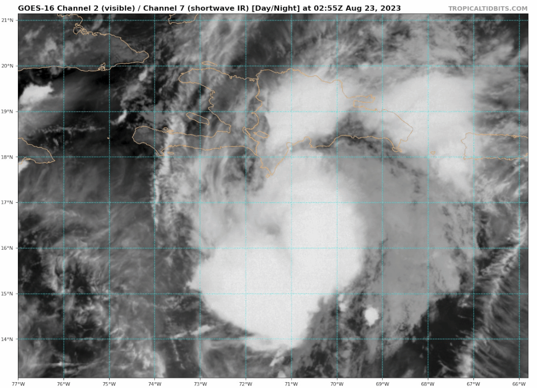
So far the imagery in the display is the same, but notice how it is a screenshot of a desktop computer it seems. I don't even know if that radar will always be live like that. Maybe they will build a display online, maybe they'll keep it that way or maybe they'll stop it once the storm is over. I don't know.

A lot of people might not know DR has a radar. And if they do, they don't know it's online. I only found out online from a tweet they posted. I don't know when it became public.

I was updating my radar database:
http://tropicalglobe.com/radar_database/
And maybe thinking about Franklin heading toward Hispaniola got me to check their Twitter profile for it because I knew they have had a new one for years, it just wasn't public. (and a lot of people online were often asking for the data on social media) And they had just posted a tweet an hour before when someone asked about it again.

But I would use 75 megabytes a day in their bandwidth getting the imagery. Maybe 2.5 gigabytes a month, just for me to get the data few might know to find on my site. Or it would use too much bandwidth if it got much usage constantly if I had the opposite problem. Not to speak of if someone wanted to be nefarious and attack it with a lot of traffic. So it's not worth it. And the display might change. Or something that makes it stop. And I already have a high bandwidth feature on my site, my recon system. The Google Earth file and the CesiumJS online display use a lot of bandwidth. And that system is exceptionally demanding, checking and then potentially downloading multiple files every single minute, 24/7/365. Status summary of my recon system's operations:
http://tropicalatlantic.com/recon/recon ... tem_status

The Bahamas display I had here quit last month and I didn't notice until the past few days:
http://tropicalatlantic.com/radars/live/bahamas/

My server is so old, some sites don't allow connections to it because it uses outdated technology. Bahamas must have upgraded their server last month. (software side of it) I had that problem with the NHC in past few years connecting to their recon archive as a backup for getting obs. I have to connect through my friend Jim William's site, HurricaneCity, to gets the obs. My site contacts that site, which then downloads the ob to that server and then my site can download from that site. I had to move my Bahamas radar display to HurricaneCity:
https://hurricanecity.com/radars/live/bahamas/
He has a much more reliable server and he said I could have it there. Those images are also a lot smaller, like 40 to 50 kilobytes per image, so that mirror I have had on for a few years now maybe. Now it will operate there. It uses a lot less resources than the DR system.

I never ask to use the mirrored data. I just do it and if they say something then I'll stop. Or at least won't make it available in real time. I might download it and save it for educational uses later. Imagery gets removed from the Bahamas site within a certain amount of time. I forget. It might be 12 or 24 hours or something around that. It's saved longer than what their display has. However, the DR site only has it for an hour. Then it's deleted. I don't know if all the data is saved. I assume, but if it is I don't think it's publicly available, so it's nice to have a public copy for a storm. They might not mind a temporary mirror just for a storm. It reduces their bandwidth. It's not like they make money from people going to their site. If my site crashes under the load, no big deal. If their site did, then people can't get the data.

Brian McNoldy has loops that I love:
https://bmcnoldy.rsmas.miami.edu/tropics/radar/

But sometimes he doesn't have some. The new Bahamas radar network had been one initially and the DR radar is so new to being available publicly.

The DR radar display is also a little complex to work with. Imagery comes out every 6 minutes approximately. But the display updates every two minutes. Usually, every three images are the same. And then sometimes only two are the same. They are taking a screenshot of their display. Data may or may not have updated in two minutes when a new screenshot is taken. I had to write a script overnight to get rid of duplicate images along with write the rest of the retrieval system that is specific to how their site is set up. But if they change one thing, my display will break. I can't have duplicate images because my display lets you pause and advance one frame. When there are no controls and it just loops, you don't notice on the DR's site. But without removing duplicate images, you would have had to advance two to three frames to go one frame. But thankfully I was able to work out that issue eventually. (and it saves bandwidth too on wasted imagery that would have been served)
6 likes   

User avatar
chaser1
S2K Supporter
S2K Supporter
Posts: 5407
Age: 64
Joined: Sat Oct 15, 2005 5:59 pm
Location: Longwood, Fl

Re: ATL: FRANKLIN - Tropical Storm - Discussion

#193 Postby chaser1 » Tue Aug 22, 2023 8:53 pm

:uarrow: Chris, I have no idea what most of that all meant but I've got to tell you.... i'm pretty damn impressed! :D
4 likes   
Andy D

(For official information, please refer to the NHC and NWS products.)

Sciencerocks
Category 5
Category 5
Posts: 8903
Age: 39
Joined: Thu Jul 06, 2017 1:51 am

Re: ATL: FRANKLIN - Tropical Storm - Discussion

#194 Postby Sciencerocks » Tue Aug 22, 2023 10:09 pm

Image
0 likes   

Sciencerocks
Category 5
Category 5
Posts: 8903
Age: 39
Joined: Thu Jul 06, 2017 1:51 am

Re: ATL: FRANKLIN - Tropical Storm - Discussion

#195 Postby Sciencerocks » Wed Aug 23, 2023 1:13 am

0 likes   

User avatar
Teban54
Category 5
Category 5
Posts: 3168
Joined: Sat May 19, 2018 1:19 pm

Re: ATL: FRANKLIN - Tropical Storm - Discussion

#196 Postby Teban54 » Wed Aug 23, 2023 3:00 am

I want to say it's getting the shrimp look, but knowing Franklin, that's giving it too much credit :lol:

Does look a lot more organized than earlier, though.
Image
0 likes   

IsabelaWeather
Category 1
Category 1
Posts: 287
Age: 35
Joined: Tue Jul 07, 2020 7:29 am
Location: Isabela, Puerto Rico

Re: ATL: FRANKLIN - Tropical Storm - Discussion

#197 Postby IsabelaWeather » Wed Aug 23, 2023 3:56 am

I really hope those big thunderstorms moving slowly east hold together and make it to my house haha. They are looking really intense on radar

EDIT: from the NWS SJU:
...however
a very strong rain band about 160 miles southwest of Cabo Rojo of
nearly north- south orientation was moving north northeast at 16
mph. It is expected to lose considerable strength before entering
the Mona Channel.


Bummer, those storms are looking crazy right now
0 likes   

User avatar
Nimbus
Category 5
Category 5
Posts: 5274
Joined: Mon Jul 19, 2004 10:54 am

Re: ATL: FRANKLIN - Tropical Storm - Discussion

#198 Postby Nimbus » Wed Aug 23, 2023 5:46 am

Intense feeder band setting up over dominican Republic which may even make it across the Mona passage into western Puerto Rico.
Expect rain rates of several inches per hour near that lightning.
0 likes   

Sciencerocks
Category 5
Category 5
Posts: 8903
Age: 39
Joined: Thu Jul 06, 2017 1:51 am

Re: ATL: FRANKLIN - Tropical Storm - Discussion

#199 Postby Sciencerocks » Wed Aug 23, 2023 6:04 am

Image
0 likes   

User avatar
abajan
S2K Supporter
S2K Supporter
Posts: 4229
Joined: Sun Sep 07, 2003 5:10 am
Location: Barbados

Re: ATL: FRANKLIN - Tropical Storm - Discussion

#200 Postby abajan » Wed Aug 23, 2023 6:51 am

Whereas most of the overnight convection has dissipated, a new burst of convection is forming near the CoC:

Image
Last edited by abajan on Wed Aug 23, 2023 7:12 am, edited 1 time in total.
0 likes   


Return to “2023”

Who is online

Users browsing this forum: No registered users and 38 guests