SIO: FREDDY - Remnants

Moderator: S2k Moderators

Message
Author
User avatar
cycloneye
Admin
Admin
Posts: 139344
Age: 67
Joined: Thu Oct 10, 2002 10:54 am
Location: San Juan, Puerto Rico

Re: SIO: FREDDY - Severe Tropical Storm

#261 Postby cycloneye » Mon Mar 06, 2023 8:56 pm

Sad news from Madagascar.

According to AFP, the storm’s total death toll in Madagascar now stands at 11. The four latest victims from the storm were a 1-year-old, who died when a house collapsed, a 2-year-old child and two women in their 50s. Strong wind gusts flattened rice fields and fruit trees and tore roofs off buildings, AFP reported. More than 6,700 homes were damaged. The city of Mananjary, home to around 25,000 people and near where Freddy moved ashore, received nearly 5 inches of rain, with sustained winds of 92 mph at landfall. At least 16,000 people had been displaced around Mananjary.


https://www.accuweather.com/en/hurrican ... ar/1493157
1 likes   
Visit the Caribbean-Central America Weather Thread where you can find at first post web cams,radars
and observations from Caribbean basin members Click Here

User avatar
TheDreamTraveler
Category 2
Category 2
Posts: 633
Joined: Sun Aug 22, 2010 3:10 am
Location: PA

Re: SIO: FREDDY - Severe Tropical Storm

#262 Postby TheDreamTraveler » Tue Mar 07, 2023 12:27 am


This is actually insane. I can't believe this storm is still alive
0 likes   

User avatar
Vince_and_Grace_fan
Category 1
Category 1
Posts: 315
Joined: Thu Nov 03, 2016 9:25 am
Location: Szombathely (Hungary)

Re: SIO: FREDDY - Severe Tropical Storm

#263 Postby Vince_and_Grace_fan » Tue Mar 07, 2023 3:02 am

The 00Z GFS turns it back from Mozambique again and prolongs its lifetime to 17-18 March (when finally would become extratripical south of Madagaskar). :lol:

Image
0 likes   

User avatar
cycloneye
Admin
Admin
Posts: 139344
Age: 67
Joined: Thu Oct 10, 2002 10:54 am
Location: San Juan, Puerto Rico

Re: SIO: FREDDY - Severe Tropical Storm

#264 Postby cycloneye » Tue Mar 07, 2023 7:14 am

0 likes   
Visit the Caribbean-Central America Weather Thread where you can find at first post web cams,radars
and observations from Caribbean basin members Click Here

ChrisH-UK
Category 1
Category 1
Posts: 426
Joined: Sat May 29, 2021 8:22 am

Re: SIO: FREDDY - Severe Tropical Storm

#265 Postby ChrisH-UK » Tue Mar 07, 2023 7:15 am

Freddy is ramping up and has a well defined eye.

Source - https://col.st/TRqHQ

1 likes   

User avatar
cycloneye
Admin
Admin
Posts: 139344
Age: 67
Joined: Thu Oct 10, 2002 10:54 am
Location: San Juan, Puerto Rico

Re: SIO: FREDDY - Severe Tropical Storm

#266 Postby cycloneye » Tue Mar 07, 2023 7:17 am

Wow, doing RI. JTWC up to 85kt.

SH, 11, 2023030712, , BEST, 0, 230S, 421E, 85, 970, TY

Image

Image

https://www.dapiya.top/satellite/floater/
1 likes   
Visit the Caribbean-Central America Weather Thread where you can find at first post web cams,radars
and observations from Caribbean basin members Click Here

User avatar
cycloneye
Admin
Admin
Posts: 139344
Age: 67
Joined: Thu Oct 10, 2002 10:54 am
Location: San Juan, Puerto Rico

Re: SIO: FREDDY - Tropical Cyclone

#267 Postby cycloneye » Tue Mar 07, 2023 7:46 am

TROPICAL CYCLONE number 7

(FREDDY)

Maximum winds (averaged over 10 minutes) estimated at sea: 130 km/h.

Estimated maximum gusts at sea: 185 km/h.

Estimated pressure at the center: 967 hPa.

Position on March 07 at 4 p.m. local time: 23.1 South / 42.1 East.

Distance from the Reunion coast: 1370 km to the sector: WEST

Distance from Mayotte: 1180 km to the sector: SOUTH-SOUTH-WEST

Movement: NORTH-NORTH-WEST, at 7 km/h.

System Information:

- FREDDY has intensified into a tropical cyclone today. It continues its slow movement towards the North-West away from the Malagasy coasts. The weather conditions are gradually improving in the south-west of Madagascar.

- The conditions of strong winds and dangerous seas persist locally in the northern part of the Atsimo-Andrefana region (north of Tulear). The inhabitants of this region are invited to listen to the instructions of the local authorities.

- Adopting a track in a general northwesterly direction, FREDDY could present intensity fluctuations during the next two days. However, a more marked intensification is possible from Thursday evening when the system will be on final approach to the coast of Mozambique. The arrival on the coasts is now expected earlier at the end of the day on Friday or the beginning of the following night, probably at the level of the Zambezi province.
0 likes   
Visit the Caribbean-Central America Weather Thread where you can find at first post web cams,radars
and observations from Caribbean basin members Click Here

User avatar
aspen
Category 5
Category 5
Posts: 8057
Joined: Sat Oct 12, 2019 7:10 pm
Location: Connecticut, USA

Re: SIO: FREDDY - Severe Tropical Storm

#268 Postby aspen » Tue Mar 07, 2023 9:25 am


Where’s the 31 day estimate coming from? Is it including the time Freddy spent as an invest? I “only” count 29.25 days starting from its formation at 6z February 6th.
0 likes   
Irene '11 Sandy '12 Hermine '16 5/15/2018 Derecho Fay '20 Isaias '20 Elsa '21 Henri '21 Ida '21

I am only a meteorology enthusiast who knows a decent amount about tropical cyclones. Look to the professional mets, the NHC, or your local weather office for the best information.

User avatar
JetFuel_SE
Category 1
Category 1
Posts: 276
Age: 24
Joined: Thu Apr 30, 2020 3:57 pm

Re: SIO: FREDDY - Severe Tropical Storm

#269 Postby JetFuel_SE » Tue Mar 07, 2023 9:49 am

aspen wrote:

Where’s the 31 day estimate coming from? Is it including the time Freddy spent as an invest? I “only” count 29.25 days starting from its formation at 6z February 6th.

The JTWC isn't an official agency, the BoM and MFR are responsible for that stuff.
Image
1 likes   

User avatar
aspen
Category 5
Category 5
Posts: 8057
Joined: Sat Oct 12, 2019 7:10 pm
Location: Connecticut, USA

Re: SIO: FREDDY - Severe Tropical Storm

#270 Postby aspen » Tue Mar 07, 2023 9:54 am

Vince_and_Grace_fan wrote:The 00Z GFS turns it back from Mozambique again and prolongs its lifetime to 17-18 March (when finally would become extratripical south of Madagaskar). :lol:

https://i.imgur.com/evtnEBx.gif

So far the GFS is mostly alone with this solution. The Euro quickly shoves Freddy and its remnants deeper into Africa, the EPS is rather split between the GFS and Euro, the CMC significantly weakens Freddy before landfall and can be discarded, and the ICON doesn’t go out quite far enough to see if it agrees with the GFS or not. If the 00z/06z GFS is right, Freddy has a chance of breaking Ioke’s record for the most ACE of any individual storm.
0 likes   
Irene '11 Sandy '12 Hermine '16 5/15/2018 Derecho Fay '20 Isaias '20 Elsa '21 Henri '21 Ida '21

I am only a meteorology enthusiast who knows a decent amount about tropical cyclones. Look to the professional mets, the NHC, or your local weather office for the best information.

User avatar
Cyclenall
Category 5
Category 5
Posts: 6628
Joined: Thu Jun 08, 2006 10:01 pm
Location: Ontario, Canada

Re: SIO: FREDDY - Severe Tropical Storm

#271 Postby Cyclenall » Tue Mar 07, 2023 9:55 am

Vince_and_Grace_fan wrote:The 00Z GFS turns it back from Mozambique again and prolongs its lifetime to 17-18 March (when finally would become extratripical south of Madagaskar). :lol:

If that verified it would be in the top 20 most absurd stats/occurrences for TCs documented. More like a once in a lifetime occurrence, every day past John's record its progressing into more elite percentiles.

Wonder if we'll see a full satellite loop in the future.
0 likes   

ChrisH-UK
Category 1
Category 1
Posts: 426
Joined: Sat May 29, 2021 8:22 am

Re: SIO: FREDDY - Tropical Cyclone

#272 Postby ChrisH-UK » Tue Mar 07, 2023 10:07 am

12z GFS MSLP and 10m

Generated by using GIB software.

0 likes   

User avatar
KWT
Category 5
Category 5
Posts: 31391
Joined: Tue Aug 17, 2004 11:02 am
Location: UK!!!

Re: SIO: FREDDY - Tropical Cyclone

#273 Postby KWT » Tue Mar 07, 2023 10:08 am

I'm starting to think my 100kts is going to be too low for Freddy given the way its wrapping up, clearly heading towards 'major status.

With this strengthening Ioke record ACE becomes far more likely to fall. I think someone calculated it would need 22 advisories at 80kts. Well its pretty likely going beyond 80kts now, perhaps majorly so. Would only need a few days at 100-110ktskts now to beat Ioke at this juncture and that seems possible to me.
0 likes   
Personal Forecast Disclaimer:
The posts in this forum are NOT official forecast and should not be used as such. They are just the opinion of the poster and may or may not be backed by sound meteorological data. They are NOT endorsed by any professional institution or storm2k.org. For official information, please refer to the NHC and NWS products

User avatar
wxman57
Moderator-Pro Met
Moderator-Pro Met
Posts: 22484
Age: 66
Joined: Sat Jun 21, 2003 8:06 pm
Location: Houston, TX (southwest)

Re: SIO: FREDDY - Tropical Cyclone

#274 Postby wxman57 » Tue Mar 07, 2023 10:12 am

I'm getting tired of Freddy. I'll be issuing our 100th advisory at 18Z. That's the most advisories we have ever issued since 2005. Current record was Dorian. Note that we initiate advisories sometimes days in advance of any official agency. We did not issue advisories for the time it spent inland over Mozambique. Those touting 35 days as a storm are counting that time when it was nearly dissipated inland (and no advisories were being issued). More like Freddy part 1 followed by Freddy part 2 with a break between the two.
5 likes   

MarioProtVI
Category 2
Category 2
Posts: 671
Age: 22
Joined: Sun Sep 29, 2019 7:33 pm
Location: New Jersey

Re: SIO: FREDDY - Tropical Cyclone

#275 Postby MarioProtVI » Tue Mar 07, 2023 10:24 am

wxman57 wrote:I'm getting tired of Freddy. I'll be issuing our 100th advisory at 18Z. That's the most advisories we have ever issued since 2005. Current record was Dorian. Note that we initiate advisories sometimes days in advance of any official agency. We did not issue advisories for the time it spent inland over Mozambique. Those touting 35 days as a storm are counting that time when it was nearly dissipated inland (and no advisories were being issued). More like Freddy part 1 followed by Freddy part 2 with a break between the two.

I’m with you on that one! Freddy is probably the most interesting TC I’ve tracked since at least 2017 and probably my entire history of hurricane tracking. The fact it’s ramping up AGAIN and likely to be a major soon is baffling. It’s already beat John’s record for longevity and it might soon break Ioke’s record for highest ACE generated worldwide.
0 likes   

User avatar
Hurricane2022
Category 4
Category 4
Posts: 945
Joined: Tue Aug 23, 2022 11:38 pm
Location: Araçatuba, Brazil

Re: SIO: FREDDY - Tropical Cyclone

#276 Postby Hurricane2022 » Tue Mar 07, 2023 10:39 am

Forecast from BOM and JTWC are showing a RI phase before weakening. Next name is Freddy.
Image
Image
SUMMARY:
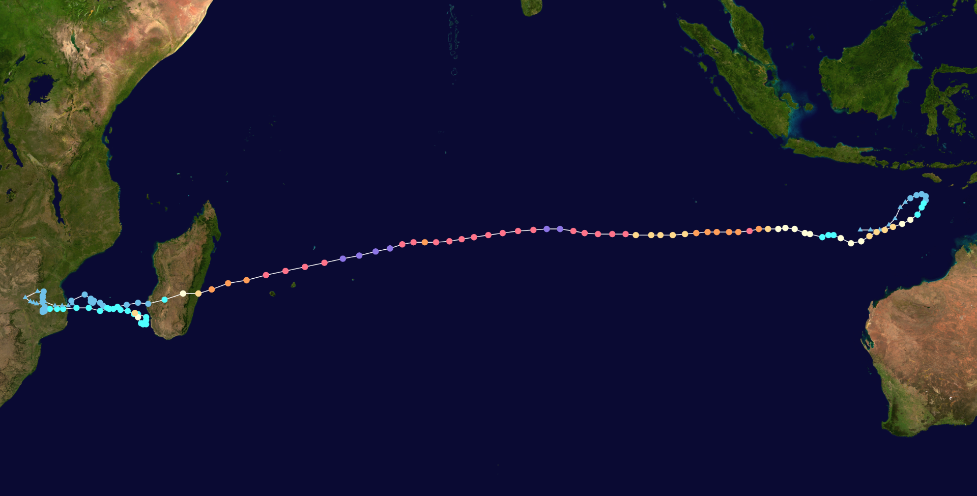
INITIAL POSITION: 12.2S 118.6E
INITIAL INTENSITY: 35 KTS
GEOGRAPHIC REFERENCE: 401 NM NORTH-NORTHWEST OF BROOME,
AUSTRALIA
MOVEMENT PAST 6 HOURS: WEST-SOUTHWESTWARD AT 06 KTS
SIGNIFICANT WAVE HEIGHT: 13 FEET

SATELLITE ANALYSIS, INITIAL POSITION AND INTENSITY DISCUSSION:
ANIMATED MULTISPECTRAL SATELLITE IMAGERY (MSI) DEPICTS A COMPACT
SYSTEM, WHICH HAS RAPIDLY DEVELOPED OVER THE PAST 12 HOURS. MSI
INDICATES THE SYSTEM REMAINS SOMEWHAT ASYMMETRIC, WITH A BALL OF
DISORGANIZED CONVECTION AND VORTICAL HOT TOWERS BEGINNING TO WRAP
INTO THE CORE OF THE CIRCULATION, AND AN ELONGATED AREA OF
FRAGMENTED CONVECTION EXTENDING OFF TO TH EAST IN A STATIONARY
BANDING COMPLEX (SBC). A 060538Z AMSR2 SHOWED THE SBC TO GOOD
EFFECT, WRAPPING UP THE WEST SIDE OF THE LOW LEVEL CIRCULATION
CENTER (LLCC), AND FRAGMENTED, FORMATIVE BANDING ON THE EASTERN
SIDE OF THE LLCC. THE INITIAL POSITION IS ASSESSED WITH HIGH
CONFIDENCE BASED ON THE AMSR2 36GHZ IMAGE NOTED ABOVE, WHICH SHOWED
A WELL-DEFINED LOW EMISSIVITY REGION (LER) SURROUNDED BY SHARP
CYCLONICALLY CURVED BANDING. THE INITIAL INTENSITY IS ASSESSED WITH
MEDIUM CONFIDENCE, SLIGHTLY BELOW THE AGGRESSIVE PGTW AND KNES T3.0
(45 KTS) DVORAK CURRENT INTENSITY ESTIMATES, HEDGED A BIT LOWER
BASED ON AN AMSR2 WIND ESTIMATE SHOWING A MAXIMUM OF 35 KNOTS.
CIMSS ANALYSIS SUGGESTS MODERATE (NEAR 20 KTS) EASTERLY SHEAR,
BUT JTWC HAND ANALYSIS AND MODEL SOUNDINGS SUGGEST A MESOSCALE
POINT SOURCE OVER TOP OF THE SYSTEM AND SIGNIFICANTLY LOWER VWS
(0-10 KTS). SSTS ARE VERY WARM (29-30C) AND UPPER-LEVEL OUTFLOW
IS RADIAL, THOUGH CONSTRAINED TO A SMALL AREA DUE TO THE SMALL SIZE
OF POINT SOURCE ALOFT. OVERALL CONDITIONS ARE NEAR-OPTIMUM FOR
RAPID INTENSIFICATION.

INITIAL WIND RADII BASIS: SMAP AND AMSR2 WIND DATA

CURRENT STEERING MECHANISM: NORTHWEST PERIPHERY OF DEVELOPING
SUBTROPICAL RIDGE (STR) OVER WESTERN AUSTRALIA.

AGENCY DVORAK AND AUTOMATED FIXES:
PGTW: T3.0 - 45 KTS
KNES: T3.0 - 45 KTS

FORECASTER ASSESSMENT OF CURRENT ENVIRONMENT: HIGHLY FAVORABLE
VWS: 0-5 KTS
SST: 29-30 CELSIUS
OUTFLOW: MODERATE RADIAL

ANALYSIS CONFIDENCE:
INITIAL POSITION: HIGH
INITIAL INTENSITY: MEDIUM
INITIAL WIND RADII: MEDIUM


3. FORECAST REASONING.

SIGNIFICANT FORECAST CHANGES: THIS INITIAL PROGNOSTIC REASONING
MESSAGE ESTABLISHES THE FORECAST PHILOSOPHY.

FORECAST DISCUSSION: TROPICAL CYCLONE 11S (ELEVEN) HAS RAPIDLY
CONSOLIDATED AND INTENSIFIED OVER THE PAST 12 HOURS AS IT TURNED
SHARPLY POLEWARD. OVER THE NEXT 48 HOURS, THE SYSTEM IS EXPECTED TO
CONTINUE ON A RATHER LEISURELY SOUTHWESTWARD TRACK (AVERAGE TRACK
SPEED JUST SIX KNOTS) ALONG A RELATIVELY WEAK GRADIENT ON THE
NORTHWEST SIDE OF A BUILDING STR CENTER OVER WESTERN AUSTRALIA.
BEYOND TAU 48, THE RIDGE EXPANDS AND STRENGTHENS, ULTIMATELY
MERGING WITH ANOTHER STR CENTER FAR TO THE WEST INTO A LARGE RIDGE
COMPLEX WITH AN AXIS LYING NEAR 25S. THIS WILL PUSH TC 11S ONTO A
WESTWARD TRACK FROM TAU 72 THROUGH THE END OF THE FORECAST
PERIOD. AS NOTED ABOVE, ENVIRONMENTAL CONDITIONS ARE HIGHLY
FAVORABLE, IN FACT, NEARLY OPTIMAL FOR RAPID INTENSIFICATION
THROUGH THE NEXT 48 HOURS. THE SYSTEM IS EXPECTED TO REMAIN IN A
VERY LOW SHEAR ENVIRONMENT THROUGH TAU 48 AND WILL RETAIN THE
UPPER-LEVEL POINT SOURCE PROVIDING GOOD, THOUGH SMALL-SCALE,
OUTFLOW ALOFT. THE FORECAST TRACK TAKES THE SYSTEM OVER A POOL OF
HIGH OHC WATERS, WITH HEAT CONTENT APPROACHING 90 KJ PER CM2,
BETWEEN TAUS 36 AND 48 WHICH WILL PROVIDE ADDITIONAL ENERGY TO
SUPPORT RAPID INTENSIFICATION (RI). THE FORECAST CALLS FOR THE
SYSTEM TO RI OVER THE NEXT 48 HOURS, REACHING A PEAK OF AT LEAST
100 KNOTS BY TAU 48. THE COMBINATION OF INCREASED EASTERLY SHEAR
AND DECREASING SSTS (ESPECIALLY WEST OF 111E) WILL SERVE TO WEAKEN
THE SYSTEM SLIGHTLY THROUGH TAU 96, THOUGH CONDITIONS ONCE AGAIN
IMPROVE AFTER TAU 96, ALLOWING THE SYSTEM TO MAINTAIN ITS INTENSITY
THROUGH TAU 120. DUE TO THE COMPACT NATURE OF THE SYSTEM,
SHORT-TERM INTENSITY FLUCTUATIONS AND RAPID EYEWALL REPLACEMENT
CYCLES (EWRC) ARE LIKELY, WHICH WILL HAVE A LARGE EFFECT ON THE
OVERALL INTENSITY TRENDS.

MODEL DISCUSSION: THE BULK OF THE DETERMINISTIC AND ENSEMBLE TRACK
GUIDANCE IS IN FAIRLY GOOD AGREEMENT, WITH TWO NOTABLE OUTLIERS IN
THE NAVGEM AND HWRF. THE MAJORITY OF THE TRACK GUIDANCE SUPPORTS THE JTWC FORECAST AND LIES WITHIN A TIGHT, 60NM ENVELOPE AT TAU 72,
WHICH DOUBLES IN SIZE BY TAU 120. THE OUTLIERS NOTED ABOVE HOWEVER,
SEPARATE FROM THE PACK AFTER TAU 36 AND DRIVE THE SYSTEM INTO THE
RIDGE, AND KEEP THE TRACK QUITE A BIT FURTHER SOUTH THAN THE
REMAINDER OF THE GUIDANCE. AFTER TAU 96, THE GFS AND THE GFS
ENSEMBLE ALSO TREND A BIT MORE POLEWARD THAN THE REMAINDER OF THE
GUIDANCE PACKAGE, LEADING TO INCREASED UNCERTAINTY IN THE LATER
FORECAST TAUS. INTENSITY GUIDANCE IS IN VERY GOOD AGREEMENT THAT
THE SYSTEM IS LIKELY TO RI IN THE FIRST 48 HOURS, WITH CTR1, RIPA,
FRIA AND RICN AIDS ALL TRIGGERED. ADDITIONALLY, THE COAMPS-TC
ENSEMBLE INTENSITY PROBABILITIES INDICATE A 100 PERCENT PROBABILITY
OF RI BETWEEN TAU 24 AND 48. THE HWRF AND COAMPS-TC PEAK THE SYSTEM
AT 100 KNOTS AT TAU 48, THEN SUGGESTS MARGINAL WEAKENING TO TAU 72
FOLLOWED BY A FLAT INTENSITY TREND OR MARGINAL REINTENSIFICATION
THROUGH THE END OF THE FORECAST PERIOD. THE JTWC FORECAST TAKES THE
BAIT AND CLOSELY FOLLOWS THE RI, HWRF AND COAMPS-TC TREND LINE TO
TAU 48, THEN REMAINS ELEVATED ABOVE THE CONSENSUS MEAN, WHICH IS
BEING PULLED DOWN BY THE UNREALISTIC DECAY-SHIPS GUIDANCE, THROUGH
THE REMAINDER OF THE FORECAST.

FORECAST CONFIDENCE:
TRACK 0 - 72 HR: HIGH
TRACK 72-120 HR: MEDIUM
INTENSITY 0 - 72 HR: HIGH
INTENSITY 72-120 HR: MEDIUM//
NNNN


Well, Well, Well.
1 likes   
Sorry for the bad English sometimes...!
For reliable and detailed information for any meteorological phenomenon, please consult the National Hurricane Center, Joint Typhoon Warning Center , or your local Meteo Center.

--------

Una cvm Christo, pro Christo, et in Christo. Sit nomen Domini benedictvm.

User avatar
InfernoFlameCat
Category 5
Category 5
Posts: 1966
Age: 21
Joined: Mon Dec 14, 2020 10:52 am
Location: Buford, GA

Re: SIO: FREDDY - Tropical Cyclone

#277 Postby InfernoFlameCat » Tue Mar 07, 2023 1:26 pm

This storm continues to improve. What a remarkable system!
0 likes   
I am by no means a professional. DO NOT look at my forecasts for official information or make decisions based on what I post.

Goal: to become a registered expert over tropical and subtropical cyclones.

User avatar
Iceresistance
Category 5
Category 5
Posts: 8925
Age: 20
Joined: Sat Oct 10, 2020 9:45 am
Location: Tecumseh, OK/Norman, OK

Re: SIO: FREDDY - Tropical Cyclone

#278 Postby Iceresistance » Tue Mar 07, 2023 1:52 pm

ADT is shooting up, Freddy is a Category 2 again.
0 likes   
Bill 2015 & Beta 2020

Winter 2020-2021 :cold:

All observations are in Tecumseh, OK unless otherwise noted.

Winter posts are focused mainly for Oklahoma & Texas.

Take any of my forecasts with a grain of salt, refer to the NWS, SPC, and NHC for official information

Never say Never with weather! Because ANYTHING is possible!

User avatar
JetFuel_SE
Category 1
Category 1
Posts: 276
Age: 24
Joined: Thu Apr 30, 2020 3:57 pm

Re: SIO: FREDDY - Tropical Cyclone

#279 Postby JetFuel_SE » Tue Mar 07, 2023 2:16 pm

Iceresistance wrote:ADT is shooting up, Freddy is a Category 2 again.

It'd say it's likely at least a C3 by now, wouldn't be surprised if we see a mid-C4 out of this.
0 likes   

User avatar
galaxy401
Category 5
Category 5
Posts: 2299
Age: 29
Joined: Sat Aug 25, 2012 9:04 pm
Location: Casa Grande, Arizona

Re: SIO: FREDDY - Tropical Cyclone

#280 Postby galaxy401 » Tue Mar 07, 2023 2:28 pm

I've been sleeping on this storm for nearly its entire existence and I deeply regret it. I really need to watch these South Hemisphere storms more. Freddy is one of a kind.
0 likes   
Got my eyes on moving right into Hurricane Alley: Florida.


Return to “2023”

Who is online

Users browsing this forum: No registered users and 6 guests