T6.5. But yeah the winds are probably not there yet.
Moderator: S2k Moderators


aspen wrote:There is a recon flight scheduled for tonight, right? I thought I saw one on the recon schedule cycloneye posted.


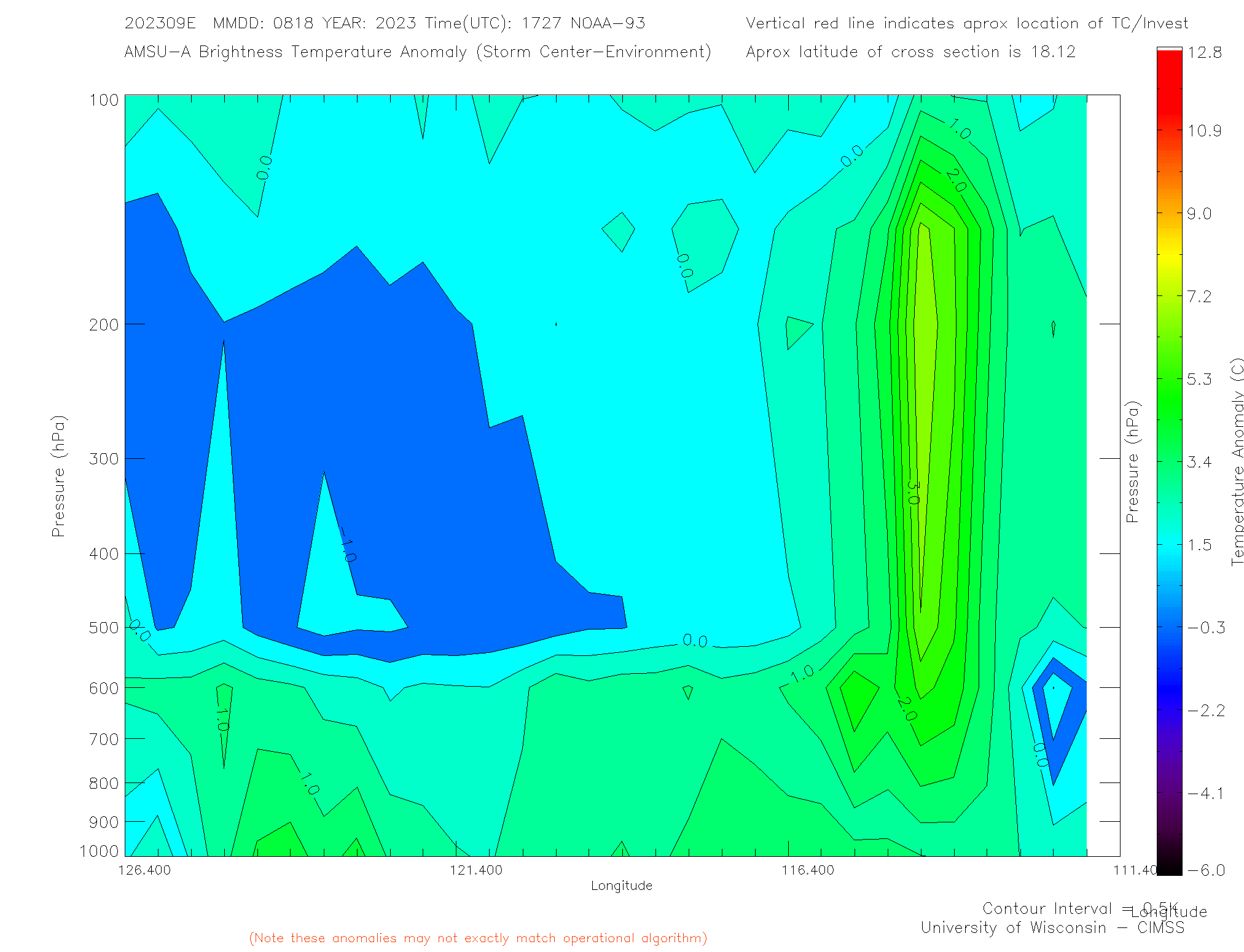
GCANE wrote:Minimal impact of the EWRC.
Running into a high shear environment
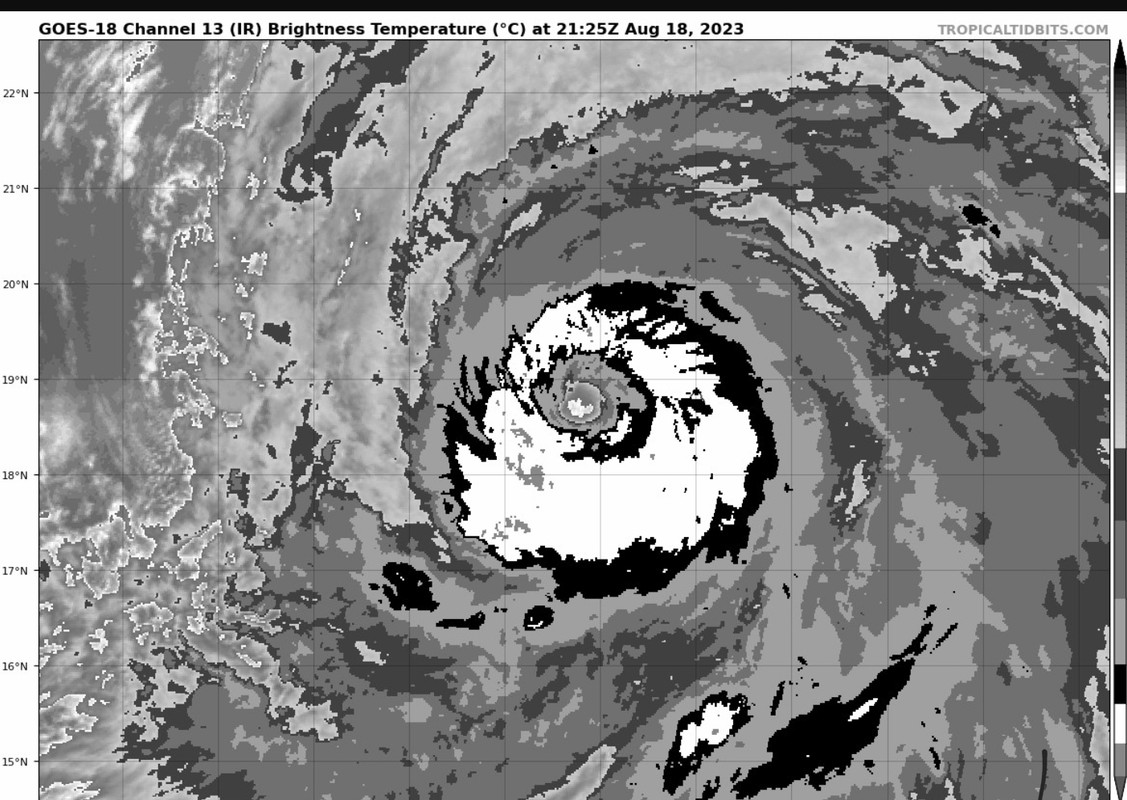
Yet still looks good
Warm core running through the entire troposphere
https://tropic.ssec.wisc.edu/real-time/ ... _xsect.gif
Minimal pickup of WISHE from the oceans hot water
Something is not normal

ScottNAtlanta wrote:aspen wrote:SoCal is now under a Tropical Storm Watch. I never thought I’d see that.
According to the NHC discussion, it's the first time this has ever happened.


Users browsing this forum: No registered users and 45 guests


