TPPN10 PGTW 250100
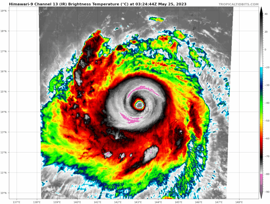
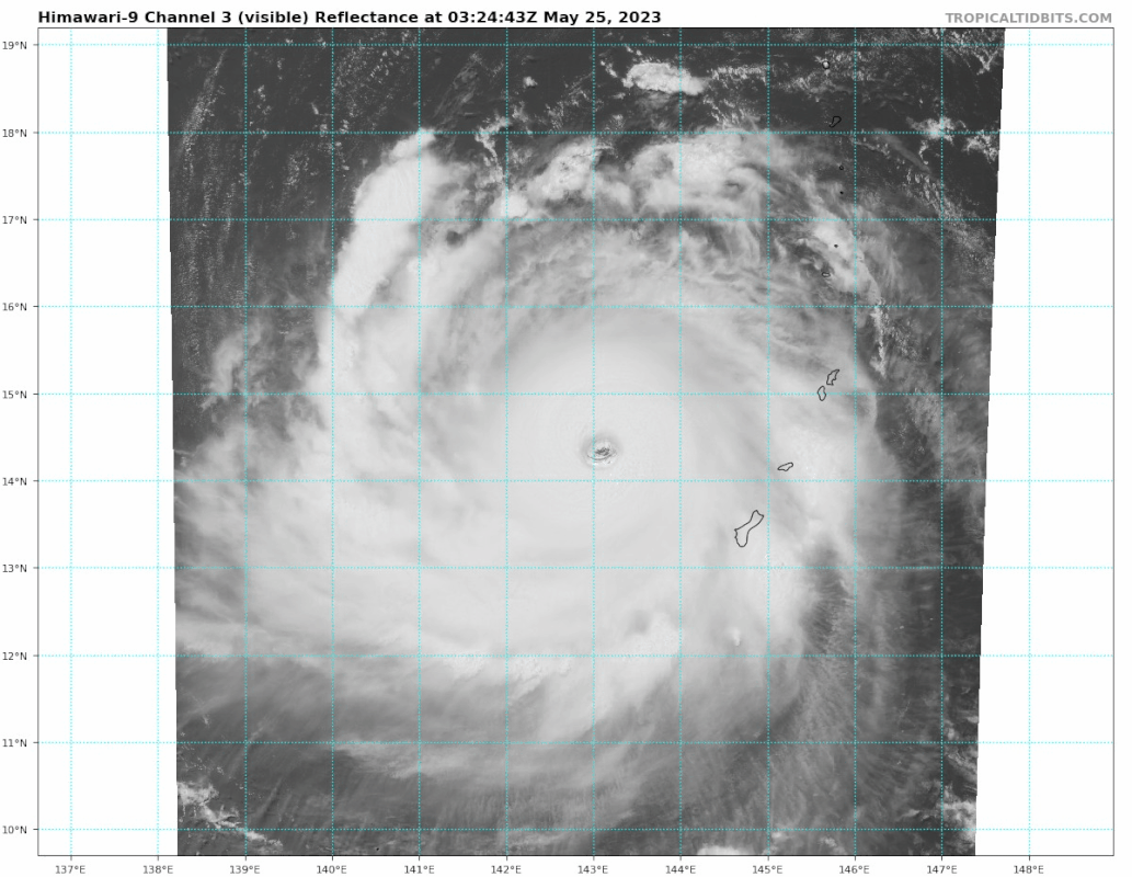
A. SUPER TYPHOON 02W (MAWAR)
B. 25/0030Z
C. 14.10N
D. 143.42E
E. ONE/GK2A
F. T7.0/7.0/D1.5/25HRS STT: D0.5/01HRS
G. IR/EIR/VIS/MSI
H. REMARKS: 03A/PBO EYE/ANMTN. WMG EYE SURROUNDED BY CMG YIELDS AN
E# OF 6.5. ADDED 1.0 EYE ADJUSTMENT FOR CMG, TO YIELD A DT OF 7.5.
MET AND PT YIELD 7.0. DBO PT DUE RECENCY OF CLOUD TOPS COOLING. VIS
EYE METHOD ALSO YIELDED A DT OF 7.0 WITH AN EYE SMBEDDED IN A 75NM
CDO + 0.5 BF.
I. ADDITIONAL POSITIONS:
24/1938Z 14.12N 144.00E SSMS
CVACH
JTWC seemingly abandoning 3 hour Dvorak fixes just to fix this a 7.0.