ATL: IDALIA - Models
Moderator: S2k Moderators
-
ScottNAtlanta

- Category 5

- Posts: 2535
- Joined: Sat May 25, 2013 3:11 pm
- Location: Atlanta, GA
Re: ATL: TEN - Models
Seems most of the hurricane models want to take this really close to the tip of Cuba before going north or northeast, and they are all stronger than the global models
0 likes
The posts in this forum are NOT official forecast and should not be used as such. They are just the opinion of the poster and may or may not be backed by sound meteorological data. They are NOT endorsed by any professional institution or storm2k.org. For official information, please refer to the NHC and NWS products.
-
ScottNAtlanta
- Category 5
- Posts: 2535
- Joined: Sat May 25, 2013 3:11 pm
- Location: Atlanta, GA
Re: ATL: TEN - Models
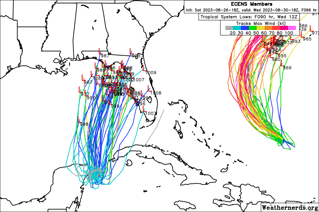
Spacecoast wrote:According to the18z EPS, the next 48hr will determine how far E, or W it will eventually take.
A SW dive, looping clockwise into Yucatan, or a SE dive looping counterclockwise towards Cuba....
https://i.ibb.co/1MgDvRH/95784605.gif
Seems most hurricane models are showing a counterclockwise loop near tip of Cuba
0 likes
The posts in this forum are NOT official forecast and should not be used as such. They are just the opinion of the poster and may or may not be backed by sound meteorological data. They are NOT endorsed by any professional institution or storm2k.org. For official information, please refer to the NHC and NWS products.
-
SFLcane

- S2K Supporter

- Posts: 10281
- Age: 48
- Joined: Sat Jun 05, 2010 1:44 pm
- Location: Lake Worth Florida
Re: ATL: TEN - Models
Ianswfl wrote:tolakram wrote:Interesting that stronger runs are both left and right of the main track estimate.
A cat2 member right up tampa bay and now a couple into ft. Myers area and one way south. Ddint see that on 12z
Yea some hurricanes near fort Myers on the 18z Eps
1 likes
-
Spacecoast

- Category 2

- Posts: 773
- Joined: Thu Aug 31, 2017 2:03 pm

Re: ATL: TEN - Models
12Z suite of models tomorrow will be very important because they will be the first runs with recon data.
4 likes

Re: ATL: TEN - Models
SFLcane wrote:Ianswfl wrote:tolakram wrote:Interesting that stronger runs are both left and right of the main track estimate.
A cat2 member right up tampa bay and now a couple into ft. Myers area and one way south. Ddint see that on 12z
Yea some hurricanes near fort Myers on the 18z Eps
https://i.postimg.cc/TY6FcDgp/IMG-7513.png
One member into Everglades city too! If this drifts further south over the next 24 hours that could cause a more south track. Then the coastline shape of FL and how sharp the NE movement is then a factor too. I still think Ft. Myers too far south but maybe Sarasota or Venice would be slightly possible. Again not optimal conditions and not a lot of time. Maybe a cat2 max. Even a cat1 landfall in Charlotte COunty or Southern Sarasota county would hurt Ian recovery.
If this was a traditional trof set up or something like it was for Charley, I'd be saying this was SWFL storm.
2 likes
Re: ATL: TEN - Models
0z icon is left of 18z up toward Crystal River.

Also worth noting, both Franklin and this system goes over Bermuda on this run.
Also worth noting, both Franklin and this system goes over Bermuda on this run.
0 likes

Re: ATL: TEN - Models
GFS swings west, Canadian a touch east from last run!
Until this thing gets in the gulf and the erratic movement stops, we're going to see swings in the models like this.
Until this thing gets in the gulf and the erratic movement stops, we're going to see swings in the models like this.
0 likes

Re: ATL: TEN - Models
0z Canadian, pretty much identical as 12z for TD#10 (Eastpoint east of Apalachicola)

This run takes Franklin over Bermuda though.
This run takes Franklin over Bermuda though.
0 likes
Re: ATL: TEN - Models
0Z UKMET: ~40 mile E shift at LF into NW Big Bend vs E Panhandle on 12Z run; once inland sharper turn to go offshore SC vs 12Z going over Augusta and then staying inland through SC into much of NC
TROPICAL DEPRESSION 10L ANALYSED POSITION : 21.0N 85.5W
ATCF IDENTIFIER : AL102023
LEAD CENTRAL MAXIMUM WIND
VERIFYING TIME TIME POSITION PRESSURE (MB) SPEED (KNOTS)
-------------- ---- -------- ------------- -------------
0000UTC 27.08.2023 0 21.0N 85.5W 1004 25
1200UTC 27.08.2023 12 20.3N 85.6W 1002 27
0000UTC 28.08.2023 24 20.6N 85.3W 999 32
1200UTC 28.08.2023 36 21.7N 85.5W 999 35
0000UTC 29.08.2023 48 22.8N 85.5W 1000 38
1200UTC 29.08.2023 60 24.5N 85.6W 1000 41
0000UTC 30.08.2023 72 26.5N 85.3W 998 39
1200UTC 30.08.2023 84 29.2N 84.1W 995 45
0000UTC 31.08.2023 96 31.9N 81.8W 992 42
1200UTC 31.08.2023 108 33.6N 77.7W 991 43
0000UTC 01.09.2023 120 34.4N 73.4W 992 56
1200UTC 01.09.2023 132 34.4N 69.0W 996 52
0000UTC 02.09.2023 144 33.2N 65.7W 1000 45
1200UTC 02.09.2023 156 33.6N 63.2W 999 43
0000UTC 03.09.2023 168 33.5N 60.3W 997 48
Last edited by LarryWx on Sat Aug 26, 2023 11:42 pm, edited 1 time in total.
1 likes
Personal Forecast Disclaimer:
The posts in this forum are NOT official forecasts and should not be used as such. They are just the opinion of the poster and may or may not be backed by sound meteorological data. They are NOT endorsed by any professional institution or storm2k.org. For official information, please refer to the NHC and NWS products.
The posts in this forum are NOT official forecasts and should not be used as such. They are just the opinion of the poster and may or may not be backed by sound meteorological data. They are NOT endorsed by any professional institution or storm2k.org. For official information, please refer to the NHC and NWS products.
-
jasons2k

- Storm2k Executive

- Posts: 8290
- Age: 52
- Joined: Wed Jul 06, 2005 12:32 pm
- Location: The Woodlands, TX
Re: ATL: TEN - Models
The models are going to show what they show, but as an old-timer looking at old school physics, this setup makes me nervous. Given the hot furnace of the Gulf, this system may wrap-up quickly before landfall and go further east, as we have seen before.
I think the entire Tampa Bay metro area needs to prepare for a landfalling hurricane, just north of the bay. I'm very concerned about the surge potential with this one. I've already called my Aunt in Dunedin Isles and told her to get ready.
I think the entire Tampa Bay metro area needs to prepare for a landfalling hurricane, just north of the bay. I'm very concerned about the surge potential with this one. I've already called my Aunt in Dunedin Isles and told her to get ready.
9 likes
Re: ATL: TEN - Models
BobHarlem wrote:https://twitter.com/watkinstrack/status/1695655862327464378
I still think Tampa down to Bradenton is still in play. I doubt down by me in Punta Gorda a direct hit but I wouldn't be shocked if I get some hurricane force gusts with a landfall in Tampa area.
1 likes

Re: ATL: TEN - Models
jasons2k wrote:The models are going to show what they show, but as an old-timer looking at old school physics, this setup makes me nervous. Given the hot furnace of the Gulf, this system may wrap-up quickly before landfall and go further east, as we have seen before.
I think the entire Tampa Bay metro area needs to prepare for a landfalling hurricane, just north of the bay. I'm very concerned about the surge potential with this one. I've already called my Aunt in Dunedin Isles and told her to get ready.
I do not know the in and outs of every single model but how many of them really take into account the super warm Gulf that is near 100 degrees in places (record temps). When it does landfall the storm should still be intensifying over those jet fuel like waters.
0 likes
Re: ATL: TEN - Models
Hurricane models are a bit more west so far. Gfs shifted west but the Hurricane models are based off the gfs so makes sense they'd shift too.
0 likes
Re: ATL: TEN - Models
Ianswfl wrote:Hurricane models are a bit more west so far. Gfs shifted west but the Hurricane models are based off the gfs so makes sense they'd shift too.
Both HALFs are pushing into the Cat 4 range this run too. (More noticeable increase on the B compared to 18z where HALFS-B is pushing toward Cat 5, but both variants are stronger)
0 likes
Re: ATL: TEN - Models
0z HAFS-B Borderline Cat 4/5 into St. Marks

0z HAFS-A Cat 4 Just East of St Marks, closer to Perry.

We need the recon.
0z HAFS-A Cat 4 Just East of St Marks, closer to Perry.
We need the recon.
Last edited by BobHarlem on Sun Aug 27, 2023 12:30 am, edited 1 time in total.
0 likes
Re: ATL: TEN - Models
BobHarlem wrote:0z HAFS-B Borderline Cat 4/5 into St. Marks
https://i.imgur.com/H2vL6C1.png
0z HAFS-A Cat 4 Just East of St Marks, closer to Perry.
https://i.imgur.com/RIWhx3E.png
Top one is 850mb level not surface winds.
0 likes
Who is online
Users browsing this forum: No registered users and 62 guests