ATL: GERT - Remnants - Discussion

Moderator: S2k Moderators

Message
Author
User avatar
Extratropical94
Professional-Met
Professional-Met
Posts: 3535
Age: 29
Joined: Wed Oct 20, 2010 6:36 am
Location: Hamburg, Germany
Contact:

Re: ATL: INVEST 99L - Discussion

#41 Postby Extratropical94 » Sat Aug 19, 2023 3:11 pm

TAFB Dvorak estimates have been at T2.5 for a whole day now, which would support 35 knots.

L, 99, 202308181800, 10, DVTS, CI, , 1340N, 4510W, , 3, 35, 2, 1005, 2, DVRK, , , , , , , , , , , , , , L, TAFB, NR, V, 5, 2525 /////, , , GOES16, CSC, T,
AL, 99, 202308181800, 70, ANAL, CI, , 1340N, 4500W, 10, 2, 25, 2, 1009, 2, MEAS, , , , , , , , , , , 2, , , L, CAR0, , , 202308181800, 202308181800, , , , CARQ tau0 34radii
AL, 99, 202308182100, 10, DVTS, C, , 1450N, 4650W, , 3, , , , , DVRK, , , , , , , , , , , , , , L, TAFB, JA, V, 5, , , , GOES16, CSC,
AL, 99, 202308190000, 10, DVTS, CI, , 1530N, 4700W, , 3, 35, 2, 1005, 2, DVRK, , , , , , , , , , , , , , L, TAFB, EC, I, 5, 2025 /////, , , GOES16, CSC, T, Data T = 2.0 via shear method due to less circular b
AL, 99, 202308190000, 70, ANAL, CI, , 1470N, 4660W, 10, 2, 30, 2, 1008, 2, MEAS, , , , , , , , , , , 2, , , L, CAR0, , , 202308190000, 202308190000, , , , CARQ tau0 34radii
AL, 99, 202308190300, 10, DVTS, C, , 1520N, 4730W, , 3, , , , , DVRK, , , , , , , , , , , , , , L, TAFB, ERA, I, 5, , , , GOES16, CSC,
AL, 99, 202308190600, 10, DVTS, CI, , 1550N, 4790W, , 3, 35, 2, 1005, 2, DVRK, , , , , , , , , , , , , , L, TAFB, ERA, I, 5, 2525 /////, , , GOES16, CSC, T,
AL, 99, 202308190900, 10, DVTS, C, , 1570N, 4820W, , 3, , , , , DVRK, , , , , , , , , , , , , , L, TAFB, ERA, I, 5, , , , GOES16, CSC,
AL, 99, 202308191106, 30, AMSU, IP, , 1600N, 4864W, , 1, 30, 2, 1005, 2, MEAS, , , , , , , , , , , 2, , , L, CIRA, JAK, , , , , , , 1005, , NOAA15, , , , , , , , , , , , , , , , , , , 2, storm center extrapolated from t=-12 and t=0 adeck
AL, 99, 202308191145, 10, DVTS, CI, , 1610N, 4850W, , 3, 35, 2, 1005, 2, DVRK, , , , , , , , , , , , , , L, TAFB, AR, VI, 5, 2525 /////, , , GOES16, CSC, T, FT is based on PT - although curvature is looking go
AL, 99, 202308191500, 10, DVTS, C, , 1620N, 4930W, , 3, , , , , DVRK, , , , , , , , , , , , , , L, TAFB, AR, VI, 5, , , , GOES16, CSC,
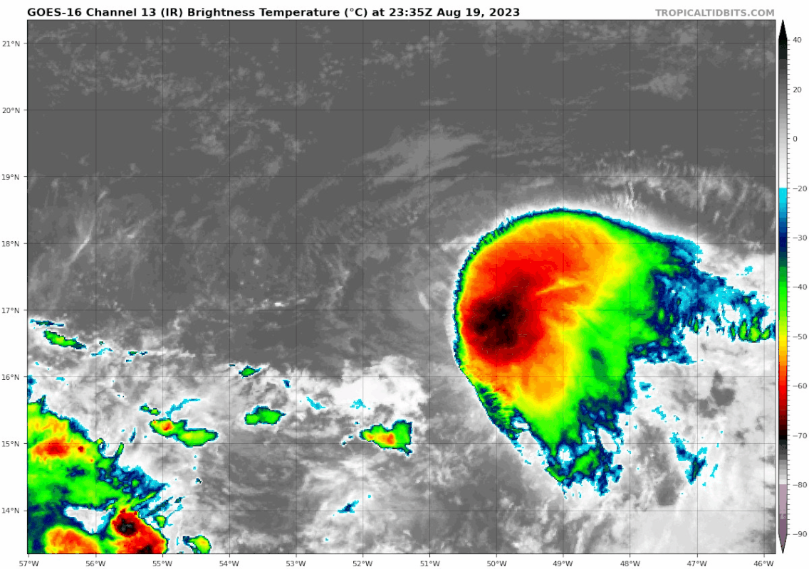
AL, 99, 202308191800, 10, DVTS, CI, , 1630N, 4950W, , 3, 35, 2, 1005, 2, DVRK, , , , , , , , , , , , , , L, TAFB, JL, VI, 5, 2525 /////, , , GOES16, CSC, T, MET is 3.5 based on D per rule of previous (2) 24hr
0 likes   
54° 11' 59'' N, 9° 9' 20'' E
Boomer Sooner!
Go Broncos! Go Cards! Go Niners!
- Daniel

Sciencerocks
Category 5
Category 5
Posts: 7300
Age: 38
Joined: Thu Jul 06, 2017 1:51 am

Re: ATL: INVEST 99L - Discussion

#42 Postby Sciencerocks » Sat Aug 19, 2023 3:17 pm

Image
1 likes   

User avatar
cycloneye
Admin
Admin
Posts: 139605
Age: 67
Joined: Thu Oct 10, 2002 10:54 am
Location: San Juan, Puerto Rico

ATL: SIX - Advisories

#43 Postby cycloneye » Sat Aug 19, 2023 3:48 pm

Tropical Depression Six Discussion Number 1
NWS National Hurricane Center Miami FL AL062023
500 PM AST Sat Aug 19 2023

Visible imagery has shown a partially-exposed, well-defined
low-level circulation for the past several hours. Infrared imagery
has also shown deep convection persisting since around 0600 UTC east
of the center with cold cloud tops of less than -85 degrees C.
Therefore, the system now meets the necessary requirements to be
classified as a tropical cyclone. Subjective satellite estimates
from TAFB and SAB are 35 kt and 25 kt, respectively, and the initial
intensity is set to 30 kt based on that data.

Models indicate that the depression is currently in a relatively
hostile environment. There is strong deep-layer vertical shear and
the mid-level relative humidities are near 40 percent. These
conditions are not expected to change much and global models suggest
this will be a short-lived depression. Simulated satellite imagery
from the ECMWF shows a few bursts of deep convection that are
sheared away by 48 hours. The official forecast shows a steady-state
depression through 36 hours that degenerates to a remnant low in 48
hours, and dissipates by 60 hours. This prediction is near the
various consensus model guidance.

The depression is moving west-northwestward at 14 kt. It is
currently being steered by a narrow low-level ridge to its north.
The system is expected to turn more westward and slow in forward
speed over the next day or so followed by a slight bend back to the
west-northwest on day 2. The NHC track forecast is near the simple
and corrected model consensus aids, and leans towards the more
southerly ECMWF track.

FORECAST POSITIONS AND MAX WINDS

INIT 19/2100Z 16.7N 50.2W 30 KT 35 MPH
12H 20/0600Z 17.0N 52.6W 30 KT 35 MPH
24H 20/1800Z 17.3N 54.8W 30 KT 35 MPH
36H 21/0600Z 17.6N 56.7W 30 KT 35 MPH
48H 21/1800Z 18.1N 58.6W 25 KT 30 MPH...POST-TROP/REMNT LOW
60H 22/0600Z...DISSIPATED

$$
Forecaster Bucci
1 likes   
Visit the Caribbean-Central America Weather Thread where you can find at first post web cams,radars
and observations from Caribbean basin members Click Here

User avatar
cycloneye
Admin
Admin
Posts: 139605
Age: 67
Joined: Thu Oct 10, 2002 10:54 am
Location: San Juan, Puerto Rico

Re: ATL: SIX - Tropical Depression - Discussion

#44 Postby cycloneye » Sat Aug 19, 2023 3:54 pm

Image
1 likes   
Visit the Caribbean-Central America Weather Thread where you can find at first post web cams,radars
and observations from Caribbean basin members Click Here

ChrisH-UK
Category 1
Category 1
Posts: 430
Joined: Sat May 29, 2021 8:22 am

Re: ATL: SIX - Tropical Depression - Discussion

#45 Postby ChrisH-UK » Sat Aug 19, 2023 3:55 pm

TD6 looks healthy with the circulation getting covered by the convection.

Source - https://col.st/eO0zv

Image
1 likes   

IcyTundra
Category 3
Category 3
Posts: 893
Joined: Mon Jun 07, 2021 9:32 pm
Location: Dickinson, Texas

Re: ATL: SIX - Tropical Depression - Discussion

#46 Postby IcyTundra » Sat Aug 19, 2023 4:01 pm

Have to wonder what the chances of becoming a TS for a brief period of time are.
0 likes   

User avatar
REDHurricane
Tropical Storm
Tropical Storm
Posts: 210
Age: 26
Joined: Sun Jul 03, 2022 2:36 pm
Location: Northeast Pacific Ocean

Re: ATL: SIX - Tropical Depression - Discussion

#47 Postby REDHurricane » Sat Aug 19, 2023 4:07 pm

IcyTundra wrote:Have to wonder what the chances of becoming a TS for a brief period of time are.


Kind of already looks like one imo
0 likes   

Sciencerocks
Category 5
Category 5
Posts: 7300
Age: 38
Joined: Thu Jul 06, 2017 1:51 am

Re: ATL: SIX - Tropical Depression - Discussion

#48 Postby Sciencerocks » Sat Aug 19, 2023 4:09 pm

Looks like a tropical storm to me too. I'd go with 40 knts.
1 likes   

User avatar
MGC
S2K Supporter
S2K Supporter
Posts: 5796
Joined: Sun Mar 23, 2003 9:05 pm
Location: Pass Christian MS, or what is left.

Re: ATL: SIX - Tropical Depression - Discussion

#49 Postby MGC » Sat Aug 19, 2023 4:27 pm

Gave up on this one this morning. Made a good comeback....never turn your back on the ocean......MGC
2 likes   

User avatar
ElectricStorm
Category 5
Category 5
Posts: 4623
Age: 23
Joined: Tue Aug 13, 2019 11:23 pm
Location: Skiatook, OK / Norman, OK

Re: ATL: SIX - Tropical Depression - Discussion

#50 Postby ElectricStorm » Sat Aug 19, 2023 4:30 pm

Nice to see them finally upgrade it. I think there's a decent chance this can become a TS and take Emily
0 likes   
I am in no way a professional. Take what I say with a grain of salt as I could be totally wrong. Please refer to the NHC, NWS, or SPC for official information.

Boomer Sooner!

User avatar
cycloneye
Admin
Admin
Posts: 139605
Age: 67
Joined: Thu Oct 10, 2002 10:54 am
Location: San Juan, Puerto Rico

Re: ATL: SIX - Tropical Depression - Discussion

#51 Postby cycloneye » Sat Aug 19, 2023 8:03 pm

AL, 06, 2023082000, , BEST, 0, 171N, 509W, 30, 1006, TD
0 likes   
Visit the Caribbean-Central America Weather Thread where you can find at first post web cams,radars
and observations from Caribbean basin members Click Here

USTropics
Category 5
Category 5
Posts: 2422
Joined: Sun Aug 12, 2007 3:45 am
Location: Florida State University

Re: ATL: SIX - Tropical Depression - Discussion

#52 Postby USTropics » Sat Aug 19, 2023 9:11 pm

TD6 going streaking tonight. Looks like the entire upper-level structure collapsed with the increase in shear, and the low-level circulation is clearly outracing the convection now:
Image
1 likes   

Sciencerocks
Category 5
Category 5
Posts: 7300
Age: 38
Joined: Thu Jul 06, 2017 1:51 am

Re: ATL: SIX - Tropical Depression - Discussion

#53 Postby Sciencerocks » Sat Aug 19, 2023 9:14 pm

Image
0 likes   

User avatar
cycloneye
Admin
Admin
Posts: 139605
Age: 67
Joined: Thu Oct 10, 2002 10:54 am
Location: San Juan, Puerto Rico

Re: ATL: SIX - Advisories

#54 Postby cycloneye » Sat Aug 19, 2023 9:48 pm

Tropical Depression Six Discussion Number 2
NWS National Hurricane Center Miami FL AL062023
1100 PM AST Sat Aug 19 2023

The latest CIMSS proxy-vis satellite imagery shows that the
low-level center of Tropical Depression Six has become completely
exposed, with all the convection displace to the east. Infrared
imagery also shows that the cold cloud tops from earlier this
afternoon have warmed over the last few hours. A blend of
subjective and objective satellite estimates remain around 30 kt.
Therefore, the intensity is held at 30 kt for this advisory.

The depression is currently in a hostile environment with strong
deep-layer vertical shear, and dry mid-level relative humidities.
These conditions are expected to persist, with the depression
expected to be fairly short-lived. Simulated satellite imagery shows
the potential for a few more convective bursts over the next day or
so. The official forecast calls for no further strengthening, and
for the system to become a post-tropical remnant low in 36 hours and
dissipate by 48 hours. However, some models suggest that it may
become devoid of convection a little earlier than currently
forecast. The intensity forecast remains near the model consensus.

The depression is moving westward at 12 kt, to the south of a
low-level ridge. The system is expected to continue westward, with a
slight decrease in forward speed over the next day or so. By Monday,
the system will round the edge of the ridge with a gradual turn to
the west-northwest. The track forecast is very close to the previous
NHC forecast and lies near the corrected model consensus aids.


FORECAST POSITIONS AND MAX WINDS

INIT 20/0300Z 17.2N 51.5W 30 KT 35 MPH
12H 20/1200Z 17.5N 53.3W 30 KT 35 MPH
24H 21/0000Z 17.8N 55.5W 30 KT 35 MPH
36H 21/1200Z 18.3N 57.5W 25 KT 30 MPH...POST-TROP/REMNT LOW
48H 22/0000Z...DISSIPATED

$$
Forecaster Kelly/Brown
0 likes   
Visit the Caribbean-Central America Weather Thread where you can find at first post web cams,radars
and observations from Caribbean basin members Click Here

User avatar
cycloneye
Admin
Admin
Posts: 139605
Age: 67
Joined: Thu Oct 10, 2002 10:54 am
Location: San Juan, Puerto Rico

Re: ATL: SIX - Advisories

#55 Postby cycloneye » Sun Aug 20, 2023 4:59 am

Tropical Depression Six Discussion Number 3
NWS National Hurricane Center Miami FL AL062023
500 AM AST Sun Aug 20 2023

The center of the depression remains fully exposed in satellite
imagery this morning, with the associated convection displaced well
to the east by strong westerly shear. Given the lack of improvement
in the cyclone's satellite presentation, and a blend of the latest
objective and subjective satellite estimates, the initial intensity
remains 30 kt for this advisory.

The strong deep-layer westerly shear plaguing the depression is
forecast to increase to over 40 kt later today. This, combined with
relatively dry mid-level air in the surrounding environment, will
make it difficult for the cyclone to sustain organized convection
going forward. Therefore, the official forecast now calls for the
system to degenerate to a remnant low in 24 h, in agreement with the
latest GFS and ECMWF model-simulated satellite imagery. The global
models suggest the weak low is likely to open into a trough soon
thereafter, and so this update shows dissipation in 36 h.

The depression has moved a bit south of due west over the past
several hours, but its long-term motion remains westward at 13 kt.
This general motion is expected to continue until dissipation
occurs, as the system moves within low-level easterly flow to the
south of a subtropical ridge. Given the recent motion toward the
west-southwest, this updated track forecast lies to the south of the
previous one.


FORECAST POSITIONS AND MAX WINDS

INIT 20/0900Z 16.8N 52.9W 30 KT 35 MPH
12H 20/1800Z 17.0N 54.8W 30 KT 35 MPH
24H 21/0600Z 17.3N 56.8W 25 KT 30 MPH...POST-TROP/REMNT LOW
36H 21/1800Z...DISSIPATED

$$
Forecaster Reinhart
1 likes   
Visit the Caribbean-Central America Weather Thread where you can find at first post web cams,radars
and observations from Caribbean basin members Click Here

zzzh
Category 2
Category 2
Posts: 560
Joined: Thu Sep 02, 2021 1:13 pm

Re: ATL: SIX - Tropical Depression - Discussion

#56 Postby zzzh » Sun Aug 20, 2023 9:24 am

Image
Nice convective burst
2 likes   

ChrisH-UK
Category 1
Category 1
Posts: 430
Joined: Sat May 29, 2021 8:22 am

Re: ATL: SIX - Tropical Depression - Discussion

#57 Postby ChrisH-UK » Sun Aug 20, 2023 10:59 am

Yep TD-6 isn't dead yet
1 likes   

User avatar
cycloneye
Admin
Admin
Posts: 139605
Age: 67
Joined: Thu Oct 10, 2002 10:54 am
Location: San Juan, Puerto Rico

Re: ATL: SIX - Tropical Depression - Discussion

#58 Postby cycloneye » Sun Aug 20, 2023 11:33 am

Tropical Depression Six Discussion Number 4
NWS National Hurricane Center Miami FL AL062023
1100 AM AST Sun Aug 20 2023

Visible satellite imagery this morning continues to show a
partially exposed center, with persistent deep convection displaced
slightly to the north and east of the depression. Based on a blend
of objective and subjective satellite estimates, the initial
intensity estimate for this advisory remains 30 kt.

Although deep convection has persisted this morning, deep-layer
westerly shear is expected to increase to near 40 kt today and
remain steady during the next 24 hours. Further, dry mid-level air
to the north of the system will likely inhibit well-organized and
sustained deep convection. Global models and ensemble systems are in
agreement that intensification of the depression is unlikely, and
thus the official forecast has the depression as a remnant low in
24 h and dissipated in 36 h.

The depression has continued moving slightly south of due west this
morning, and it is expected to turn slightly north of due west
today, with this general motion expected to continue until
dissipation occurs. Given the continued motion toward the
west-southwest, the official track forecast lies slightly to the
south of the previous forecast.


FORECAST POSITIONS AND MAX WINDS

INIT 20/1500Z 16.8N 53.7W 30 KT 35 MPH
12H 21/0000Z 16.9N 55.1W 30 KT 35 MPH
24H 21/1200Z 17.2N 57.0W 25 KT 30 MPH...POST-TROP/REMNT LOW
36H 22/0000Z...DISSIPATED

$$
Forecaster Hogsett/Cangialosi
0 likes   
Visit the Caribbean-Central America Weather Thread where you can find at first post web cams,radars
and observations from Caribbean basin members Click Here

Sciencerocks
Category 5
Category 5
Posts: 7300
Age: 38
Joined: Thu Jul 06, 2017 1:51 am

Re: ATL: SIX - Tropical Depression - Discussion

#59 Postby Sciencerocks » Sun Aug 20, 2023 2:59 pm

Image
0 likes   

Sciencerocks
Category 5
Category 5
Posts: 7300
Age: 38
Joined: Thu Jul 06, 2017 1:51 am

Re: ATL: SIX - Tropical Depression - Discussion

#60 Postby Sciencerocks » Sun Aug 20, 2023 8:54 pm

Image
0 likes   


Return to “2023”

Who is online

Users browsing this forum: No registered users and 2 guests