EPAC: HILARY - Post-Tropical - Discussion

Moderator: S2k Moderators

Message
Author
User avatar
cycloneye
Admin
Admin
Posts: 139346
Age: 67
Joined: Thu Oct 10, 2002 10:54 am
Location: San Juan, Puerto Rico

EPAC: HILARY - Post-Tropical - Discussion

#1 Postby cycloneye » Mon Aug 14, 2023 1:26 pm

EP, 90, 2023081418, , BEST, 0, 95N, 945W, 25, 1009, DB, 34, NEQ, 0, 0, 0, 0, 1011, 150, 90, 0, 0, E, 0, , 0, 0, INVEST, S, 0, , 0, 0, 0, 0, genesis-num, 014, SPAWNINVEST, ep752023 to ep902023,


https://ftp.nhc.noaa.gov/atcf/btk/bep902023.dat

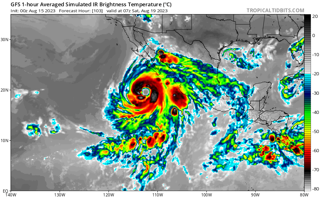
Off the Coast of Southern Mexico:
A broad area of low pressure associated with a tropical wave is
producing widespread showers and thunderstorms off the southern
coasts of Mexico, Guatemala, and El Salvador. Environmental
conditions appear conducive for development, and a tropical
depression is expected to form within the next few days, while the
system moves west-northwestward, roughly parallel to the coast of
southern and southwestern Mexico.
* Formation chance through 48 hours...medium...60 percent.
* Formation chance through 7 days...high...90 percent.


Image
0 likes   
Visit the Caribbean-Central America Weather Thread where you can find at first post web cams,radars
and observations from Caribbean basin members Click Here

User avatar
cycloneye
Admin
Admin
Posts: 139346
Age: 67
Joined: Thu Oct 10, 2002 10:54 am
Location: San Juan, Puerto Rico

Re: EPAC: INVEST 90E - Discussion

#2 Postby cycloneye » Mon Aug 14, 2023 2:04 pm

There is a spread among the GEFS members in this first run away of Baja California to a few that move close, and three that make landfall.

Image
0 likes   
Visit the Caribbean-Central America Weather Thread where you can find at first post web cams,radars
and observations from Caribbean basin members Click Here

User avatar
ElectricStorm
Category 5
Category 5
Posts: 4602
Age: 23
Joined: Tue Aug 13, 2019 11:23 pm
Location: Skiatook, OK / Norman, OK

Re: EPAC: INVEST 90E - Discussion

#3 Postby ElectricStorm » Mon Aug 14, 2023 2:18 pm

Could be a big one. Really the only thing that could hold this back is if it becomes a large, sprawling system like models are showing. Even then though I think it can still get pretty strong.

Great chance to become the next major.
2 likes   
I am in no way a professional. Take what I say with a grain of salt as I could be totally wrong. Please refer to the NHC, NWS, or SPC for official information.

Boomer Sooner!

User avatar
cycloneye
Admin
Admin
Posts: 139346
Age: 67
Joined: Thu Oct 10, 2002 10:54 am
Location: San Juan, Puerto Rico

Re: EPAC: INVEST 90E - Discussion

#4 Postby cycloneye » Mon Aug 14, 2023 2:19 pm

Wow.

Image
1 likes   
Visit the Caribbean-Central America Weather Thread where you can find at first post web cams,radars
and observations from Caribbean basin members Click Here

User avatar
aspen
Category 5
Category 5
Posts: 8057
Joined: Sat Oct 12, 2019 7:10 pm
Location: Connecticut, USA

Re: EPAC: INVEST 90E - Discussion

#5 Postby aspen » Mon Aug 14, 2023 2:33 pm

ElectricStorm wrote:Could be a big one. Really the only thing that could hold this back is if it becomes a large, sprawling system like models are showing. Even then though I think it can still get pretty strong.

Great chance to become the next major.

I remember doubting that Adrian would amount to much due to how broad of a system it started out from, but it consolidated quite well and became what might have been the season’s first major. If future Hilary is able to consolidate similarly well, its ceiling will be very high.
1 likes   
Irene '11 Sandy '12 Hermine '16 5/15/2018 Derecho Fay '20 Isaias '20 Elsa '21 Henri '21 Ida '21

I am only a meteorology enthusiast who knows a decent amount about tropical cyclones. Look to the professional mets, the NHC, or your local weather office for the best information.

User avatar
cycloneye
Admin
Admin
Posts: 139346
Age: 67
Joined: Thu Oct 10, 2002 10:54 am
Location: San Juan, Puerto Rico

Re: EPAC: INVEST 90E - Discussion

#6 Postby cycloneye » Mon Aug 14, 2023 4:48 pm

0 likes   
Visit the Caribbean-Central America Weather Thread where you can find at first post web cams,radars
and observations from Caribbean basin members Click Here

Sciencerocks
Category 5
Category 5
Posts: 7287
Age: 38
Joined: Thu Jul 06, 2017 1:51 am

Re: EPAC: INVEST 90E - Discussion

#7 Postby Sciencerocks » Mon Aug 14, 2023 6:32 pm

Image
0 likes   

User avatar
cycloneye
Admin
Admin
Posts: 139346
Age: 67
Joined: Thu Oct 10, 2002 10:54 am
Location: San Juan, Puerto Rico

Re: EPAC: INVEST 90E - Discussion

#8 Postby cycloneye » Mon Aug 14, 2023 6:40 pm

Off the Coast of Southern and Southwestern Mexico (EP90):
A broad area of low pressure associated with a tropical wave is
producing widespread showers and thunderstorms off the southern
coasts of Mexico, Guatemala, and El Salvador. Environmental
conditions appear conducive for development, and a tropical
depression is expected to form within the next two to three days,
while the system moves west-northwestward, roughly parallel to the
coast of southern and southwestern Mexico.
* Formation chance through 48 hours...high...70 percent.
* Formation chance through 7 days...high...90 percent.
0 likes   
Visit the Caribbean-Central America Weather Thread where you can find at first post web cams,radars
and observations from Caribbean basin members Click Here

User avatar
cycloneye
Admin
Admin
Posts: 139346
Age: 67
Joined: Thu Oct 10, 2002 10:54 am
Location: San Juan, Puerto Rico

Re: EPAC: INVEST 90E - Discussion

#9 Postby cycloneye » Mon Aug 14, 2023 7:47 pm

EP, 90, 2023081500, , BEST, 0, 95N, 955W, 25, 1008, DB
0 likes   
Visit the Caribbean-Central America Weather Thread where you can find at first post web cams,radars
and observations from Caribbean basin members Click Here

User avatar
cycloneye
Admin
Admin
Posts: 139346
Age: 67
Joined: Thu Oct 10, 2002 10:54 am
Location: San Juan, Puerto Rico

Re: EPAC: INVEST 90E - Discussion

#10 Postby cycloneye » Mon Aug 14, 2023 8:19 pm

SHIP not as bullish as the first run.

* GFS version *
* EAST PACIFIC 2023 SHIPS INTENSITY FORECAST *
* IR SAT DATA AVAILABLE, OHC AVAILABLE *
* INVEST EP902023 08/15/23 00 UTC *

TIME (HR) 0 6 12 18 24 36 48 60 72 84 96 108 120 132 144 156 168
V (KT) NO LAND 25 29 32 36 40 52 62 69 76 79 78 77 75 70 66 62 60
V (KT) LAND 25 29 32 36 40 52 62 69 76 79 78 77 75 70 66 62 60
V (KT) LGEM 25 26 27 28 29 34 40 50 61 73 82 87 85 79 70 58 45
Storm Type TROP TROP TROP TROP TROP TROP TROP TROP TROP TROP TROP TROP TROP TROP TROP TROP TROP

SHEAR (KT) 20 11 12 15 9 8 4 11 3 1 6 7 5 3 9 12 10
SHEAR ADJ (KT) 0 -1 0 0 0 -3 -3 -4 -4 0 -6 -3 -1 1 1 1 1
SHEAR DIR 22 28 29 29 19 41 71 34 2 268 297 258 162 162 172 219 214
SST (C) 29.5 29.8 30.0 29.8 29.8 29.4 29.6 30.3 30.5 30.9 30.5 28.6 26.1 25.5 23.6 21.7 19.8
POT. INT. (KT) 160 163 166 163 163 158 160 169 172 174 172 151 123 118 99 80 62
200 MB T (C) -51.7 -52.3 -52.5 -52.0 -51.4 -51.9 -50.8 -51.3 -50.2 -50.4 -49.3 -49.5 -48.6 -48.9 -48.1 -48.7 -48.3
200 MB VXT (C) 0.1 0.0 0.0 0.0 0.0 0.0 0.0 0.0 0.0 0.0 0.0 0.0 0.0 0.0 0.0 0.0 0.0
TH_E DEV (C) 4 4 4 4 4 4 4 5 7 7 7 4 3 2 2 1 2
700-500 MB RH 85 84 83 83 86 85 84 85 83 80 77 74 66 62 56 50 40
MODEL VTX (KT) 13 LOST LOST LOST LOST LOST LOST LOST LOST LOST LOST LOST LOST LOST LOST LOST LOST
850 MB ENV VOR 107 92 84 82 84 65 55 38 68 92 119 96 127 105 127 103 102
200 MB DIV 150 127 120 139 113 171 222 157 201 155 121 88 79 40 46 31 56
700-850 TADV -6 0 -1 -3 -1 -5 -3 -1 -2 0 -7 -4 3 9 8 15 11
LAND (KM) 655 673 664 674 680 712 675 576 410 343 348 288 314 272 162 183 260
LAT (DEG N) 9.5 9.6 9.8 10.0 10.2 10.6 11.5 13.1 15.3 17.7 19.8 21.4 22.6 xx.x xx.x xx.x xx.x
LONG(DEG W) 95.5 96.6 97.7 98.8 99.8 101.7 103.0 104.2 105.6 107.7 110.2 112.3 114.0 xxx.x xxx.x xxx.x xxx.x
STM SPEED (KT) 11 11 11 11 10 8 8 12 14 16 14 12 7 9 12 13 12
HEAT CONTENT 19 22 27 28 30 26 28 49 43 44 23 8 0 0 0 0 0

FORECAST TRACK FROM TABM INITIAL HEADING/SPEED (DEG/KT):270/ 11 CX,CY: -10/ 0
T-12 MAX WIND: 25 PRESSURE OF STEERING LEVEL (MB): 554 (MEAN=588)
GOES IR BRIGHTNESS TEMP. STD DEV. 50-200 KM RAD: 7.3 (MEAN=14.5)
% GOES IR PIXELS WITH T < -20 C 50-200 KM RAD: 99.0 (MEAN=65.0)
PRELIM RI PROB (DV .GE. 35 KT IN 36 HR): 35.8

INDIVIDUAL CONTRIBUTIONS TO INTENSITY CHANGE
6 12 18 24 36 48 60 72 84 96 108 120 132 144 156 168
--------------------------------------------------------------------------------------------
SAMPLE MEAN CHANGE 0. 1. 1. 1. 1. 2. 2. 1. 1. -0. -1. -1. -2. -3. -3. -4.
SST POTENTIAL 0. -0. 1. 2. 10. 20. 30. 37. 41. 44. 47. 48. 49. 48. 47. 45.
VERTICAL SHEAR MAG 0. 1. 1. 1. 0. -1. -3. -2. -1. 0. 2. 4. 6. 8. 8. 8.
VERTICAL SHEAR ADJ 0. 0. 0. 0. 1. 2. 2. 2. 1. 1. 1. 0. 0. 0. 0. 0.
VERTICAL SHEAR DIR 0. 1. 1. 2. 3. 5. 7. 7. 6. 5. 5. 4. 3. 2. 1. 0.
PERSISTENCE -0. -0. -0. -1. -1. -1. -0. -0. -0. -0. -0. -0. -0. -0. -0. -0.
200/250 MB TEMP. -0. -0. -1. -1. -2. -3. -4. -5. -6. -7. -7. -7. -7. -8. -8. -10.
THETA_E EXCESS -0. -1. -1. -1. -2. -3. -3. -3. -3. -2. -2. -2. -3. -3. -3. -3.
700-500 MB RH 0. 0. 1. 1. 2. 2. 2. 3. 3. 2. 2. 2. 1. 1. 1. 2.
MODEL VTX TENDENCY 0. 0. -0. -0. -0. -0. -0. -0. -1. -1. -1. -1. -1. -1. -1. -0.
850 MB ENV VORTICITY 0. 0. 0. 0. 0. 0. -0. -0. -0. -1. -1. -1. -1. -1. -1. -1.
200 MB DIVERGENCE 0. 1. 1. 1. 1. 2. 5. 8. 9. 10. 8. 5. 2. -0. -1. -2.
850-700 T ADVEC 0. 0. 0. 0. 0. 0. 0. 0. 0. 0. 0. -0. -0. -0. 0. 1.
ZONAL STORM MOTION 0. -0. -0. -0. 0. 0. 0. -0. -0. -0. -0. -0. -0. -1. -1. -1.
STEERING LEVEL PRES -0. -0. -0. -0. -0. -0. -0. -0. -0. -1. -1. -1. -1. -1. -0. -0.
DAYS FROM CLIM. PEAK 0. 0. 0. 0. 0. 1. 1. 1. 2. 2. 2. 3. 3. 3. 4. 4.
GOES PREDICTORS 2. 3. 4. 4. 3. 2. 3. 2. 2. 2. 3. 3. 3. 2. 1. 0.
OCEAN HEAT CONTENT -0. -0. -0. -0. -0. 0. 0. 0. -0. -0. -0. -0. -1. -1. -2. -2.
RI POTENTIAL 1. 2. 4. 6. 9. 8. 4. 1. -1. -2. -4. -4. -4. -4. -4. -4.
--------------------------------------------------------------------------------------------
TOTAL CHANGE 4. 7. 11. 15. 27. 37. 44. 51. 54. 53. 52. 50. 45. 41. 37. 35.

CURRENT MAX WIND (KT): 25. LAT, LON: 9.5 95.5

** 2023 E. PACIFIC RI INDEX EP902023 INVEST 08/15/23 00 UTC **
(SHIPS-RII PREDICTOR TABLE for 30 KT OR MORE MAXIMUM WIND INCREASE IN NEXT 24-h)

Predictor Value RI Predictor Range Scaled Value(0-1) % Contribution
POT = MPI-VMAX (KT) : 138.1 36.9 to 148.5 0.91 9.4
12 HR PERSISTENCE (KT) : 0.0 -22.0 to 44.0 0.33 3.0
MULTI-LAYER SHEAR (KT) : 22.0 30.9 to 7.7 0.38 2.7
BL DRY-AIR FLUX (W/M2) : 1.6 816.2 to -81.4 0.91 -7.3
D200 (10**7s-1) : 129.8 -33.0 to 159.5 0.85 5.3
MAXIMUM WIND (KT) : 25.0 22.5 to 132.0 0.07 0.4
STD DEV OF IR BR TEMP : 7.3 37.8 to 2.1 0.85 4.3
HEAT CONTENT (KJ/CM2) : 25.2 2.7 to 103.4 0.22 0.7
%area of TPW <45 mm upshear : 0.0 49.8 to 0.0 1.00 1.9
2nd PC OF IR BR TEMP : 0.2 2.2 to -2.3 0.44 0.0

SHIPS Prob RI for 20kt/ 12hr RI threshold= 0% is 0.0 times climatological mean ( 6.3%)
SHIPS Prob RI for 25kt/ 24hr RI threshold= 41% is 3.3 times climatological mean (12.5%)
SHIPS Prob RI for 30kt/ 24hr RI threshold= 20% is 2.4 times climatological mean ( 8.6%)
SHIPS Prob RI for 35kt/ 24hr RI threshold= 0% is 0.0 times climatological mean ( 6.2%)
SHIPS Prob RI for 40kt/ 24hr RI threshold= 0% is 0.0 times climatological mean ( 4.2%)
SHIPS Prob RI for 45kt/ 36hr RI threshold= 31% is 4.6 times climatological mean ( 6.7%)
SHIPS Prob RI for 55kt/ 48hr RI threshold= 64% is 10.8 times climatological mean ( 5.9%)
SHIPS Prob RI for 65kt/ 72hr RI threshold= 0% is 0.0 times climatological mean ( 4.7%)

Matrix of RI probabilities
------------------------------------------------------------------------------
RI (kt / h) | 20/12 | 25/24 | 30/24 | 35/24 | 40/24 | 45/36 | 55/48 |65/72
------------------------------------------------------------------------------
SHIPS-RII: 0.0% 41.3% 20.4% 0.0% 0.0% 30.8% 63.7% 0.0%
Logistic: 2.4% 31.4% 11.1% 7.3% 2.4% 17.4% 50.0% 60.0%
Bayesian: 0.1% 3.0% 1.6% 0.3% 0.0% 1.6% 1.2% 9.0%
Consensus: 0.8% 25.2% 11.1% 2.5% 0.8% 16.6% 38.3% 23.0%
DTOPS: 999.0% 999.0% 999.0% 999.0% 999.0% 999.0% 999.0% 999.0%

## ANNULAR HURRICANE INDEX (AHI) EP902023 INVEST 08/15/23 00 UTC ##
## STORM NOT ANNULAR, SCREENING STEP FAILED, NPASS=4 NFAIL=3 ##
## AHI= 0 (AHI OF 100 IS BEST FIT TO ANN. STRUC., 1 IS MARGINAL, 0 IS NOT ANNULAR) ##
0 likes   
Visit the Caribbean-Central America Weather Thread where you can find at first post web cams,radars
and observations from Caribbean basin members Click Here

User avatar
cycloneye
Admin
Admin
Posts: 139346
Age: 67
Joined: Thu Oct 10, 2002 10:54 am
Location: San Juan, Puerto Rico

Re: EPAC: INVEST 90E - Discussion

#11 Postby cycloneye » Mon Aug 14, 2023 8:42 pm

0 likes   
Visit the Caribbean-Central America Weather Thread where you can find at first post web cams,radars
and observations from Caribbean basin members Click Here

User avatar
galaxy401
Category 5
Category 5
Posts: 2299
Age: 29
Joined: Sat Aug 25, 2012 9:04 pm
Location: Casa Grande, Arizona

Re: EPAC: INVEST 90E - Discussion

#12 Postby galaxy401 » Mon Aug 14, 2023 9:41 pm

Wow this system is huge on the NHC graphic.
0 likes   
Got my eyes on moving right into Hurricane Alley: Florida.

Brent
S2K Supporter
S2K Supporter
Posts: 37125
Age: 35
Joined: Sun May 16, 2004 10:30 pm
Location: Tulsa Oklahoma
Contact:

Re: EPAC: INVEST 90E - Discussion

#13 Postby Brent » Mon Aug 14, 2023 10:21 pm

Some of the model runs for this have been insane

Also there are GFS ensembles that try and reach the US
0 likes   
#neversummer

User avatar
Yellow Evan
Professional-Met
Professional-Met
Posts: 15956
Age: 25
Joined: Fri Jul 15, 2011 12:48 pm
Location: Henderson, Nevada/Honolulu, HI
Contact:

Re: EPAC: INVEST 90E - Discussion

#14 Postby Yellow Evan » Mon Aug 14, 2023 10:26 pm

Image

Nice ML rotation that will probably drill down an LLC. I’d expect some convective bursts over the shear line beforehand though.
0 likes   

User avatar
Yellow Evan
Professional-Met
Professional-Met
Posts: 15956
Age: 25
Joined: Fri Jul 15, 2011 12:48 pm
Location: Henderson, Nevada/Honolulu, HI
Contact:

Re: EPAC: INVEST 90E - Discussion

#15 Postby Yellow Evan » Mon Aug 14, 2023 10:44 pm

Image

Holy ULAC.


Image

Holy moisture envelope.
1 likes   

User avatar
captainbarbossa19
Category 5
Category 5
Posts: 1040
Joined: Wed Aug 21, 2019 11:09 pm
Location: Starkville, MS

Re: EPAC: INVEST 90E - Discussion

#16 Postby captainbarbossa19 » Mon Aug 14, 2023 11:04 pm

0 likes   

User avatar
Yellow Evan
Professional-Met
Professional-Met
Posts: 15956
Age: 25
Joined: Fri Jul 15, 2011 12:48 pm
Location: Henderson, Nevada/Honolulu, HI
Contact:

Re: EPAC: INVEST 90E - Discussion

#17 Postby Yellow Evan » Mon Aug 14, 2023 11:50 pm

Image

Better than earlier but still broad.
0 likes   

User avatar
cycloneye
Admin
Admin
Posts: 139346
Age: 67
Joined: Thu Oct 10, 2002 10:54 am
Location: San Juan, Puerto Rico

Re: EPAC: INVEST 90E - Discussion

#18 Postby cycloneye » Tue Aug 15, 2023 7:01 am

Off the Coast of Southern and Southwestern Mexico (EP90):
A broad area of low pressure associated with a tropical wave is
producing widespread showers and thunderstorms off the southern
coasts of Mexico, Guatemala, and El Salvador. Environmental
conditions appear conducive for development, and a tropical
depression is expected to form within the next two days or so, while
the system moves west-northwestward, roughly parallel to the coast
of southern and southwestern Mexico. Additional information on this
system, including gale warnings, can be found in High Seas Forecasts
issued by the National Weather Service.
* Formation chance through 48 hours...high...80 percent.
* Formation chance through 7 days...high...90 percent.
0 likes   
Visit the Caribbean-Central America Weather Thread where you can find at first post web cams,radars
and observations from Caribbean basin members Click Here

User avatar
Kingarabian
S2K Supporter
S2K Supporter
Posts: 15451
Joined: Sat Aug 08, 2009 3:06 am
Location: Honolulu, Hawaii

Re: EPAC: INVEST 90E - Discussion

#19 Postby Kingarabian » Tue Aug 15, 2023 7:09 am

Image
0 likes   
RIP Kobe Bryant

User avatar
cycloneye
Admin
Admin
Posts: 139346
Age: 67
Joined: Thu Oct 10, 2002 10:54 am
Location: San Juan, Puerto Rico

Re: EPAC: INVEST 90E - Discussion

#20 Postby cycloneye » Tue Aug 15, 2023 8:06 am

EP, 90, 2023081512, , BEST, 0, 99N, 977W, 25, 1007, DB
0 likes   
Visit the Caribbean-Central America Weather Thread where you can find at first post web cams,radars
and observations from Caribbean basin members Click Here


Return to “2023”

Who is online

Users browsing this forum: No registered users and 9 guests