https://ftp.nhc.noaa.gov/atcf/btk/bal912023.dat
ATL: HAROLD - Remnants - Discussion
Moderator: S2k Moderators
- cycloneye
- Admin
- Posts: 143863
- Age: 68
- Joined: Thu Oct 10, 2002 10:54 am
- Location: San Juan, Puerto Rico
ATL: HAROLD - Remnants - Discussion
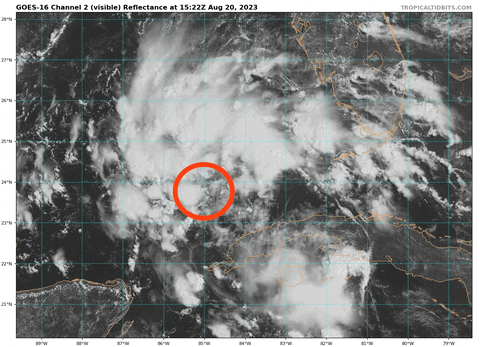
AL, 91, 2023082012, , BEST, 0, 241N, 833W, 20, 1012, DB, 34, NEQ, 0, 0, 0, 0, 1014, 150, 90, 0, 0, L, 0, , 0, 0, INVEST, S, 0, , 0, 0, 0, 0, genesis-num, 019, SPAWNINVEST, al722023 to al912023,
https://ftp.nhc.noaa.gov/atcf/btk/bal912023.dat
0 likes
Visit the Caribbean-Central America Weather Thread where you can find at first post web cams,radars
and observations from Caribbean basin members Click Here
-
- Category 2
- Posts: 571
- Joined: Tue Jun 20, 2017 2:26 pm
- REDHurricane
- Category 1
- Posts: 394
- Age: 27
- Joined: Sun Jul 03, 2022 2:36 pm
- Location: Northeast Pacific Ocean
Re: ATL: INVEST 91L - Discussion
It's still clearly dealing with some northwesterly shear but nevertheless starting to show some signs of low to mid-level consolidation:
925mb vorticity

850mb vorticity

700mb vorticity

500mb vorticity

925mb vorticity

850mb vorticity

700mb vorticity

500mb vorticity

0 likes
- ElectricStorm
- Category 5
- Posts: 5017
- Age: 24
- Joined: Tue Aug 13, 2019 11:23 pm
- Location: Skiatook, OK / Norman, OK
Re: ATL: INVEST 91L - Discussion
I'm thinking TS at landfall for now. Hopefully southern TX can get some decent rain
1 likes
I am in no way a professional. Take what I say with a grain of salt as I could be totally wrong. Please refer to the NHC, NWS, or SPC for official information.
Boomer Sooner!
Boomer Sooner!
- Rgv20
- S2K Supporter
- Posts: 2466
- Age: 38
- Joined: Wed Jan 05, 2011 5:42 pm
- Location: Edinburg/McAllen Tx
Re: ATL: INVEST 91L - Discussion
Looking very healthy today. Looks like a TS at landfall in Lower Texas Coast/NE Mexico would be a good bet. Looking at the most recent 12z models the landfall have been sped up from Tuesday Evening/Night to Tuesday Morning.


1 likes
The following post is NOT an official forecast and should not be used as such. It is just the opinion of the poster and may or may not be backed by sound meteorological data. It is NOT endorsed by any professional institution including storm2k.org For Official Information please refer to the NHC and NWS products.
- cycloneye
- Admin
- Posts: 143863
- Age: 68
- Joined: Thu Oct 10, 2002 10:54 am
- Location: San Juan, Puerto Rico
Re: ATL: INVEST 91L - Discussion
Western Gulf of Mexico (AL91):
Showers and thunderstorms have increased this afternoon in
association with an area of disturbed weather located in the eastern
Gulf of Mexico. Additional development of this system is possible as
it moves westward at about 15 to 20 mph, and a tropical depression
could form as it approaches the western Gulf of Mexico coastline by
Tuesday.
* Formation chance through 48 hours...medium...50 percent.
* Formation chance through 7 days...medium...60 percent.
0 likes
Visit the Caribbean-Central America Weather Thread where you can find at first post web cams,radars
and observations from Caribbean basin members Click Here
- wxman57
- Moderator-Pro Met
- Posts: 22951
- Age: 67
- Joined: Sat Jun 21, 2003 8:06 pm
- Location: Houston, TX (southwest)
Re: ATL: INVEST 91L - Discussion
Models have it inland into south TX between 7am-10am Tuesday, which is easily within the next 48 hrs. How are chances of development greater beyond 48 hrs?
3 likes
Re: ATL: INVEST 91L - Discussion
It wouldn’t take much to close off a circulation, is almost there. The GOM doing its magic as usual.
https://twitter.com/ndgmetchef/status/1693321873642156094
1 likes
Re: ATL: INVEST 91L - Discussion
PTC before the day is out IMO. Looks too good not to pull the trigger and the tailwind of climo on bell ring day makes it all the more fitting.
1 likes
- toad strangler
- S2K Supporter
- Posts: 4543
- Joined: Sun Jul 28, 2013 3:09 pm
- Location: Earth
- Contact:
Re: ATL: INVEST 91L - Discussion
wxman57 wrote:Models have it inland into south TX between 7am-10am Tuesday, which is easily within the next 48 hrs. How are chances of development greater beyond 48 hrs?
Crossover?
0 likes
My Weather Station
https://www.wunderground.com/dashboard/pws/KFLPORTS603
Re: ATL: INVEST 91L - Discussion
toad strangler wrote:wxman57 wrote:Models have it inland into south TX between 7am-10am Tuesday, which is easily within the next 48 hrs. How are chances of development greater beyond 48 hrs?
Crossover?
Nope, is not going to the EPAC.
0 likes
- REDHurricane
- Category 1
- Posts: 394
- Age: 27
- Joined: Sun Jul 03, 2022 2:36 pm
- Location: Northeast Pacific Ocean
Re: ATL: INVEST 91L - Discussion
LLC forming somewhere around this area? (excuse the poor gif making skills)


3 likes
- REDHurricane
- Category 1
- Posts: 394
- Age: 27
- Joined: Sun Jul 03, 2022 2:36 pm
- Location: Northeast Pacific Ocean
Re: ATL: INVEST 91L - Discussion
Moisture envelope looks to be coming together a bit as well. I would not be at all surprised if this ends up a hurricane before landfall -- moist environment + low wind shear + 31ºC and higher SST + existing impulse = increased chance of unexpected intensification


1 likes
-
- Category 5
- Posts: 8903
- Age: 39
- Joined: Thu Jul 06, 2017 1:51 am
Re: ATL: INVEST 91L - Discussion
Pretty much all of Texas needs rain so I'm glad for anyone that gets some from this system. But dang it, I wish we could get some of it here in the Houston area.
2 likes
-
- Category 5
- Posts: 2370
- Joined: Fri Jul 21, 2023 10:59 pm
- Location: Katy, Tx
Re: ATL: INVEST 91L - Discussion
91L is becoming better organized, and maybe a little quicker than some of the model guidance expected
1 likes
-
- Tropical Wave
- Posts: 8
- Joined: Thu Sep 09, 2021 2:58 pm
Re: ATL: INVEST 91L - Discussion
Its 108, my tomatoes are dying I'm flying the white flag of surrender
As wxman said "NO soup for you, Galveston." I know my family in San Antonio is gonna be happy with some rain though.
0 likes
Re: ATL: INVEST 91L - Discussion
Looks very close to being a depression right now. I am surprised the NHC is not issuing PTC advisory already as TS watches will need to be issued soon.
I would bet recon will Gert.
0 likes
Who is online
Users browsing this forum: No registered users and 12 guests