
ATL: BERYL - Post-Tropical - Discussion
Moderator: S2k Moderators
-
Sciencerocks
- Category 5

- Posts: 10193
- Age: 40
- Joined: Thu Jul 06, 2017 1:51 am
-
HurricaneBrain

- S2K Supporter

- Posts: 520
- Joined: Thu Jun 30, 2011 2:07 pm
Re: ATL: BERYL - Hurricane - Discussion
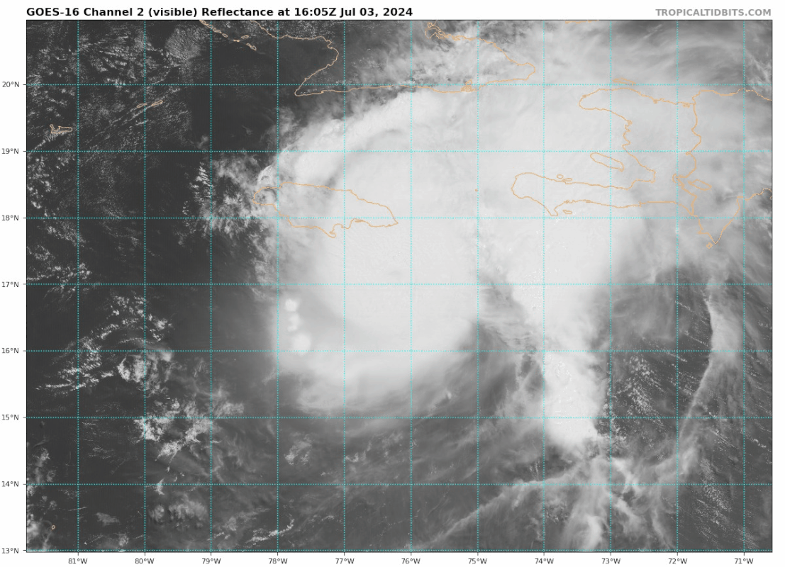
To me, it looks like the motion is NW in the last few frames...
Sciencerocks wrote:https://i.imgur.com/r2ohKI2.gif
2 likes
-
WaveBreaking

- Category 2

- Posts: 728
- Joined: Sun Jun 30, 2024 11:33 am
- Location: US
Re: ATL: BERYL - Hurricane - Discussion
Odeseus wrote:GCANE wrote:Odeseus wrote:Anyone else notice a “blob” structure to the east? Reminds me of Matthew in the same general location in 2016.
A smaller one is to the south of that.
IMHO its an indication of a feeder band with associated vigorous convection
I’m not so sure on that. Feeder band at least try to wrap around. This feature shows no sign of rotating around the core of the hurricane. It is firmly planted almost due east of the center.
It is also almost completely cut off from the rest of the system. And it seems stable. Been a feature for a while. For Matthew, the “blob” existed for a LONG time directly to the east of the system, while also being relatively cut off. That smaller burst to the southeast popped and is fading already. But the “blob” stays.
Finally, the cloud tops in the “blob” are just as intense on IR as the core of the system. I can’t recall another system besides Matthew that had a similar feature. Feeder bands don’t have cloud tops that match or exceed the core. Something else is going on here.
IMO it looks like the fast ESE trade winds are creating a convergence zone with SW winds from Beryl’s circulation.

Last edited by WaveBreaking on Wed Jul 03, 2024 2:10 pm, edited 1 time in total.
4 likes
I am NOT a professional meteorologist, so take all of my posts with a grain of salt. My opinions are mine and mine alone.
-
Craters
- Category 1

- Posts: 428
- Joined: Sat Aug 24, 2013 2:34 pm
- Location: Alvin, TX (south of Houston)
Re: ATL: BERYL - Hurricane - Discussion
Is that a huge outflow boundary from collapsing cells on the northwest edge of the storm? Beryl is definitely moving into a lot of dry air.
0 likes
Nothing that I post here should ever be treated as a forecast or anything resembling one. Please check with your local NWS office or the NHC for forecasts, watches, and warnings.
Re: ATL: BERYL - Hurricane - Discussion
HurricaneBrain wrote:To me, it looks like the motion is NW in the last few frames...Sciencerocks wrote:https://i.imgur.com/r2ohKI2.gif
Was thinking the same maybe land friction?looks ATTM maybe bisect Jamaica
1 likes
-
UTSARoadrunner4
- Category 1
- Posts: 265
- Age: 29
- Joined: Wed Aug 26, 2020 11:19 pm
Re: ATL: BERYL - Hurricane - Discussion
According to https://tropic.ssec.wisc.edu/real-time/windmain.php?&basin=atlantic&sat=wg8&prod=shr&zoom=&time= , it seems like shear has slightly weakened to the NW of Beryl. There’s an isolated pocket of 15-20 knots of shear to the WNW of Beryl, right before the Yucatán & Belize. I would think that further weakening of Beryl depends on its interaction of this pocket of shear and what part of the Yucatán it hits.
If it aims for Cancun, then I would anticipate a major or high-end Category 2 in the Gulf due to less interaction with that shear pocket and land. Versus if it hits Tulum, then we’ll probably see Beryl as a Category 1 back into the Gulf due to interaction with that shear pocket and the Yucatán/Puuc Hills.
Let me know if my assumption is wrong, but that’s just my 2 cents.
3 likes

Re: ATL: BERYL - Hurricane - Discussion
I don't see her weakening down to 100 MPH before the Yucatan, therefore I think all the forecast from the Yucatan onwards is way off. I can see this staying a Major all the way to the Yucatan and possibly only clip the Yucatan and go much further North.
4 likes
Personal Forecast Disclaimer:
The posts in this forum are NOT official forecast and should not be used as such. They are just the opinion of the poster and may or may not be backed by sound meteorological data. They are NOT endorsed by any professional institution or storm2k.org. For official information, please refer to the NHC and NWS products.
The posts in this forum are NOT official forecast and should not be used as such. They are just the opinion of the poster and may or may not be backed by sound meteorological data. They are NOT endorsed by any professional institution or storm2k.org. For official information, please refer to the NHC and NWS products.
-
jaguars_22
- Category 2
- Posts: 629
- Joined: Tue Jun 20, 2017 2:26 pm
- Location: Victoria TX
Re: ATL: BERYL - Hurricane - Discussion
Blinhart… idk it looks like it’s possibly already under 100mph!?? This thing is taking a beating! And all models show it weak now… not just a few models but most of them!
I say a low end hurricane hitting Yucatán and then weakening to low end tropical storm and landfall Tampico…. So weird and odd everything wants Tampico this year
I say a low end hurricane hitting Yucatán and then weakening to low end tropical storm and landfall Tampico…. So weird and odd everything wants Tampico this year
1 likes
Re: ATL: BERYL - Hurricane - Discussion
jaguars_22 wrote:Blinhart… idk it looks like it’s possibly already under 100mph!?? This thing is taking a beating! And all models show it weak now… not just a few models but most of them!
I say a low end hurricane hitting Yucatán and then weakening to low end tropical storm and landfall Tampico…. So weird and odd everything wants Tampico this year
There is no way it is down to 100, got -90C cloud tops and getting the eye wall reforming I think this thing still has winds about 135, since the NHC just updated and said it is 140.
8 likes
Personal Forecast Disclaimer:
The posts in this forum are NOT official forecast and should not be used as such. They are just the opinion of the poster and may or may not be backed by sound meteorological data. They are NOT endorsed by any professional institution or storm2k.org. For official information, please refer to the NHC and NWS products.
The posts in this forum are NOT official forecast and should not be used as such. They are just the opinion of the poster and may or may not be backed by sound meteorological data. They are NOT endorsed by any professional institution or storm2k.org. For official information, please refer to the NHC and NWS products.
-
jaguars_22
- Category 2
- Posts: 629
- Joined: Tue Jun 20, 2017 2:26 pm
- Location: Victoria TX
Re: ATL: BERYL - Hurricane - Discussion
Is recon going out this afternoon? Your probably right blinhart! Just weird it looks this way and still that strong
1 likes
-
Blown Away

- S2K Supporter
- Posts: 10253
- Joined: Wed May 26, 2004 6:17 am
Re: ATL: BERYL - Hurricane - Discussion
Warm spot in the middle looks like a real close brush or landfall…
4 likes
Hurricane Eye Experience: David 79, Irene 99, Frances 04, Jeanne 04, Wilma 05… Hurricane Brush Experience: Andrew 92, Erin 95, Floyd 99, Matthew 16, Irma 17, Ian 22, Nicole 22…
-
Iceresistance

- Category 5
- Posts: 9607
- Age: 22
- Joined: Sat Oct 10, 2020 9:45 am
- Location: Tecumseh, OK/Norman, OK
Re: ATL: BERYL - Hurricane - Discussion
Didn't we see this before back in June where Beryl was able to wrap upshear and strengthened to the earliest C4 hurricane on record?

https://s10.gifyu.com/images/SrPnU.gif
https://s10.gifyu.com/images/SrPnU.gif
5 likes
Bill 2015 & Beta 2020
Winter 2020-2021
All observations are in Tecumseh, OK unless otherwise noted.
Winter posts are focused mainly for Oklahoma & Texas.
Take any of my forecasts with a grain of salt, refer to the NWS, SPC, and NHC for official information
Never say Never with weather! Because ANYTHING is possible!
Winter 2020-2021
All observations are in Tecumseh, OK unless otherwise noted.
Winter posts are focused mainly for Oklahoma & Texas.
Take any of my forecasts with a grain of salt, refer to the NWS, SPC, and NHC for official information
Never say Never with weather! Because ANYTHING is possible!
-
LadyBug72

- Tropical Storm

- Posts: 121
- Joined: Mon Jun 01, 2020 3:39 pm
- Location: about 20 miles from Galveston, Tx
Re: ATL: BERYL - Hurricane - Discussion
Iceresistance wrote:Didn't we see this before back in June where Beryl was able to wrap upshear and strengthened to the earliest C4 hurricane on record?
https://s10.gifyu.com/images/SrPnU.gif
https://s10.gifyu.com/images/SrPnU.gif
What does this show?
0 likes
Formerly known as the user: Nikki
Alicia 83, Allison 01, Rita 05, Ike 08, Harvey 17, Nicholas 21, Coastal Texas Derecho 24, Beryl 24
Alicia 83, Allison 01, Rita 05, Ike 08, Harvey 17, Nicholas 21, Coastal Texas Derecho 24, Beryl 24
-
Hypercane_Kyle

- Category 5
- Posts: 3465
- Joined: Sat Mar 07, 2015 7:58 pm
- Location: Cape Canaveral, FL
Re: ATL: BERYL - Hurricane - Discussion
jaguars_22 wrote:Blinhart… idk it looks like it’s possibly already under 100mph!?? This thing is taking a beating! And all models show it weak now… not just a few models but most of them!
I say a low end hurricane hitting Yucatán and then weakening to low end tropical storm and landfall Tampico…. So weird and odd everything wants Tampico this year
There is absolutely zero evidence to support Beryl being that weak; we just had a recon fairly recently that still showed Category 4 despite ragged appearance.
Believe it or not, it's not unheard of to have major hurricanes that look ragged. Matthew 2016 is a striking example.
Last edited by Hypercane_Kyle on Wed Jul 03, 2024 1:54 pm, edited 1 time in total.
8 likes
My posts are my own personal opinion, defer to the National Hurricane Center (NHC) and other NOAA products for decision making during hurricane season.

Re: ATL: BERYL - Hurricane - Discussion
There is a new burst of convection but the dangerous core winds appear to be staying off Jamaica for the most part. Recon will give us more information about the current intensity later.
1 likes
-
Hurrilurker

- Category 2
- Posts: 738
- Joined: Mon Jun 09, 2003 3:32 pm
- Location: San Francisco, CA
Re: ATL: BERYL - Hurricane - Discussion
Heavy rains coming down in Kingston. Winds aren't crazy yet but definitely picking up, notably gustier compared to an hour ago.
https://www.skylinewebcams.com/en/webca ... orama.html
https://www.skylinewebcams.com/en/webca ... orama.html
2 likes
-
HurricaneBrain
- S2K Supporter
- Posts: 520
- Joined: Thu Jun 30, 2011 2:07 pm
Re: ATL: BERYL - Hurricane - Discussion
IR sure does give an illusion of the center reforming SE.
0 likes

Re: ATL: BERYL - Hurricane - Discussion

radar still shows a pretty solid eyewall
5 likes
The above post is not official and should not be used as such. It is the opinion of the poster and may or may not be backed by sound meteorological data. It is not endorsed by any professional institution or storm2k.org. For official information, please refer to the NHC and NWS products.

Re: ATL: BERYL - Hurricane - Discussion
The last recon pass fixed the pressure as being 1mb lower. Certainly looks to be holding steady if not deepening again. That new burst of convection wrapping around the center is impressive for a "weakening" system.
Last edited by Kazmit on Wed Jul 03, 2024 2:37 pm, edited 1 time in total.
8 likes
Igor 2010, Sandy 2012, Fay 2014, Gonzalo 2014, Joaquin 2015, Nicole 2016, Humberto 2019, Imelda 2025
I am only a tropical weather enthusiast. My predictions are not official and may or may not be backed by sound meteorological data. For official information, please refer to the NHC and NWS products.
I am only a tropical weather enthusiast. My predictions are not official and may or may not be backed by sound meteorological data. For official information, please refer to the NHC and NWS products.
-
cheezyWXguy

- Category 5
- Posts: 6282
- Joined: Mon Feb 13, 2006 12:29 am
- Location: Dallas, TX
Re: ATL: BERYL - Hurricane - Discussion
HurricaneBrain wrote:IR sure does give an illusion of the center reforming SE.
It does, but IR is only seeing the top-most layer of clouds. Beryl has been tilted some by the shear, which is why its eye has been cloud filled. Whatever abatement of the shear that’s occurring right now seems to be allowing it to realign vertically.
2 likes
Who is online
Users browsing this forum: No registered users and 34 guests