ATL: MILTON - Post-Tropical - Discussion
Moderator: S2k Moderators
-
dukeblue219
- S2K Supporter

- Posts: 556
- Joined: Fri Sep 30, 2016 3:52 pm
Re: ATL: MILTON - Hurricane - Discussion: 145 mph / 929 mbs
139kt SFMR reading from the AF plane at 1253Z is interesting.
0 likes

Re: ATL: MILTON - Hurricane - Discussion: 145 mph / 929 mbs
Curious to see how winds have picked up a lot in the last few hours while pressure has remained steady. When the first recon plane arrived earlier Milton was down to 115 kt, barely a cat 4. However, the latest FL measurements now support 130 kt. However, the pressure has been meandering a bit around 926 - 932 mb values for the last few hours without a clear trend. I expect the pressure won't drop a lot until the eye clears out.
Last edited by kevin on Tue Oct 08, 2024 8:14 am, edited 1 time in total.
2 likes

-
InfernoFlameCat

- Category 5

- Posts: 2127
- Age: 22
- Joined: Mon Dec 14, 2020 10:52 am
- Location: Buford, GA
Re: ATL: MILTON - Hurricane - Discussion: 145 mph / 929 mbs
tolakram wrote:MEANINGLESS_NUMBERS wrote:Has there ever been a storm that went sub-900 mbar on two separate occasions? It looks like there is a small window for restrengthening but it is still a long way off its peak intensity.
Really hard to get sub 900 without a pinhole eye, I'm also not sure if it's ever happened.
Typhoon tip, the most intense cyclone of all time did it. Katrina almost did it with a large eye.
2 likes
I am by no means a professional. DO NOT look at my forecasts for official information or make decisions based on what I post.
Goal: to become a registered expert over tropical and subtropical cyclones.
Goal: to become a registered expert over tropical and subtropical cyclones.
-
WaveBreaking

- Category 2

- Posts: 713
- Joined: Sun Jun 30, 2024 11:33 am
- Location: US
Re: ATL: MILTON - Hurricane - Discussion: 145 mph / 929 mbs
Loop of yesterday

3 likes
I am NOT a professional meteorologist, so take all of my posts with a grain of salt. My opinions are mine and mine alone.
-
eastcoastFL

- Category 5
- Posts: 3996
- Age: 44
- Joined: Thu Apr 12, 2007 12:29 pm
- Location: Palm City, FL
Re: ATL: MILTON - Hurricane - Discussion: 145 mph / 929 mbs
tolakram wrote:Clearcloudz wrote:This question has been on my mind for some time so I'm going to go ahead and ask in this forum. Most professionals say to evacuate storm surge which is very important and I completely understand that but why do professionals also not focus on freshwater flooding that could occur from this storm. Some models are showing 24 inches of rain in a very short amount of time and I believe people will be caught off guard by the freshwater flooding from this storm. A suggestion could be just like the NHC used potential storm surge maps maybe the NWS can use potential fresh water flooding maps. From recent storms like Helene a lot people who were asked said that if they knew it would flood like this they would evacuate.
Your local officials should, the NHC focuses on the storm, but also mentions surge and rain. If you read the weather service messages from Helene you will see all local offices screaming about how bad it was going to be. I think the focus is there and where it should be.
The NWS has great local products like this page where it breaks down each potential threat like wind, surge, flooding etc
https://www.weather.gov/srh/tropical?office=mlb
0 likes
Personal Forecast Disclaimer:
The posts in this forum are NOT official forecast and should not be used as such. They are just the opinion of the poster and may or may not be backed by sound meteorological data. They are NOT endorsed by any professional institution or storm2k.org. For official information, please refer to the NHC and NWS products.
The posts in this forum are NOT official forecast and should not be used as such. They are just the opinion of the poster and may or may not be backed by sound meteorological data. They are NOT endorsed by any professional institution or storm2k.org. For official information, please refer to the NHC and NWS products.
Re: ATL: MILTON - Hurricane - Discussion: 145 mph / 929 mbs
xironman wrote:Buck wrote:AutoPenalti wrote:tapping into some colder waters.
Not accurate.
Actually there is a lower heat content pocket just north of the Yucatan. It has been mentioned before when storms cross the peninsula it takes them a while to get going again. The storm will soon be moving into a more favorable environment.TIME (HR) 0 6 12 18 24 36 48 60 72 84 96 108 120 132 144 156 168
HEAT CONTENT 23 27 39 65 50 23 5 43 19 16 13 10 7 N/A N/A N/A N/A
OHC is only very important when the hurricane is stalled or barely moving. EPAC Hurricane Gilma became a Cat 4 over ZERO OHC.
SSTs along the northern Yucatan coast are more than warm enough, they are just very shallow because of the continental shelf.

9 likes
-
SecondBreakfast
- Tropical Storm

- Posts: 102
- Joined: Sun Sep 10, 2017 7:14 am
- Location: NYC/LI
Re: ATL: MILTON - Hurricane - Discussion: 145 mph / 929 mbs
Clearcloudz wrote:This question has been on my mind for some time so I'm going to go ahead and ask in this forum. Most professionals say to evacuate storm surge which is very important and I completely understand that but why do professionals also not focus on freshwater flooding that could occur from this storm. Some models are showing 24 inches of rain in a very short amount of time and I believe people will be caught off guard by the freshwater flooding from this storm. A suggestion could be just like the NHC used potential storm surge maps maybe the NWS can use potential fresh water flooding maps. From recent storms like Helene a lot people who were asked said that if they knew it would flood like this they would evacuate.
Inland flooding from Helene was well forecast, including news outlets saying it would rival the 1916 flood in the Appalachians. I also have seen warnings up for Milton for inland low lying areas, including graphics showing the extreme flash flooding risk in and around Orlando. I am sure my brother is about to live on a small island because of all the ponds in his subdivision.
The fact that there are people who said “if I’d only known” is an important indicator that the messaging isn’t getting to a lot of people who need it, and that should be a top policy priority to sort out.
10 likes
Biologist by training, weather enthusiast for life.

Re: ATL: MILTON - Hurricane - Discussion: 145 mph / 929 mbs
It looks like after a brief eye clearing episode (which probably helped it go from low-end Cat 4 to high-end Cat 4 during recon), Milton's satellite appearance is holding steady now, without additional eye warming recently.
If this is true, it's likely due to the slightly cooler and/or less deep waters near the shore. So I expect further intensification once Milton pulls away from Yucatan.
If this is true, it's likely due to the slightly cooler and/or less deep waters near the shore. So I expect further intensification once Milton pulls away from Yucatan.
0 likes
TC naming lists: retirements and intensity
Most aggressive Advisory #1's in North Atlantic (cr. kevin for starting the list)
Most aggressive Advisory #1's in North Atlantic (cr. kevin for starting the list)
Re: ATL: MILTON - Hurricane - Discussion: 145 mph / 929 mbs
SecondBreakfast wrote:Clearcloudz wrote:This question has been on my mind for some time so I'm going to go ahead and ask in this forum. Most professionals say to evacuate storm surge which is very important and I completely understand that but why do professionals also not focus on freshwater flooding that could occur from this storm. Some models are showing 24 inches of rain in a very short amount of time and I believe people will be caught off guard by the freshwater flooding from this storm. A suggestion could be just like the NHC used potential storm surge maps maybe the NWS can use potential fresh water flooding maps. From recent storms like Helene a lot people who were asked said that if they knew it would flood like this they would evacuate.
Inland flooding from Helene was well forecast, including news outlets saying it would rival the 1916 flood in the Appalachians. I also have seen warnings up for Milton for inland low lying areas, including graphics showing the extreme flash flooding risk in and around Orlando. I am sure my brother is about to live on a small island because of all the ponds in his subdivision.
The fact that there are people who said “if I’d only known” is an important indicator that the messaging isn’t getting to a lot of people who need it, and that should be a top policy priority to sort out.
The fact that even weather nerds on this forum paid little attention to Helene's inland flooding until it was already happening tells you everything you need to know.
4 likes
TC naming lists: retirements and intensity
Most aggressive Advisory #1's in North Atlantic (cr. kevin for starting the list)
Most aggressive Advisory #1's in North Atlantic (cr. kevin for starting the list)
-
USTropics
- Professional-Met

- Posts: 2736
- Joined: Sun Aug 12, 2007 3:45 am
- Location: Florida State University
Re: ATL: MILTON - Hurricane - Discussion: 145 mph / 929 mbs
InfernoFlameCat wrote:tolakram wrote:MEANINGLESS_NUMBERS wrote:Has there ever been a storm that went sub-900 mbar on two separate occasions? It looks like there is a small window for restrengthening but it is still a long way off its peak intensity.
Really hard to get sub 900 without a pinhole eye, I'm also not sure if it's ever happened.
Typhoon tip, the most intense cyclone of all time did it. Katrina almost did it with a large eye.
On mobile so can't verify this, but I believe Katrina was 920mb with an insane eye diameter (32 miles wideI believe).
1 likes
Re: ATL: MILTON - Hurricane - Discussion: 145 mph / 929 mbs
NOAA recon must have dropped a drone inside of the eye like they did during Helene by the number of times they circled around inside of Milton's eye.

3 likes
Re: ATL: MILTON - Hurricane - Discussion: 145 mph / 929 mbs
NDG wrote:xironman wrote:Buck wrote:
Not accurate.
Actually there is a lower heat content pocket just north of the Yucatan. It has been mentioned before when storms cross the peninsula it takes them a while to get going again. The storm will soon be moving into a more favorable environment.TIME (HR) 0 6 12 18 24 36 48 60 72 84 96 108 120 132 144 156 168
HEAT CONTENT 23 27 39 65 50 23 5 43 19 16 13 10 7 N/A N/A N/A N/A
OHC is only very important when the hurricane is stalled or barely moving. EPAC Hurricane Gilma became a Cat 4 over ZERO OHC.
SSTs along the northern Yucatan coast are more than warm enough, they are just very shallow because of the continental shelf.
https://i.imgur.com/ke7RaUD.jpg
https://mds.marshall.edu/geography_faculty/1/
The rapid intensification of tropical cyclones is the most serious aspect, when it comes to forecasting. It is generally accepted that sufficient surface ocean temperatures (approximately 26°C) are needed to produce and sustain tropical cyclone formation. However, the sea-surface temperature (SST) has shown not to be critical in intensity forecasting by itself, particularly with rapid intensification (Schade & Emmanuel, 1999; Law & Hobgood 2007). Tropical cyclones derive much of their energy from warm, deep ocean water. Therefore, a quantified measure of the amount of this warm, deep water is a better way to measure the amount of energy available to the storm. The oceanic heat content (OHC) is such a variable to measure the amount of warm water available for the tropical cyclone to convert into energy and has been shown to be a much better predictor than SST alone (Zebiak, 1989; McDougall, 2003; Wada & Usui 2007; Palmer & Haines, 2009; Shay & Brewster, 2010)
3 likes
Re: ATL: MILTON - Hurricane - Discussion: 145 mph / 929 mbs

xironman wrote:Buck wrote:AutoPenalti wrote:tapping into some colder waters.
Not accurate.
Actually there is a lower heat content pocket just north of the Yucatan. It has been mentioned before when storms cross the peninsula it takes them a while to get going again. The storm will soon be moving into a more favorable environment.TIME (HR) 0 6 12 18 24 36 48 60 72 84 96 108 120 132 144 156 168
HEAT CONTENT 23 27 39 65 50 23 5 43 19 16 13 10 7 N/A N/A N/A N/A
Yes....and as evidence of this restrengthing indicated by the NHC in its current forecast wind speeds......FORECAST POSITIONS AND MAX WINDS
INIT 08/0900Z 22.3N 88.9W 135 KT 155 MPH
12H 08/1800Z 22.9N 87.5W 140 KT 160 MPH
24H 09/0600Z 24.2N 85.8W 135 KT 155 MPH
36H 09/1800Z 26.0N 84.2W 125 KT 145 MPH
48H 10/0600Z 27.6N 82.6W 110 KT 125 MPH...NEAR THE COAST
60H 10/1800Z 28.8N 79.9W 70 KT 80 MPH...OVER WATER
72H 11/0600Z 29.7N 76.5W 60 KT 70 MPH...POST-TROP/EXTRATROP
96H 12/0600Z 30.4N 69.9W 45 KT 50 MPH...POST-TROP/EXTRATROP
120H 13/0600Z 31.5N 63.8W 35 KT 40 MPH...POST-TROP/EXTRATROP
Milton's winds lowered....and its my understanding that Milton has been undergoing an eyewall replacement cycle?....is the reduced wind speeds a product of an eyewall replacement cycle?....along with Milton's proximity to the northern coastline of the Yucatan Peninsula?...
Last edited by underthwx on Tue Oct 08, 2024 8:37 am, edited 3 times in total.
1 likes

Re: ATL: MILTON - Hurricane - Discussion: 145 mph / 929 mbs
Clearcloudz wrote:This question has been on my mind for some time so I'm going to go ahead and ask in this forum. Most professionals say to evacuate storm surge which is very important and I completely understand that but why do professionals also not focus on freshwater flooding that could occur from this storm. Some models are showing 24 inches of rain in a very short amount of time and I believe people will be caught off guard by the freshwater flooding from this storm. A suggestion could be just like the NHC used potential storm surge maps maybe the NWS can use potential fresh water flooding maps. From recent storms like Helene a lot people who were asked said that if they knew it would flood like this they would evacuate.
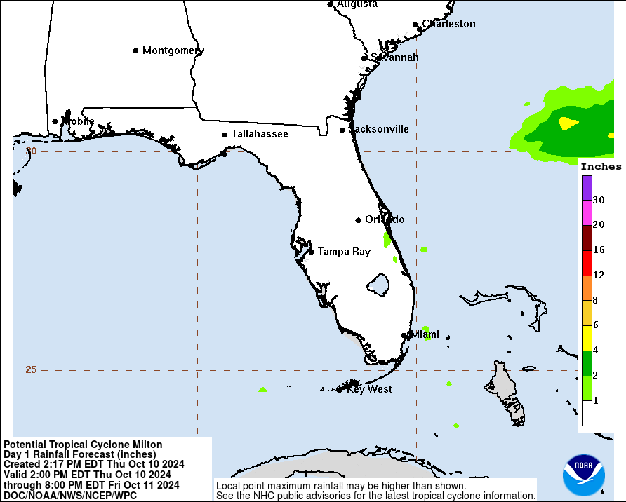
I think that's more on the NOAA/NWS forecast offices. NHC always has a summary of hazards they number at the end of their discussions. They also will emphasize if there is a specific rain threat for a system. And they have a graphic they use for rainfall. For instance:
Rainfall Graphic on the storm section of the home page.
From the discussion;
Key Messages:
1. Damaging hurricane-force winds and a life-threatening storm surge
with destructive waves are expected across portions of the northern
coast of the Yucatan Peninsula today.
2. Milton is expected to grow in size and remain an extremely
dangerous hurricane when it approaches the west coast of Florida on
Wednesday. A large area of destructive storm surge will occur along
parts of the west coast of Florida. This is an extremely
life-threatening situation and residents in those areas should
follow advice given by local officials and evacuate immediately if
told to do so.
3. Devastating hurricane-force winds are expected along portions of
the west coast of Florida, where a Hurricane Warning is in effect.
Milton is forecast to remain a hurricane as it crosses the Florida
Peninsula and life-threatening hurricane-force winds, especially in
gusts, are expected to spread inland across the peninsula.
Preparations to protect life and property in the warning areas
should be complete by tonight.
4. Areas of heavy rainfall will continue to impact portions of
Florida well ahead of Milton through early Thursday. This rainfall
brings the risk of life-threatening flash, urban and aerial
flooding along with moderate to major river flooding. Flooding will
be exacerbated in areas where coastal and inland flooding combine to
increase the overall threat.
Last edited by Steve on Tue Oct 08, 2024 8:57 am, edited 1 time in total.
4 likes
Re: ATL: MILTON - Hurricane - Discussion: 145 mph / 929 mbs
Does this mean more of a tug to the right of forecast?
Edit: read the whole post. Answer is Northward tug
Last edited by caneman on Tue Oct 08, 2024 8:43 am, edited 1 time in total.
1 likes
-
USTropics
- Professional-Met
- Posts: 2736
- Joined: Sun Aug 12, 2007 3:45 am
- Location: Florida State University
Re: ATL: MILTON - Hurricane - Discussion: 145 mph / 929 mbs
Teban54 wrote:SecondBreakfast wrote:Clearcloudz wrote:This question has been on my mind for some time so I'm going to go ahead and ask in this forum. Most professionals say to evacuate storm surge which is very important and I completely understand that but why do professionals also not focus on freshwater flooding that could occur from this storm. Some models are showing 24 inches of rain in a very short amount of time and I believe people will be caught off guard by the freshwater flooding from this storm. A suggestion could be just like the NHC used potential storm surge maps maybe the NWS can use potential fresh water flooding maps. From recent storms like Helene a lot people who were asked said that if they knew it would flood like this they would evacuate.
Inland flooding from Helene was well forecast, including news outlets saying it would rival the 1916 flood in the Appalachians. I also have seen warnings up for Milton for inland low lying areas, including graphics showing the extreme flash flooding risk in and around Orlando. I am sure my brother is about to live on a small island because of all the ponds in his subdivision.
The fact that there are people who said “if I’d only known” is an important indicator that the messaging isn’t getting to a lot of people who need it, and that should be a top policy priority to sort out.
The fact that even weather nerds on this forum paid little attention to Helene's inland flooding until it was already happening tells you everything you need to know.
While true, there were some big time influencers/enthusiasts that did spend time talking about it. I remember catching a few hours of Ryan Halls stream while prepping for Helene and he exclusively was focusing on how the moisture would get rung out over the mountains and cause devastating flooding. Same for Mark Sudduth/hurricanetrack, who lives in North Carolina. It's hard to get that messaging across when there isn't an apples to apples comparison (something like this hasn't really occurred in our lifetime). It's human nature to have to fight complacency (well it's never happened before so...) until it does happen. See Harvey in Houston and Katrina in New Orleans as well.
8 likes
-
USTropics
- Professional-Met
- Posts: 2736
- Joined: Sun Aug 12, 2007 3:45 am
- Location: Florida State University
Re: ATL: MILTON - Hurricane - Discussion: 145 mph / 929 mbs
caneman wrote:
Does this mean more of a tug to the right of forecast?
Basically what he is saying is as Milton begins interacting with the trough more, the convective spatial pattern will become asymmetrical (displaced to the northeast). This will cause downshear tugging, or essentially Milton will want to 'wobble' more to the north (so tug to north/left).
6 likes
-
xtyphooncyclonex

- Category 5
- Posts: 3890
- Age: 24
- Joined: Sat Dec 08, 2012 9:07 am
- Location: Cebu City
- Contact:
Re: ATL: MILTON - Hurricane - Discussion: 145 mph / 929 mbs
IIRC Rita had a pretty decently-sized eye when it bombed out to 895 mb. Same thing with Allen (899 mb) I think.
In the WPac, we've had Surigae, Meranti and Haiyan with non-pinhole eyes go sub-900 mb. There could be plenty more due to recon, but this is based off JMA official estimates.
Not gonna say he will do it, but Milton *could* go bonkers once he taps into the waters of the Loop Current. Can't rule out a sub-900 secondary peak either. Milton's radar/MW structure is looking robust. SSTs are at least 29C, ventilation/outflow is decent to its NE and SW, and upwelling over the shallow waters may be minimized by the forward speed of 12 mph.
5 likes
REMINDER: My opinions that I, or any other NON Pro-Met in this forum, are unofficial. Please do not take my opinions as an official forecast and warning. I am NOT a meteorologist. Following my forecasts blindly may lead to false alarm, danger and risk if official forecasts from agencies are ignored.
Re: ATL: MILTON - Hurricane - Discussion: 145 mph / 929 mbs
Teban54 wrote:SecondBreakfast wrote:Clearcloudz wrote:This question has been on my mind for some time so I'm going to go ahead and ask in this forum. Most professionals say to evacuate storm surge which is very important and I completely understand that but why do professionals also not focus on freshwater flooding that could occur from this storm. Some models are showing 24 inches of rain in a very short amount of time and I believe people will be caught off guard by the freshwater flooding from this storm. A suggestion could be just like the NHC used potential storm surge maps maybe the NWS can use potential fresh water flooding maps. From recent storms like Helene a lot people who were asked said that if they knew it would flood like this they would evacuate.
Inland flooding from Helene was well forecast, including news outlets saying it would rival the 1916 flood in the Appalachians. I also have seen warnings up for Milton for inland low lying areas, including graphics showing the extreme flash flooding risk in and around Orlando. I am sure my brother is about to live on a small island because of all the ponds in his subdivision.
The fact that there are people who said “if I’d only known” is an important indicator that the messaging isn’t getting to a lot of people who need it, and that should be a top policy priority to sort out.
The fact that even weather nerds on this forum paid little attention to Helene's inland flooding until it was already happening tells you everything you need to know.
Some of us were pointing that out at least a week in advance when the cutoff low showed up in the modeling albeit farther west at the time. It was clear that as the pattern evolved, the trough was going to get and trap it inland. There were a few people (not so much me because I was more pointing out the sort of uniqueness of the phenomenon) that posted how extreme this was looking for the eastern slopes and mountains in general. But because everyone was watching the evolution of the modeling and worrying about landfall adjustments and all that, I think some of those posts got lost in the noise. But there are definitely several of them in that 197 page thread.
Relative to Milton, obviously it's not going to get hung up. Different models have different depictions of where the heaviest rain is going to fall. Imgur blocked at work but
GFS 06z
https://www.tropicaltidbits.com/analysi ... 806&fh=120
ICON 06z
https://www.tropicaltidbits.com/analysi ... 806&fh=120
CMC 00z
https://www.tropicaltidbits.com/analysi ... 800&fh=120
EC 00z
https://www.tropicaltidbits.com/analysi ... 800&fh=120
ECAI 00z
https://www.tropicaltidbits.com/analysi ... 806&fh=120
NAM 12km 06z
https://www.tropicaltidbits.com/analysi ... 0806&fh=84
2 likes
Who is online
Users browsing this forum: No registered users and 21 guests