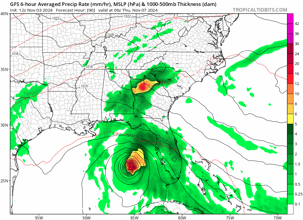
18z GFS… Significant E bump near SW FL coast…
Moderator: S2k Moderators


A drift? Where then do you say it will go?TallyTracker wrote:I’m really having trouble believing the hurricane models intensities in the Gulf of a Cat 4 or 5. I think a weakening Cat 2 or 3 moving north into the Gulf is possible. The environment in the Gulf just doesn’t look as good as it was when Milton formed a month ago. I’m thinking right now a Cat 1 into Cuba weakening to a moderate TS upon hitting the northern Gulf coast. I’m still not buying the stall and drift west to Louisiana.
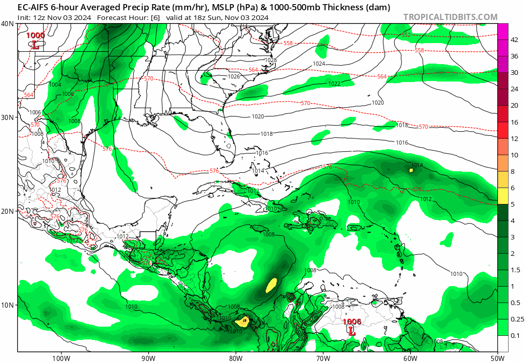
jhpigott wrote:Are the hurricane models running for PTC18 for the 18z model cycle? Didn't see them up on Tropical Tidbits
chaser1 wrote:jhpigott wrote:Are the hurricane models running for PTC18 for the 18z model cycle? Didn't see them up on Tropical Tidbits
I was thinking the same thing. Got home from work and went to check the Hurricane regionals first. None were there. Perhaps they'll show up at 0Z?
wxman57 wrote:GCANE wrote:GFS is trending for a solid Anti-Cyclone in the N GoM
Chances increasing for a Cat 1 or higher before landfall
I'm not seeing any upper high over the Gulf in the GFS after tomorrow. Just a digging trof and increasing SW shear.


Jr0d wrote:wxman57 wrote:GCANE wrote:GFS is trending for a solid Anti-Cyclone in the N GoM
Chances increasing for a Cat 1 or higher before landfall
I'm not seeing any upper high over the Gulf in the GFS after tomorrow. Just a digging trof and increasing SW shear.
Crosspost from discussion thread
I would say the NHC does an excellent job of a forecast track within 5 days!
I was thinking sheared TS yesterday, but after seeing the hurricane model runs, I am increasingly concerned about intensity.
It is tough for me to ignore my location bias, but I do not see how the models are taking this so far west after Cuba. Could they be struggling because of the time of the year?
Here is the 200mb wind forecast from the NAM for 00Z Tuesday and 36 hours later, 12Z Wednesday, NAM and EURO There seems to be a ULAC, but with I don't see how it can go past 85 W with that steering pattern...I would think it would be taking the storm North to Northeast by Wednesday morning.
https://i.ibb.co/X2KCwDt/nam-uv200-watl-11.png
https://i.ibb.co/6bR0588/nam-uv200-watl-25.png
https://i.ibb.co/gFjqqFz/ecmwf-uv200-watl-27.png
3090 wrote:Jr0d wrote:wxman57 wrote:
I'm not seeing any upper high over the Gulf in the GFS after tomorrow. Just a digging trof and increasing SW shear.
Crosspost from discussion thread
I was thinking sheared TS yesterday, but after seeing the hurricane model runs, I am increasingly concerned about intensity.
It is tough for me to ignore my location bias, but I do not see how the models are taking this so far west after Cuba. Could they be struggling because of the time of the year?
Here is the 200mb wind forecast from the NAM for 00Z Tuesday and 36 hours later, 12Z Wednesday, NAM and EURO There seems to be a ULAC, but with I don't see how it can go past 85 W with that steering pattern...I would think it would be taking the storm North to Northeast by Wednesday morning.
https://i.ibb.co/X2KCwDt/nam-uv200-watl-11.png
https://i.ibb.co/6bR0588/nam-uv200-watl-25.png
https://i.ibb.co/gFjqqFz/ecmwf-uv200-watl-27.png

3090 wrote:3090 wrote:Jr0d wrote:Crosspost from discussion thread
I was thinking sheared TS yesterday, but after seeing the hurricane model runs, I am increasingly concerned about intensity.
It is tough for me to ignore my location bias, but I do not see how the models are taking this so far west after Cuba. Could they be struggling because of the time of the year?
Here is the 200mb wind forecast from the NAM for 00Z Tuesday and 36 hours later, 12Z Wednesday, NAM and EURO There seems to be a ULAC, but with I don't see how it can go past 85 W with that steering pattern...I would think it would be taking the storm North to Northeast by Wednesday morning.
https://i.ibb.co/X2KCwDt/nam-uv200-watl-11.png
https://i.ibb.co/6bR0588/nam-uv200-watl-25.png
https://i.ibb.co/gFjqqFz/ecmwf-uv200-watl-27.png
I would say the NHC does an excellent job of a forecast track within 5 days!


xironman wrote:GFS showing 18 keeping its moisture envelope a bit better. I remember that with Milton originally it was going to fall apart because of the dry air but that lessened over time.
https://i.imgur.com/xvKKLA2.gif
I think it is dry air, sure there is shear but it is not super destructive, the worst is 22kt and the storm is moving with itTIME (HR) 0 6 12 18 24 36 48 60 72 84 96 108 120 132 144 156 168
SHEAR (KT) 9 9 7 3 3 4 11 15 22 17 18 19 23 28 46 48 77

Users browsing this forum: No registered users and 54 guests


