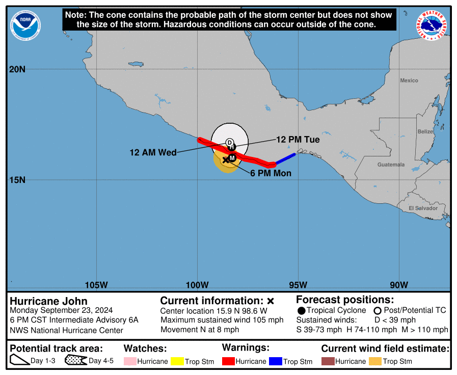
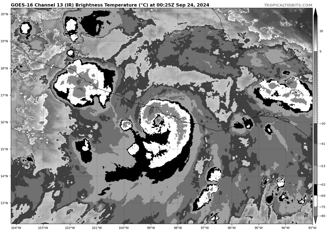
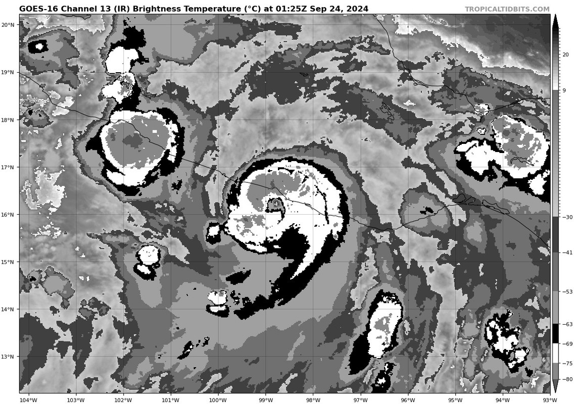
Landy wrote:A bit upsetting to see that seemingly nothing has been learned since Otis. No idea why recon wasn't scheduled for until tomorrow afternoon, especially now that it's a coin flip's chance whether this is even still offshore by then.
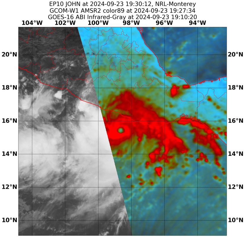
Part of it is resources - it is a long trip from Keesler AFB to southern Mexico. However, the lack of any real good data in the EPAC is definitely problematic, since we have almost no upper-air data there. It's all guessing by satellite imagery and we don't have the best analysis of shear and other environmental conditions.


 wi
wi