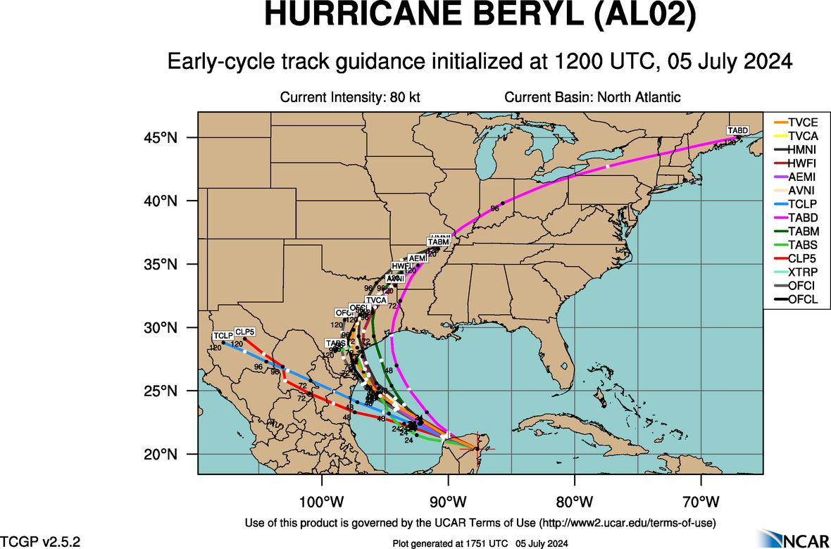
kevin wrote:Big win for ICON if the current trend continues and we really get a west/central Texas landfall.
It was mostly all alone earlier in the week. It was probably too far east, but it telegraphed the northern move regardless of whether it ends up 2 degrees farther west than what it had progged a few days ago. Globals had different solutions from moving into northern Mexico and heading west or heading into the RGV and moving W/WNW. Icon always liked that northerly component. It's rare that any models outside of the GFS or ECMWF can score that single-model coup. If it pans out, it doesn't mean trust the ICON or anything. It just means to watch its outputs and take it into consideration. Like all the models, it's frequently wrong.