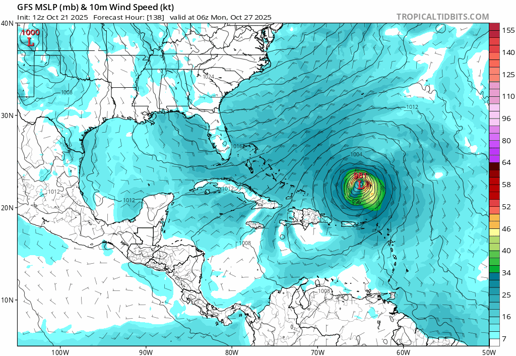
06z, Oct/22/2026, hurricane model blend, Melissa--- Model peak intensity ---HWRF = 944mb/112kt
HMON = 935mb/119kt
HAFS-A = 901mb/146kt
HAFS-B = 900mb/144kt
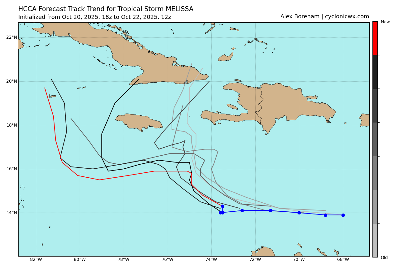
--- Hurricane model blend ---The new 06z hurricane models are somewhat similar to the 00z ones. They show slightly delayed intensification (6 - 12 hours later) and as such this blend 'only' peaks at 127 kt. But all models (with the exception of HWRF due to some land interaction) are still intensifying at +126 hr. The blend also shows a 60 kt peak in the coming 12 hours before struggling around 40 - 50 kt for 2 more days. I think the brief 60 kt peak is not realistic and simply a result of the initialization of Melissa. Like with the 00z cycle, HWRF is the only model which passes between Jamaica and Cuba and the other 3 models go south of Jamaica. HMON is a bit closer to Jamaica compared to 00z, but HAFS-A and HAFS-B are even farther south than they were in 00z and as such the blend average track doesn't really change and still passes close to but south of Jamaica. If the track shifts farther north and Melissa hits Jamaica, this would probably be around cat 3 intensity based on this blend. Uncertainty has gone down compared to 00z: the standard deviation in position at +72/+96/+108hr is now 45/95/130 miles, respectively, instead of 95/120/160 miles in the 00z blend. Still, this uncertainty window is big enough for significant differences in impact with respect to landfalls so this remains a very difficult forecast.
BlendPEAK: 920 mb @ 126 hrs | 127 kt @ 126 hrs
ACE (0 - 126 hrs) = 13.4
Time (hr) / Pressure (mb) / Wind (kt) / Location (lat, lon [deg])
00 / 999 / 44 /14.0N, 73.3W
06 / 995 / 60
12 / 995 / 51
18 / 997 / 49 / 15.0N, 74.1W
24 / 998 / 42
30 / 998 / 45
36 / 998 / 47 / 15.2N, 75.4W
42 / 996 / 48
48 / 995 / 49
54 / 994 / 49 / 15.8N, 75.0W
60 / 993 / 45
66 / 988 / 61
72 / 985 / 57 / 16.4N, 75.4W
78 / 981 / 68
- C184 / 972 / 76
90 / 962 / 94 / 16.5N, 76.2W
- C296 / 955 / 99
- C3102 / 946 / 108
108 / 935 / 119 / 16.7N, 77.6W
- C4114 / 932 / 120
120 / 926 / 123
126 / 920 / 127 / 17.0N, 78.3W
--- Previous blend analyses ---00z, Oct 22 = 911mb/134kt
Forecast track (weighted average of the hurricane model tracks) 


