From TYboard
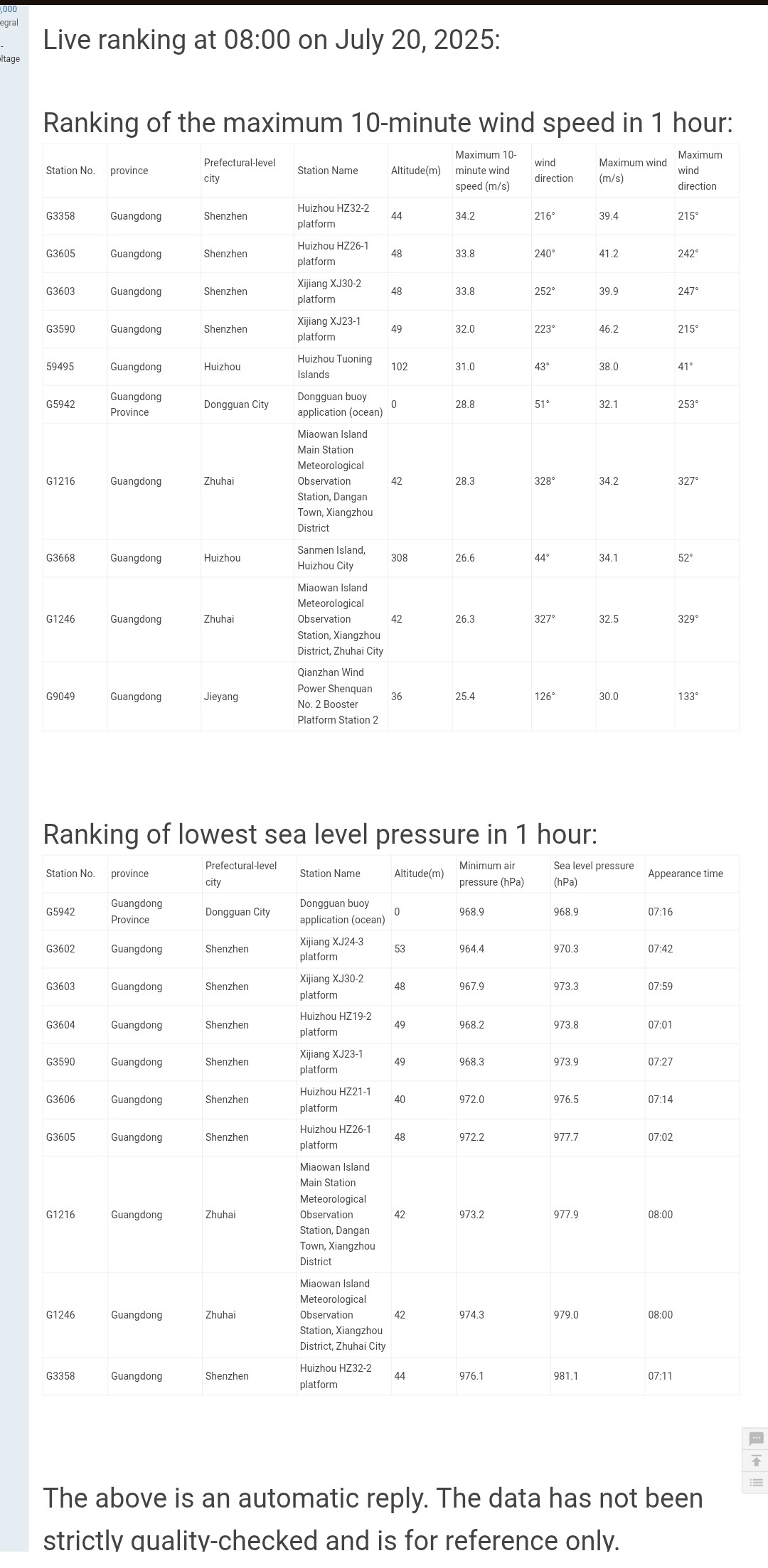
SLP at the buoy has plunged to 968.9 hPa
Moderator: S2k Moderators


mrbagyo wrote:8:00 AM update (0000 UTC)
From TYboard
SLP at the buoy has plunged to 968.9 hPa
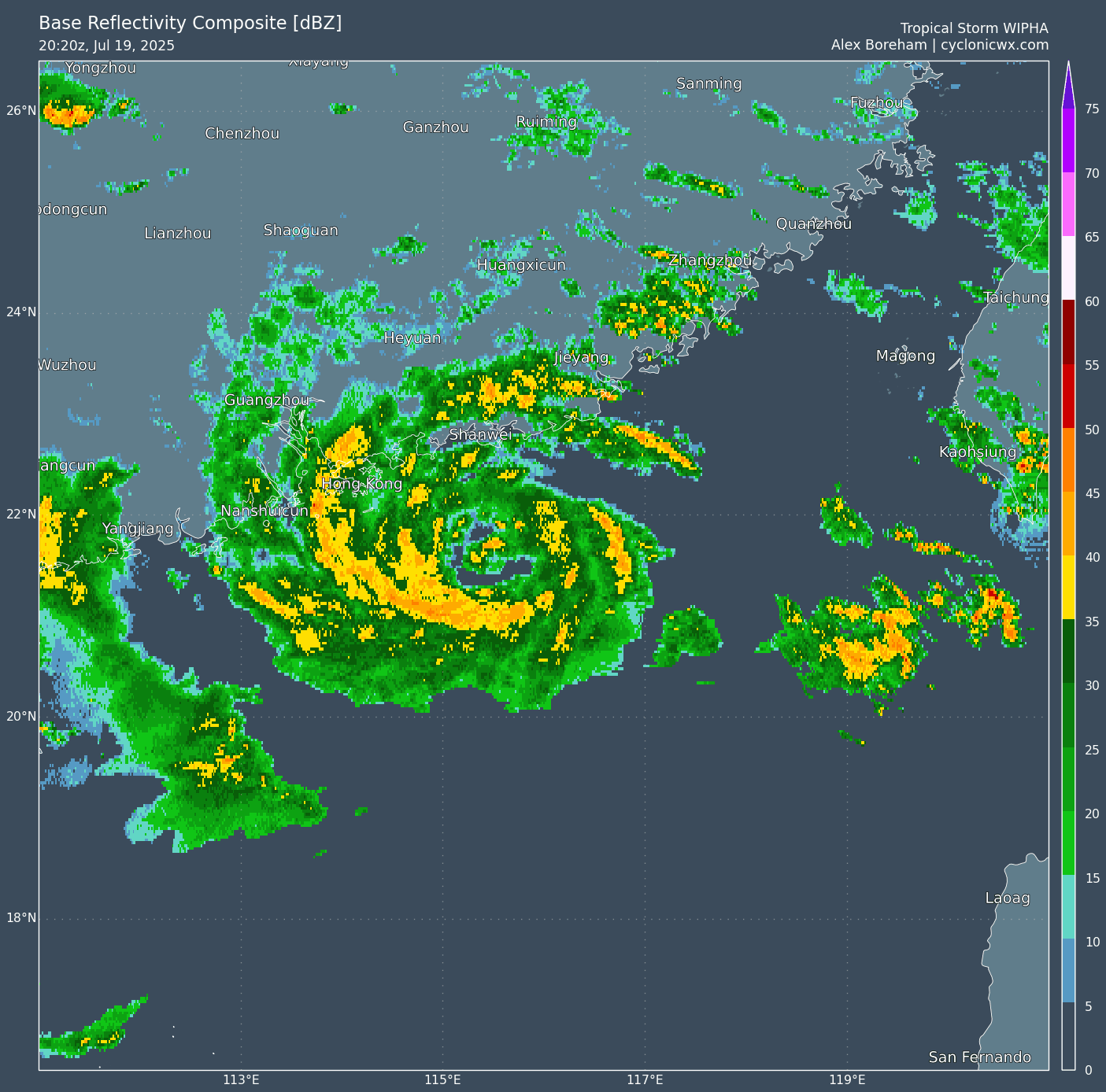
https://s14.gifyu.com/images/bKjfu.jpg
sasha_B wrote:09W WIPHA 250720 0000 21.6N 114.6E WPAC 60 970
Looks like JTWC went with 60 kts / 970 hPa for the 0z Best Track point. (CMA has 70 / 970, and JMA 55 / 975.)


Hurricane2022 wrote:The title of this thread needs to be corrected back to "Severe Tropical Storm", because JMA still hasn't upgraded it (and they probably won't, due to their inexplicable hatred of typhoons that pass through or form in the South China Sea)


cycloneye wrote:Still STS from JMA.

Users browsing this forum: No registered users and 19 guests


