

Moderator: S2k Moderators


hipshot wrote:wxman57 wrote:hipshot wrote:I'm just a lurker and weather nerd so can someone explain to me, so that I can understand, what is going to cause Imelda to make this
90 degree turn OTS. If it's Humberto, how is it tugging on Imelda when they are basically rotating in the same direction, if anything I
would think the stronger storm would push the weaker one more to the west.
Prior to tomorrow, Humberto is producing a steering current from north to south on its western side, causing Imelda to slow down. Once Humberto passes Imelda a little bit more, the jet stream will dip south in Humberto's wake. It is this WSW-ENE jet stream that carries Imelda off to the east-northeast. Humberto isn't pulling on Imelda.
Thanks Wxman, that makes perfect since. Any chance the jet stream backs up to the north.
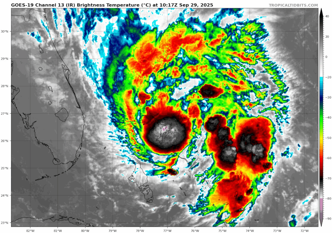
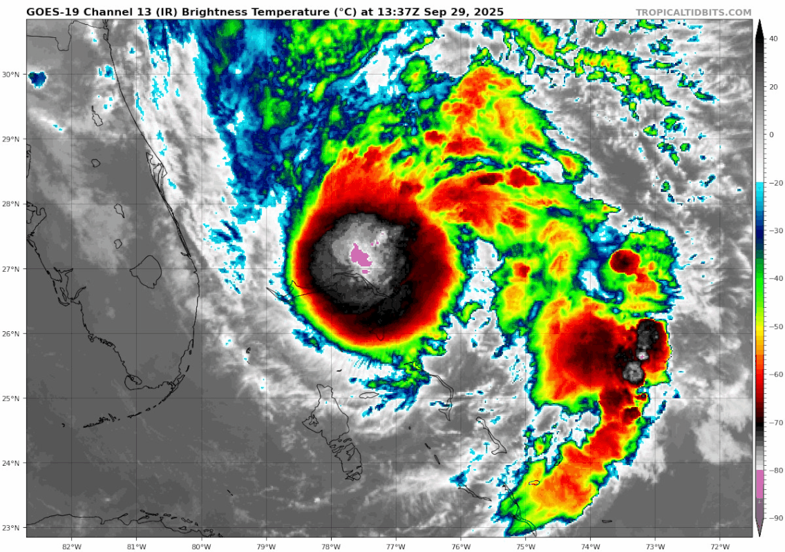
cheezyWXguy wrote:Developing eyewall can be seen on the eastern edge of the Melbourne, FL radar
wxman57 wrote:cheezyWXguy wrote:Developing eyewall can be seen on the eastern edge of the Melbourne, FL radar
The center is about 230 miles SE of Melbourne radar. The radar on the Melbourne NWS office web site doesn't go out to the center. You'd be looking about 30,000 ft above the surface at that distance. The plane is finding evidence of 45 kt wind NE of the center.


ElectricStorm wrote:Think this may have a chance to make a run towards 100kts on approach to Bermuda. First 4 hurricanes becoming majors would probably be something that won't happen again for an extremely long time. Heck even 3 probably won't happen for a while.

Users browsing this forum: No registered users and 123 guests


