https://s4.gifyu.com/images/gfs_mslp_pcpn_watl_fh174_trend.gif
Moderator: S2k Moderators


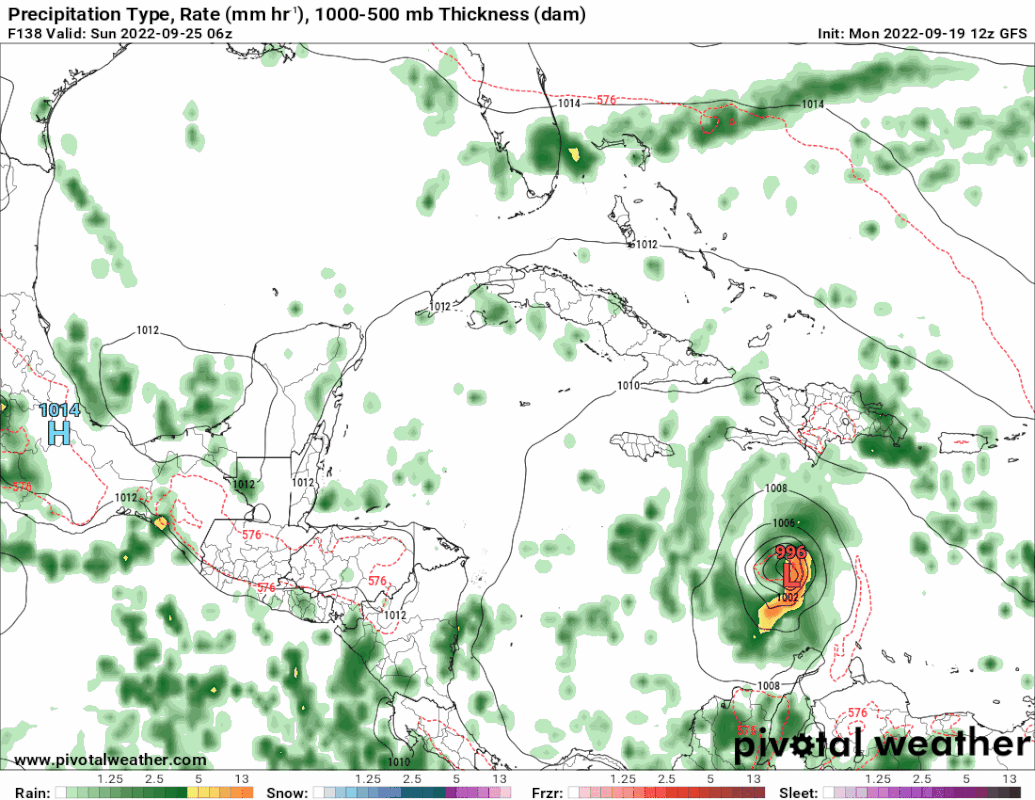
Iceresistance wrote:The GFS is maintaining the intensity of this system as a strong TS (Mid-990s mb) before it reaches the Western Caribbean, I'm really not liking this trend.

Iceresistance wrote:The best analog modelstorm that I can come up with right now is Delta 2020
Iceresistance wrote:The best analog modelstorm that I can come up with right now is Delta 2020
Iceresistance wrote:The GFS is maintaining the intensity of this system as a strong TS (Mid-990s mb) before it reaches the Western Caribbean, I'm really not liking this trend.


skyline385 wrote:Oh boy it’s still going
Sent from my iPhone using Tapatalk
Users browsing this forum: Google [Bot] and 51 guests