#3664 Postby iorange55 » Wed Jan 21, 2026 11:58 pm
Latest from Steve McCauley:
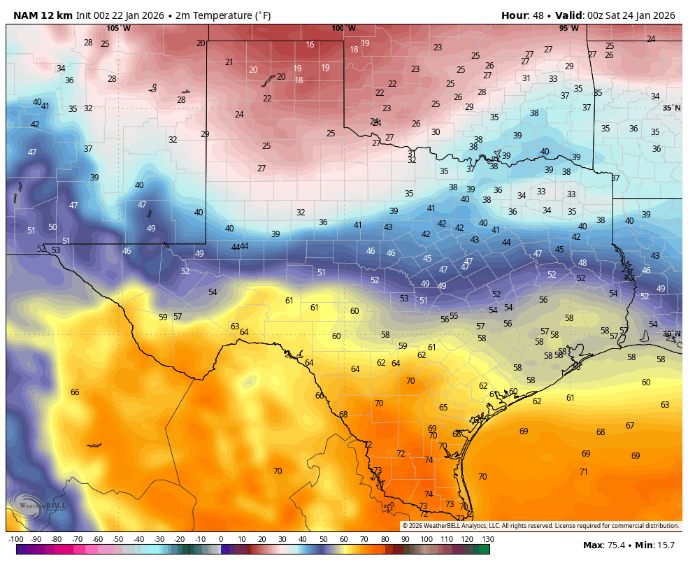
“The storm system off the coast of California is digging to the south and will eventually eject to the NE bringing a wintry mix of precipitation to north Texas this weekend.
In the Metroplex, precipitation will start off as a cold rain on Friday changing to freezing rain and sleet Friday night, and transitioning to mostly sleet on Saturday and then to a mix of snow and sleet late Saturday and Saturday night before ending as all snow Sunday morning as the system exits to the east.
Even though the math shows the system weakening as it moves in - the last thing we want is for it to maintain its current strength since this would make it worse than Feb 2021 - the upper-level storm will have more than enough energy to make a mess of the roads this weekend, and the bitterly cold temperatures are not going to help with wind chills falling below zero Sunday night into Monday morning threatening to freeze exposed pipes and water lines.
As most visitors to this page know, the Stat Method is unable to predict ice and snow accumulations more than 24 hour in advance, and since precipitation in most of the Metroplex is expected to remain liquid through the daylight hours on Friday, we are still more than 24 hours away from the ice / snow in the immediate DFW area.
Even though precise ice/snow totals cannot CURRENTLY be reliably predicted, the math still shows the heaviest snow (whatever that ends up being) to fall across the north and northwest sections of north Texas (and much worse in Oklahoma), the heaviest sleet will be here in the central portions of north Texas, and the heaviest ice will be in the southern and eastern sections of north Texas and down into central Texas. Ultimately, however, most locations will end up seeing all 3 precipitation types; it's just some locations will see more of one than the other two.
The critical question to answer is exactly where will the freezing rain-sleet-snow lines be drawn Friday through Sunday morning. Keep in mind that the lines will be constantly changing over this period as bitterly cold air continues to drain in from the north causing the thickness of the arctic air mass to increase. This, in turn, changes the precipitation type observed at the ground.
Stay tuned...”
8 likes
 The posts in this forum are NOT official forecast and should not be used as such. They are just the opinion of the poster and may or may not be backed by sound meteorological data. They are NOT endorsed by any professional institution or


 and Norman already pulling the trigger so early

