Texas Winter 2025-2026

Winter Weather Discussion

Moderator: S2k Moderators

Forum rules

The posts in this forum are NOT official forecast and should not be used as such. They are just the opinion of the poster and may or may not be backed by sound meteorological data. They are NOT endorsed by any professional institution or STORM2K.

Help Support Storm2K
Message
Author
Jag95
Category 1
Category 1
Posts: 469
Joined: Sat Aug 15, 2009 8:43 pm
Location: Mobile, AL

Re: Texas Winter 2025-2026

#3661 Postby Jag95 » Wed Jan 21, 2026 11:51 pm

Snowman67 wrote:
Stratton23 wrote:Ntxw yeah, taking a peak at the gfs and cmc, their definitely looks to be potentially another winter storm threat around the 29-30th, absolutely insane pattern we are in


I know it's la la land, but the GFS actually shows some snow near Houston on the 30th.


It actually showed 4" around Gainesville, FL on the 18Z. Bears watching I guess, especially if that next slug of polar air makes it down. Euro shows the same system only further south.
Last edited by Jag95 on Wed Jan 21, 2026 11:58 pm, edited 1 time in total.
1 likes   

rwfromkansas
Category 5
Category 5
Posts: 2879
Joined: Sat Aug 27, 2005 12:47 am
Location: North Fort Worth

Re: Texas Winter 2025-2026

#3662 Postby rwfromkansas » Wed Jan 21, 2026 11:54 pm

Our spa is getting delivered on the 30th so I hope it's dry that day at least lol.
0 likes   

User avatar
Ntxw
Storm2k Moderator
Storm2k Moderator
Posts: 23301
Joined: Wed Oct 21, 2009 6:34 pm
Location: DFW, Texas

Re: Texas Winter 2025-2026

#3663 Postby Ntxw » Wed Jan 21, 2026 11:57 pm

rwfromkansas wrote:Our spa is getting delivered on the 30th so I hope it's dry that day at least lol.


GFS has snow/sleet potentially and cold, Canadian has snow storm and temps plunging towards teens on the 30th.
6 likes   
The above post and any post by Ntxw is NOT an official forecast and should not be used as such. It is just the opinion of the poster and may or may not be backed by sound meteorological data. It is NOT endorsed by any professional institution including Storm2k. For official information, please refer to NWS products.

  Help support Storm2K!
Help Support Storm2K

User avatar
iorange55
Category 5
Category 5
Posts: 2395
Joined: Thu Nov 13, 2008 9:47 pm
Location: Big D

Re: Texas Winter 2025-2026

#3664 Postby iorange55 » Wed Jan 21, 2026 11:58 pm

Latest from Steve McCauley:

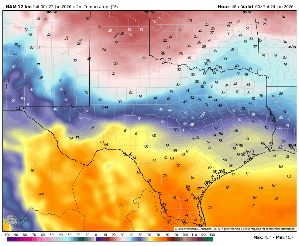
“The storm system off the coast of California is digging to the south and will eventually eject to the NE bringing a wintry mix of precipitation to north Texas this weekend.

In the Metroplex, precipitation will start off as a cold rain on Friday changing to freezing rain and sleet Friday night, and transitioning to mostly sleet on Saturday and then to a mix of snow and sleet late Saturday and Saturday night before ending as all snow Sunday morning as the system exits to the east.

Even though the math shows the system weakening as it moves in - the last thing we want is for it to maintain its current strength since this would make it worse than Feb 2021 - the upper-level storm will have more than enough energy to make a mess of the roads this weekend, and the bitterly cold temperatures are not going to help with wind chills falling below zero Sunday night into Monday morning threatening to freeze exposed pipes and water lines.

As most visitors to this page know, the Stat Method is unable to predict ice and snow accumulations more than 24 hour in advance, and since precipitation in most of the Metroplex is expected to remain liquid through the daylight hours on Friday, we are still more than 24 hours away from the ice / snow in the immediate DFW area.

Even though precise ice/snow totals cannot CURRENTLY be reliably predicted, the math still shows the heaviest snow (whatever that ends up being) to fall across the north and northwest sections of north Texas (and much worse in Oklahoma), the heaviest sleet will be here in the central portions of north Texas, and the heaviest ice will be in the southern and eastern sections of north Texas and down into central Texas. Ultimately, however, most locations will end up seeing all 3 precipitation types; it's just some locations will see more of one than the other two.

The critical question to answer is exactly where will the freezing rain-sleet-snow lines be drawn Friday through Sunday morning. Keep in mind that the lines will be constantly changing over this period as bitterly cold air continues to drain in from the north causing the thickness of the arctic air mass to increase. This, in turn, changes the precipitation type observed at the ground.

Stay tuned...”
6 likes   

User avatar
Texas Snow
S2K Supporter
S2K Supporter
Posts: 804
Joined: Mon Oct 19, 2015 12:06 pm
Location: N. Dallas & Cedar Creek Lake

Re: Texas Winter 2025-2026

#3665 Postby Texas Snow » Thu Jan 22, 2026 12:00 am

rwfromkansas wrote:Our spa is getting delivered on the 30th so I hope it's dry that day at least lol.


You need to request an early delivery. Ain’t nuthin better about a hot tub than a hot tub in the snow.

(Barring an appearance from the Swedish bikini team in said hot tub, naturally )
2 likes   
"Don't let wishcastin get in the way of your forecastin"

Image

User avatar
Edwards Limestone
S2K Supporter
S2K Supporter
Posts: 482
Age: 36
Joined: Tue Dec 28, 2021 11:05 am
Location: Smithson Valley, TX

Re: Texas Winter 2025-2026

#3666 Postby Edwards Limestone » Thu Jan 22, 2026 12:04 am

snownado wrote:
Texas Snow wrote:
snownado wrote:

I don't see how the bolded would be an issue. Pine Trees are built to withstand heavy snow, and most of the other trees are already bare.

But I agree. As awful as it is, sleet is the lesser evil between it and freezing rain.


Guessing you didn’t have any Texas Live Oaks when we got a foot of heavy wet snow. Devastated thousands of trees and lined the streets with debris for a month


I'm not a Texas native (I also wasn't here for Feb. 2010), so I'm not familiar with that specific type of tree.

But that's fair.


We can tell. :D
1 likes   
The above post is NOT an official forecast and should not be used as such. It is just the opinion of the poster and may or may not be backed by sound meteorological data. It is NOT endorsed by any professional institution including Storm2k. For official information, please refer to NWS products.

User avatar
Ntxw
Storm2k Moderator
Storm2k Moderator
Posts: 23301
Joined: Wed Oct 21, 2009 6:34 pm
Location: DFW, Texas

Re: Texas Winter 2025-2026

#3667 Postby Ntxw » Thu Jan 22, 2026 12:11 am

snownado wrote:
cheezyWXguy wrote:
snownado wrote:
I don't see how the bolded would be an issue. Pine Trees are built to withstand heavy snow, and most of the other trees are already bare.

But I agree. As awful as it is, sleet is the lesser evil between it and freezing rain.

I’m fortunate enough to live in an apartment during this storm, and therefore not have to deal with property damage myself, but I have homeowning family and friends who have had well established trees on their properties lose large branches due to snow weighing down trees in past events. It wouldn’t be unheard of for occurrences like that to lead to power outages when snow-heavy branches fall onto power lines. This isn’t really a high risk with sleet, but would definitely be an issue if this amount of qpf fell as snow.


It would have to be the right combination of big snowfall accumulations and really high water content for that to happen, which is very rare with most snowstorms. I suppose Feb 2010 was the perfect storm for that kind of combination though.


Indeed it was a very wet snow. DFW hovered 33F for nearly the entire event, much of the initial ~10" was that pasty snow. Huge flakes though most of the day. 1.08" qpf for 11.2" in the first 24 hours.
5 likes   
The above post and any post by Ntxw is NOT an official forecast and should not be used as such. It is just the opinion of the poster and may or may not be backed by sound meteorological data. It is NOT endorsed by any professional institution including Storm2k. For official information, please refer to NWS products.


  Help support Storm2K!

Help Support Storm2K


User avatar
txtwister78
Category 5
Category 5
Posts: 2060
Joined: Wed Jan 30, 2019 12:56 pm
Location: San Antonio

Re: Texas Winter 2025-2026

#3668 Postby txtwister78 » Thu Jan 22, 2026 12:18 am

By tomorrow evening the short range model guidance will really start to offer some assistance with progression of the arctic air in comparison to the globals. The WRF members (specifically ARW and NSSL) have a pretty good track record along with the RGEM. Take a look at the WRF-NSSL in comparison to the NAM regarding surface temps at 6PM Friday. NSSL has a temp of 28 in San Angelo while the NAM has 51. Lol. Good test case going forward.

Image

Image
6 likes   

Gotwood
Category 2
Category 2
Posts: 697
Joined: Wed Dec 14, 2022 7:18 pm
Location: Brock Tx

Re: Texas Winter 2025-2026

#3669 Postby Gotwood » Thu Jan 22, 2026 12:23 am

txtwister78 wrote:By tomorrow evening the short range model guidance will really start to offer some assistance with progression of the arctic air in comparison to the globals. The WRF members (specifically ARW and NSSL) have a pretty good track record along with the RGEM. Take a look at the WRF-NSSL in comparison to the NAM regarding surface temps at 6PM Friday. NSSL has a temp of 28 in San Angelo while the NAM has 51. Lol. Good test case going forward.

https://m2o.pivotalweather.com/maps/models/hrwnssl/2026012200/048/sfct-imp.us_sc.png

https://images.weatherbell.com/model/nam-218-all/tx/t2m_f/1769040000/1769212800-askyBrILH90.png

NWS says it will be down to 34 by 5pm near my area so that lines up better considering most models are showing the temps not getting to freezing till around midnight.
3 likes   

User avatar
wxman22
Category 5
Category 5
Posts: 1772
Joined: Mon Jan 30, 2006 12:39 am
Location: Wichita Falls, TX
Contact:

Re: Texas Winter 2025-2026

#3670 Postby wxman22 » Thu Jan 22, 2026 1:05 am

Image
0 likes   

Brent
S2K Supporter
S2K Supporter
Posts: 38590
Age: 37
Joined: Sun May 16, 2004 10:30 pm
Location: Tulsa Oklahoma
Contact:

Re: Texas Winter 2025-2026

#3671 Postby Brent » Thu Jan 22, 2026 1:15 am

Tulsa is still saying up to 15 in a watch :double: and Norman already pulling the trigger so early

This is crazy. I definitely think this storm could be actually historic here

The GFS had 18 inches by Monday good grief :double:

Again the record for Tulsa is 14
2 likes   
#neversummer

User avatar
Cerlin
Category 5
Category 5
Posts: 1183
Age: 23
Joined: Thu Dec 08, 2016 12:06 am
Location: Norman, OK

Re: Texas Winter 2025-2026

#3672 Postby Cerlin » Thu Jan 22, 2026 2:38 am

Was supposed to drive to southeast Texas on Friday. Gonna ride this one out in Oklahoma instead! Definitely placing more trust into Euro/WRF solutions than NAM/HRRR at this point, as I believe the NAM especially is struggling with surface temperatures (it's 27 degrees in Norman right now, the recent 3km NAM thinks it's 34). I would not be shocked if this is an event where the initial frontal passage is about 3-6 hours ahead of schedule and sleet happens for the red river before sunset if the models struggle with anomalously cold air like they usually do. Shallow cold always wins!!
1 likes   
Graduate Meteorology Student at the University of Oklahoma!
All opinions independent of employers and the university.


Return to “Winter Weather”

Who is online

Users browsing this forum: kassi, Texas Snowman and 175 guests