Brent wrote:srainhoutx wrote:Apparently no one has seen the Longer Range ECMWF EPS centered on February 4th. Brrrr
Details please lol

Moderator: S2k Moderators
 The posts in this forum are NOT official forecast and should not be used as such. They are just the opinion of the poster and may or may not be backed by sound meteorological data. They are NOT endorsed by any professional institution or STORM2K.


Brent wrote:srainhoutx wrote:Apparently no one has seen the Longer Range ECMWF EPS centered on February 4th. Brrrr
Details please lol


Brent wrote:GFS has a winter storm on February 2nd
mostly south of Dallas it appears


wxman57 wrote:These long-range charts should be no big surprise. I told you I'm working on a Texas winter weather event for mid-February.


gpsnowman wrote::uarrow: Someone correct me if I am wrong, but does that map have a McFarland look to it? I see a slight backwards "S" with Pacific ridging and the central trough.
orangeblood wrote:gpsnowman wrote::uarrow: Someone correct me if I am wrong, but does that map have a McFarland look to it? I see a slight backwards "S" with Pacific ridging and the central trough.
Not quite yet, you need that northeast pacific ridge axis to poke into northwestern Canada while the trough axis stays back over the southwest...the potential is there that's for sure!

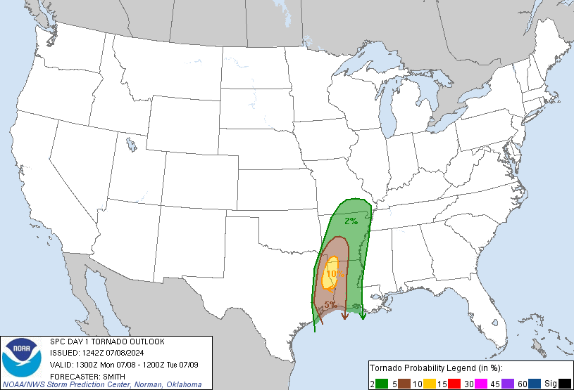
cheezyWXguy wrote:HRRR is trending slightly further west with convective initiation today. Will be interesting to see if the spc reflects that in their next update

Users browsing this forum: Brent and 81 guests


