 The posts in this forum are NOT official forecast and should not be used as such. They are just the opinion of the poster and may or may not be backed by sound meteorological data. They are NOT endorsed by any professional institution or

In my opinion, rather than the danger that the storm tracks west of the I-95 cities, I believe the higher risk is that it is more suppressed along the lines of some earlier runs of the NAM and GFS. The modest shift to the south and east in the forecast storm track on both the 0z NAM and GFS may well be highlighting this somewhat greater risk.
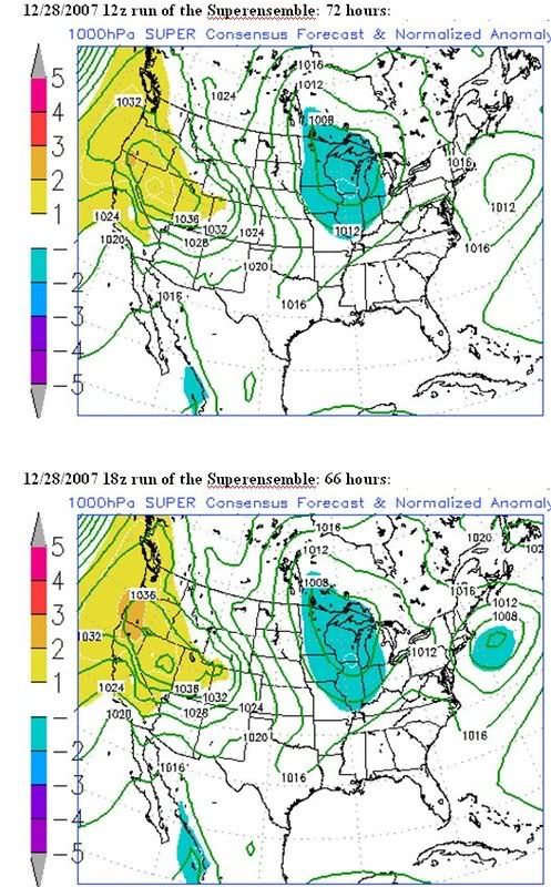
If one examines the 12/28 12z and 18z Superensemble guidance, one finds that there is no strong signal that the expansive Southeast ridge is backing westward nor that it is growing stronger. Instead, one finds only a signal for perhaps a somewhat deeper storm.
Based largely on the good continuity between the 12/28 0z and 12z runs of the ECMWF and GFS and the 12/29 0z runs of the NAM and GFS, my snowfall thoughts are as follows:
High risk of 2" or more; Moderate risk of 4" or more:
Allentown, Boston, Hartford, Providence, Worcester
By the time the storm has departed, Boston should have set a new December snowfall mark. There is the possibility that Boston's December snowfall could reach or exceed 30".
The following cities also have a reasonable potential to pick up several inches of snow, though my confidence is a little lower: Concord, Harrisburg, New York City, Newark, and Portland. Even Philadelphia has a chance to get into the proverbial game.
As has so often been the case this winter, the NAM and GFS have some sizable disagreements. At some point tomorrow, I may make my initial snowfall estimates.


