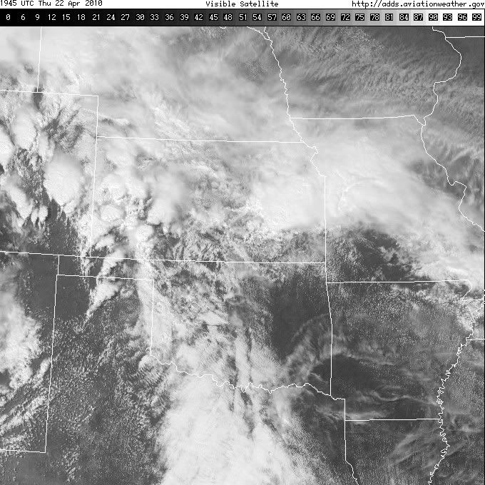
CrazyC83 wrote:Could we see a MDT for today as well at 2000Z over the Panhandles/W OK?
My guess is Yes. I surfed some analysis pages some hours ago and i spotted < 4000 Cape in the ~? AMA area at 0z ?
Moderator: S2k Moderators


SPC and Norman are both analyzing the dryline just to the west of Amarillo right now - I'd think it would be through the area by 00ZBunkertor wrote:My guess is Yes. I surfed some analysis pages some hours ago and i spotted < 4000 Cape in the ~? AMA area at 0z ?


That cell is just devouring the one to its NW, as wellBunkertor wrote:The Hook echo SE of DEN is marvellous


thetruesms wrote:SPC and Norman are both analyzing the dryline just to the west of Amarillo right now - I'd think it would be through the area by 00ZBunkertor wrote:My guess is Yes. I surfed some analysis pages some hours ago and i spotted < 4000 Cape in the ~? AMA area at 0z ?

Exciting, I didn't think they'd go ahead and do itCrazyC83 wrote:Yes indeed, the first Day 1 moderate risk of 2010. Upgraded, awaiting text.

thetruesms wrote:Exciting, I didn't think they'd go ahead and do itCrazyC83 wrote:Yes indeed, the first Day 1 moderate risk of 2010. Upgraded, awaiting text.


I'm thinking perhaps not, because of a potentially small window. The storms should quickly go linear as the cold front overtakes the dry line, decreasing the threat of strong tornadoes. But then again, I was wrong about them throwing in a moderate risk today, so maybe they're up for it!CrazyC83 wrote:I'm wondering if the watch should be canceled and replaced with a new PDS Tornado Watch, seeing how the threat might last well into the night?

thetruesms wrote:I'm thinking perhaps not, because of a potentially small window. The storms should quickly go linear as the cold front overtakes the dry line, decreasing the threat of strong tornadoes. But then again, I was wrong about them throwing in a moderate risk today, so maybe they're up for it!CrazyC83 wrote:I'm wondering if the watch should be canceled and replaced with a new PDS Tornado Watch, seeing how the threat might last well into the night?


Ah, the terrible chaser's dilemma - go to the better shear, or the better instability? One of my friends from school had a blog post earlier about just that topic. She decided to go to the Panhandles and the instability. I hope it works out for herCrazyC83 wrote:MESOSCALE DISCUSSION 0337
NWS STORM PREDICTION CENTER NORMAN OK
0321 PM CDT THU APR 22 2010
AREAS AFFECTED...MUCH OF ERN CO AND WRN KS
CONCERNING...TORNADO WATCH 74...
VALID 222021Z - 222115Z
THE SEVERE WEATHER THREAT FOR TORNADO WATCH 74 CONTINUES.
NUMEROUS SEVERE SUPERCELL THUNDERSTORMS HAVE DEVELOPED WITHIN
UPSLOPE REGION OF THE CNTRL HIGH PLAINS FROM ERN CO INTO WRN KS.
THIS ACTIVITY IS EVOLVING WITHIN STRONGLY FORCED LEFT EXIT REGION OF
UPPER JET...AND CONVERGENT LOW LEVEL ELY FLOW REGIME. ALTHOUGH
INSTABILITY IS NOT PARTICULARLY IMPRESSIVE...LOW CLOUD BASES WITHIN
STRONGLY SHEARED ENVIRONMENT FAVOR A CONTINUED TORNADO THREAT. ONE
PARTICULARLY LONG-LIVED TORNADIC SUPERCELL IS LIFTING NEWD ACROSS
KIOWA COUNTY CO. THIS STORM HAS EDGED INTO WRN PLUME OF GREATER
BOUNDARY LAYER MOISTURE AND COULD MAINTAIN TORNADIC CHARACTERISTICS
FOR SOME TIME...ESPECIALLY IF STORM MERGERS DO NOT INTERRUPT IT/S
INFLOW.
..DARROW.. 04/22/2010

Peanut432 wrote:I'll be here in SW oklahoma waiting. Its been cloudy and cool all day so I not sure what they are seeing
Return to “USA & Caribbean Weather”
Users browsing this forum: A1A, AnnularCane and 128 guests