94E, WILL IT DEVELOP, OR NOT?

This is the general tropical discussion area. Anyone can take their shot at predicting a storms path.

Moderator: S2k Moderators

Forum rules

The posts in this forum are NOT official forecasts and should not be used as such. They are just the opinion of the poster and may or may not be backed by sound meteorological data. They are NOT endorsed by any professional institution or STORM2K. For official information, please refer to products from the National Hurricane Center and National Weather Service.

Help Support Storm2K
Message
Author
User avatar
HURAKAN
Professional-Met
Professional-Met
Posts: 46086
Age: 38
Joined: Thu May 20, 2004 4:34 pm
Location: Key West, FL
Contact:

94E, WILL IT DEVELOP, OR NOT?

#1 Postby HURAKAN » Mon Jun 07, 2004 8:52 pm

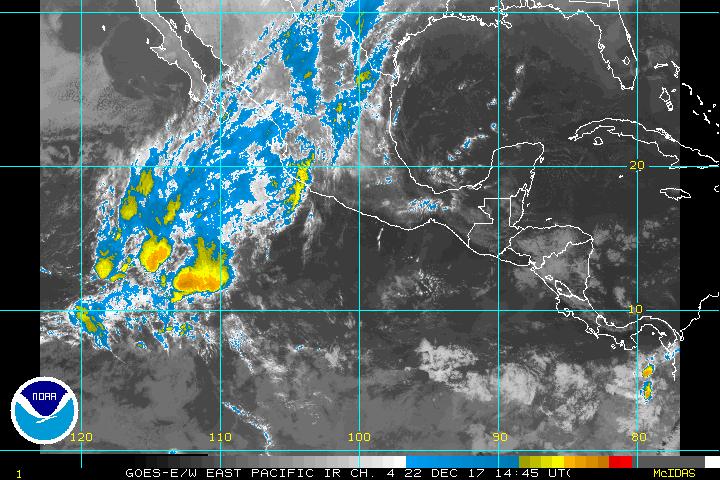
The disturbance off the Mexican coast near Manzanillo has been trying to develop for a few days but the shear has not let it do so. For a few days we have been expecting the possible development of at least TD-2E but every time we see thunderstorms developing over the low level circulation, a few hours later they just die out. The low have been through many or several bursting situationS but none of them have been permanent. At this moment, 9:53 P.M. EDT, a new cluster of thunderstorms is developing of what seems to be the low level circulation. Something that we have seen since the beginning is that the system has maintain its distance from the coast moving in a parallel way. Although it may not be right I think this system will not develop into nothing more of what now it is, a low level circulation system. I believe the future of the low will be moving toward the Mexican coast and after landfall dissipate, or just dissipate over water, simply because shear doesn't seems to be relaxing over the system.

Image

http://cimss.ssec.wisc.edu/tropic/real- ... g9shr.html

SANDY DELGADO
0 likes   

User avatar
Aquawind
Category 5
Category 5
Posts: 6714
Age: 62
Joined: Mon Jun 16, 2003 10:41 pm
Location: Salisbury, NC
Contact:

#2 Postby Aquawind » Mon Jun 07, 2004 9:17 pm

It's a close call..If the Current storms are still there in the morning with some deep convection at the LLC it could make TD status...It needs some deep convection to persist alrighty..
0 likes   

User avatar
USAwx1
Professional-Met
Professional-Met
Posts: 936
Joined: Mon Apr 26, 2004 5:57 pm
Location: Marineland, FL

#3 Postby USAwx1 » Mon Jun 07, 2004 9:20 pm

Aquawind wrote:It's a close call..If the Current storms are still there in the morning with some deep convection at the LLC it could make TD status...It needs some deep convection to persist alrighty..


As it can develop as much deep convection as it wants, BUT if it remains disjointed from the LLC, then development won't occur anyway. Right now the MOST it is doing is bringing some rain/wind and squalls to the coast of Mexico.

The circulation center MUST remained intact as well.
0 likes   

User avatar
Aquawind
Category 5
Category 5
Posts: 6714
Age: 62
Joined: Mon Jun 16, 2003 10:41 pm
Location: Salisbury, NC
Contact:

#4 Postby Aquawind » Mon Jun 07, 2004 9:32 pm

Stacked with Deep convection overhead..ohh yeahhh..Thats what we be talkin about.. 8-)
0 likes   


Return to “Talkin' Tropics”

Who is online

Users browsing this forum: USTropics and 124 guests