Low Pressure in the Northwest Caribbean Sea (Is Invest 93L)
Moderator: S2k Moderators
Forum rules

The posts in this forum are NOT official forecasts and should not be used as such. They are just the opinion of the poster and may or may not be backed by sound meteorological data. They are NOT endorsed by any professional institution or STORM2K. For official information, please refer to products from the National Hurricane Center and National Weather Service.
-
lsuhurricane
- Category 1

- Posts: 270
- Joined: Tue Aug 15, 2017 2:53 pm
Re: Possible Development in the Northwestern Caribbean
12z Euro with 990mb on landfall at Cedar Key, FL
0 likes

Re: Possible Development in the Northwestern Caribbean
Today's 12z shows a strong TS with wind gusts to hurricane force but not as strong as yesterday's 12z run.
12z GFS & 12z Euro are still worlds apart in the mid & UL environment past 48 hrs.

12z GFS & 12z Euro are still worlds apart in the mid & UL environment past 48 hrs.
2 likes
-
SFLcane

- S2K Supporter

- Posts: 10281
- Age: 48
- Joined: Sat Jun 05, 2010 1:44 pm
- Location: Lake Worth Florida
Re: Possible Development in the Northwestern Caribbean
NDG wrote:Today's 12z shows a strong TS with wind gusts to hurricane force but not as strong as yesterday's 12z run.
12z GFS & 12z Euro are still worlds apart in the mid & UL environment past 48 hrs.
https://i.imgur.com/42jHqBX.gif
Yea id wait really to see were things stand until it moves into the caribbean. Models till then will be all over the place
0 likes
-
Sciencerocks
- Category 5

- Posts: 10193
- Age: 40
- Joined: Thu Jul 06, 2017 1:51 am

Re: Possible Development in the Northwestern Caribbean
Well a weak storm wouldn't surprise me as I have lived here 30 years and never had a properly powerful non lopsided no air entrained hurricane hit us up here directly in the tampabay area. I live in hernando county. Granted we had Irma but right on the west coast in this particular area wasn't nowhere near as bad as other areas. There is always sheer making it lopsided or dry air getting mixed into the core that has saved our area I don't know how many times. But those on the immediate coast who still get flooded would disagree with me. We had an 'A' TS storm a few years back that caused flooding a good 15 miles inland. We were also hit but seriously weakened by jeanne and francis in 2004. But a strong hurricane nope and thank goodness for that.
0 likes
Robbielyn McCrary
I know just about enough to sound like I know what I'm talking about sometimes. But for your safety please follow the nhc for truly professional forecasting.
I know just about enough to sound like I know what I'm talking about sometimes. But for your safety please follow the nhc for truly professional forecasting.
Re: Possible Development in the Northwestern Caribbean
12 Euro (Fasr) closest to landfall frame. When the full set comes out we'll have one closer to the landfall point. Strong TS/Cat1 probably.

1 likes
-
Stratton23
- Category 5
- Posts: 3574
- Joined: Fri Jul 21, 2023 10:59 pm
- Location: Katy, Tx
Re: Possible Development in the Northwestern Caribbean
A track to Florida is not set in stone yet, 12z GEPS guidance has a huge spread, yeah the EPS may make it look like florida is a guaranteed hit, that definitely is far from the case, its going to depend on the timing on this system moving north and a weak front coming in from the north, lots can still change
0 likes
-
lsuhurricane
- Category 1
- Posts: 270
- Joined: Tue Aug 15, 2017 2:53 pm
Re: Possible Development in the Northwestern Caribbean
Stratton23 wrote:A track to Florida is not set in stone yet, 12z GEPS guidance has a huge spread, yeah the EPS may make it look like florida is a guaranteed hit, that definitely is far from the case, its going to depend on the timing on this system moving north and a weak front coming in from the north, lots can still change
Agree with you on that. Interaction with the Yucatan Peninsula ultimately decides where the lower pressure center develops. Both GFS and Euro have different outcomes with respect to entanglement. Will it pop out to the east of the peninsula or north. Track deviations are sure to occur
1 likes
-
AtlanticWind

- S2K Supporter
- Posts: 1898
- Age: 67
- Joined: Sun Aug 08, 2004 9:57 pm
- Location: Plantation,Fla
Re: Possible Development in the Northwestern Caribbean
Stratton23 wrote:A track to Florida is not set in stone yet, 12z GEPS guidance has a huge spread, yeah the EPS may make it look like florida is a guaranteed hit, that definitely is far from the case, its going to depend on the timing on this system moving north and a weak front coming in from the north, lots can still change
It may not be set in stone but it is very likely this system would
strike somewhere in Florida from Naples to the panhandle.
2 likes
Re: Possible Development in the Northwestern Caribbean
Stratton23 wrote:A track to Florida is not set in stone yet, 12z GEPS guidance has a huge spread, yeah the EPS may make it look like florida is a guaranteed hit, that definitely is far from the case, its going to depend on the timing on this system moving north and a weak front coming in from the north, lots can still change
GEPS has some members as far west as Texas and Louisiana I would think it would be more likely to take the eastern route to FL west coast or panhandle, but it is hard to know exactly where it is going to go until we get a low level center which we don’t have right now. Land interaction with Central America and or the Yucatán could also throw a wrench into things.
0 likes

-
Stratton23
- Category 5
- Posts: 3574
- Joined: Fri Jul 21, 2023 10:59 pm
- Location: Katy, Tx
Re: Possible Development in the Northwestern Caribbean
Exactly, lets see what happens when the energy interacts with the yucatan peninsula, dont want anyone caught off guard if something unexpected happens
0 likes
-
lsuhurricane
- Category 1
- Posts: 270
- Joined: Tue Aug 15, 2017 2:53 pm

Re: Possible Development in the Northwestern Caribbean
It always seems that the Ians and Michaels and Ivans all either hit SW FL or Panama City points or points west of Applachicola. Our area, the area in between have been very very fortunate. If we get anything in this area, it usually is a sloppy right sided dry air entrained system. Im not complaining either.
0 likes
Robbielyn McCrary
I know just about enough to sound like I know what I'm talking about sometimes. But for your safety please follow the nhc for truly professional forecasting.
I know just about enough to sound like I know what I'm talking about sometimes. But for your safety please follow the nhc for truly professional forecasting.
-
chris_fit

- Category 5
- Posts: 3261
- Age: 43
- Joined: Wed Sep 10, 2003 11:58 pm
- Location: Tampa Bay Area, FL
Re: Possible Development in the Northwestern Caribbean
lsuhurricane wrote:Closer look at the 12s EPS...
https://i.ibb.co/FHJ79wk/14-km-EPS-Global-Cyclones-Gulf-of-Mexico-Ens-MSLP-Spaghettios-5.gif
Can you repost? All I see is an empty GoM
0 likes
Re: Possible Development in the Northwestern Caribbean
This setup toward the end of the Euro run is setting up to be interesting too with a possible loop back. May not be the end of it if it goes over Florida.

Last edited by BobHarlem on Thu Aug 24, 2023 3:04 pm, edited 1 time in total.
1 likes
-
SFLcane
- S2K Supporter
- Posts: 10281
- Age: 48
- Joined: Sat Jun 05, 2010 1:44 pm
- Location: Lake Worth Florida
Re: Possible Development in the Northwestern Caribbean
chris_fit wrote:lsuhurricane wrote:Closer look at the 12s EPS...
https://i.ibb.co/FHJ79wk/14-km-EPS-Global-Cyclones-Gulf-of-Mexico-Ens-MSLP-Spaghettios-5.gif
Can you repost? All I see is an empty GoM
0 likes
-
Spacecoast

- Category 2

- Posts: 773
- Joined: Thu Aug 31, 2017 2:03 pm
Re: Possible Development in the Northwestern Caribbean
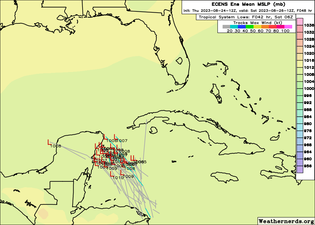
12z EPS Prob's:
70% prob for TD

50% prob for TS

<10% prob for Hurr

70% prob for TD
50% prob for TS
<10% prob for Hurr
0 likes
Re: Possible Development in the Northwestern Caribbean
Euro ensembles some clustered more south this run.
Two main clusters. Biggest cluster from Cedar Key to Naples, and the smaller cluster around Panama City. I would go around Tampa.
It seems the strong ensemble members are the more north ones with more time over water. South of Tampa weaker storm.
Two main clusters. Biggest cluster from Cedar Key to Naples, and the smaller cluster around Panama City. I would go around Tampa.
It seems the strong ensemble members are the more north ones with more time over water. South of Tampa weaker storm.
0 likes
Re: Possible Development in the Northwestern Caribbean
I think I saw some 930s and 940s in the EPS ensemble.
0 likes
Who is online
Users browsing this forum: Iceresistance and 156 guests