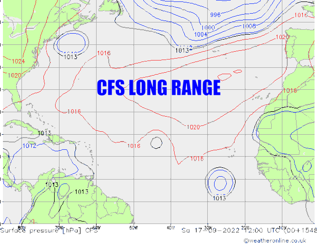
cycloneye wrote:SFLcane wrote:My treat for S2K for today! Enjoy your weekend guys

https://i.postimg.cc/Hs0xGH6g/CFS.gif
A slower loop to see it better.
Your wish is my command!
Moderator: S2k Moderators


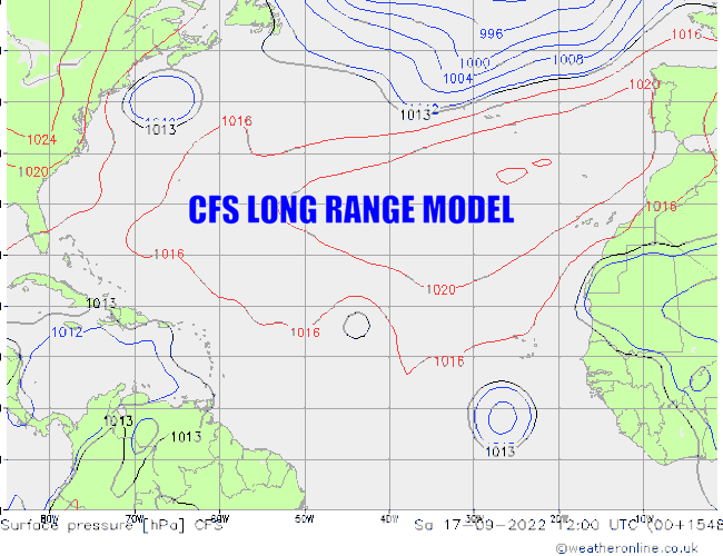
cycloneye wrote:SFLcane wrote:My treat for S2K for today! Enjoy your weekend guys
https://i.postimg.cc/Hs0xGH6g/CFS.gif
A slower loop to see it better.


SFLcane wrote:cycloneye wrote:SFLcane wrote:My treat for S2K for today! Enjoy your weekend guys
https://i.postimg.cc/Hs0xGH6g/CFS.gif
A slower loop to see it better.
Your wish is my command!
https://i.postimg.cc/mktQXkYB/CFS2-JPEG.gif


SFLcane wrote:

Spacecoast wrote:SFLcane wrote:https://i.postimg.cc/xTRRMj7x/hurricane.jpg
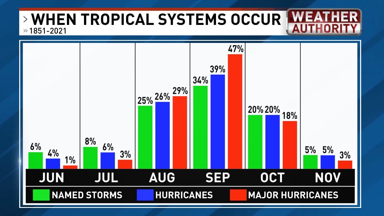
Transposing the above distribution into CSU 2022 forecast of:
20 Named Storms
10 Hurricanes
5 Major Hurricanes
https://i.ibb.co/RTfhWWh/sched.jpg
This suggests 8 Named Stroms, 4 Hurricanes, and 1 Major will occur by the end of August.


Category5Kaiju wrote:So I came across some comments on weather social media where individuals are mentioning that they have a "gut feeling" this is going to be a bust season, and their evidence is due to the SAL, wind shear, active EPAC, and TUTT. That's it.
Referring off of captainbarbossa's timeline, looks like we're on track!


skyline385 wrote:Not an expert on Atl Nina either, not sure how this would work. Maybe an expert here can explain a bit.
https://twitter.com/tybtime/status/1547950359636676610


DorkyMcDorkface wrote:Looks like Euro and CMC are anticipating for a big monsoon trough in the eastern/central MDR by the time the MJO reaches Africa and reinvigorates the WAM later this month. Would serve to slow down trades significantly and allow for another warm up down there if it were to come to fruition.
https://i.ibb.co/5snQbFc/ec-fast-uv850-vort-eatl-6.png
https://i.ibb.co/Br1pKvb/gem-z850-vort-eatl-21-1.png
https://i.ibb.co/c8g0yV2/ec-fast-u850a-Mean-eatl-fh120-240.gif
https://i.ibb.co/TcQ4zYv/gem-u850a-Mean-eatl-fh120-240-1.gif
GFS is less enthusiastic but that's probably because it stalls out the MJO further west (which would also explain the constant stream of long-range EPAC storms it keeps pumping out). Knowing GFS' biases towards phase 8 of the MJO, along with the fact that the La Niña base state isn't exactly permissive of such a pattern, I find this hard to believe for the most part.
https://i.ibb.co/dfvJ8vz/gfs-z850-vort-eatl-31.png


Teban54 wrote:DorkyMcDorkface wrote:Looks like Euro and CMC are anticipating for a big monsoon trough in the eastern/central MDR by the time the MJO reaches Africa and reinvigorates the WAM later this month. Would serve to slow down trades significantly and allow for another warm up down there if it were to come to fruition.
https://i.ibb.co/5snQbFc/ec-fast-uv850-vort-eatl-6.png
https://i.ibb.co/Br1pKvb/gem-z850-vort-eatl-21-1.png
https://i.ibb.co/c8g0yV2/ec-fast-u850a-Mean-eatl-fh120-240.gif
https://i.ibb.co/TcQ4zYv/gem-u850a-Mean-eatl-fh120-240-1.gif
GFS is less enthusiastic but that's probably because it stalls out the MJO further west (which would also explain the constant stream of long-range EPAC storms it keeps pumping out). Knowing GFS' biases towards phase 8 of the MJO, along with the fact that the La Niña base state isn't exactly permissive of such a pattern, I find this hard to believe for the most part.
https://i.ibb.co/dfvJ8vz/gfs-z850-vort-eatl-31.png
Is it just me, or has "models show another period of slow trades which could warm up the MDR" been suggested numerous times since June with few of them actually materializing?
skyline385 wrote:Not an expert on Atl Nina either, not sure how this would work. Maybe an expert here can explain a bit.
https://twitter.com/tybtime/status/1547950359636676610
Teban54 wrote:DorkyMcDorkface wrote:Looks like Euro and CMC are anticipating for a big monsoon trough in the eastern/central MDR by the time the MJO reaches Africa and reinvigorates the WAM later this month. Would serve to slow down trades significantly and allow for another warm up down there if it were to come to fruition.
https://i.ibb.co/5snQbFc/ec-fast-uv850-vort-eatl-6.png
https://i.ibb.co/Br1pKvb/gem-z850-vort-eatl-21-1.png
https://i.ibb.co/c8g0yV2/ec-fast-u850a-Mean-eatl-fh120-240.gif
https://i.ibb.co/TcQ4zYv/gem-u850a-Mean-eatl-fh120-240-1.gif
GFS is less enthusiastic but that's probably because it stalls out the MJO further west (which would also explain the constant stream of long-range EPAC storms it keeps pumping out). Knowing GFS' biases towards phase 8 of the MJO, along with the fact that the La Niña base state isn't exactly permissive of such a pattern, I find this hard to believe for the most part.
https://i.ibb.co/dfvJ8vz/gfs-z850-vort-eatl-31.png
Is it just me, or has "models show another period of slow trades which could warm up the MDR" been suggested numerous times since June with few of them actually materializing?

DorkyMcDorkface wrote:Teban54 wrote:DorkyMcDorkface wrote:Looks like Euro and CMC are anticipating for a big monsoon trough in the eastern/central MDR by the time the MJO reaches Africa and reinvigorates the WAM later this month. Would serve to slow down trades significantly and allow for another warm up down there if it were to come to fruition.
https://i.ibb.co/5snQbFc/ec-fast-uv850-vort-eatl-6.png
https://i.ibb.co/Br1pKvb/gem-z850-vort-eatl-21-1.png
https://i.ibb.co/c8g0yV2/ec-fast-u850a-Mean-eatl-fh120-240.gif
https://i.ibb.co/TcQ4zYv/gem-u850a-Mean-eatl-fh120-240-1.gif
GFS is less enthusiastic but that's probably because it stalls out the MJO further west (which would also explain the constant stream of long-range EPAC storms it keeps pumping out). Knowing GFS' biases towards phase 8 of the MJO, along with the fact that the La Niña base state isn't exactly permissive of such a pattern, I find this hard to believe for the most part.
https://i.ibb.co/dfvJ8vz/gfs-z850-vort-eatl-31.png
Is it just me, or has "models show another period of slow trades which could warm up the MDR" been suggested numerous times since June with few of them actually materializing?
None of those prior scenarios depicted had an MJO-generated monsoon trough iirc, just -NAO and/or cutoff lows. This is different.
Additionally as mentioned above by another poster most of those modeled trade relaxations from months prior did verify, otherwise this wouldn't have happened:


zzh wrote:https://i.imgur.com/y1Jxcp8.png
https://i.imgur.com/aiDVyFx.png
Very large divergence between EPS and GEFS.


DorkyMcDorkface wrote:zzh wrote:https://i.imgur.com/y1Jxcp8.png
https://i.imgur.com/aiDVyFx.png
Very large divergence between EPS and GEFS.
Ya again the placement of the MJO makes all the difference. African Standing Wave on EPS vs. South American Standing Wave on GEFS.
https://i.ibb.co/GkbQwvJ/eps-chi200-global-27.png
https://i.ibb.co/jHqF3m2/gfs-ens-chi200-global-27.png

