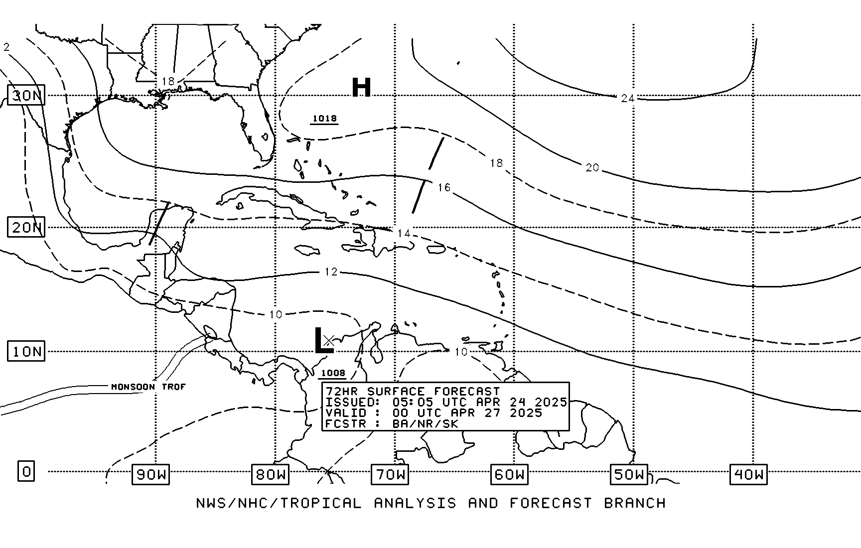
Low Pressure in the NW Caribbean/SE GOM: 1006mb
Moderator: S2k Moderators
Forum rules
The posts in this forum are NOT official forecasts and should not be used as such. They are just the opinion of the poster and may or may not be backed by sound meteorological data. They are NOT endorsed by any professional institution or STORM2K. For official information, please refer to products from the National Hurricane Center and National Weather Service.
- HURAKAN
- Professional-Met

- Posts: 46086
- Age: 38
- Joined: Thu May 20, 2004 4:34 pm
- Location: Key West, FL
- Contact:
DON'T START PULLING YOUR HAIRS AND MAKING ALL KIND OF PREDICTIONS!!!
48 hrs.

72 hrs.

http://www.nhc.noaa.gov/tafb-atl.shtml
48 hrs.

72 hrs.

http://www.nhc.noaa.gov/tafb-atl.shtml
0 likes
Y'all ought to be glad it is May! Visible Loop is showing a highly sheared, but seemingly developing area of low pressure near 17N 83W.
http://wwwghcc.msfc.nasa.gov/GOES/goeseastconus.html
http://wwwghcc.msfc.nasa.gov/GOES/goeseastconus.html
0 likes
- HURAKAN
- Professional-Met

- Posts: 46086
- Age: 38
- Joined: Thu May 20, 2004 4:34 pm
- Location: Key West, FL
- Contact:
http://www.ndbc.noaa.gov/station_page.php?station=42057
This station is very close to the south of the convection and it's showing easterly winds, meaning, no circulation at the surface. At least just yet.
This station is very close to the south of the convection and it's showing easterly winds, meaning, no circulation at the surface. At least just yet.
0 likes
- cycloneye
- Admin

- Posts: 148753
- Age: 69
- Joined: Thu Oct 10, 2002 10:54 am
- Location: San Juan, Puerto Rico
FRONTAL WAVE IN THE SOUTHWEST ATLANTIC...
AS A RESULT OF THE VIGOROUS SHRTWV DIGGING INTO THE ERN STATES ON
DAY 3...ALL MODELS FORECAST BAROCLINIC CYCLOGENESIS OVER THE SW
ATL...OFFSHORE THE SE CONUS COAST. THE GFS...LIKE
YESTERDAY...STILL BRINGS A WEAK TROPICAL LOW NORTH TO NORTHEAST
INTO THE BAHAMAS BY DAY 3...WITH AN ORIGIN SOMEWHERE OVER THE NW
CARIBBEAN ON DAYS 2. HOWEVER...MOST OF THE GLOBAL GUIDANCE KEYS
IN ON THE BAROCLINIC DEVELOPMENT OFFSHORE THE CAROLINAS ON DAY
3...WITH THE GFS/NAM/ECMWF/CMC FAIRLY CLOSE TO ONE ANOTHER...WHILE
THE UKMET IS THE SLOWEST OF THE BUNCH. NEARLY HALF OF THE 12Z
NCEP ENS MEMBERS WERE AS FAR NORTH AS THE GFS/NAM/ECMWF/CMC
CONSENSUS...WHILE THE OTHER HALF WAS SLOWER LIKE THE UKMET. GIVEN
THAT WE ARE FAVORING A MORE PROGRESSIVE SOLN OVER THE NORTHEAST ON
DAY 3...IT STANDS TO REASON THAT THE MORE NORTHWARD CAMP OF
SOLNS...GIVEN BY THE GFS/NAM/ECMWF/CMC...IS THE WAY TO GO.
http://www.hpc.ncep.noaa.gov/discussions/pmdhmd.html
Discussion about the model scenarios by HPC.
0 likes
Visit the Caribbean-Central America Weather Thread where you can find at first post web cams,radars
and observations from Caribbean basin members Click Here
and observations from Caribbean basin members Click Here
- AnnularCane
- S2K Supporter

- Posts: 2949
- Joined: Thu Jun 08, 2006 9:18 am
- Location: Wytheville, VA
- MusicCityMan
- Category 1

- Posts: 483
- Joined: Sat Feb 17, 2007 10:57 pm
- Location: Somewhere in Central Florida
-
jaxfladude
- Category 5

- Posts: 1249
- Joined: Wed Aug 24, 2005 9:36 pm
- Location: Jacksonville, Fla
-
Scorpion
- deltadog03
- Professional-Met

- Posts: 3580
- Joined: Tue Jul 05, 2005 6:16 pm
- Location: Macon, GA
- Evil Jeremy
- S2K Supporter

- Posts: 5463
- Age: 32
- Joined: Mon Apr 10, 2006 2:10 pm
- Location: Los Angeles, CA
- Evil Jeremy
- S2K Supporter

- Posts: 5463
- Age: 32
- Joined: Mon Apr 10, 2006 2:10 pm
- Location: Los Angeles, CA
- HURAKAN
- Professional-Met

- Posts: 46086
- Age: 38
- Joined: Thu May 20, 2004 4:34 pm
- Location: Key West, FL
- Contact:
Evil Jeremy wrote:wow. but, as the other topic says, for entertainment only!
It's a computer model projection into the future, therefore, we know that there could be an element of truth to it but it could also be just a miscalculation by the model. So, it's for entertainment mainly until it verifies, if so.
0 likes
Low level turning is noted in the NW Caribbean.
Buoys and ships also show this at low levels:
http://coolwx.com/buoydata/regions/caribplot.php
Buoys and ships also show this at low levels:
http://coolwx.com/buoydata/regions/caribplot.php
0 likes
- deltadog03
- Professional-Met

- Posts: 3580
- Joined: Tue Jul 05, 2005 6:16 pm
- Location: Macon, GA
Who is online
Users browsing this forum: No registered users and 43 guests


