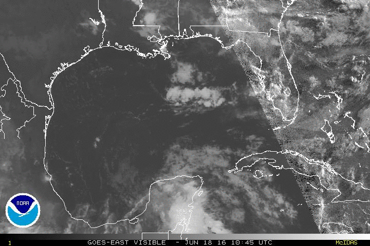
Cyclonic spin centered over Mobile bay
Moderator: S2k Moderators
Forum rules

The posts in this forum are NOT official forecasts and should not be used as such. They are just the opinion of the poster and may or may not be backed by sound meteorological data. They are NOT endorsed by any professional institution or STORM2K. For official information, please refer to products from the National Hurricane Center and National Weather Service.
-
rolltide

- Tropical Storm

- Posts: 234
- Age: 65
- Joined: Thu Sep 09, 2004 5:33 pm
- Location: Pensacola Florida
Cyclonic spin centered over Mobile bay
Any chance this drops south into the GOM?
Last edited by tolakram on Tue Jul 22, 2014 11:57 am, edited 1 time in total.
Reason: updated title
Reason: updated title
0 likes
-
northjaxpro

- S2K Supporter

- Posts: 8900
- Joined: Mon Sep 27, 2010 11:21 am
- Location: Jacksonville, FL
Re: Aanticyclonic spin centered over Mobile bay
It is an Upper Level Low. This feature is retrograding westward along the coast as the Bermuda High builds back in from the SW Atlantic. I am not anticipating development from this ULL at this time.
0 likes
NEVER, EVER SAY NEVER in the tropics and weather in general, and most importantly, with life itself!!
________________________________________________________________________________________
Fay 2008 Beryl 2012 Debby 2012 Colin 2016 Hermine 2016 Julia 2016 Matthew 2016 Irma 2017 Dorian 2019
________________________________________________________________________________________
Fay 2008 Beryl 2012 Debby 2012 Colin 2016 Hermine 2016 Julia 2016 Matthew 2016 Irma 2017 Dorian 2019
-
tropicwatch

- Category 5

- Posts: 3427
- Age: 62
- Joined: Sat Jun 02, 2007 10:01 am
- Location: The Villages, Florida
- Contact:
It looks like it has been sliding a little further south. If it makes it to the GOM I don't think it will be around long enough to sink to the surface.
0 likes
Tropicwatch
Agnes 72', Eloise 75, Elena 85', Kate 85', Charley 86', Florence 88', Beryl 94', Dean 95', Erin 95', Opal 95', Earl 98', Georges 98', Ivan 2004', Arlene 2005', Dennis 2005', Ida 2009' Debby 2012' Irma 2017' Michael 2018'
Agnes 72', Eloise 75, Elena 85', Kate 85', Charley 86', Florence 88', Beryl 94', Dean 95', Erin 95', Opal 95', Earl 98', Georges 98', Ivan 2004', Arlene 2005', Dennis 2005', Ida 2009' Debby 2012' Irma 2017' Michael 2018'
-
northjaxpro
- S2K Supporter
- Posts: 8900
- Joined: Mon Sep 27, 2010 11:21 am
- Location: Jacksonville, FL
The ULL may be currently drifting a little south of west, but eventually will likely move or drift more westward right along the coast of MS and into LA as the ridge will build in from the east.
0 likes
NEVER, EVER SAY NEVER in the tropics and weather in general, and most importantly, with life itself!!
________________________________________________________________________________________
Fay 2008 Beryl 2012 Debby 2012 Colin 2016 Hermine 2016 Julia 2016 Matthew 2016 Irma 2017 Dorian 2019
________________________________________________________________________________________
Fay 2008 Beryl 2012 Debby 2012 Colin 2016 Hermine 2016 Julia 2016 Matthew 2016 Irma 2017 Dorian 2019
-
fwbbreeze

- S2K Supporter
- Posts: 898
- Joined: Sun Mar 21, 2004 10:09 pm
- Location: Fort Walton Beach, FL
Re: Aanticyclonic spin centered over Mobile bay
It does appear to be upper level...but the storms along the coast are rotating towards the center.
0 likes
-
tropicwatch
- Category 5
- Posts: 3427
- Age: 62
- Joined: Sat Jun 02, 2007 10:01 am
- Location: The Villages, Florida
- Contact:
Re: Aanticyclonic spin centered over Mobile bay
fwbbreeze wrote:It does appear to be upper level...but the storms along the coast are rotating towards the center.
Noticed that too!
0 likes
Tropicwatch
Agnes 72', Eloise 75, Elena 85', Kate 85', Charley 86', Florence 88', Beryl 94', Dean 95', Erin 95', Opal 95', Earl 98', Georges 98', Ivan 2004', Arlene 2005', Dennis 2005', Ida 2009' Debby 2012' Irma 2017' Michael 2018'
Agnes 72', Eloise 75, Elena 85', Kate 85', Charley 86', Florence 88', Beryl 94', Dean 95', Erin 95', Opal 95', Earl 98', Georges 98', Ivan 2004', Arlene 2005', Dennis 2005', Ida 2009' Debby 2012' Irma 2017' Michael 2018'

Re: Aanticyclonic spin centered over Mobile bay
http://www.ssd.noaa.gov/goes/east/wfo/mob/mflash-rgb.html
If you check the wind box, it appears that there is a very weak surface reflection.
If you check the wind box, it appears that there is a very weak surface reflection.
0 likes
The above post is not official and should not be used as such. It is the opinion of the poster and may or may not be backed by sound meteorological data. It is not endorsed by any professional institution or storm2k.org. For official information, please refer to the NHC and NWS products.
-
tropicwatch
- Category 5
- Posts: 3427
- Age: 62
- Joined: Sat Jun 02, 2007 10:01 am
- Location: The Villages, Florida
- Contact:
Re:
djones65 wrote:Title needs to be changed... In northern hemisphere low pressure spins CYCLONICALLY, not "anti-cyclonic."
And yes, 12Z surface analysis depicts 1016-1017 mb surface low vertically stacked with the upper level circulation and progged to move west southwest along the coast.
Knew something didn't look right
0 likes
Tropicwatch
Agnes 72', Eloise 75, Elena 85', Kate 85', Charley 86', Florence 88', Beryl 94', Dean 95', Erin 95', Opal 95', Earl 98', Georges 98', Ivan 2004', Arlene 2005', Dennis 2005', Ida 2009' Debby 2012' Irma 2017' Michael 2018'
Agnes 72', Eloise 75, Elena 85', Kate 85', Charley 86', Florence 88', Beryl 94', Dean 95', Erin 95', Opal 95', Earl 98', Georges 98', Ivan 2004', Arlene 2005', Dennis 2005', Ida 2009' Debby 2012' Irma 2017' Michael 2018'
-
TheStormExpert
-
fwbbreeze
- S2K Supporter
- Posts: 898
- Joined: Sun Mar 21, 2004 10:09 pm
- Location: Fort Walton Beach, FL
Re: Cyclonic spin centered over Mobile bay
a rotation of the afternoon tstorms for sure!
http://radar.weather.gov/radar.php?rid=MOB&product=N0R&overlay=11101111&loop=yes
http://radar.weather.gov/radar.php?rid=MOB&product=N0R&overlay=11101111&loop=yes
0 likes
-
tropicwatch
- Category 5
- Posts: 3427
- Age: 62
- Joined: Sat Jun 02, 2007 10:01 am
- Location: The Villages, Florida
- Contact:
Re: Cyclonic spin centered over Mobile bay
The low is still hanging around and looks to be in the area of Houma La.

0 likes
Tropicwatch
Agnes 72', Eloise 75, Elena 85', Kate 85', Charley 86', Florence 88', Beryl 94', Dean 95', Erin 95', Opal 95', Earl 98', Georges 98', Ivan 2004', Arlene 2005', Dennis 2005', Ida 2009' Debby 2012' Irma 2017' Michael 2018'
Agnes 72', Eloise 75, Elena 85', Kate 85', Charley 86', Florence 88', Beryl 94', Dean 95', Erin 95', Opal 95', Earl 98', Georges 98', Ivan 2004', Arlene 2005', Dennis 2005', Ida 2009' Debby 2012' Irma 2017' Michael 2018'
-
CFLHurricane

- Category 1

- Posts: 350
- Joined: Thu Mar 27, 2014 5:56 pm
- Location: Floriduh
Re: Cyclonic spin centered over Mobile bay
My amateur eyes would buy that this could be something.
Certainly more interesting than TD#2.
Certainly more interesting than TD#2.
0 likes
I'm not a meteorologist, but I did stay at a motel 8.

Re: Cyclonic spin centered over Mobile bay
Well it's a LITTLE something to watch. IF it hangs around down there long enough the 850 mb vorticity seems to be increasing a bit. Pressure looks to be steady or rising ATTM.
0 likes
The following post is NOT an official forecast and should not be used as such. It is just the opinion of the poster and may or may not be backed by sound meteorological data. It is NOT endorsed by any professional institution including storm2k.org For Official Information please refer to the NHC and NWS products.
Re: Cyclonic spin centered over Mobile bay
Yep it seems to be centered on my house at the moment.
0 likes
The following post is NOT an official forecast and should not be used as such. It is just the opinion of the poster and may or may not be backed by sound meteorological data. It is NOT endorsed by any professional institution including storm2k.org For Official Information please refer to the NHC and NWS products.
Who is online
Users browsing this forum: hurricanes1234 and 126 guests